Murg (Northern Black Forest)
| Murg | |
| River | |
 The river Murg at Gaggenau-Hörden | |
| Country | Germany |
|---|---|
| State | Baden-Württemberg |
| Tributaries | |
| - left | Tonbach, Schönmünz, Raumünzach, Oos River (North channel) |
| - right | Forbach |
| Source | Murgursprung |
| - elevation | 875 m (2,871 ft) |
| Source confluence | Rechtmurg and Rotmurg |
| - location | Obertal, Baiersbronn, Freudenstadt District |
| - elevation | 602 m (1,975 ft) |
| - coordinates | 48°31′57″N 08°17′18.5″E / 48.53250°N 8.288472°E |
| Mouth | Rhine |
| - location | Steinmauern, Rastatt District |
| - elevation | 110 m (361 ft) |
| - coordinates | 48°55′08″N 08°09′54″E / 48.91889°N 8.16500°ECoordinates: 48°55′08″N 08°09′54″E / 48.91889°N 8.16500°E |
| Length | 79.267 km (49 mi) |
| Basin | 617 km2 (238 sq mi) |
| Discharge | |
| - average | 18.44 m3/s (651 cu ft/s) |
 Location of the mouth of the Murg in Baden-Württemberg
| |
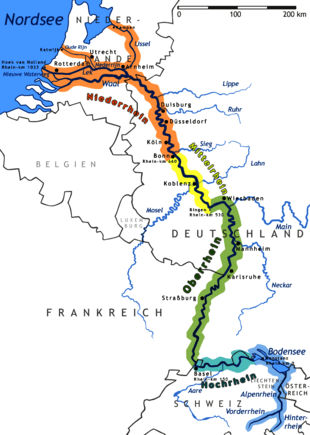
The Murg is an 80.2-kilometre-long[1] river (including its headstream, the Rechtmurg) and a right tributary of the Rhine in Baden-Württemberg, Germany. It flows through the Northern Black Forest into the Upper Rhine Plain, crossing the counties of Freudenstadt and Rastatt.
Sources
The river has numerous tributaries and is known as the Murg only from the point of confluence of the rivers Rechtmurg ("Right Murg") and Rotmurg ("Red Murg") in the community of Obertal, a part (Ortsteil) of Baiersbronn. The main source river is the Rechtmurg that rises on the Schliffkopf hill at an elevation of 875 metres (2,871 ft). One of the other many tributaries is called Murgursprung ("Source of the Murg"), but the tributary watercourses have lengths that vary with rainfall. The Rotmurg also has many tributaries, the most important of which rises on the Ruhestein hill near Baiersbronn. The length figure of 79.267 kilometres (49.254 mi) given by the Ministry of the Environment for Baden-Württemberg should, as a result, be taken as an approximate figure.[2]
Course
From the confluence of the Rotmurg and Rechtmurg, the Murg flows east to Baiersbronn, then north through Forbach, Gernsbach and Gaggenau. It then turns northwest through Rastatt and reaches the Rhine at kilometre 344.5 at the community of Steinmauern.
Watershed
The Murg flows through one of the largest valleys of the Black Forest, the Murg Valley in the west of the Northern Black Forest, then through the Upper Rhine Plain, primarily north and northwest. Its drainage basin covers 617 square kilometres (238 sq mi).
River modifications
The mouth of the Murg was shifted 1.5 kilometres (0.9 mi) northwest when the course of the Rhine was straightened in the 19th century by engineer Johann Gottfried Tulla.
History
The Murg historically was important for timber rafting. Wood was rafted first as far as Steinmauern, where it was dried and combined into bigger rafts. From Steinmauern the larger rafts were floated down to Mannheim and onward to the Netherlands.
Economy
Transport
The Murg Valley Railway and the Black Forest Valley Highway (Bundesstraße 462) follow the Murg Valley. Both are amongst the most notable transportation routes in Germany for civil engineering and natural beauty.
Gallery
 Light rail near Raumünzach
 The Murg Valley
 Wooden bridge in Forbach
 Light rail on the Tennetschlucht bridge
 Overlooking Loffenau, Gaggenau in the Murg valley, and the Rhine valley near Rastatt
 The mouth of the Murg near Steinmauern
See also
References
- Bittmann, Markus; Bittmann, Meinrad (2009). Das Murgtal: Geschichte einer Landschaft im Nordschwarzwald [The Murg Valley: the story of a landscape in the Northern Black Forest]. Sonderveröffentlichung des Kreisarchivs Rastatt, Band 6 [Special edition of the Rastatt County Archives, Volume 6] (in German). Gernsbach: Casimir Katz Verlag. ISBN 978-3-938047-44-6. OCLC 498958530.
- Max Scheifele, Max; Katz, Casimir; Wolf, Eckhart (1995). Die Murgschifferschaft. Geschichte des Floßhandels, des Waldes und der Holzindustrie im Murgtal [Mariners' of the Murg: the story of the river trade, forests, and the forest industry]. Schriftenreihe der Landesforstverwaltung Baden-Württemberg (Band 66) [Publication series of the State Office for Forestry of Baden-Württemberg (Volume 66)] (in German) (2nd ed.). Gernsbach: Casimir Katz Verlag. ISBN 978-3-925825-20-0. OCLC 635676533.
Notes
- ↑ State Office for the Environment, Survey and Nature Conservation, Baden-Württemberg (LUBW), see there under Wasser > Gewässernetz > Gewässernetz (AWGN)
- ↑ "Willkommen beim Daten- und Kartendienst der LUBW" [Welcome to the Data and Map Service of the LUBW] (in German). Landesanstalt für Umwelt, Messungen und Naturschutz Baden-Württemberg (LUBW) [State Office for the Environment, Measurement and Nature Conservation]. Retrieved 8 March 2011. Under Wasser > Gewässernetz und Einzugsgebiet ("Water > River network and drainage basins"). It is unclear if the 79.267 km figure is measured from the Murgursprung or from another point. The figure of 96 kilometres (60 mi) given by some encyclopedias is not verifiable. The figure of 70 kilometres (43 mi) given by some other sources probably is the distance from the confluence of the Rotmurg and Rechtmurg to the river mouth.
External links
| Wikimedia Commons has media related to Murg (Northern Black Forest). |
Tributaries of the Rhine | ||
|---|---|---|
| Left (western) |
|  |
| Right (eastern) |
| |