Muuratjärvi
| Muuratjärvi | |
|---|---|
 Muuratjärvi in Muurame | |
| Location | Muurame, Jyväskylä |
| Coordinates | 62°08′N 025°33′E / 62.133°N 25.550°ECoordinates: 62°08′N 025°33′E / 62.133°N 25.550°E |
| Primary inflows | Myllyjoki, Mattilanjoki |
| Primary outflows | Muuratjoki |
| Catchment area | Kymijoki |
| Basin countries | Finland |
| Surface area | 32 km2 (12 sq mi) |
| Average depth | 13.47 m (44.2 ft) |
| Max. depth | 42.6 m (140 ft) |
| Water volume | 0.425 km3 (345,000 acre·ft) |
| Shore length1 | 112.2 km (69.7 mi) |
| Surface elevation | 90.1 m (296 ft) |
| Frozen | December–April |
| Settlements | Muurame |
| References | [1] |
| 1 Shore length is not a well-defined measure. | |
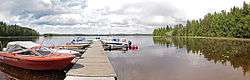
Muuratjärvi is a lake of Finland in Muurame and Korpilahti, Jyväskylä, with a surface area of 32 km2. The lake drains into Päijänne via about 1 kilometre (0.6 mi) long Muuratjoki river flowing through the center of Muurame. It has got several islands like, Siikasaari, Konttisaari, Jahko and Raita. Vuohensalo is only island which can be accessed by car.[1]
References
- 1 2 "Muuratjärvi in Järviwiki Web Service". jarviwiki.fi Lakes in Finland (in Finnish). Finnish Environment Institute. Retrieved 2016-03-05. {English version may be available.}
- Kansalaisen karttapaikka. Map of Muuratjärvi (Finnish)
- Fishing in Muuratjärvi. Kalapaikka.net (Finnish)
External links
-
 Media related to Lake Muuratjärvi at Wikimedia Commons
See also
This article is issued from Wikipedia - version of the 9/20/2016. The text is available under the Creative Commons Attribution/Share Alike but additional terms may apply for the media files.