Nakfa, Eritrea
| Nakfa ናቕፋ | |
|---|---|
| Town | |
|
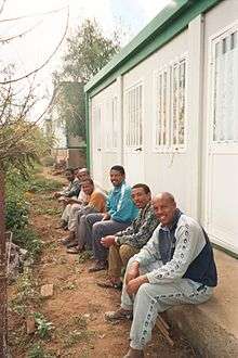
Tsabra School at Nakfa | |
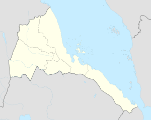 Nakfa Location in Eritrea | |
| Coordinates: 16°40′N 38°28′E / 16.667°N 38.467°E | |
| Country |
|
| Region | Northern Red Sea |
| District | Nakfa |
| Climate | BSh |
Nakfa (Tigrinya: ናቕፋ?, IPA: [naxʼfa]) is a town in the Northern Red Sea region of Eritrea. It is also the name of a sub region of Eritrea.
History
Nakfa served as a base for the Eritrean People's Liberation Front during the Eritrean War of Independence. It was subjected to a number of destructive attacks that left only the mosque standing. Other towns, where hospitals, printing presses, factories, a radio station and a college are located, were built underground by Eritrea's independence fighters. The town is also surrounded by trenches.
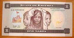
The nakfa currency was later named after the town, owing to its historic place in the independence struggle.
Nakfa Sub-Region
Nakfa Subregion is a subregion in the Northern Red Sea Region of Eritrea. Its capital lies at Nakfa. The district contains the Yob Wildlife Reserve, established in 1959.
Nakfa Mosque
The Ethiopean air force bombed Nakfa several times during the Eritrean War of Independence wars. Each time they spared the Nakfa mosque maybe because they wanted some landmark for the next attack.
Education
- Tsabra Senior Secondary School, Nakfa
- Winna Technical College, Nakfa.
- Nakfa Primary School
Transportation in Nakfa
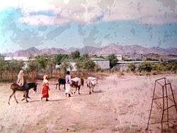
The road from Keren to Nakfa via Afabet is extremely narrow and the village van bulges with passengers. The people here are all tribal Muslims and they live in small stone huts. More important is the generator which is essential as this village has no electricity. Even a telephone is available in the village but it works on sunny days only as the power source is solar.
Climate
| Climate data for Nakfa | |||||||||||||
|---|---|---|---|---|---|---|---|---|---|---|---|---|---|
| Month | Jan | Feb | Mar | Apr | May | Jun | Jul | Aug | Sep | Oct | Nov | Dec | Year |
| Average high °C (°F) | 21.4 (70.5) |
22.0 (71.6) |
24.0 (75.2) |
25.9 (78.6) |
28.4 (83.1) |
30.2 (86.4) |
28.4 (83.1) |
27.5 (81.5) |
28.5 (83.3) |
25.1 (77.2) |
22.5 (72.5) |
21.0 (69.8) |
25.41 (77.73) |
| Average low °C (°F) | 9.5 (49.1) |
9.8 (49.6) |
10.7 (51.3) |
12.4 (54.3) |
13.5 (56.3) |
16.8 (62.2) |
18.4 (65.1) |
17.4 (63.3) |
15.8 (60.4) |
11.6 (52.9) |
10.8 (51.4) |
9.3 (48.7) |
13 (55.38) |
| Average rainfall mm (inches) | 4 (0.16) |
3 (0.12) |
10 (0.39) |
28 (1.1) |
41 (1.61) |
28 (1.1) |
74 (2.91) |
116 (4.57) |
34 (1.34) |
21 (0.83) |
15 (0.59) |
4 (0.16) |
378 (14.88) |
| Source: Climate-Data[1] | |||||||||||||
See also
References
- ↑ "Climate-Data : Eritrea". Retrieved 11 July 2014.
External links
![]() Nakfa travel guide from Wikivoyage
Nakfa travel guide from Wikivoyage
Coordinates: 16°40′N 38°28′E / 16.667°N 38.467°E