Nam Fung Chau
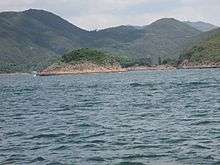
The islet of Nam Fung Chau is visible in the centre left. The land in the background is the southwestern coast of High Island, a former island of Sai Kung District, Hong Kong.
Nam Fung Chau (Chinese: 南風洲) is an island of Hong Kong, under the administration of Sai Kung District. It is located in Rocky Harbour (Leung Shuen Wan Hoi 糧船灣海).
Coordinates: 22°20′32″N 114°21′06″E / 22.342300°N 114.351792°E
This article is issued from Wikipedia - version of the 7/25/2016. The text is available under the Creative Commons Attribution/Share Alike but additional terms may apply for the media files.