Nam Sang Wai


Nam Sang Wai (Chinese: 南生圍) is a wetland area to the north of Yuen Long, in Hong Kong.
Geography
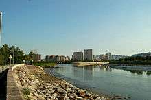
Nam Sang Wai covers a roughly triangular area. It is bordered by the Shan Pui River in the west, separating it from Yuen Long Industrial Estate, the Kam Tin River in the east and a branch of the Kam Tin River in the south.
Flora and fauna
It is home to many birds, including seagulls, northern pintails (Anas acuta), yellow-nib ducks (Anas poecilorhyncha) and black-faced spoonbills (Platalea minor).[1] Flora includes reeds and mangroves.[2]
Conservation
In what is considered to be a landmark case in the history of Hong Kong’s planning law regime, the Privy Council upheld the decision of the Town Planning Appeal Board approving development of a large scale residential, golf course, and nature reserve at Nam Sang Wai with conditions.[3] The validity of planning permission was extended three times. In late 2010 a further extension was denied by the Town Planning Board.[4]
Development
KHI Holdings Group, which retains 50 percent of the Nam Sang Wai Development Company Limited (NSWD), resumed the role of project manager in 2011 for development at Nam Sang Wai and Lut Chau. The group has initiated the planning process under the Environmental Impact Assessment Ordinance by submitting a project profile to the Environmental Protection Department and applying for a study brief.[5]
The NSWD recently launched a website detailing their plans for development.[6]
Access
A small boat in the southern part of Nam Sang Wai serves as a ferry across the Kam Tin River towards the village of Shan Pui Tsuen, north of Yuen Long Kau Hui.[7]
A road, the Nam Sang Wai Road, runs along the eastern edge and most of the western edge of Nam Sang Wai.
See also
References
- ↑ Wetland Ecotour: Nam Sang Wai
- ↑ The Incredible Journey of Yuen Long: Migratory Birds' Secret Happy Land
- ↑ Cooray, A. "Recent developments in planning law", in Law Lectures for Practitioners 1997, p. 153
- ↑ Hong Kong Development Bureau Press Releases LCQ7 – Nam Sang Wai Development
- ↑ Project Profile of Proposed Comprehensive Development with Wetland Enhancement (CDWE) at Nam Sang Wai and Lut Chau
- ↑ Nam Sang Wai & Lut Chau: Nam Sang Wai Development Company Limited Website
- ↑ thaiworldview.com - Shan Pui Tsuen
External links
| Wikimedia Commons has media related to Nam Sang Wai. |
- Aerial view of Nam Sang Wai
- Nam Sang Wai & Lut Chau: Nam Sang Wai Development Company Limited Website
Coordinates: 22°27′36″N 114°02′12″E / 22.459978°N 114.03667°E