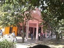
Nangli Wazidpur
| Nangli Wazidpur नंगली वाज़िदपुर | |
|---|---|
| Village | |
 Nangli Wazidpur  Nangli Wazidpur Location in Uttar Pradesh, India | |
| Coordinates: 28°34′N 77°19′E / 28.57°N 77.32°ECoordinates: 28°34′N 77°19′E / 28.57°N 77.32°E | |
| Country | India |
| State | Uttar Pradesh |
| District | Gautam Buddha Nagar District |
| Population | |
| • Total | 5,500 |
| Languages | |
| • Official | Hindi |
| Time zone | IST (UTC+5:30) |
| PIN | 201302 |
Nangli Wazidpur is a village in the western part of the state of Uttar Pradesh. It forms part of the New Okhla Industrial Development Authority's planned industrial city, Noida, falling in Sector-130, noida. Nangli Wazidpur is about 25 kilometres (12 mi) southeast of New Delhi and Nangli Wazidpur is around 900 metres from Yamuna Expressway, formerly known as Taj Expressway, and opposite Sector 93.The village is a part of the Noida Vidhan Sabha (state assembly) constituency and Gautam Buddh Nagar Lok Sabha (parliamentary) constituency.
Climate
Nangli Wazidpur falls under the catchment area of the Yamuna river, and is located on the old river bed. The soil is rich and loamy. Nangli Wazidpur has a hot and humid climate for most of the year. It becomes very hot during June, which is followed by monsoon period from somewhere between mid-June and mid-September. In summer (March to June) the weather remains hot and temperature ranges from a maximum of 48 °C to a minimum of 28 °C.Greater Noida, Monsoon is quite unpredictable where you can't predict which way they will turn. monsoon has never been like the one we witness in other parts of India, say for example Mumbai. Winter in Nangli Wazidpur is very chilly which peaks in at the start of November and continues till the month of February. The foggy and chilly weather during winters makes village climate a tough one to confront with.

The cold waves from the Himalayan region makes the winters in village chilly. Temperatures fall down to as low as 3 to 4 °C at the peak of winters. In January a dense fog envelopes the village, reducing visibility on the streets.
Up until the 1980s the village and nearby area were flooded every 2–3 years.
| Climate data for nangli wazidpur | |||||||||||||
|---|---|---|---|---|---|---|---|---|---|---|---|---|---|
| Month | Jan | Feb | Mar | Apr | May | Jun | Jul | Aug | Sep | Oct | Nov | Dec | Year |
| Average high °C (°F) | 21 (70) |
24 (75) |
30 (86) |
36 (97) |
41 (106) |
40 (104) |
35 (95) |
34 (93) |
34 (93) |
35 (95) |
29 (84) |
23 (73) |
31.8 (89.3) |
| Average low °C (°F) | 7 (45) |
10 (50) |
15 (59) |
21 (70) |
27 (81) |
29 (84) |
27 (81) |
26 (79) |
25 (77) |
19 (66) |
12 (54) |
08 (46) |
18.8 (66) |
| Average precipitation mm (inches) | 25 (0.98) |
22 (0.87) |
17 (0.67) |
7 (0.28) |
8 (0.31) |
65 (2.56) |
211 (8.31) |
173 (6.81) |
150 (5.91) |
31 (1.22) |
1 (0.04) |
5 (0.2) |
715 (28.16) |
| Source: Greater Noida Weather | |||||||||||||
Issues
Farmer's oppression's
Nangli Wazidpur farmers have been demanding a hike in compensation for their land acquired by the Noida Authority from past many decades.[1] Buoyed by the courts' quashing several farm land acquisitions in Noida Extension, village farmers whose land was acquired eight years ago for development are demanding a share in the upcoming infrastructure. They say they have a right to get free check-ups at hospitals and education for their children. Village lands were acquired in 2003 and compensation of Rs 329 per M2 was given to farmers.[2]
Illegal sand mining
Illegal sand mining is adding to the plight of the Yamuna river in the banks of whole Yamuna area. It has not only changed the course of the river but also made its riverbed unstable, thus disturbing the biodiversity of the region.[3][4][5]
References
- ↑ http://indiatoday.intoday.in/story/farmers-warn-noida-authority-over-land-compensation/1/163877.html
- ↑ http://archive.indianexpress.com/news/farmers-demand-free-health-checks-education-from-noida-authority/821482/
- ↑ http://www.dailymail.co.uk/indiahome/indianews/article-2386267/Illegal-sand-mining-changed-course-Yamuna-River-experts-claim.html
- ↑ http://www.dailypioneer.com/todays-newspaper/wily-mafia-changes-tactics-mines-sand-at-night.html
- ↑ http://ibnlive.in.com/news/moef-team-inspects-sand-mining-sites-on-yamuna-banks-in-noida/412588-3-242.html