National Hall Historic District
|
National Hall Historic District | |
 | |
  | |
| Location | Riverside Ave., Wilton and Post Rds., Westport, Connecticut |
|---|---|
| Coordinates | 41°8′25″N 73°21′54″W / 41.14028°N 73.36500°WCoordinates: 41°8′25″N 73°21′54″W / 41.14028°N 73.36500°W |
| Area | 3 acres (1.2 ha) |
| Architectural style | Greek Revival, Federal, Italianate |
| NRHP Reference # | 84000812[1] |
| Added to NRHP | September 13, 1984 |
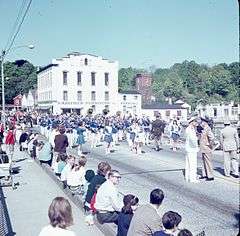
The National Hall Historic District is a 3-acre (1.2 ha) historic district in Westport, Connecticut that was listed on the National Register of Historic Places in 1984.[1] The district encompasses a historic commercial center of the town, located on the west bank of the Saugatuck River where the Boston Post Road crosses the river. It includes eleven historic structures, most of which historically had some sort of commercial function. There are a few residences, and one civic structure, the wood-frame Vigilante Fire House on Wilton Road. The centerpiece of the district is the large National Hall building, an 1873 three-story Italianate structure that visually dominates the junction of the Post Road with Wilton Road and Reservoir Road. The area's first period of development was in the early 19th century, a period from which five buildings survive.[2]
See also
References
- 1 2 National Park Service (2009-03-13). "National Register Information System". National Register of Historic Places. National Park Service.
- ↑ Kate Ohno and John Herzan (1983). "National Register of Historic Places Inventory-Nomination: National Hall Historic District" (PDF). National Park Service. and Accompanying eight photos, from 1983, 1984, and 1900
| Topics | |
|---|---|
| Lists by states |
|
| Lists by insular areas | |
| Lists by associated states | |
| Other areas | |
| |