National Register of Historic Places listings in Dane County, Wisconsin
This is a list of the National Register of Historic Places listings in Dane County, Wisconsin. It aims to provide a comprehensive listing of buildings, sites, structures, districts, and objects in Dane County, Wisconsin listed on the National Register of Historic Places.
The locations of National Register properties for which the latitude and longitude coordinates are included below may be seen in a map.[1]
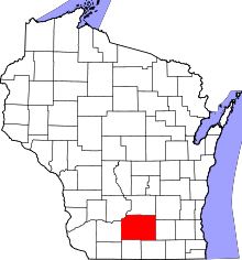
There are 234 properties and districts listed on the National Register in Dane County, including 10 National Historic Landmarks. 141 of these properties and districts, including 8 of the National Historic Landmarks, are located in the city of Madison; these are listed separately, while the remaining 93 properties and districts are listed below. An additional site was once listed on the National Register but has been removed.
- This National Park Service list is complete through NPS recent listings posted December 2, 2016.[2]
Current listings
| [3] | Name on the Register | Image | Date listed[4] | Location | City or town | Description |
|---|---|---|---|---|---|---|
| 1 | Francis Marian Ames Farmstead |  |
(#92001555) |
221 US 14 42°51′26″N 89°20′40″W / 42.857222°N 89.344444°W |
Rutland | |
| 2 | Bedrud-Olson Farmstead |  |
(#99000429) |
996 E. Church Rd. 42°57′12″N 89°05′14″W / 42.953333°N 89.087222°W |
Christiana | |
| 3 | Bram Mound Group |  |
(#93000216) |
Address Restricted |
Dunn | 3 linear mounds and 1 low conical mound |
| 4 | Brown-Sewell House |  |
(#03000307) |
101 S. Fifth St. 42°55′05″N 89°12′59″W / 42.918056°N 89.216389°W |
Stoughton | 1859, Greek Revival style |
| 5 | Cambridge Public School and High School |  |
(#98000708) |
103 South St. 43°00′06″N 89°00′54″W / 43.001667°N 89.015°W |
Cambridge | |
| 6 | Chase Grain Elevator | 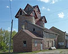 |
(#10000540) |
123 Railroad St. 43°10′43″N 89°12′53″W / 43.178611°N 89.214722°W |
Sun Prairie | 1922, elevator silos made of tile |
| 7 | Jens and Ingeborg Cold House |  |
(#03000169) |
111 S Fifth St. 42°55′05″N 89°12′58″W / 42.918056°N 89.216111°W |
Stoughton | 1892, Queen Anne style |
| 8 | College Hills Historic District |  |
(#02001518) |
Roughly bounded by Colombia Rd., Amherst Dr., Bowdoin Rd., Corporate Limit, University Bay, and Harvard Dr. 43°04′45″N 89°26′20″W / 43.079167°N 89.438889°W |
Shorewood Hills | |
| 9 | Dr. Charles G. Crosse House |  |
(#93000029) |
133 W. Main St. 43°10′59″N 89°12′54″W / 43.183056°N 89.215°W |
Sun Prairie | 1864, Carpenter Gothic style |
| 10 | Henry L. and Sarah Dahle House |  |
(#03001218) |
312 S. Fourth St. 43°00′16″N 89°44′07″W / 43.004444°N 89.735278°W |
Mount Horeb | |
| 11 | Herman B. and Anne Marie Dahle House |  |
(#03001217) |
200 N. Second St. 43°00′39″N 89°44′19″W / 43.010833°N 89.738611°W |
Mount Horeb | |
| 12 | Onon B. and Betsy Dahle House |  |
(#08000322) |
10779 Evergreen Ave. 42°54′57″N 89°48′56″W / 42.915696°N 89.815551°W |
Perry | |
| 13 | John Sweet Donald Farmstead |  |
(#84003633) |
1972 WI 92 42°57′52″N 89°41′08″W / 42.964444°N 89.685556°W |
Springdale | |
| 14 | Adam Dunlap Farmstead |  |
(#01001242) |
9646 Dunlap Hollow Rd. 43°12′28″N 89°43′53″W / 43.207778°N 89.731389°W |
Mazomanie | |
| 15 | Dunroven House |  |
(#80000120) |
7801 Dunroven Rd. 43°17′04″N 89°28′23″W / 43.284444°N 89.473056°W |
Dane | |
| 16 | East End Historic District |  |
(#03000699) |
7002-7016 Hubbard Ave., 1812-1916 Park St. (even only) 7002-7227,7233,7235,7237 Elmwood Ave. 43°05′45″N 89°30′12″W / 43.095833°N 89.503333°W |
Middleton | |
| 17 | East Park Historic District |  |
(#03000335) |
108-324 S. Lynn St., 700-816 Park St., and East Park 42°55′02″N 89°12′41″W / 42.917222°N 89.211389°W |
Stoughton | |
| 18 | East Side Historic District |  |
(#96001577) |
Roughly bounded by Ridge, Henry, Vernon, and Academy Sts. 42°55′06″N 89°12′31″W / 42.918333°N 89.208611°W |
Stoughton | |
| 19 | First Lutheran Church | 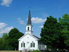 |
(#88000728) |
Pleasant View Rd. at Old Sauk Rd. 43°04′31″N 89°32′11″W / 43.075278°N 89.536389°W |
Middleton | 1866, steeple added 1884, Gothic Revival style |
| 20 | First National Bank | .JPG) |
(#07001096) |
113 N. Main St. 42°55′36″N 89°23′04″W / 42.926667°N 89.384444°W |
Oregon | |
| 21 | First Unitarian Society Meeting House | 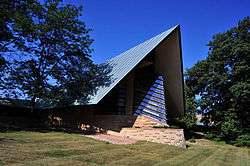 |
(#73000076) |
900 University Bay Dr. 43°04′34″N 89°26′04″W / 43.076111°N 89.434444°W |
Shorewood Hills | 1947, Frank Lloyd Wright |
| 22 | Fort Blue Mounds | 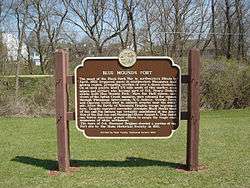 |
(#01001044) |
Address Restricted |
Blue Mounds | |
| 23 | Fox Hall | 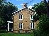 |
(#83004273) |
5183 County Hwy. M 42°56′57″N 89°24′01″W / 42.949167°N 89.400278°W |
Fitchburg | |
| 24 | Frey School |  |
(#11000461) |
8847 County Road Y 43°14′58″N 89°40′19″W / 43.249444°N 89.671944°W |
Roxbury | |
| 25 | John Fritz Farmstead |  |
(#98000879) |
642 Fritz Rd. 42°53′24″N 89°35′46″W / 42.89°N 89.596111°W |
Montrose | |
| 26 | Fuhremann Canning Company Factory |  |
(#04001003) |
151 Market St. 43°10′51″N 89°12′40″W / 43.180833°N 89.211111°W |
Sun Prairie | 1900 |
| 27 | John and Flora Gilbert House |  |
(#07000933) |
357 N. Main St. 42°55′54″N 89°23′02″W / 42.931667°N 89.383889°W |
Oregon | 1906, Queen Anne style |
| 28 | Sereno W. Graves House |  |
(#82000651) |
4006 Old Stage Rd. 42°51′49″N 89°18′50″W / 42.863611°N 89.313889°W |
Rutland | |
| 29 | Nicholas Haight Farmstead |  |
(#93001162) |
4926 Lacy Rd. 43°00′08″N 89°22′42″W / 43.002222°N 89.378333°W |
Fitchburg | |
| 30 | Samuel Hall House |  |
(#93001445) |
974 Hillside Rd. 42°54′03″N 89°02′31″W / 42.900833°N 89.041944°W |
Albion | |
| 31 | Hauge Log Church |  |
(#74000071) |
1 mi (1.6 km). north of Daleyville on CR Z 42°55′48″N 89°49′13″W / 42.93°N 89.820278°W |
Daleyville | |
| 32 | Heim Mound | 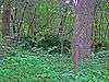 |
(#04000254) |
Address Restricted 43°05′38″N 89°29′21″W / 43.093889°N 89.489167°W |
Middleton | effigy of a fox or wolf |
| 33 | Heiney's Meat Market | 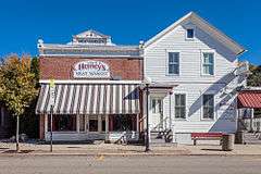 |
(#84003642) |
1221 Mills St. 43°08′16″N 89°44′52″W / 43.137778°N 89.747778°W |
Black Earth | |
| 34 | Hoff Department Store | 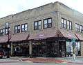 |
(#89000005) |
101-103 Main St. 43°00′30″N 89°44′16″W / 43.008333°N 89.737778°W |
Mount Horeb | |
| 35 | Hornung Mound Group | Upload image | (#96000497) |
Address Restricted |
Roxbury | |
| 36 | Samuel Hunt House | 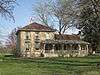 |
(#82000652) |
632 Center Rd. 42°52′51″N 89°18′35″W / 42.880833°N 89.309722°W |
Rutland | |
| 37 | Gaute Ingebretson Loft House | 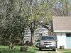 |
(#87000437) |
1212 Pleasant Hill Rd. 42°54′47″N 89°10′12″W / 42.913056°N 89.17°W |
Stoughton | |
| 38 | Iverson-Johnson House | 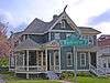 |
(#87002501) |
327 E. Washington St. 42°55′02″N 89°13′00″W / 42.917222°N 89.216667°W |
Stoughton | 1898, Queen Anne style with Nordic gable fretwork |
| 39 | Herbert and Katherine Jacobs Second House | 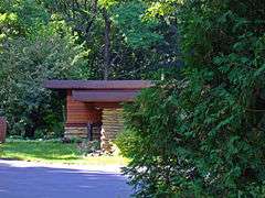 |
(#74000074) |
3995 Shawn Trail 43°04′26″N 89°32′05″W / 43.073889°N 89.534722°W |
Middleton | 1943, Frank Lloyd Wright; designated National Historic Landmark July 31, 2003 |
| 40 | Gulbrand and Bertha Jensvold House | 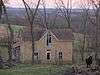 |
(#08000370) |
1033 WI 78 42°54′44″N 89°49′01″W / 42.912297°N 89.816953°W |
Perry | |
| 41 | Kehl Winery |  |
(#76000056) |
East of Prairie du Sac on WI 188 43°17′19″N 89°42′27″W / 43.288611°N 89.7075°W |
Roxbury | |
| 42 | John and Margarethe Kemp Cabin |  |
(#08001187) |
6950 WI Hwy. 78 43°13′51″N 89°43′35″W / 43.230839°N 89.72631°W |
Mazomanie | |
| 43 | Friederich Kohlmann House |  |
(#74000075) |
West of Springfield Corners off WI 19 43°11′10″N 89°38′22″W / 43.186111°N 89.639444°W |
Springfield Corners | |
| 44 | Robert M. LaFollette House | .jpg) |
(#66000020) |
733 Lakewood Blvd. 43°06′57″N 89°22′22″W / 43.115936°N 89.372912°W |
Maple Bluff | |
| 45 | Lewis Mound Group (47-Da-74) | Upload image | (#84000809) |
Address Restricted |
McFarland | |
| 46 | Library Park |  |
(#81000038) |
Bounded by Vine, Main, Park and Pearl Sts. 42°51′33″N 89°32′00″W / 42.859167°N 89.533333°W |
Belleville | 1894 (Village Hall) |
| 47 | Aslak Lie Cabin | 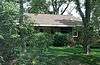 |
(#86000622) |
3022 County Trunk P 43°01′14″N 89°40′05″W / 43.020556°N 89.668056°W |
Mount Horeb | |
| 48 | Lincoln Street Historic District | 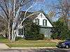 |
(#06000276) |
W. Lincoln St., bet. Main St. and Market St. 42°55′55″N 89°23′04″W / 42.931944°N 89.384444°W |
Oregon | |
| 49 | Little Norway | 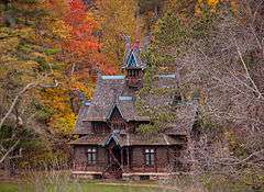 |
(#98000169) |
3576 CTH JG 43°01′32″N 89°47′44″W / 43.025556°N 89.795556°W |
Blue Mounds | |
| 50 | Lockwood Barn | 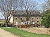 |
(#82000653) |
Old Stage Rd 42°51′54″N 89°19′22″W / 42.865°N 89.322778°W |
Rutland | |
| 51 | Lower Mud Lake Archeological Complex | Upload image | (#04000253) |
Address Restricted |
Dunn | |
| 52 | John Mann House | 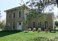 |
(#82000655) |
6261 Nesbitt Rd. 43°00′34″N 89°28′44″W / 43.009444°N 89.478889°W |
Fitchburg | |
| 53 | Mazomanie Downtown Historic District | 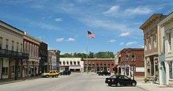 |
(#92000406) |
1-118 Brodhead, 2-46 Hudson, 37-105 Crescent and 113 E. Exchange Sts. 43°10′32″N 89°47′36″W / 43.175556°N 89.793333°W |
Mazomanie | |
| 54 | Mazomanie Town Hall | 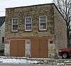 |
(#80000126) |
51 Crescent St. 43°10′34″N 89°47′33″W / 43.176111°N 89.7925°W |
Mazomanie | |
| 55 | McCoy Farmhouse | 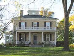 |
(#80000124) |
South of Madison at 2925 Syene Rd. 43°00′51″N 89°23′49″W / 43.014167°N 89.396944°W |
Fitchburg | |
| 56 | McFarland House |  |
(#88002228) |
5923 Exchange St. 43°00′48″N 89°17′19″W / 43.013333°N 89.288611°W |
McFarland | 1857, Greek Revival |
| 57 | Middleton Depot, Chicago, Milwaukee, and St. Paul Railroad | 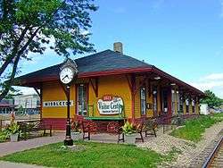 |
(#99000520) |
1811 Parmenter St. 43°05′42″N 89°30′40″W / 43.095°N 89.511111°W |
Middleton | 1895, J. U. Nettenstrom, Late Victorian style |
| 58 | Monona Mound (47DA275) |  |
(#89002064) |
Address Restricted |
Monona | water spirit effigy mound, 800-1100 |
| 59 | Moore Mound Group | Upload image | (#93000809) |
Address Restricted |
Dunn | |
| 60 | Mt. Horeb Opera Block | 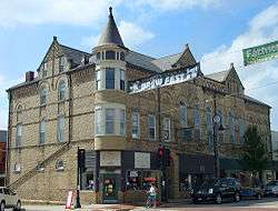 |
(#89000068) |
109-117 E. Main St. 43°00′30″N 89°44′19″W / 43.008333°N 89.738611°W |
Mount Horeb | |
| 61 | Mount Horeb Public School | 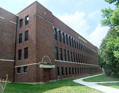 |
(#10000298) |
207 Academy St. 43°00′13″N 89°44′13″W / 43.003494°N 89.73705°W |
Mount Horeb | |
| 62 | Jens Naeset House | 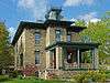 |
(#85000577) |
126 E. Washington 42°55′04″N 89°13′09″W / 42.917778°N 89.219167°W |
Stoughton | 1878, Italianate style with Second Empire cupola |
| 63 | Northwest Side Historic District | 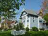 |
(#98000221) |
Roughly bounded by Van Buren, Clyde, Grant, and Main Sts. 42°55′09″N 89°13′36″W / 42.919167°N 89.226667°W |
Stoughton | |
| 64 | Oregon High School | 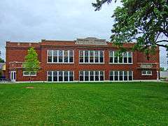 |
(#98000406) |
220 N. Main St. 42°55′41″N 89°22′58″W / 42.928056°N 89.382778°W |
Oregon | |
| 65 | Oregon Masonic Lodge | 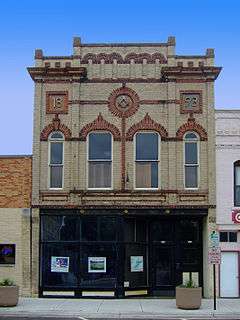 |
(#92000803) |
117-119 S. Main St. 42°55′33″N 89°23′06″W / 42.925833°N 89.385°W |
Oregon | |
| 66 | Oregon Water Tower and Pump House | 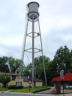 |
(#07001097) |
134 Janesville St. 42°55′31″N 89°23′01″W / 42.925278°N 89.383611°W |
Oregon | |
| 67 | Outlet Mound | 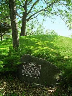 |
(#03001022) |
Junction of Ridgewood and Midwood Aves. 43°03′06″N 89°20′05″W / 43.051667°N 89.334722°W |
Monona | Oval mound |
| 68 | Paoli Mills |  |
(#79000337) |
6890 Sun Valley Pkwy. 42°55′47″N 89°31′31″W / 42.929722°N 89.525278°W |
Paoli | 4 buildings on a 5-acre (20,000 m2) site |
| 69 | Daniel Pond Farmhouse |  |
(#80000128) |
East of Brooklyn on U.S. 14 42°50′58″N 89°20′02″W / 42.849444°N 89.333889°W |
Brooklyn | |
| 70 | Ole K. Roe House |  |
(#84003652) |
404 S. 5th St. 42°54′56″N 89°13′01″W / 42.915620°N 89.216926°W |
Stoughton | |
| 71 | Dr. Newman C. Rowley House |  |
(#99000518) |
7410 Hubbard Ave. 43°05′43″N 89°30′32″W / 43.095278°N 89.508889°W |
Middleton | 1867 |
| 72 | Rutland United Brethren in Christ Meeting House and Cemetery |  |
(#04001002) |
687 US 14 42°52′59″N 89°21′05″W / 42.883056°N 89.351389°W |
Rutland | |
| 73 | St. Peter's Roman Catholic Church |  |
(#80000130) |
W I K 43°08′23″N 89°32′27″W / 43.139722°N 89.540833°W |
Ashton | |
| 74 | Frederick Schumann Farmstead |  |
(#93001426) |
8313 WI 19 43°11′40″N 89°37′49″W / 43.194444°N 89.630278°W |
Berry | |
| 75 | Shorewood Historic District |  |
(#02001432) |
Roughly bounded by Lake Mendota Dr., Tallyho Ln., Shorewood Blvd., and the Blackhawk Country Club 43°04′50″N 89°26′48″W / 43.080556°N 89.446667°W |
Shorewood Hills | |
| 76 | Siggelkow Park Mound Group (47-Da-504) |  |
(#85000576) |
Address Restricted |
McFarland | 1 linear mound and remnants of 2 others |
| 77 | Eric and Jerome Skindrud Farm |  |
(#94001156) |
3070 Town Hall Rd. 43°01′19″N 89°41′18″W / 43.021944°N 89.688333°W |
Springdale | |
| 78 | Adam and Mary Smith House |  |
(#98000434) |
south corner of Smith's Crossing and Leopold Way 43°09′47″N 89°15′53″W / 43.163056°N 89.264722°W |
Sun Prairie | ca. 1856-60, Samuel Donnel and August Kutzbock, Italianate style |
| 79 | South Main Street Historic District |  |
(#00000699) |
S. Main St., junction with Jefferson and Janesville Sts. 42°55′33″N 89°23′05″W / 42.925833°N 89.384722°W |
Oregon | |
| 80 | South School |  |
(#85002319) |
1009 Summit Ave. 42°54′37″N 89°13′08″W / 42.910278°N 89.218889°W |
Stoughton | |
| 81 | Southwest Side Historic District |  |
(#97001554) |
Roughly bounded by Lowell, S. Monroe, W. Main and S. Page Sts. 42°54′52″N 89°13′31″W / 42.914444°N 89.225278°W |
Stoughton | Shown here is the landmarked Ovren House (1884). |
| 82 | Stoughton High School |  |
(#01001476) |
211 N. Forrest St. 42°55′09″N 89°13′07″W / 42.919167°N 89.218611°W |
Stoughton | 1892, neo-Renaissance style |
| 83 | Stoughton Main Street Commercial Historic District |  |
(#82001842) |
Main St. from the Yahara River to Forest St. 42°55′01″N 89°13′14″W / 42.916944°N 89.220556°W |
Stoughton | Boundary increase (listed May 12, 1994): Main St. from Forest St. to Fifth St. |
| 84 | Stoughton Universalist Church |  |
(#82000659) |
324 S. Page St. 42°54′58″N 89°13′25″W / 42.916111°N 89.223611°W |
Stoughton | 1858, neo-Classicist style |
| 85 | Stricker Pond I Site (47 DA 424) |  |
(#79000069) |
Address Restricted |
Middleton | |
| 86 | Sun Prairie Water Tower | 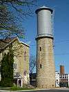 |
(#00000360) |
Junction of Columbus, Church and Cliff Sts. 43°11′14″N 89°12′39″W / 43.187222°N 89.210833°W |
Sun Prairie | Frank Stegerwald, 1899 and 1912 |
| 87 | Sure Johnson Mound Group | Upload image | (#94000537) |
Address Restricted |
McFarland | |
| 88 | Tompkins-Brindler Mound Group | 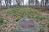 |
(#03001023) |
Monona Dr. 43°03′18″N 89°19′28″W / 43.055°N 89.324444°W |
Monona | 2 linear mounds |
| 89 | Waubesa School | 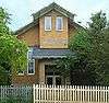 |
(#97000806) |
3579 Sigglekow Rd. 43°01′34″N 89°16′38″W / 43.026111°N 89.277222°W |
Blooming Grove | 1920, Louis A. Harrison, Bungalow/Craftsman style |
| 90 | Waunakee Railroad Depot | 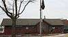 |
(#78000092) |
South and Main Sts. 43°11′30″N 89°27′15″W / 43.191667°N 89.454167°W |
Waunakee | |
| 91 | West School | 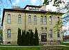 |
(#91001992) |
404 Garfield St. 42°54′52″N 89°13′30″W / 42.914335°N 89.225038°W |
Stoughton | 1886 |
| 92 | Wisconsin Heights Battlefield |  |
(#01001553) |
0.4 mi (0.64 km) southeast of the junction of County Rd. Y and WI 78 43°14′41″N 89°43′05″W / 43.244722°N 89.718056°W |
Roxbury | |
| 93 | Wisconsin Industrial School for Girls |  |
(#91001391) |
5212 WI M 42°57′42″N 89°22′39″W / 42.961667°N 89.3775°W |
Fitchburg |
Former listing
| [3] | Name on the Register | Image | Date listed | Date removed | Location | City or town | Summary |
|---|---|---|---|---|---|---|---|
| 1 | Savage House | Upload image | (#80000392) | SR 1 42°50′47″N 89°14′25″W / 42.846389°N 89.240278°W |
Stoughton |
See also
| Wikimedia Commons has media related to National Register of Historic Places in Dane County, Wisconsin. |
- List of National Historic Landmarks in Wisconsin
- National Register of Historic Places listings in Wisconsin
- National Historic Preservation Act of 1966
- Wisconsin Historical Society
References
- ↑ The latitude and longitude information provided is primarily from the National Register Information System, and has been found to be fairly accurate for about 99% of listings. For 1%, the location info may be way off. We seek to correct the coordinate information wherever it is found to be erroneous. Please leave a note in the Discussion page for this article if you believe any specific location is incorrect.
- ↑ "National Register of Historic Places: Weekly List Actions". National Park Service, United States Department of the Interior. Retrieved on December 2, 2016.
- 1 2 Numbers represent an ordering by significant words. Various colorings, defined here, differentiate National Historic Landmarks and historic districts from other NRHP buildings, structures, sites or objects.
- ↑ The eight-digit number below each date is the number assigned to each location in the National Register Information System database, which can be viewed by clicking the number.
External links
| Topics | |
|---|---|
| Lists by states |
|
| Lists by insular areas | |
| Lists by associated states | |
| Other areas | |
| |