National Register of Historic Places listings in Jefferson Parish, Louisiana
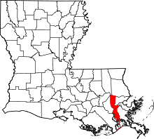
Location of Jefferson Parish in Louisiana
This is a list of the National Register of Historic Places listings in Jefferson Parish, Louisiana.
This is intended to be a complete list of the properties and districts on the National Register of Historic Places in Jefferson Parish, Louisiana, United States. The locations of National Register properties and districts for which the latitude and longitude coordinates are included below, may be seen in a map.[1]
There are 19 properties and districts listed on the National Register in the parish.
- This National Park Service list is complete through NPS recent listings posted December 16, 2016.[2]
Current listings
| [3] | Name on the Register[4] | Image | Date listed[5] | Location | City or town | Description |
|---|---|---|---|---|---|---|
| 1 | Barataria Unit of Jean Lafitte Historical Park Historic District | 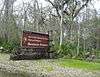 |
(#66000966) |
Roughly bounded by Bayou Coquilles, Bayou des Familles, Bayou Barataria, Bayou Villars, and Lake Salvador 29°46′31″N 90°08′20″W / 29.775278°N 90.138889°W |
Barataria | Nature preserve |
| 2 | L.J. Bernard Hardware Store |  |
(#00001144) |
275 Sala Ave. 29°54′49″N 90°08′36″W / 29.913611°N 90.143333°W |
Westwego | |
| 3 | Conrad A. Buchler House | 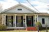 |
(#99001114) |
236 Sala Ave. 29°54′52″N 90°08′36″W / 29.914444°N 90.143333°W |
Westwego | |
| 4 | Camp Parapet Powder Magazine | 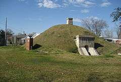 |
(#77000671) |
Arlington St., east of Causeway Boulevard 29°57′39″N 90°09′20″W / 29.960833°N 90.155556°W |
Metairie | Civil War fortification |
| 5 | David Crockett Fire Hall and Pumper | 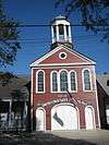 |
(#83000510) |
205 Lafayette St. 29°55′08″N 90°03′46″W / 29.918889°N 90.062778°W |
Gretna | Historic firehouse |
| 6 | Felix-Block Building | 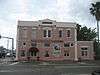 |
(#85001587) |
303 Williams Boulevard 29°58′25″N 90°14′49″W / 29.973611°N 90.246944°W |
Kenner | |
| 7 | Fort Livingston | 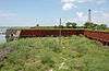 |
(#74000925) |
Western tip of Grande Terre Island 29°16′24″N 89°56′43″W / 29.273333°N 89.945278°W |
Grand Isle | Ruins of early 19th century fort |
| 8 | Gretna Historic District | 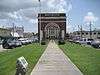 |
(#85000954) |
Roughly bounded by 1st, Amelia, and 9th Sts., Gulf Dr., 4th, and Huey P. Long Ave. 29°54′53″N 90°03′47″W / 29.914722°N 90.063056°W |
Gretna | |
| 9 | Harahan Elementary School | 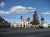 |
(#83000511) |
6723 Jefferson Highway 29°56′17″N 90°11′47″W / 29.938056°N 90.196389°W |
Harahan | |
| 10 | Kenner Town Hall | 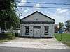 |
(#86000112) |
1903 Short St. 29°58′31″N 90°14′53″W / 29.975278°N 90.248056°W |
Kenner | |
| 11 | Kerner House | 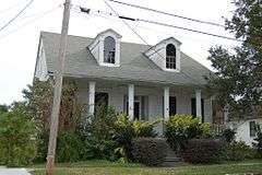 |
(#00000008) |
1012 Monroe St. 29°55′44″N 90°03′03″W / 29.928889°N 90.050833°W |
Gretna | |
| 12 | Magnolia Lane Plantation House | 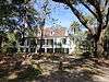 |
(#86000253) |
Louisiana Highway 541 at Nine Mile Pt. 29°56′57″N 90°09′11″W / 29.949167°N 90.153056°W |
Westwego | Plantation house at Nine Mile Point; originally Fortier Plantation |
| 13 | Ed Martin Seafood Company Factory and House | 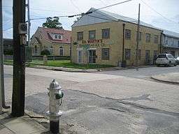 |
(#00001170) |
300 Sala Ave. and 306 Sala House 29°54′48″N 90°08′38″W / 29.913333°N 90.143889°W |
Westwego | |
| 14 | Old Kenner High School |  |
(#08000014) |
1601 Rev. Richard Wilson 29°58′35″N 90°15′09″W / 29.976389°N 90.2525°W |
Kenner | |
| 15 | Old Jefferson Parish Courthouse | 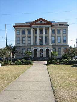 |
(#83000512) |
200 Huey P. Long Ave. 29°54′59″N 90°03′55″W / 29.916389°N 90.065278°W |
Gretna | |
| 16 | Vic Pitre House | 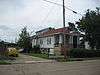 |
(#98001080) |
476 Sala Ave. 29°54′39″N 90°08′43″W / 29.910833°N 90.145278°W |
Westwego | |
| 17 | Raziano House | 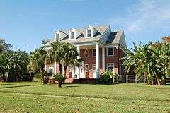 |
(#98001058) |
913 Minor St. 29°58′54″N 90°14′45″W / 29.981667°N 90.245833°W |
Kenner | |
| 18 | St. Joseph Church-Convent of the Most Holy Sacrament Complex | 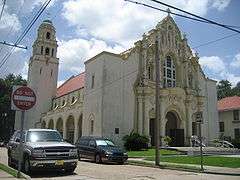 |
(#83000513) |
Lavousier and 7th Sts. 29°54′51″N 90°03′40″W / 29.914167°N 90.061111°W |
Gretna | |
| 19 | Southern Pacific Steam Locomotive #745 | 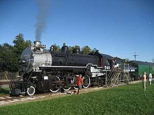 |
(#98001077) |
Spur line off Jefferson Highway, between Betz Ave. and Coolidge St. 29°57′48″N 90°08′42″W / 29.963333°N 90.145°W |
Jefferson | Restored 1921 Louisiana built steam locomotive |
See also
| Wikimedia Commons has media related to National Register of Historic Places in Jefferson Parish, Louisiana. |
- List of National Historic Landmarks in Louisiana
- National Register of Historic Places listings in Louisiana
References
- ↑ The latitude and longitude information provided in this table was derived originally from the National Register Information System, which has been found to be fairly accurate for about 99% of listings. For about 1% of NRIS original coordinates, experience has shown that one or both coordinates are typos or otherwise extremely far off; some corrections may have been made. A more subtle problem causes many locations to be off by up to 150 yards, depending on location in the country: most NRIS coordinates were derived from tracing out latitude and longitudes off of USGS topographical quadrant maps created under the North American Datum of 1927, which differs from the current, highly accurate WGS84 GPS system used by most on-line maps. Chicago is about right, but NRIS longitudes in Washington are higher by about 4.5 seconds, and are lower by about 2.0 seconds in Maine. Latitudes differ by about 1.0 second in Florida. Some locations in this table may have been corrected to current GPS standards.
- ↑ "National Register of Historic Places: Weekly List Actions". National Park Service, United States Department of the Interior. Retrieved on December 16, 2016.
- ↑ Numbers represent an ordering by significant words. Various colorings, defined here, differentiate National Historic Landmarks and historic districts from other NRHP buildings, structures, sites or objects.
- ↑ National Park Service (2009-03-13). "National Register Information System". National Register of Historic Places. National Park Service.
- ↑ The eight-digit number below each date is the number assigned to each location in the National Register Information System database, which can be viewed by clicking the number.
| Topics | |
|---|---|
| Lists by states |
|
| Lists by insular areas | |
| Lists by associated states | |
| Other areas | |
| |
Municipalities and communities of Jefferson Parish, Louisiana, United States | ||
|---|---|---|
| Cities | | |
| Towns | ||
| CDPs | ||
| Others Unincorporated communities | ||
This article is issued from Wikipedia - version of the 4/9/2016. The text is available under the Creative Commons Attribution/Share Alike but additional terms may apply for the media files.