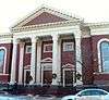
| [3] |
Name on the Register |
Image |
Date listed[4] |
Location |
City or town |
Description |
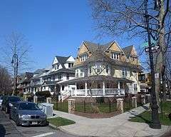
|---|
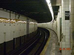
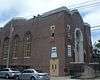
| 1 |
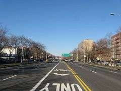
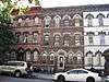
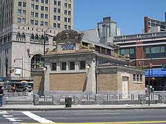
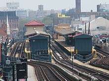
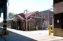
4th Avenue Station (IND) |
|
000000002005-07-06-0000July 6, 2005
(#05000673) |
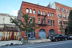
4th Ave. between 9th and 10th Sts.
40°40′13″N 73°59′24″W / 40.670278°N 73.99°W / 40.670278; -73.99 (4th Avenue Station (IND)) |
Park Slope and Gowanus |
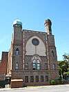
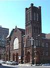
Subway station (F G trains); part of the New York City Subway System MPS
|
| 2 |
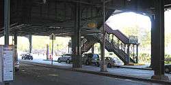
9th Avenue Station (Dual System BRT) |
|
000000002005-07-06-0000July 6, 2005
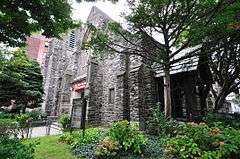
(#05000676) |
38th St. and 9th Ave. near the junction of New Utrecht Ave.
40°38′47″N 73°59′41″W / 40.646389°N 73.994722°W / 40.646389; -73.994722 (9th Avenue Station (Dual System BRT)) |
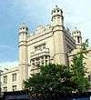
Sunset Park |
Subway station (D train); part of the New York City Subway System MPS
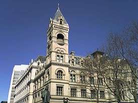
|
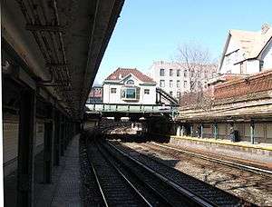
| 3 |
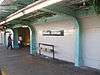
15th Street – Prospect Park Subway Station (IND) |
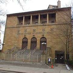
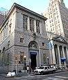
|
000000002005-07-27-0000July 27, 2005
(#05000748) |
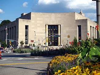
15th St./Prospect Park W and SW
40°39′37″N 73°58′49″W / 40.660278°N 73.980278°W / 40.660278; -73.980278 (15th Street – Prospect Park Subway Station (IND)) |
Windsor Terrace and Park Slope |
Subway station (F G trains); part of the New York City Subway System MPS
|
| 4 |
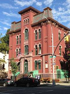
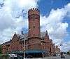
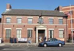
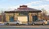
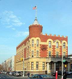
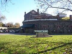
68th Police Precinct Station House and Stable |
|
000000001982-06-03-0000June 3, 1982
(#82003359) |
4302 4th Ave.
40°39′01″N 74°00′34″W / 40.650278°N 74.009444°W / 40.650278; -74.009444 (68th Police Precinct Station House and Stable) |
Sunset Park |
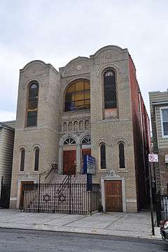
|
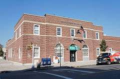
| 5 |
75th Police Precinct Station House |
|
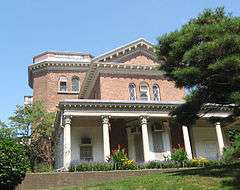
000000002007-09-10-0000September 10, 2007
(#07000952) |
484 Liberty Ave.
40°40′29″N 73°53′33″W / 40.674722°N 73.8925°W / 40.674722; -73.8925 (75th Police Precinct Station House) |
East New York |
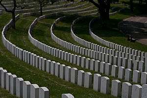
|
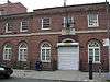
| 6 |
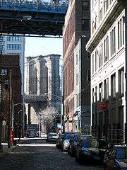
83rd Precinct Police Station and Stable |
|
000000001982-04-14-0000April 14, 1982
(#82003360) |
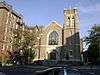
179 Wilson Ave.
40°42′06″N 73°55′25″W / 40.701667°N 73.923611°W / 40.701667; -73.923611 (83rd Precinct Police Station and Stable) |
Bushwick |
|
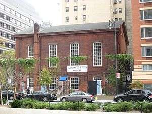
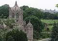
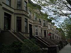
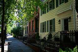
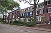
| 7 |
Albemarle-Kenmore Terraces Historic District |
|
000000001983-06-30-0000June 30, 1983
(#83001685) |
Albemarle Terrace, Kenmore Terrace , and E. 21st St.
40°39′03″N 73°57′33″W / 40.650833°N 73.959167°W / 40.650833; -73.959167 (Albemarle-Kenmore Terraces Historic District) |
Flatbush |
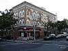
|
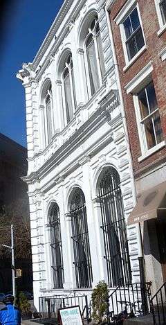
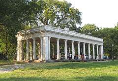
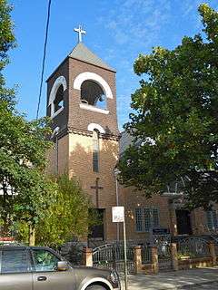
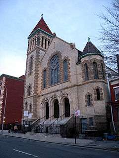
| 8 |
Andrews United Methodist Church |
|
000000001992-01-22-0000January 22, 1992
(#91001977) |
95 Richmond St.
40°41′07″N 73°52′38″W / 40.685278°N 73.877222°W / 40.685278; -73.877222 (Andrews United Methodist Church) |
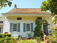
East New York |
|
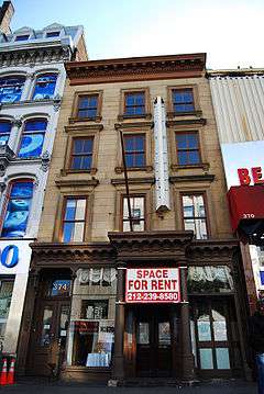
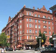
| 9 |
Astral Apartments |
|
000000001982-10-29-0000October 29, 1982
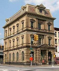
(#82001178) |
184 Franklin St.
40°43′54″N 73°57′28″W / 40.731667°N 73.957778°W / 40.731667; -73.957778 (Astral Apartments) |
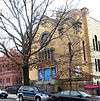
Greenpoint |
|
| 10 |
Atlantic Avenue Control House |
|
000000001980-05-06-0000May 6, 1980
(#80002643) |
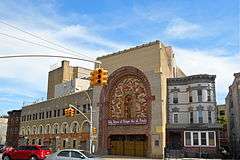
Flatbush and Atlantic Aves.
40°41′04″N 73°58′42″W / 40.684444°N 73.978333°W / 40.684444; -73.978333 (Atlantic Avenue Control House) |
Downtown Brooklyn |
part of the Interborough Rapid Transit Subway Control Houses TR
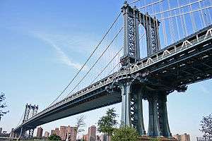
|
| 11 |
Atlantic Avenue Subway Station (IRT and BMT) |
|
000000002004-09-17-0000September 17, 2004
(#04001023) |
Junction of Flatbush Ave. at Atlantic and 4th Aves.
40°41′05″N 73°58′42″W / 40.684722°N 73.978333°W / 40.684722; -73.978333 (Atlantic Avenue Subway Station (IRT and BMT)) |
Downtown Brooklyn |
Subway station (2 3 4 5 B Q D N R trains); part of the New York City Subway System MPS
|
| 12 |
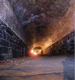
Atlantic Avenue Tunnel |
|
000000001989-09-07-0000September 7, 1989
(#89001388) |
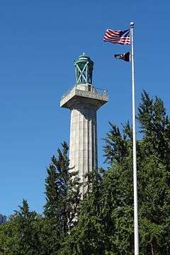
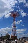
Below Atlantic Ave. between Boerum Pl. and Columbia St.
40°41′30″N 74°00′00″W / 40.691667°N 74.0°W / 40.691667; -74.0 (Atlantic Avenue Tunnel) |
Cobble Hill |
|
| 13 |
Austin, Nichols and Company Warehouse |
|
000000002007-06-28-0000June 28, 2007
(#07000629) |
184 Kent Ave.
40°43′07″N 73°57′54″W / 40.718611°N 73.965°W / 40.718611; -73.965 (Austin, Nichols and Company Warehouse) |
Williamsburg |
|
| 14 |
Avenue U Station (Dual System BRT) |
|
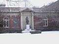
000000002005-07-06-0000July 6, 2005
(#05000675) |
Bet. Ave. U and Ave. T and 7th and 8th Sts.
40°35′50″N 73°58′46″W / 40.597222°N 73.979444°W / 40.597222; -73.979444 (Avenue U Station (Dual System BRT)) |
Gravesend |
Subway station (N train); part of the New York City Subway System MPS
|
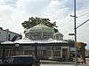
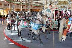
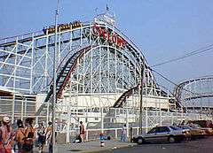
| 15 |
B & B Carousel |
|
000000002016-02-23-0000February 23, 2016
(#16000035) |
1615 Boardwalk
Coordinates missing |
Coney Island |
Coney Island's only remaining original carousel dates to 1906
|
| 16 |
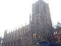
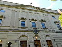
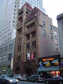
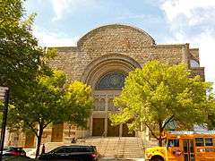
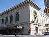
Baptist Temple (Brooklyn, New York) |
|
000000001995-11-20-0000November 20, 1995
(#95001334) |
360 Schermerhorn St.
40°41′11″N 73°58′50″W / 40.686389°N 73.980556°W / 40.686389; -73.980556 (Baptist Temple (Brooklyn, New York)) |
Downtown Brooklyn |
|
| 17 |
Bay Parkway Station (Dual System BRT) |
|
000000002005-07-06-0000July 6, 2005
(#05000670) |
Above Bay Parkway at 86th St.
40°36′06″N 73°59′40″W / 40.601667°N 73.994444°W / 40.601667; -73.994444 (Bay Parkway Station (Dual System BRT)) |
Bensonhurst and Bath Beach |
Subway station (D train); part of the New York City Subway System MPS
|
| 18 |
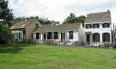
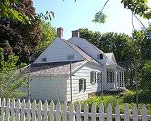
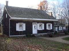
Bay Ridge United Methodist Church |
|
000000001999-09-09-0000September 9, 1999
(#99001132) |
7002 Fourth St.
40°38′01″N 74°01′29″W / 40.633611°N 74.024722°W / 40.633611; -74.024722 (Bay Ridge United Methodist Church) |
Bay Ridge |
Razed October 21, 2008[5]
|
| 19 |
Beth El Jewish Center of Flatbush |
|
000000002009-05-29-0000May 29, 2009
(#09000377) |
1981 Homecrest Ave.
40°36′04″N 73°57′35″W / 40.601008°N 73.959628°W / 40.601008; -73.959628 (Beth El Jewish Center of Flatbush) |
Flatbush |
|
| 20 |
Beth Olam Cemetery |
Upload image |
000000002016-05-16-0000May 16, 2016
(#16000254) |
2 Cypress Hills St.
40°41′26″N 73°52′48″W / 40.69069°N 73.87990°W / 40.69069; -73.87990 (Beth Olam Cemetery) |
Cypress Hills |
Rural cemetery started in 1851 by the three oldest Jewish congregations in the city; contains many different examples of architecture and funerary art. Shared with Queens.
|
| 21 |
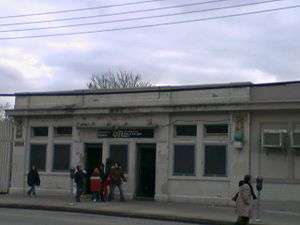
Beverley Road Subway Station (BRT pre-Dual System) |
|
000000002004-09-17-0000September 17, 2004
(#04001024) |
Beverley Rd. at Marlborough Rd.
40°38′39″N 73°57′53″W / 40.644167°N 73.964722°W / 40.644167; -73.964722 (Beverley Road Subway Station (BRT pre-Dual System)) |
Flatbush |
Subway station (Q train); part of the New York City Subway System MPS
|
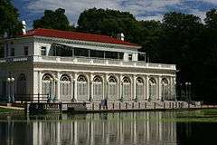
| 22 |
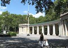
Boathouse on the Lullwater of the Lake in Prospect Park |
|
000000001972-01-07-0000January 7, 1972
(#72000850) |
Prospect Park
40°39′39″N 73°57′55″W / 40.660833°N 73.965278°W / 40.660833; -73.965278 (Boathouse on the Lullwater of the Lake in Prospect Park) |
Prospect Park (Brooklyn) |
|
| 23 |
Boerum Hill Historic District |
|
000000001983-09-26-0000September 26, 1983
(#83001686) |
Roughly bounded by Pacific, Wyckoff, Bergen, Nevins, Bond and Hoyt Sts.
40°41′07″N 73°59′13″W / 40.685278°N 73.986944°W / 40.685278; -73.986944 (Boerum Hill Historic District) |
Boerum Hill |
|
| 24 |
Borough Hall Subway Station (IRT) |
|
000000002004-09-17-0000September 17, 2004
(#04001022) |
Junction of Joralemon, Court and Adams Sts.
40°41′32″N 73°59′27″W / 40.692222°N 73.990833°W / 40.692222; -73.990833 (Borough Hall Subway Station (IRT)) |
Downtown Brooklyn |
Subway station (4 5 trains); part of the New York City Subway System MPS
|
| 25 |
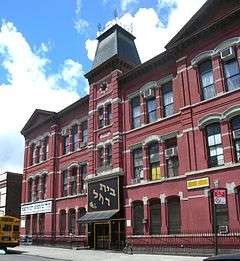
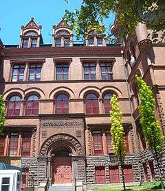
Boy's High School |
|
000000001982-02-25-0000February 25, 1982
(#82003361) |
832 Marcy Ave.
40°41′04″N 73°56′54″W / 40.684444°N 73.948333°W / 40.684444; -73.948333 (Boy's High School) |
Bedford-Stuyvesant |
|
| 26 |
Brooklyn Academy of Music |
|
000000002006-05-02-0000May 2, 2006
(#06000251) |
30 Lafayette Ave.
40°41′11″N 73°58′41″W / 40.686389°N 73.978056°W / 40.686389; -73.978056 (Brooklyn Academy of Music) |
Fort Greene |
|
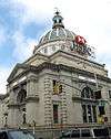
| 27 |
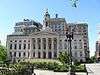
Brooklyn Borough Hall |
|
000000001980-01-10-0000January 10, 1980
(#80002630) |
209 Joralemon St.
40°41′34″N 73°59′27″W / 40.692778°N 73.990833°W / 40.692778; -73.990833 (Brooklyn Borough Hall) |
Downtown Brooklyn |
|
| 28 |
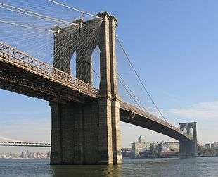
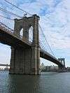
Brooklyn Bridge |
|
000000001966-10-15-0000October 15, 1966
(#66000523) |
Across the East River from Brooklyn to Manhattan
40°42′23″N 73°59′51″W / 40.706389°N 73.9975°W / 40.706389; -73.9975 (Brooklyn Bridge) |
Brooklyn |
|
| 29 |
Brooklyn Heights Historic District |
|
000000001966-10-15-0000October 15, 1966
(#66000524) |
Borough of Brooklyn, bounded by Atlantic Ave., Court and Fulton Sts. and the East River
40°41′48″N 73°59′48″W / 40.696667°N 73.996667°W / 40.696667; -73.996667 (Brooklyn Heights Historic District) |
Brooklyn Heights |
|
| 30 |
Brooklyn Historical Society |
|
000000001991-07-17-0000July 17, 1991
(#91002054) |
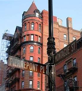
128 Pierrepont St.
40°41′41″N 73°59′34″W / 40.694722°N 73.992778°W / 40.694722; -73.992778 (Brooklyn Historical Society) |
Brooklyn Heights |
|
| 31 |
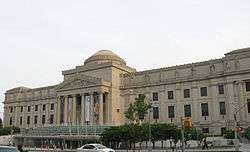
Brooklyn Museum |
|
000000001977-08-22-0000August 22, 1977
(#77000944) |
Eastern Parkway and Washington Ave.
40°40′14″N 73°57′51″W / 40.670556°N 73.964167°W / 40.670556; -73.964167 (Brooklyn Museum) |
Prospect Heights |
|
| 32 |
Brooklyn Navy Yard Historic District |
|
000000002014-05-22-0000May 22, 2014
(#14000261) |
Little, Evans, Navy & Williamsburg Sts., Hudson & Flushing Aves., Wallabout Bay
40°42′00″N 73°58′12″W / 40.70000°N 73.97000°W / 40.70000; -73.97000 (Brooklyn Navy Yard Historic District) |
Wallabout Basin |
Shipyard where naval vessels were built and maintained from Revolution to World War II.
|
| 33 |
Brooklyn Public Library-Central Building |
|
000000002002-01-11-0000January 11, 2002
(#01001446) |
Grand Army Plaza
40°40′20″N 73°58′07″W / 40.672222°N 73.968611°W / 40.672222; -73.968611 (Brooklyn Public Library-Central Building) |
Grand Army Plaza |
|
| 34 |
Brooklyn Trust Company Building |
|
000000002009-08-20-0000August 20, 2009
(#09000632) |
177 Montague St.
40°41′39″N 73°59′33″W / 40.694286°N 73.9924°W / 40.694286; -73.9924 (Brooklyn Trust Company Building) |
Brooklyn Heights |
|
| 35 |
Buildings at 375-379 Flatbush Avenue and 185-187 Sterling Place |
|
000000001984-09-07-0000September 7, 1984
(#84002440) |
375-379 Flatbush Ave. and 185-187 Sterling Pl.
40°40′36″N 73°58′19″W / 40.676667°N 73.971944°W / 40.676667; -73.971944 (Buildings at 375-379 Flatbush Avenue and 185-187 Sterling Place) |
Brooklyn |
|
| 36 |
Carroll Gardens Historic District |
|
000000001983-09-26-0000September 26, 1983
(#83001687) |
Carroll and President Sts. between Smith and Hoyt Sts.
40°40′47″N 73°59′25″W / 40.679722°N 73.990278°W / 40.679722; -73.990278 (Carroll Gardens Historic District) |
Carroll Gardens |
|
| 37 |
Casemate Fort, Whiting Quadrangle |
|
000000001974-08-07-0000August 7, 1974
(#74001249) |
Fort Hamilton, off NY 27
40°36′31″N 74°01′58″W / 40.608611°N 74.032778°W / 40.608611; -74.032778 (Casemate Fort, Whiting Quadrangle) |
Fort Hamilton |
|
| 38 |
Christ Evangelical English Lutheran Church |
|
000000002007-08-30-0000August 30, 2007
(#07000870) |
1084 Lafayette Ave.
40°41′32″N 73°55′45″W / 40.692222°N 73.929167°W / 40.692222; -73.929167 (Christ Evangelical English Lutheran Church) |
Bedford–Stuyvesant |
|
| 39 |
Church of the Holy Innocents |
|
000000002005-06-16-0000June 16, 2005
(#05000617) |
279 E. 17th St.
40°38′39″N 73°57′46″W / 40.644167°N 73.962778°W / 40.644167; -73.962778 (Church of the Holy Innocents) |
Flatbush |
|
| 40 |
Clinton Hill Historic District |
|
000000001985-06-19-0000June 19, 1985
(#85001335) |
Roughly bounded by Willoughby and Grand Aves., Fulton St. and Vanderbilt Ave.
40°41′14″N 73°57′55″W / 40.687222°N 73.965278°W / 40.687222; -73.965278 (Clinton Hill Historic District) |
Clinton Hill |
|
| 41 |
Clinton Hill South Historic District |
|
000000001986-07-17-0000July 17, 1986
(#86001675) |
Roughly Lefferts and Brevoort Pl. between Washington Ave. and Bedford Pl.
40°40′50″N 73°57′32″W / 40.680556°N 73.958889°W / 40.680556; -73.958889 (Clinton Hill South Historic District) |
Clinton Hill |
|
| 42 |
Cobble Hill Historic District |
|
000000001976-06-11-0000June 11, 1976
(#76001225) |
Roughly bounded by Atlantic Ave., Court, Degraw and Hicks Sts.
40°41′21″N 73°59′47″W / 40.689167°N 73.996389°W / 40.689167; -73.996389 (Cobble Hill Historic District) |
Cobble Hill |
|
| 43 |
Coney Island Fire Station Pumping Station |
|
000000001981-12-08-0000December 8, 1981
(#81000405) |
2301 Neptune Ave.
40°34′43″N 73°59′31″W / 40.578611°N 73.991944°W / 40.578611; -73.991944 (Coney Island Fire Station Pumping Station) |
Coney Island |
|
| 44 |
Coney Island Yard Electric Motor Repair Shop |
|
000000002006-02-09-0000February 9, 2006
(#06000016) |
SW corner of Avenue X and Shell Rd.
40°35′23″N 73°58′31″W / 40.589722°N 73.975278°W / 40.589722; -73.975278 (Coney Island Yard Electric Motor Repair Shop) |
Coney Island |
part of the New York City Subway System MPS
|
| 45 |
Coney Island Yard Gatehouse |
|
000000002006-02-09-0000February 9, 2006
(#06000017) |
SW corner of Shell Rd. and Avenue X
40°35′22″N 73°58′30″W / 40.589444°N 73.975°W / 40.589444; -73.975 (Coney Island Yard Gatehouse) |
Coney Island |
part of the New York City Subway System MPS
|
| 46 |
Congregation Beth Israel |
|
000000002009-04-30-0000April 30, 2009
(#09000256) |
203 E. 37th St.
40°39′08″N 73°56′35″W / 40.652242°N 73.942922°W / 40.652242; -73.942922 (Congregation Beth Israel) |
East Flatbush |
|
| 47 |
Congregation Chevra Linath Hazedeck |
Upload image |
000000002016-02-16-0000February 16, 2016
(#16000016) |
109 Clara St.
Coordinates missing |
Kensington |
Synagogue completed in 1932 reflects era when Brooklyn was becoming one of the world's major Jewish population centers
|
| 48 |
Congregational Church of the Evangel |
|
000000002009-12-11-0000December 11, 2009
(#09001081) |
1950 Bedford Ave.
40°39′27″N 73°57′24″W / 40.657428°N 73.956575°W / 40.657428; -73.956575 (Congregational Church of the Evangel) |
Flatbush |
|
| 49 |
Congregation Tifereth Israel |
|
000000002002-01-11-0000January 11, 2002
(#01001442) |
1320 Eight Ave.
40°39′47″N 73°58′56″W / 40.663056°N 73.982222°W / 40.663056; -73.982222 (Congregation Tifereth Israel) |
South Slope |
|
| 50 |
William B. Cronyn House |
|
000000001982-06-03-0000June 3, 1982
(#82005030) |
271 9th St.
40°40′11″N 73°59′16″W / 40.669722°N 73.987778°W / 40.669722; -73.987778 (William B. Cronyn House) |
Park Slope |
|
| 51 |
Crown Heights North Historic District |
|
000000002014-03-31-0000March 31, 2014Boundary increase: 2016-03-11
(#14000092) |
Albany, Brooklyn & St. Mark's Aves., Dean & Pacific Sts., Hampton, Lincoln, Park, Prospect, Revere & St. John's Pls.
40°40′36″N 73°56′43″W / 40.676742°N 73.9451687°W / 40.676742; -73.9451687 (Crown Heights North Historic District) |
Crown Heights |
Neighborhood first developed in 1870 contains over 1,500 well-preserved buildings in distinct period styles up to 1930s. 2016 boundary increase added properties related to Shirley Chisholm, first African-American woman in Congress.
|
| 52 |
Cuyler Presbyterian Church |
|
000000002001-03-23-0000March 23, 2001
(#01000253) |
358-360 Pacific St.
40°41′12″N 73°59′13″W / 40.686667°N 73.986944°W / 40.686667; -73.986944 (Cuyler Presbyterian Church) |
Boerum Hill |
|
| 53 |
Cyclone Roller Coaster |
|
000000001991-06-25-0000June 25, 1991
(#91000907) |
834 Surf Ave. at W. 10th St.
40°34′30″N 73°58′44″W / 40.575°N 73.978889°W / 40.575; -73.978889 (Cyclone Roller Coaster) |
Coney Island |
|
| 54 |
Cypress Avenue West Historic District |
|
000000001983-09-30-0000September 30, 1983
(#83001768) |
Roughly bounded by St. Nicholas and Seneca Aves., Linden and Stockholm Sts.
40°42′15″N 73°54′46″W / 40.704097°N 73.912906°W / 40.704097; -73.912906 (Cypress Avenue West Historic District) |
New York |
part of the Ridgewood MRA
|
| 55 |
Cypress Hills National Cemetery |
|
000000001997-11-13-0000November 13, 1997
(#97001439) |
625 Jamaica Ave.
40°41′14″N 73°52′55″W / 40.687197°N 73.882081°W / 40.687197; -73.882081 (Cypress Hills National Cemetery) |
Cypress Hills |
part of the Civil War Era National Cemeteries MPS
|
| 56 |
Ditmas Park Historic District |
|
000000001983-09-30-0000September 30, 1983
(#83001688) |
Bounded by Marlborough Rd., Dorchester, Ocean, and Newkirk Aves.
40°38′19″N 73°57′40″W / 40.638611°N 73.961111°W / 40.638611; -73.961111 (Ditmas Park Historic District) |
Ditmas Park |
|
| 57 |
DUMBO Industrial District |
|
000000002000-09-22-0000September 22, 2000
(#00001151) |
Roughly bounded by Main and Washington Sts, East River, John St., Bridge and Jay Sts., and Front and York Sts.
40°42′11″N 73°59′17″W / 40.703056°N 73.988056°W / 40.703056; -73.988056 (DUMBO Industrial District) |
DUMBO |
|
| 58 |
East Midwood Jewish Center |
|
000000002006-06-07-0000June 7, 2006
(#06000478) |
1625 Ocean Ave.
40°37′20″N 73°57′20″W / 40.622222°N 73.955556°W / 40.622222; -73.955556 (East Midwood Jewish Center) |
Midwood |
|
| 59 |
Eastern Parkway |
|
000000001983-09-26-0000September 26, 1983
(#83001689) |
Eastern Pkwy from Grand Army Plaza to Ralph Ave.
40°40′14″N 73°58′08″W / 40.670556°N 73.968889°W / 40.670556; -73.968889 (Eastern Parkway) |
Brooklyn |
|
| 60 |
Eighth Avenue (14th Brooklyn Regiment) Armory |
|
000000001994-04-14-0000April 14, 1994
(#94000367) |
1402 Eighth Ave.
40°39′46″N 73°59′00″W / 40.662778°N 73.983333°W / 40.662778; -73.983333 (Eighth Avenue (14th Brooklyn Regiment) Armory) |
Park Slope |
Former home of 14th Brooklyn Regiment; part of the Army National Guard Armories in New York State MPS
|
| 61 |
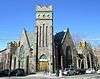
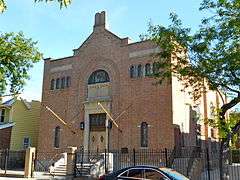
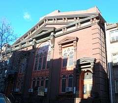
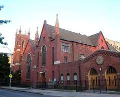
Emmanuel Baptist Church |
|
000000001977-12-16-0000December 16, 1977
(#77000945) |
279 Lafayette Ave.
40°41′17″N 73°58′10″W / 40.688056°N 73.969444°W / 40.688056; -73.969444 (Emmanuel Baptist Church) |
Clinton Hill |
|
| 62 |
Erasmus Hall Academy |
|
000000001975-11-11-0000November 11, 1975
(#75001192) |
Between Flatbush, Bedford, Church, and Snyder Aves.
40°38′58″N 73°57′28″W / 40.649444°N 73.957778°W / 40.649444; -73.957778 (Erasmus Hall Academy) |
Flatbush |
|
| 63 |
Evergreens Cemetery |
|
000000002007-11-15-0000November 15, 2007
(#07001192) |
1629 Bushwick Ave.
40°41′04″N 73°54′04″W / 40.684531°N 73.901198°W / 40.684531; -73.901198 (Evergreens Cemetery) |
Brooklyn |
|
| 64 |
Federal Building and Post Office |
|
000000001974-10-09-0000October 9, 1974
(#74001250) |
271 Cadman Plaza, E.
40°41′44″N 73°59′24″W / 40.695556°N 73.99°W / 40.695556; -73.99 (Federal Building and Post Office) |
Downtown Brooklyn |
|
| 65 |
Feuchtwanger Stable |
|
000000001986-03-20-0000March 20, 1986
(#86000485) |
159 Carlton Ave.
40°41′34″N 73°58′22″W / 40.692778°N 73.972778°W / 40.692778; -73.972778 (Feuchtwanger Stable) |
Fort Greene |
|
| 66 |
Flatbush Dutch Reformed Church Complex |
|
000000001983-09-08-0000September 8, 1983
(#83001690) |
890 Flatbush Ave. and 2101-2103 Kenmore Terr.
40°39′00″N 73°57′33″W / 40.65°N 73.959167°W / 40.65; -73.959167 (Flatbush Dutch Reformed Church Complex) |
Flatbush |
|
| 67 |
Flatbush Town Hall |
|
000000001972-07-24-0000July 24, 1972
(#72000851) |
35 Snyder Ave.
40°38′56″N 73°57′26″W / 40.648889°N 73.957222°W / 40.648889; -73.957222 (Flatbush Town Hall) |
Flatbush |
|
| 68 |
Flatlands Dutch Reformed Church |
|
000000001979-08-30-0000August 30, 1979
(#79001588) |
Kings Hwy. and E. 40th St.
40°37′26″N 73°56′13″W / 40.623889°N 73.936944°W / 40.623889; -73.936944 (Flatlands Dutch Reformed Church) |
Flatlands |
|
| 69 |
Floyd Bennett Field Historic District |
|
000000001980-04-11-0000April 11, 1980
(#80000363) |
Flatbush Ave.
40°35′17″N 73°53′32″W / 40.588056°N 73.892222°W / 40.588056; -73.892222 (Floyd Bennett Field Historic District) |
Marine Park |
|
| 70 |
Fort Greene Historic District |
|
000000001983-09-26-0000September 26, 1983
(#83001691) |
Roughly bounded by Ft. Greene Pl., Fulton St., Vanderbilt and Myrtle Aves.; also roughly bounded by Ashland Pl., DeKalb Ave., Hanson Pl., and Oxford St., Adelphi St., Vanderbilt and Myrtle Aves.
40°41′19″N 73°58′19″W / 40.688611°N 73.971944°W / 40.688611; -73.971944 (Fort Greene Historic District) |
Fort Greene |
Second set of boundaries represents a boundary increase of 000000001984-09-07-0000September 7, 1984
|
| 71 |
Friends Meetinghouse and School |
|
000000001982-11-04-0000November 4, 1982
(#82001179) |
110 Schermerhorn St.
40°41′23″N 73°59′24″W / 40.689722°N 73.99°W / 40.689722; -73.99 (Friends Meetinghouse and School) |
Downtown Brooklyn |
|
| 72 |
Fulton Ferry District |
|
000000001974-06-28-0000June 28, 1974
(#74001251) |
Roughly bounded by the East River and Washington, Water, Front, and Doughty Sts.
40°42′12″N 73°59′35″W / 40.703333°N 73.993056°W / 40.703333; -73.993056 (Fulton Ferry District) |
Fulton Ferry |
|
| 73 |
Gage and Tollner Restaurant |
|
000000001982-06-03-0000June 3, 1982
(#82003362) |
372 Fulton St.
40°41′28″N 73°59′17″W / 40.691111°N 73.988056°W / 40.691111; -73.988056 (Gage and Tollner Restaurant) |
Downtown Brooklyn |
|
| 74 |
Grecian Shelter |
|
000000001972-01-20-0000January 20, 1972
(#72000852) |
Prospect Park near Parkside Ave.
40°39′13″N 73°58′03″W / 40.653611°N 73.9675°W / 40.653611; -73.9675 (Grecian Shelter) |
Prospect Park |
|
| 75 |
Green-Wood Cemetery |
|
000000001997-03-08-0000March 8, 1997
(#97000228) |
500 25th Street
40°39′08″N 73°59′26″W / 40.652222°N 73.990556°W / 40.652222; -73.990556 (Green-Wood Cemetery) |
Brooklyn |
|
| 76 |
Greenwood Baptist Church |
|
000000002016-02-16-0000February 16, 2016
(#16000017) |
461 6th St.
Coordinates missing |
Park Slope |
Gothic Revival church built 1901 for congregation that played a large role in the growth of Baptism in Brooklyn
|
| 77 |
Greenpoint Historic District |
|
000000001983-09-26-0000September 26, 1983
(#83001692) |
Roughly bounded by Kent, Calyer, Noble, and Franklin Sts., Clifford Pl. and Manhattan Ave.
40°43′43″N 73°57′20″W / 40.728611°N 73.955556°W / 40.728611; -73.955556 (Greenpoint Historic District) |
Greenpoint |
|
| 78 |
Hanson Place Seventh Day Adventist Church |
|
000000001980-04-23-0000April 23, 1980
(#80002631) |
88 Hanson Pl.
40°41′07″N 73°58′28″W / 40.685278°N 73.974444°W / 40.685278; -73.974444 (Hanson Place Seventh Day Adventist Church) |
Fort Greene |
|
| 79 |
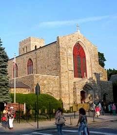
Holy Trinity Church (Protestant Episcopal) |
|
000000001987-12-23-0000December 23, 1987
(#87002590) |
157 Montague St.
40°41′40″N 73°59′35″W / 40.694444°N 73.993056°W / 40.694444; -73.993056 (Holy Trinity Church (Protestant Episcopal)) |
Brooklyn Heights |
|
| 80 |
Houses at 216-264 Ovington Ave. |
|
000000002007-06-05-0000June 5, 2007
(#07000488) |
216-264 Ovington Ave.
40°38′05″N 74°01′42″W / 40.634722°N 74.028333°W / 40.634722; -74.028333 (Houses at 216-264 Ovington Ave.) |
Bay Ridge |
|
| 81 |
Hubbard House |
|
000000002000-06-02-0000June 2, 2000
(#00000575) |
2138 McDonald Ave.
40°36′00″N 73°58′25″W / 40.6°N 73.973611°W / 40.6; -73.973611 (Hubbard House) |
Gravesend |
|
| 82 |
Hunterfly Road Historic District |
|
000000001972-12-05-0000December 5, 1972
(#72000853) |
1698, 1700, 1702, 1704, 1706, 1708 Bergen St.
40°40′28″N 73°55′35″W / 40.674444°N 73.926389°W / 40.674444; -73.926389 (Hunterfly Road Historic District) |
Weeksville |
|
| 83 |
Immanuel Congregational Church |
|
000000002006-06-07-0000June 7, 2006
(#06000479) |
461 Decatur St.
40°40′57″N 73°55′30″W / 40.6825°N 73.925°W / 40.6825; -73.925 (Immanuel Congregational Church) |
Bedford–Stuyvesant |
|
| 84 |
Industrial Complex at 221 McKibbin Street |
|
000000002009-05-12-0000May 12, 2009
(#09000303) |
221 McKibbin St.
40°42′20″N 73°56′19″W / 40.705417°N 73.938636°W / 40.705417; -73.938636 (Industrial Complex at 221 McKibbin Street) |
East Williamsburg |
|
| 85 |
The Jewish Center of Coney Island |
|
000000002013-12-11-0000December 11, 2013
(#13000908) |
2915 Ocean Parkway
40°34′47″N 73°58′09″W / 40.5798004°N 73.9692527°W / 40.5798004; -73.9692527 (The Jewish Center of Coney Island) |
Brighton Beach |
First synagogue serving newly established Jewish community in Brighton Beach, built ca. 1930, uses unique combination of Renaissance Revival and Semitic architectural styles.
|
| 86 |
Jewish Center of Kings Highway |
|
000000002010-02-12-0000February 12, 2010
(#10000009) |
1202-1218 Ave. P
40°36′36″N 73°57′39″W / 40.610128°N 73.960958°W / 40.610128; -73.960958 (Jewish Center of Kings Highway) |
Flatbush |
|
| 87 |
Kings County Savings Bank |
|
000000001980-04-16-0000April 16, 1980
(#80002632) |
135 Broadway
40°42′37″N 73°57′51″W / 40.710278°N 73.964167°W / 40.710278; -73.964167 (Kings County Savings Bank) |
Williamsburg |
|
| 88 |
Kingsway Jewish Center |
|
000000002010-02-12-0000February 12, 2010
(#10000010) |
2810 Nostrand Ave.
40°36′57″N 73°56′41″W / 40.615867°N 73.944781°W / 40.615867; -73.944781 (Kingsway Jewish Center) |
Midwood |
|
| 89 |
Kismet Temple |
|
000000002013-12-11-0000December 11, 2013
(#13000909) |
92 Herkimer St.
40°40′45″N 73°57′10″W / 40.679184°N 73.9527247°W / 40.679184; -73.9527247 (Kismet Temple) |
Bedford–Stuyvesant |
|
| 90 |
Knickerbocker Field Club |
|
000000001982-10-29-0000October 29, 1982
(#82001180) |
114 E. 18th St.
40°38′52″N 73°57′49″W / 40.647778°N 73.963611°W / 40.647778; -73.963611 (Knickerbocker Field Club) |
Prospect Park South |
Destroyed by fire in 1988, building pictured is the modern replacement.
|
| 91 |
Kol Israel Synagogue |
|
000000002009-12-02-0000December 2, 2009
(#09000966) |
603 St. John's Place
40°40′22″N 73°57′29″W / 40.672842°N 73.958186°W / 40.672842; -73.958186 (Kol Israel Synagogue) |
Crown Heights |
|
| 92 |
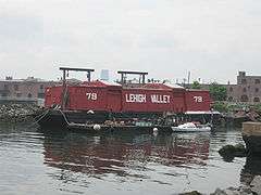
Lehigh Valley Railroad Barge No. 79 |
|
000000002015-06-02-0000June 2, 2015
(#15000309) |
290 Conover St.
40°40′31″N 74°01′11″W / 40.6753473°N 74.0198149°W / 40.6753473; -74.0198149 (Lehigh Valley Railroad Barge No. 79) |
Red Hook |
Moved here from Edgewater, N.J.
|
| 93 |
Lefferts Manor Historic District |
|
000000001992-05-18-0000May 18, 1992
(#83004872) |
Roughly bounded by Lincoln Rd., Fenimore St., Rogers Ave. and Flatbush Ave.
40°39′26″N 73°57′26″W / 40.657222°N 73.957222°W / 40.657222; -73.957222 (Lefferts Manor Historic District) |
Prospect Lefferts Gardens |
|
| 94 |
Lefferts-Laidlaw House |
|
000000001985-09-12-0000September 12, 1985
(#85002279) |
136 Clinton St.
40°41′37″N 73°58′10″W / 40.693611°N 73.969444°W / 40.693611; -73.969444 (Lefferts-Laidlaw House) |
Brooklyn Heights |
|
| 95 |
Lincoln Club |
|
000000001983-01-27-0000January 27, 1983
(#83001693) |
65 Putnam Ave.
40°40′59″N 73°57′35″W / 40.683056°N 73.959722°W / 40.683056; -73.959722 (Lincoln Club) |
Clinton Hill |
|
| 96 |
Litchfield Villa |
|
000000001977-09-14-0000September 14, 1977
(#77000946) |
Prospect Park W. and 5th St.
40°40′08″N 73°58′26″W / 40.668889°N 73.973889°W / 40.668889; -73.973889 (Litchfield Villa) |
Prospect Park |
|
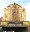
| 97 |
Loew's Kings Theatre |
|
000000002012-08-22-0000August 22, 2012
(#12000534) |
1027 Flatbush Ave
40°38′45″N 73°57′27″W / 40.64580°N 73.95750°W / 40.64580; -73.95750 (Loew's Kings Theatre) |
Flatbush |
1929 Rapp and Rapp theater, unusually spacious for the area, closed in 1977. Sylvester Stallone once worked as an usher.
|
| 98 |
Hendrick I. Lott House |
|
000000001994-03-03-0000March 3, 1994
(#83004645) |
1940 E. 36th St.
40°36′37″N 73°55′58″W / 40.610278°N 73.932778°W / 40.610278; -73.932778 (Hendrick I. Lott House) |
Marine Park |
|
| 99 |
Magen David Synagogue |
|
000000002004-04-15-0000April 15, 2004
(#04000293) |
2017 67th St.
40°36′54″N 73°59′12″W / 40.615°N 73.986667°W / 40.615; -73.986667 (Magen David Synagogue) |
Bensonhurst |
|
| 100 |
Manhattan Beach Jewish Center |
Upload image |
000000002015-05-26-0000May 26, 2015
(#15000266) |
60 West End Ave.
40°34′50″N 73°57′22″W / 40.5804399°N 73.9560968°W / 40.5804399; -73.9560968 (Manhattan Beach Jewish Center) |
Manhattan Beach |
1952 Bauhaus-influenced synagogue building
|
| 101 |
Manhattan Bridge |
|
000000001983-08-30-0000August 30, 1983
(#83001694) |
Spans East River between Front and Canal St.
40°42′36″N 73°59′18″W / 40.71°N 73.988333°W / 40.71; -73.988333 (Manhattan Bridge) |
Downtown Brooklyn |
|
| 102 |
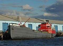
MARY A. WHALEN (tanker) |
|
000000002012-10-03-0000October 3, 2012
(#12000831) |
Pier 9B, Red Hook Container Terminal
40°41′05″N 74°00′28″W / 40.6847785°N 74.0076727°W / 40.6847785; -74.0076727 (MARY A. WHALEN (tanker)) |
Red Hook |
Tanker that shipped oil along East Coast; at center of United States v. Reliable Transfer Co., seminal decision in maritime law
|
| 103 |
Monsignor McGolrick Park and Shelter Pavilion |
|
000000001980-05-06-0000May 6, 1980
(#80002633) |
Bounded by Nassau and Driggs Aves., Russell and Monitor Sts.
40°43′28″N 73°56′38″W / 40.724444°N 73.943889°W / 40.724444; -73.943889 (Monsignor McGolrick Park and Shelter Pavilion) |
Greenpoint |
|
| 104 |
New England Congregational Church and Rectory |
|
000000001983-09-15-0000September 15, 1983
(#83001695) |
177-179 S. 9th St.
40°42′31″N 73°57′45″W / 40.708611°N 73.9625°W / 40.708611; -73.9625 (New England Congregational Church and Rectory) |
Williamsburg |
|
| 105 |
New Lots Reformed Church and Cemetery |
|
000000001983-05-19-0000May 19, 1983
(#83001696) |
630 New Lots Ave.
40°39′53″N 73°53′08″W / 40.664722°N 73.885556°W / 40.664722; -73.885556 (New Lots Reformed Church and Cemetery) |
New Lots |
|
| 106 |
New Utrecht Avenue Station (Dual System BRT) |
|
000000002005-07-06-0000July 6, 2005
(#05000678) |
Beneath the junction of New Utrecht Ave. with 15th Ave. and 62nd St.
40°37′29″N 73°59′48″W / 40.624722°N 73.996667°W / 40.624722; -73.996667 (New Utrecht Avenue Station (Dual System BRT)) |
Bensonhurst and Borough Park |
Subway station (N train); part of the New York City Subway System MPS
|
| 107 |
New Utrecht Reformed Church and Buildings |
|
000000001980-04-09-0000April 9, 1980
(#80002634) |
18th Ave. and 83rd St.; also 8523 16th Ave.
40°36′30″N 74°00′03″W / 40.608333°N 74.000833°W / 40.608333; -74.000833 (New Utrecht Reformed Church and Buildings) |
New Utrecht |
16th Ave. represents a boundary increase of 000000002001-03-05-0000March 5, 2001, the "New Utrecht Reformed Church Complex"
|
| 108 |
New York Congregational Home for the Aged |
|
000000002008-11-05-0000November 5, 2008
(#08001033) |
123 Linden Blvd.
40°39′09″N 73°57′15″W / 40.652425°N 73.954175°W / 40.652425; -73.954175 (New York Congregational Home for the Aged) |
Flatbush |
|
| 109 |
Ocean Parkway |
|
000000001983-09-08-0000September 8, 1983
(#83001697) |
From Church Ave. to Seabreeze Ave.
40°36′19″N 73°58′11″W / 40.605278°N 73.969722°W / 40.605278; -73.969722 (Ocean Parkway) |
Brooklyn |
|
| 110 |
Ocean Parkway Jewish Center |
|
000000002009-12-11-0000December 11, 2009
(#09001082) |
550 Ocean Pkwy.
40°38′04″N 73°58′23″W / 40.634511°N 73.973058°W / 40.634511; -73.973058 (Ocean Parkway Jewish Center) |
Kensington |
|
| 111 |
Ocean Parkway Station (Dual System BRT) |
|
000000002005-07-29-0000July 29, 2005
(#05000749) |
Above the junction of Brighton Beach Ave. and Ocean Pkwy
40°34′35″N 73°58′08″W / 40.576389°N 73.968889°W / 40.576389; -73.968889 (Ocean Parkway Station (Dual System BRT)) |
Brighton Beach |
Subway station (Q train); part of the New York City Subway System MPS
|
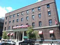
| 112 |
Old Brooklyn Fire Headquarters |
|
000000001972-01-20-0000January 20, 1972
(#72000854) |
365-367 Jay St.
40°41′34″N 73°59′15″W / 40.692778°N 73.9875°W / 40.692778; -73.9875 (Old Brooklyn Fire Headquarters) |
Downtown Brooklyn |
|
| 113 |
Nassau Brewing Company |
|
000000002014-10-22-0000October 22, 2014
(#14000873) |
925-949 Bergan & 1024 Dean Sts.
40°40′37″N 73°57′30″W / 40.6769073°N 73.9583888°W / 40.6769073; -73.9583888 (Nassau Brewing Company) |
Crown Heights |
1865 brewery complex reflecting influx of German immigrants to the area at that time
|
| 114 |
Old First Reformed Church |
|
000000001998-04-01-0000April 1, 1998
(#98000316) |
729 Carroll St.
40°40′24″N 73°58′37″W / 40.673333°N 73.976944°W / 40.673333; -73.976944 (Old First Reformed Church) |
Park Slope |
|
| 115 |
Old Gravesend Cemetery |
|
000000001980-09-17-0000September 17, 1980
(#80002635) |
Gravesend Neck Rd. and MacDonald Ave.
40°35′41″N 73°58′30″W / 40.594722°N 73.975°W / 40.594722; -73.975 (Old Gravesend Cemetery) |
Gravesend |
|
| 116 |
The Old Stone House of Brooklyn |
|
000000002012-09-19-0000September 19, 2012
(#12000797) |
3rd St. at 5th Ave.
40°40′23″N 73°59′04″W / 40.672981°N 73.984575°W / 40.672981; -73.984575 (The Old Stone House of Brooklyn) |
Brooklyn vicinity |
|
| 117 |
Parachute Jump |
|
000000001980-09-02-0000September 2, 1980
(#80002645) |
Coney Island
40°34′21″N 73°59′06″W / 40.5725°N 73.985°W / 40.5725; -73.985 (Parachute Jump) |
Coney Island |
|
| 118 |
Park Slope Historic District |
|
000000001980-11-21-0000November 21, 1980
(#80002636) |
Roughly bounded by Prospect Park West, Berkeley Pl., 15th St., 6th, 7th and Flatbush Aves.
40°40′08″N 73°58′35″W / 40.668889°N 73.976389°W / 40.668889; -73.976389 (Park Slope Historic District) |
Park Slope |
|
| 119 |
Parkway Theatre |
|
000000002010-03-31-0000March 31, 2010
(#10000136) |
1768 St. John's Pl.
40°40′12″N 73°55′08″W / 40.669875°N 73.918772°W / 40.669875; -73.918772 (Parkway Theatre) |
Brownsville |
|
| 120 |
Plymouth Church of the Pilgrims |
|
000000001966-10-15-0000October 15, 1966
(#66000525) |
75 Hicks St.
40°41′57″N 73°59′37″W / 40.699167°N 73.993611°W / 40.699167; -73.993611 (Plymouth Church of the Pilgrims) |
Brooklyn Heights |
|
| 121 |
Pratt Institute Historic District |
|
000000002005-03-23-0000March 23, 2005
(#90001138) |
Roughly bounded by Hall St., Dekalb Ave., Willoughby St. and Emerson Pl.
40°41′28″N 73°57′50″W / 40.691111°N 73.963889°W / 40.691111; -73.963889 (Pratt Institute Historic District) |
Clinton Hill |
|
| 122 |
Prospect Hall |
|
000000001999-04-15-0000April 15, 1999
(#99000460) |
263 Prospect Ave.
40°39′49″N 73°59′24″W / 40.663611°N 73.99°W / 40.663611; -73.99 (Prospect Hall) |
Prospect Heights |
|
| 123 |
Prospect Heights Historic District |
|
000000001983-09-15-0000September 15, 1983
boundary increased February 16, 2016
(#83001698) |
Portions of Bergen and Dean Sts., Flatbush, Underhill, Vanderbelt & Washington Aves., Butler, Prospect & Sterling Pls.
40°40′44″N 73°58′20″W / 40.678889°N 73.972222°W / 40.678889; -73.972222 (Prospect Heights Historic District) |
Prospect Heights |
|
| 124 |
Prospect Park |
|
000000001980-09-17-0000September 17, 1980
(#80002637) |
Bounded by Parkside, Ocean and Flatbush Aves., Prospect Park W., and Prospect SW.
40°39′34″N 73°58′14″W / 40.659444°N 73.970556°W / 40.659444; -73.970556 (Prospect Park) |
Brooklyn |
|
| 125 |
Prospect Park South Historic District |
|
000000001983-07-21-0000July 21, 1983
(#83001699) |
Roughly bounded by BMT RR Tracks, Beverly Rd., and Coney Island and Church Aves.
40°38′46″N 73°58′01″W / 40.646111°N 73.966944°W / 40.646111; -73.966944 (Prospect Park South Historic District) |
Flatbush |
|
| 126 |
Public Bath No. 7 |
|
000000001985-09-12-0000September 12, 1985
(#85002275) |
227-231 Fourth Ave.
40°40′36″N 73°59′00″W / 40.676667°N 73.983333°W / 40.676667; -73.983333 (Public Bath No. 7) |
Park Slope |
|
| 127 |
Public School 108 |
|
000000001982-12-10-0000December 10, 1982
(#82003363) |
200 Lindwood St.
40°40′52″N 73°53′05″W / 40.681111°N 73.884722°W / 40.681111; -73.884722 (Public School 108) |
Cypress Hills |
|
| 128 |
Public School 111 and Public School 9 Annex |
|
000000001981-12-14-0000December 14, 1981
(#81000407) |
249 Sterling Place and 251 Sterling Place
40°40′35″N 73°58′11″W / 40.676389°N 73.969722°W / 40.676389; -73.969722 (Public School 111 and Public School 9 Annex) |
Prospect Heights |
|
| 129 |
Public School 39 |
|
000000001980-04-17-0000April 17, 1980
(#80002646) |
417 6th Ave.
40°40′07″N 73°59′02″W / 40.668611°N 73.983889°W / 40.668611; -73.983889 (Public School 39) |
Park Slope |
|
| 130 |
Public School 65K |
|
000000001981-12-10-0000December 10, 1981
(#81000408) |
158 Richmond St.
40°40′59″N 73°52′40″W / 40.683056°N 73.877778°W / 40.683056; -73.877778 (Public School 65K) |
Cypress Hills |
|
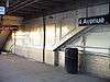
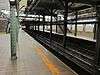
| 131 |
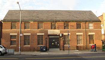
Public School 7 |
Upload image |
000000001983-11-03-0000November 3, 1983
(#83003986) |
131-143 York St.
40°42′06″N 73°59′09″W / 40.701667°N 73.985833°W / 40.701667; -73.985833 (Public School 7) |
Downtown Brooklyn |
|
| 132 |
Public School 71K |
|
000000001982-11-04-0000November 4, 1982
(#82001181) |
119 Heyward St.
40°42′06″N 73°57′24″W / 40.701667°N 73.956667°W / 40.701667; -73.956667 (Public School 71K) |
Williamsburg |
|
| 133 |
Quarters A |
|
000000001974-05-30-0000May 30, 1974
(#74001252) |
U.S. Naval Facility
40°42′09″N 73°58′49″W / 40.702381°N 73.980331°W / 40.702381; -73.980331 (Quarters A) |
Brooklyn Navy Yard |
|
| 134 |
John Rankin House |
|
000000001978-11-16-0000November 16, 1978
(#78001856) |
440 Clinton St.
40°40′53″N 73°59′56″W / 40.681389°N 73.998889°W / 40.681389; -73.998889 (John Rankin House) |
Carroll Gardens |
|
| 135 |
Renaissance Apartments |
|
000000001995-08-22-0000August 22, 1995
(#95001026) |
480 Nostrand Ave.
40°40′56″N 73°57′02″W / 40.682222°N 73.950556°W / 40.682222; -73.950556 (Renaissance Apartments) |
Bedford–Stuyvesant |
|
| 136 |
John Roosevelt "Jackie" Robinson House |
|
000000001976-05-11-0000May 11, 1976
(#76001226) |
5224 Tilden St.
40°38′54″N 73°54′54″W / 40.648333°N 73.915°W / 40.648333; -73.915 (John Roosevelt "Jackie" Robinson House) |
East Flatbush |
|
| 137 |
Rockwood Chocolate Factory Historic District |
|
000000001983-10-06-0000October 6, 1983
(#83003991) |
54-88 Washington, 13-53 Waverly, and 255-275 Park Aves.
40°41′47″N 73°58′06″W / 40.696389°N 73.968333°W / 40.696389; -73.968333 (Rockwood Chocolate Factory Historic District) |
Fort Greene |
|
| 138 |
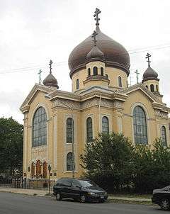
Russian Orthodox Cathedral of the Transfiguration of Our Lord |
|
000000001980-04-16-0000April 16, 1980
(#80002638) |
228 N. 12th St.
40°43′10″N 73°57′14″W / 40.719444°N 73.953889°W / 40.719444; -73.953889 (Russian Orthodox Cathedral of the Transfiguration of Our Lord) |
Greenpoint |
|
| 139 |
Saitta House |
|
000000002007-05-30-0000May 30, 2007
(#07000480) |
1135 84th St.
40°37′02″N 74°00′59″W / 40.617222°N 74.016389°W / 40.617222; -74.016389 (Saitta House) |
Dyker Heights |
|
| 140 |
Senator Street Historic District |
|
000000002002-10-10-0000October 10, 2002
(#02001115) |
318-370 and 317-347 Senator St.
40°38′12″N 74°01′27″W / 40.6366°N 74.0241°W / 40.6366; -74.0241 (Senator Street Historic District) |
Bay Ridge |
|
| 141 |
Shaari Zedek Synagogue |
|
000000002009-12-04-0000December 4, 2009
(#09000968) |
767 Putnam Ave.
40°41′11″N 73°55′51″W / 40.686442°N 73.9309°W / 40.686442; -73.9309 (Shaari Zedek Synagogue) |
Bedford-Stuyvesant |
|
| 142 |
South Bushwick Reformed Protestant Dutch Church Complex |
|
000000001982-11-04-0000November 4, 1982
(#82001182) |
855-857 Bushwick Ave.
40°41′39″N 73°55′34″W / 40.694167°N 73.926111°W / 40.694167; -73.926111 (South Bushwick Reformed Protestant Dutch Church Complex) |
South Bushwick |
|
| 143 |
South Congregational Church |
|
000000001982-11-04-0000November 4, 1982
(#82001183) |
President and Court Sts.
40°40′55″N 73°59′48″W / 40.681944°N 73.996667°W / 40.681944; -73.996667 (South Congregational Church) |
South Brooklyn |
|
| 144 |
St. Bartholomew's Protestant Episcopal Church and Rectory |
|
000000001980-04-23-0000April 23, 1980
(#80002639) |
1227 Pacific St.
40°40′41″N 73°57′09″W / 40.678056°N 73.9525°W / 40.678056; -73.9525 (St. Bartholomew's Protestant Episcopal Church and Rectory) |
Crown Heights |
|
| 145 |
St. George's Protestant Episcopal Church |
|
000000001983-09-08-0000September 8, 1983
(#83001700) |
800 Marcy Ave.
40°41′10″N 73°56′54″W / 40.686111°N 73.948333°W / 40.686111; -73.948333 (St. George's Protestant Episcopal Church) |
Bedford-Stuyvesant |
|
| 146 |
St. Luke's Protestant Episcopal Church |
|
000000001982-09-16-0000September 16, 1982
(#82003364) |
520 Clinton Ave.
40°40′57″N 73°58′04″W / 40.6825°N 73.967778°W / 40.6825; -73.967778 (St. Luke's Protestant Episcopal Church) |
Clinton Hill |
|
| 147 |
St. Mary's Episcopal Church |
|
000000001983-07-21-0000July 21, 1983
(#83001701) |
230 Classon Ave.
40°41′34″N 73°57′42″W / 40.692778°N 73.961667°W / 40.692778; -73.961667 (St. Mary's Episcopal Church) |
Clinton Hill |
|
| 148 |
St. Paul's Protestant Episcopal Church |
|
000000001989-12-21-0000December 21, 1989
(#89002086) |
199 Carroll St.
40°40′55″N 73°58′25″W / 40.681944°N 73.973611°W / 40.681944; -73.973611 (St. Paul's Protestant Episcopal Church) |
South Brooklyn |
|
| 149 |
State Street Houses |
|
000000001980-01-17-0000January 17, 1980
(#80002640) |
291-299 (odd), 290-324 (even) State St.
40°41′19″N 73°59′16″W / 40.688611°N 73.987778°W / 40.688611; -73.987778 (State Street Houses) |
Downtown |
|
| 150 |
Stoothoff-Baxter-Kouwenhaven House |
|
000000001982-11-14-0000November 14, 1982
(#82001184) |
1640 E. 48th St.
40°37′12″N 73°55′44″W / 40.62°N 73.928889°W / 40.62; -73.928889 (Stoothoff-Baxter-Kouwenhaven House) |
Flatlands |
|
| 151 |
Storehouse No. 2, U.S. Navy Fleet Supply Base |
|
000000002013-02-20-0000February 20, 2013
(#13000026) |
850 3rd Ave.
40°39′34″N 74°00′16″W / 40.659383°N 74.004425°W / 40.659383; -74.004425 (Storehouse No. 2, U.S. Navy Fleet Supply Base) |
Sunset Park |
One of two remaining such facilities from base built for World War I.
|
| 152 |
Stuyvesant Heights Historic District |
|
000000001975-12-04-0000December 4, 1975
(#75001193) |
Roughly bounded by Macon, Tompkins, Decatur, Lewis, Chauncey, and Stuyvesant; also roughly, Decatur St. from Tompkins to Lewis Aves.
40°40′52″N 73°56′14″W / 40.681111°N 73.937222°W / 40.681111; -73.937222 (Stuyvesant Heights Historic District) |
Bedford-Stuyvesant |
Second set of addresses represents a boundary increase of 000000001996-11-15-0000November 15, 1996
|
| 153 |
Substation #401 |
|
000000002005-07-06-0000July 6, 2005
(#05000680) |
3046 Fulton St. bet. Essex St. and Shepherd Ave.
40°40′49″N 73°52′59″W / 40.680278°N 73.883056°W / 40.680278; -73.883056 (Substation #401) |
East New York |
part of the New York City Subway System MPS
|
| 154 |
Sunset Park Historic District |
|
000000001988-09-15-0000September 15, 1988
(#88001464) |
Roughly bounded by Fourth Ave., Thirty-eighth St., Seventh Ave. and Sixty-fourth St.
40°38′38″N 74°00′28″W / 40.643889°N 74.007778°W / 40.643889; -74.007778 (Sunset Park Historic District) |
Sunset Park |
|
| 155 |
Temple Beth El of Borough Park |
|
000000002010-04-27-0000April 27, 2010
(#10000224) |
4802 15th Ave.
40°37′59″N 73°59′14″W / 40.632942°N 73.987142°W / 40.632942; -73.987142 (Temple Beth El of Borough Park) |
Borough Park |
|
| 156 |
Twenty third Regiment Armory |
|
000000001980-05-06-0000May 6, 1980
(#80002641) |
1322 Bedford Ave.
40°40′43″N 73°57′16″W / 40.678611°N 73.954444°W / 40.678611; -73.954444 (Twenty third Regiment Armory) |
Crown Heights |
|
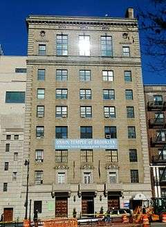
| 157 |
Union Temple of Brooklyn |
|
000000002015-05-18-0000May 18, 2015
(#15000232) |
17 Eastern Pkwy.
40°40′24″N 73°58′05″W / 40.67333°N 73.96792°W / 40.67333; -73.96792 (Union Temple of Brooklyn) |
Prospect Heights |
1926 structure is an excellent example of a synagogue center, merging social, educational and religious practices
|
| 158 |
U.S. Army Military Ocean Terminal |
|
000000001983-09-23-0000September 23, 1983
(#83001702) |
58th-65th St. and 2nd Ave.
40°38′41″N 74°01′40″W / 40.644722°N 74.027778°W / 40.644722; -74.027778 (U.S. Army Military Ocean Terminal) |
Sunset Park |
|
| 159 |
US Post Office-Flatbush Station |
|
000000001988-11-17-0000November 17, 1988
(#88002460) |
2273 Church Ave.
40°39′02″N 73°57′24″W / 40.650556°N 73.956667°W / 40.650556; -73.956667 (US Post Office-Flatbush Station) |
Flatbush |
part of the US Post Offices in New York State, 1858-1943, TR
|
| 160 |
US Post Office-Kensington |
|
000000001988-11-17-0000November 17, 1988
(#88002461) |
421 McDonald Ave.
40°38′37″N 73°58′47″W / 40.643611°N 73.979722°W / 40.643611; -73.979722 (US Post Office-Kensington) |
Kensington |
part of the US Post Offices in New York State, 1858-1943, TR
|
| 161 |
US Post Office-Metropolitan Station |
|
000000001988-11-17-0000November 17, 1988
(#88002462) |
47 Debevoise St.
40°42′06″N 73°56′30″W / 40.701667°N 73.941667°W / 40.701667; -73.941667 (US Post Office-Metropolitan Station) |
Williamsburg |
part of the US Post Offices in New York State, 1858-1943, TR
|
| 162 |
US Post Office-Parkville Station |
|
000000001988-11-17-0000November 17, 1988
(#88002463) |
6618 20th Ave.
40°36′56″N 73°59′15″W / 40.615556°N 73.9875°W / 40.615556; -73.9875 (US Post Office-Parkville Station) |
Bensonhurst |
part of the US Post Offices in New York State, 1858-1943, TR
|
| 163 |
Joost Van Nuyse House |
|
000000002006-06-09-0000June 9, 2006
(#06000477) |
1128 E. 34th St.
40°37′41″N 73°56′38″W / 40.628056°N 73.943889°W / 40.628056; -73.943889 (Joost Van Nuyse House) |
Flatlands |
|
| 164 |
Wallabout Historic District |
|
000000002011-04-27-0000April 27, 2011
(#11000229) |
73-83 & 123-141 Clermont Ave.; 74-148 & 75-143 Clinton Ave.; 381-387, 403-421 & 455-461 Myrtle Ave.; 74-132 & 69-149 Vanderbilt Ave.
40°41′40″N 73°58′12″W / 40.694444°N 73.97°W / 40.694444; -73.97 (Wallabout Historic District) |
Wallabout |
Surviving frame houses from 17th century; one of oldest areas of borough.
|
| 165 |
Wallabout Industrial Historic District |
|
000000002012-08-07-0000August 7, 2012
(#12000479) |
Clinton, Flushing, Grand, Park, Washington, & Waverly Aves., Hall, & Ryerson Sts.
40°41′49″N 73°58′01″W / 40.6969°N 73.967033°W / 40.6969; -73.967033 (Wallabout Industrial Historic District) |
Wallabout |
|
| 166 |
Weir Greenhouse |
|
000000001984-05-10-0000May 10, 1984
(#84002487) |
750-751-5th Ave.
40°39′32″N 73°59′47″W / 40.658889°N 73.996389°W / 40.658889; -73.996389 (Weir Greenhouse) |
Sunset Park |
|
| 167 |
Williamsburgh Savings Bank |
|
000000001980-04-09-0000April 9, 1980
(#80002642) |
175 Broadway
40°42′36″N 73°57′42″W / 40.71°N 73.961667°W / 40.71; -73.961667 (Williamsburgh Savings Bank) |
Williamsburg |
|
| 168 |
Willoughby-Suydam Historic District |
|
000000001983-09-30-0000September 30, 1983
(#83001782) |
Suydam St., Willoughby, St. Nicholas, and Wyckoff Aves.
40°42′21″N 73°55′14″W / 40.705833°N 73.920556°W / 40.705833; -73.920556 (Willoughby-Suydam Historic District) |
Brooklyn |
part of the Ridgewood MRA
|
| 169 |
Wilson Avenue Subway Station (Dual System BMT) |
|
000000002005-07-06-0000July 6, 2005
(#05000681) |
Chauncey St. at Wilson Ave.
40°41′19″N 73°54′17″W / 40.688611°N 73.904722°W / 40.688611; -73.904722 (Wilson Avenue Subway Station (Dual System BMT)) |
Bushwick |
Subway station (L train); part of the New York City Subway System MPS
|
| 170 |
Pieter Wyckoff House |
|
000000001967-12-24-0000December 24, 1967
(#67000013) |
5902 Canarsie Lane
40°38′40″N 73°55′16″W / 40.644444°N 73.921111°W / 40.644444; -73.921111 (Pieter Wyckoff House) |
Flatbush |
|
| 171 |
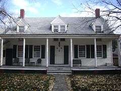
Wyckoff-Bennett Homestead |
|
000000001974-12-24-0000December 24, 1974
(#74001253) |
1669 E. 22nd St.
40°36′39″N 73°57′06″W / 40.61083°N 73.9518°W / 40.61083; -73.9518 (Wyckoff-Bennett Homestead) |
Flatlands |
|
| 172 |
Young Israel of Flatbush |
|
000000002010-02-12-0000February 12, 2010
(#10000011) |
1012 Avenue I
40°37′37″N 73°57′57″W / 40.626925°N 73.965931°W / 40.626925; -73.965931 (Young Israel of Flatbush) |
Flatbush |
|
.JPG)
_Emmanuel_Baptist_Church-1534893.jpeg)