| [3] |
Name on the Register |
Image |
Date listed[4] |
Location |
City or town |
Description |
|---|
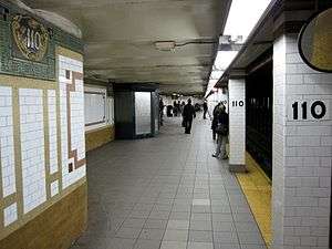
| 1 |
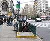
110th Street-Cathedral Parkway Subway Station (IRT) |
|
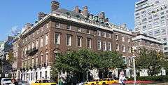
000000002004-09-17-0000September 17, 2004
(#04001019) |
Junction of Broadway, W. 110th St., and Cathedral Pkwy.
40°48′14″N 73°58′01″W / 40.803889°N 73.966944°W / 40.803889; -73.966944 (110th Street-Cathedral Parkway Subway Station (IRT)) |
Morningside Heights |
Subway station (1 train)
|
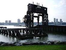
| 2 |
69th Street Transfer Bridge |
|
000000002003-06-26-0000June 26, 2003
(#03000577) |
Hudson River W of the West Side Highway bet. W 66th and 70th Sts.
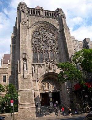
40°46′44″N 73°59′26″W / 40.778889°N 73.990556°W / 40.778889; -73.990556 (69th Street Transfer Bridge) |
Riverside Park |
|
| 3 |
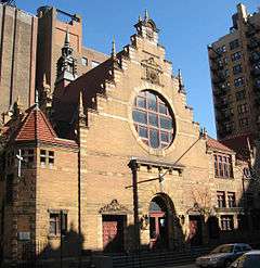
72nd Street Subway Station (IRT) |
|
000000002004-09-17-0000September 17, 2004
(#04001017) |
jct. of Broadway and W. 72nd St.
40°46′42″N 73°58′57″W / 40.778333°N 73.9825°W / 40.778333; -73.9825 (72nd Street Subway Station (IRT)) |
Upper West Side |
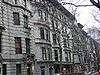
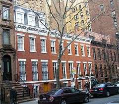
Subway station (1 2 3 trains)
|
| 4 |
79th Street Subway Station (IRT) |
|
000000002004-09-17-0000September 17, 2004
(#04001018) |
Jxt. of W. 79th St. and Broadway
40°47′01″N 73°58′50″W / 40.783611°N 73.980556°W / 40.783611; -73.980556 (79th Street Subway Station (IRT)) |
Upper West Side |
Subway station (1 2 trains)
|
| 5 |
86th Street Subway Station (Dual System IRT) |
|
000000002005-03-30-0000March 30, 2005
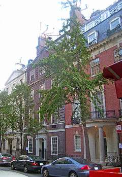
(#05000236) |
Under Lexington Ave., bet E. 85th and E. 87th Sts.
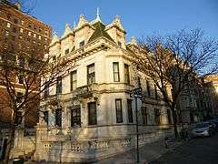
40°46′46″N 73°57′22″W / 40.779444°N 73.956111°W / 40.779444; -73.956111 (86th Street Subway Station (Dual System IRT)) |
Upper East Side |
Subway station (4 5 6 <6> trains)
|
| 6 |
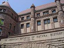
American Museum of Natural History |
|
000000001976-06-24-0000June 24, 1976
(#76001235) |
Central Park West and 77th St.
40°46′53″N 73°58′28″W / 40.781389°N 73.974444°W / 40.781389; -73.974444 (American Museum of Natural History) |
Upper West Side |
|
| 7 |
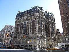
Ansonia Hotel |
|
000000001980-01-10-0000January 10, 1980
(#80002665) |
2101-2119 Broadway
40°46′48″N 73°58′57″W / 40.78°N 73.9825°W / 40.78; -73.9825 (Ansonia Hotel) |
Upper West Side |
|
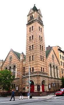
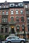
| 8 |
Apartment at 1261 Madison Avenue |
|
000000001982-10-29-0000October 29, 1982
(#82001185) |
1261 Madison Ave.
40°47′00″N 73°57′25″W / 40.783333°N 73.956944°W / 40.783333; -73.956944 (Apartment at 1261 Madison Avenue) |
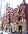
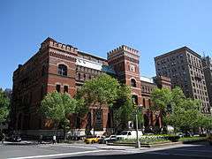
New York |
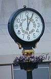
|
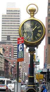
| 9 |
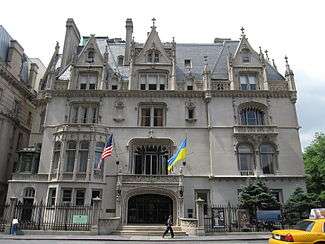
Apthorp Apartments |
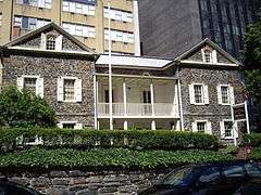
|
000000001978-01-30-0000January 30, 1978
(#78001868) |
2201-2219 Broadway
40°47′02″N 73°58′53″W / 40.783889°N 73.981389°W / 40.783889; -73.981389 (Apthorp Apartments) |
Upper West Side |
|
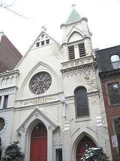
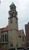
| 10 |
Association Residence Nursing Home |
|
000000001975-02-20-0000February 20, 1975
(#75001201) |
891 Amsterdam Ave. (@ 104)
40°47′55″N 73°58′01″W / 40.798611°N 73.966944°W / 40.798611; -73.966944 (Association Residence Nursing Home) |
New York |
|
| 11 |
George F. Baker Jr. and Sr. Houses |
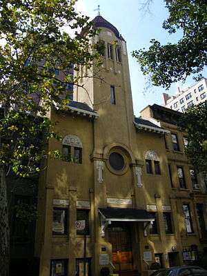
|
000000001982-06-03-0000June 3, 1982
(#82003367) |
67, 69, and 75 E. 93rd St.
40°47′06″N 73°57′15″W / 40.785°N 73.954167°W / 40.785; -73.954167 (George F. Baker Jr. and Sr. Houses) |
New York |
|
| 12 |
Barbizon Hotel for Women |
|
000000001982-10-29-0000October 29, 1982
(#82001186) |
140 E. 63rd St.
40°45′53″N 73°57′58″W / 40.764664°N 73.966239°W / 40.764664; -73.966239 (Barbizon Hotel for Women) |
Upper East Side |
|
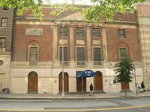
| 13 |
Beacon Theater and Hotel |
|
000000001982-11-04-0000November 4, 1982
(#82001187) |
2124 Broadway
40°46′50″N 73°58′52″W / 40.780556°N 73.981111°W / 40.780556; -73.981111 (Beacon Theater and Hotel) |
Upper West Side |
|
| 14 |
Belnord Apartments |
|
000000001980-04-23-0000April 23, 1980
(#80002670) |
225 W. 86th St.
40°47′18″N 73°58′34″W / 40.788333°N 73.976111°W / 40.788333; -73.976111 (Belnord Apartments) |
Upper West Side |
|
| 15 |
Building at 133 East 80th Street |
|
000000002010-08-16-0000August 16, 2010
(#10000553) |
133 E. 80th St.
40°46′33″N 73°57′31″W / 40.775833°N 73.958611°W / 40.775833; -73.958611 (Building at 133 East 80th Street) |
New York |
Architecturally distinctive building home to McGeorge Bundy and other notable public figures
|
| 16 |
Building at 210 East 68th Street |
|
000000002005-06-16-0000June 16, 2005
(#05000619) |
210 E. 68th St.
40°46′01″N 73°57′46″W / 40.766944°N 73.962778°W / 40.766944; -73.962778 (Building at 210 East 68th Street) |
New York |
|
| 17 |
Building at 45 East 66th Street |
|
000000001980-05-06-0000May 6, 1980
(#80002674) |
45 E. 66th St.
40°46′05″N 73°58′05″W / 40.768056°N 73.968056°W / 40.768056; -73.968056 (Building at 45 East 66th Street) |
New York |
|
| 18 |
James A. Burden Jr. House and Otto H. Kahn House |
|
000000002006-09-12-0000September 12, 2006
(#06000821) |
70 and 1 E. 91st St. (@ 5th)
40°47′05″N 73°57′29″W / 40.784722°N 73.958056°W / 40.784722; -73.958056 (James A. Burden Jr. House and Otto H. Kahn House) |
New York |
|
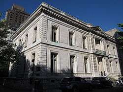
| 19 |
Andrew Carnegie Mansion |
|
000000001966-11-13-0000November 13, 1966
(#66000536) |
2 E. 91st St. (@ Fifth Ave.)
40°47′04″N 73°57′29″W / 40.784444°N 73.958056°W / 40.784444; -73.958056 (Andrew Carnegie Mansion) |
Carnegie Hill |
Now the Cooper-Hewitt, National Design Museum
|
| 20 |
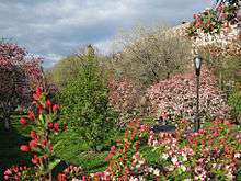
Central Park |
|
000000001966-10-15-0000October 15, 1966
(#66000538) |
Bounded by Central Park S., 5th Ave., Central Park W., 110th St.
40°46′57″N 73°57′57″W / 40.7825°N 73.965833°W / 40.7825; -73.965833 (Central Park) |
New York |
Park designed by Frederick Law Olmsted and Calvert Vaux is their best-known work. One of the world's most famous parks.
|
| 21 |
Central Park West Historic District |
|
000000001982-11-09-0000November 9, 1982
(#82001189) |
Central Park West between 61st and 97th Sts.
40°46′44″N 73°58′32″W / 40.778889°N 73.975556°W / 40.778889; -73.975556 (Central Park West Historic District) |
New York |
Unique and distinctive skyline over park
|
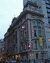
| 22 |
Central Savings Bank |
|
000000001983-09-08-0000September 8, 1983
(#83001720) |
2100-2108 Broadway
40°46′47″N 73°58′54″W / 40.779722°N 73.981667°W / 40.779722; -73.981667 (Central Savings Bank) |
New York |
aka Apple Bank for Savings
|
| 23 |
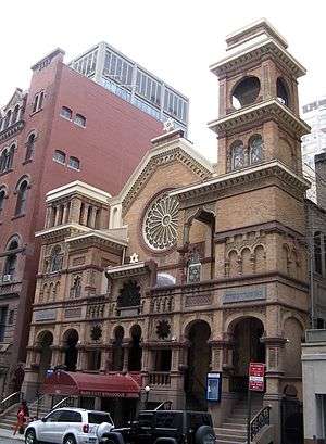
Church of St. Ignatius Loyola Complex |
|
000000001980-07-24-0000July 24, 1980
(#80002679) |
Park Ave., 83rd and 84th Sts.
40°46′44″N 73°57′34″W / 40.778889°N 73.959444°W / 40.778889; -73.959444 (Church of St. Ignatius Loyola Complex) |
New York |
|
| 24 |
Church of St. Paul the Apostle |
|
000000001991-12-05-0000December 5, 1991
(#91001723) |
415 W. 59th St.
40°46′11″N 73°59′07″W / 40.769722°N 73.985278°W / 40.769722; -73.985278 (Church of St. Paul the Apostle) |
New York |
|
| 25 |
City and Suburban Homes Company's First Avenue Estate Historic District |
|
000000001986-08-01-0000August 1, 1986
(#86002622) |
1168-1200 First Ave., 401-429 E. Sixty-fourth, and 402-430 E. Sixty-fifth Sts.
40°45′45″N 73°57′32″W / 40.7625°N 73.958889°W / 40.7625; -73.958889 (City and Suburban Homes Company's First Avenue Estate Historic District) |
New York |
|
| 26 |
City and Suburban Homes Company's York Avenue Estate and Shively Sanitary Tenements Historic District |
|
000000001994-09-15-0000September 15, 1994
(#86003823) |
Roughly bounded by York Ave., E. 77th St., Franklin D. Roosevelt Dr., and E. 79th St.
40°46′13″N 73°56′59″W / 40.770278°N 73.949722°W / 40.770278; -73.949722 (City and Suburban Homes Company's York Avenue Estate and Shively Sanitary Tenements Historic District) |
New York |
|
| 27 |
Claremont Stables |
|
000000001980-04-16-0000April 16, 1980
(#80002683) |
173-177 W. 89th St.
40°47′22″N 73°58′24″W / 40.789444°N 73.973333°W / 40.789444; -73.973333 (Claremont Stables) |
New York |
|
| 28 |
Congregation B'nai Jeshurun Synagogue and Community House |
|
000000001989-06-02-0000June 2, 1989
(#89000474) |
257 W. 88th St. and 270 W. 89th St.
40°47′24″N 73°58′35″W / 40.79°N 73.976389°W / 40.79; -73.976389 (Congregation B'nai Jeshurun Synagogue and Community House) |
New York |
|
| 29 |
Control House on 72nd Street |
|
000000001980-05-06-0000May 6, 1980
(#80002684) |
W. 72nd St. and Broadway
40°46′42″N 73°58′57″W / 40.778333°N 73.9825°W / 40.778333; -73.9825 (Control House on 72nd Street) |
Upper West Side |
Subway control house for the 1 2 3 trains.
|
| 30 |
Lucy Drexel Dahlgren House |
|
000000001989-07-20-0000July 20, 1989
(#89000946) |
15 E. 96th St.
40°47′13″N 73°57′15″W / 40.786944°N 73.954167°W / 40.786944; -73.954167 (Lucy Drexel Dahlgren House) |
Carnegie Hill and East Harlem |
|
| 31 |
Dakota Apartments |
|
000000001972-04-26-0000April 26, 1972
(#72000869) |
1 W. 72nd St. (@ CPW)
40°46′36″N 73°58′35″W / 40.776667°N 73.976389°W / 40.776667; -73.976389 (Dakota Apartments) |
Upper West Side |
Architecturally distinctive late 19th-century apartment complex on Central Park; used for exteriors in Rosemary's Baby and site of John Lennon's murder.
|
| 32 |
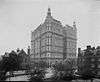
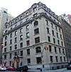
The Dorilton |
|
000000001983-09-08-0000September 8, 1983
(#83001723) |
171 W. 71st St.
40°46′41″N 73°58′55″W / 40.778056°N 73.981944°W / 40.778056; -73.981944 (The Dorilton) |
Upper West Side |
|
| 33 |
Duke Residence |
|
000000001989-12-07-0000December 7, 1989
(#89002090) |
1009 Fifth Ave. (@ 82nd)
40°46′43″N 73°57′45″W / 40.778611°N 73.9625°W / 40.778611; -73.9625 (Duke Residence) |
New York |
|
| 34 |
James B. Duke House |
|
000000001977-11-10-0000November 10, 1977
(#77000956) |
1 E. 78th St.
40°46′35″N 73°57′51″W / 40.776389°N 73.964167°W / 40.776389; -73.964167 (James B. Duke House) |
New York |
Associated with James Buchanan Duke
|
| 35 |
East 73rd Street Historic District |
|
000000001982-07-22-0000July 22, 1982
(#82003374) |
161-179 and 166-182 E. 73rd St.
40°46′14″N 73°57′41″W / 40.770556°N 73.961389°W / 40.770556; -73.961389 (East 73rd Street Historic District) |
New York |
Small enclave of intact former carriage houses of area's wealthy residents
|
| 36 |
East 78th Street Houses |
|
000000001980-03-25-0000March 25, 1980
(#80002685) |
157,159,161, and 163-165 E. 78th St.
40°46′26″N 73°57′32″W / 40.773889°N 73.958889°W / 40.773889; -73.958889 (East 78th Street Houses) |
New York |
Oldest townhouses on the Upper East Side
|
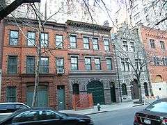
| 37 |
East 80th Street Houses |
|
000000001980-03-26-0000March 26, 1980
(#80002686) |
116-130 E. 80th St.
40°46′00″N 73°57′36″W / 40.766667°N 73.96°W / 40.766667; -73.96 (East 80th Street Houses) |
New York |
Intact high-end 1920s townhouses; homes of Vincent Astor and George Whitney
|
| 38 |
First Battery Armory |
|
000000002013-02-20-0000February 20, 2013
(#13000028) |
56 W. 66th St.
40°46′23″N 73°58′51″W / 40.773034°N 73.9808°W / 40.773034; -73.9808 (First Battery Armory) |
New York |
Intact, exemplary 1903 armory now converted into TV studio
|
| 39 |
First Hungarian Reformed Church |
|
000000002000-08-31-0000August 31, 2000
(#00001012) |
344-346 East 69th St.
40°45′57″N 73°57′32″W / 40.765833°N 73.958889°W / 40.765833; -73.958889 (First Hungarian Reformed Church) |
New York |
1916 Emery Roth church in Hungarian vernacular style is his only Christian religious building
|
| 40 |
Founder's Hall, The Rockefeller University |
|
000000001974-09-13-0000September 13, 1974
(#74001269) |
66th St. and York Ave.
40°45′47″N 73°57′18″W / 40.763056°N 73.955°W / 40.763056; -73.955 (Founder's Hall, The Rockefeller University) |
New York |
|
| 41 |
The Frick Collection and Frick Art Reference Library Building |
|
000000002008-10-06-0000October 6, 2008
(#08001091) |
1 E. 70th St. and 12 E. 71st St.
40°46′22″N 73°58′02″W / 40.772778°N 73.967222°W / 40.772778; -73.967222 (The Frick Collection and Frick Art Reference Library Building) |
New York |
|
| 42 |
Archibald Gracie Mansion |
|
000000001975-05-12-0000May 12, 1975
(#75001205) |
East End Ave. at 88th St.
40°46′34″N 73°56′36″W / 40.776111°N 73.943333°W / 40.776111; -73.943333 (Archibald Gracie Mansion) |
New York |
New York City mayor's residence (HHT)
|
| 43 |
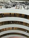
Solomon R. Guggenheim Museum |
|
000000002005-05-19-0000May 19, 2005
(#05000443) |
1071 Fifth Ave. (@ 88th)
40°46′58″N 73°57′34″W / 40.782778°N 73.959444°W / 40.782778; -73.959444 (Solomon R. Guggenheim Museum) |
Museum Mile |
Frank Lloyd Wright's best-known late work
|
| 44 |
Barbara Rutherford Hatch House |
|
000000001983-06-09-0000June 9, 1983
(#83001728) |
153 E. 63rd St.
40°45′52″N 73°57′57″W / 40.764444°N 73.965833°W / 40.764444; -73.965833 (Barbara Rutherford Hatch House) |
New York |
|
| 45 |
Henderson Place Historic District |
|
000000001974-06-20-0000June 20, 1974
(#74001271) |
Henderson Pl. (E86th nr East End Ave)
40°46′31″N 73°56′42″W / 40.775278°N 73.945°W / 40.775278; -73.945 (Henderson Place Historic District) |
New York |
|
| 46 |
Holy Trinity Church, St. Christopher House and Parsonage |
|
000000001980-05-30-0000May 30, 1980
(#80002694) |
312-316 and 332 E. 88th St.
40°46′41″N 73°56′59″W / 40.778056°N 73.949722°W / 40.778056; -73.949722 (Holy Trinity Church, St. Christopher House and Parsonage) |
Upper East Side |
|
| 47 |
House at 49 East 80th Street |
|
000000002007-11-15-0000November 15, 2007
(#07001193) |
49 E 80th St.
40°46′44″N 73°57′40″W / 40.778889°N 73.961111°W / 40.778889; -73.961111 (House at 49 East 80th Street) |
New York |
|
| 48 |
Houses at 1026-1028 Fifth Ave. |
|
000000001999-02-12-0000February 12, 1999
(#99000197) |
1026-1028 Fifth Ave.
40°46′47″N 73°57′42″W / 40.779722°N 73.961667°W / 40.779722; -73.961667 (Houses at 1026-1028 Fifth Ave.) |
New York |
|
| 49 |
Houses at 120 and 122 East 92nd Street |
|
000000001982-10-29-0000October 29, 1982
(#82001195) |
120-122 East 92nd St.
40°47′00″N 73°57′15″W / 40.783333°N 73.954167°W / 40.783333; -73.954167 (Houses at 120 and 122 East 92nd Street) |
New York |
|
| 50 |
Houses at 146-156 East 89th Street |
|
000000001982-06-03-0000June 3, 1982
(#82003378) |
146-156 E. 89th St.
40°46′52″N 73°57′15″W / 40.781111°N 73.954167°W / 40.781111; -73.954167 (Houses at 146-156 East 89th Street) |
Upper East Side |
|
| 51 |
Houses at 208-218 East 78th Street |
|
000000001983-06-30-0000June 30, 1983
(#83001732) |
208-218 E. 78th St.
40°46′23″N 73°57′28″W / 40.773056°N 73.957778°W / 40.773056; -73.957778 (Houses at 208-218 East 78th Street) |
Upper East Side |
Five remaining Civil War-era townhouses of an original row of 16; rounded window lintels unusual in Italianate buildings
|
| 52 |
Level Club |
|
000000001984-04-09-0000April 9, 1984
(#84002784) |
253 W. 73rd St.
40°46′49″N 73°59′00″W / 40.780278°N 73.983333°W / 40.780278; -73.983333 (Level Club) |
Upper West Side |
|
| 53 |
William Goadby Loew House |
|
000000001982-07-15-0000July 15, 1982
(#82003384) |
56 E. 93rd St.
40°47′06″N 73°57′20″W / 40.785°N 73.955556°W / 40.785; -73.955556 (William Goadby Loew House) |
New York |
|
| 54 |
Madison Avenue Facade of the Squadron A Armory |
|
000000001972-03-24-0000March 24, 1972
(#72000877) |
Madison Ave. between 94th and 95th Sts.
40°47′10″N 73°57′18″W / 40.786111°N 73.955°W / 40.786111; -73.955 (Madison Avenue Facade of the Squadron A Armory) |
New York |
|
| 55 |
Master Building |
|
000000002016-02-23-0000February 23, 2016
(#16000036) |
310 Riverside Drive
40°48′02″N 73°58′16″W / 40.80042°N 73.97108°W / 40.80042; -73.97108 (Master Building) |
New York |
Pioneering Art Deco apartment building dating to 1929
|
| 56 |
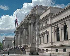
Metropolitan Museum of Art |
|
000000001986-06-24-0000June 24, 1986
(#86003556) |
Fifth Ave. at Eighty-second St.
40°46′44″N 73°57′47″W / 40.779°N 73.963°W / 40.779; -73.963 (Metropolitan Museum of Art) |
Museum Mile |
Richard Morris Hunt's best-known building; America's most important art museum.
|
| 57 |
Lewis G. Morris House |
|
000000001977-02-12-0000February 12, 1977
(#77000960) |
100 E. 85th St.
40°46′46″N 73°57′28″W / 40.779444°N 73.957778°W / 40.779444; -73.957778 (Lewis G. Morris House) |
New York |
|
| 58 |
Municipal Asphalt Plant |
|
000000001980-05-23-0000May 23, 1980
(#80002702) |
East End Ave. between 90th and 91st Sts.
40°46′42″N 73°56′39″W / 40.778333°N 73.944167°W / 40.778333; -73.944167 (Municipal Asphalt Plant) |
New York |
|
| 59 |
New York Cancer Hospital |
|
000000001977-04-29-0000April 29, 1977
(#77000961) |
2 W. 106th St.
40°47′52″N 73°57′39″W / 40.797778°N 73.960833°W / 40.797778; -73.960833 (New York Cancer Hospital) |
New York |
Converted to condominiums; also known as Towers Nursing Home
|
| 60 |
New York Public Library, Yorkville Branch |
|
000000001982-07-15-0000July 15, 1982
(#82003386) |
222 E. 79th St.
40°46′25″N 73°57′25″W / 40.773611°N 73.956944°W / 40.773611; -73.956944 (New York Public Library, Yorkville Branch) |
Yorkville |
|
| 61 |
Park Avenue Historic District |
|
000000002010-08-29-0000August 29, 2010
(#10000588) |
900-1240 and 903-1235 Park Ave.
40°46′53″N 73°57′23″W / 40.781389°N 73.956389°W / 40.781389; -73.956389 (Park Avenue Historic District) |
New York |
Many architecturally distinguished apartment houses from late 19th and early 20th centuries
|
| 62 |
Park Avenue Houses |
|
000000001980-01-03-0000January 3, 1980
(#80002708) |
680, 684, 686 and 690 Park Ave. (@ 68th)
40°46′03″N 73°57′59″W / 40.7675°N 73.966389°W / 40.7675; -73.966389 (Park Avenue Houses) |
New York |
|
| 63 |
Park East Synagogue, Congregation Zichron Ephraim |
|
000000001983-08-18-0000August 18, 1983
(#83001738) |
163 E. 67th St.
40°46′01″N 73°57′50″W / 40.766944°N 73.963889°W / 40.766944; -73.963889 (Park East Synagogue, Congregation Zichron Ephraim) |
New York |
|
| 64 |
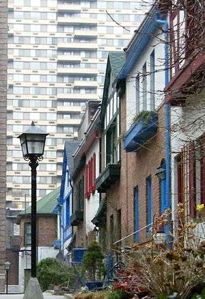
Pomander Walk District |
|
000000001983-09-08-0000September 8, 1983
(#83001739) |
261-267 W. 94th St., 260-274 W. 95th St. and Pomander Walk
40°47′38″N 73°58′25″W / 40.793889°N 73.973611°W / 40.793889; -73.973611 (Pomander Walk District) |
New York |
|
| 65 |
Public School 109 |
|
000000002000-09-22-0000September 22, 2000
(#00001159) |
215 East 99th St.
40°47′13″N 73°56′51″W / 40.786944°N 73.9475°W / 40.786944; -73.9475 (Public School 109) |
New York |
|
| 66 |
Public School 9 |
|
000000001987-08-03-0000August 3, 1987
(#87001258) |
466 W. End Ave.
40°47′11″N 73°58′46″W / 40.786389°N 73.979444°W / 40.786389; -73.979444 (Public School 9) |
New York |
|
| 67 |
Red House |
|
000000001983-09-08-0000September 8, 1983
(#83001742) |
350 W. 85th St.
40°47′20″N 73°58′51″W / 40.788889°N 73.980833°W / 40.788889; -73.980833 (Red House) |
New York |
|
| 68 |
Isaac L. Rice Mansion |
|
000000001980-06-25-0000June 25, 1980
(#80002711) |
346 W. 89th St.
40°47′29″N 73°58′45″W / 40.791389°N 73.979167°W / 40.791389; -73.979167 (Isaac L. Rice Mansion) |
New York |
also known as Isaac L. and Julia B. Rice House: "Villa Julia"; now Yeshiva Ketana of Manhattan
|
| 69 |
Riverside Drive-West 80th-81st Streets Historic District |
|
000000001984-05-10-0000May 10, 1984
(#84002790) |
Riverside Dr., W. 80th and W. 81st Sts.
40°47′28″N 73°58′56″W / 40.791111°N 73.982222°W / 40.791111; -73.982222 (Riverside Drive-West 80th-81st Streets Historic District) |
New York |
|
| 70 |
Riverside Park and Drive |
|
000000001983-09-02-0000September 2, 1983
(#83001743) |
From 72nd St. to 129th St.
40°47′53″N 73°58′31″W / 40.798056°N 73.975278°W / 40.798056; -73.975278 (Riverside Park and Drive) |
New York |
First major Robert Moses project in Manhattan; speeded up travel time to Bronx and Westchester and made river accessible via park
|
| 71 |
Riverside-West 105th Street Historic District |
|
000000001980-08-19-0000August 19, 1980
(#80002712) |
Roughly bounded by W. End Ave., Riverside Dr., W. 104th and W. 106th Sts.
40°48′05″N 73°58′14″W / 40.801389°N 73.970556°W / 40.801389; -73.970556 (Riverside-West 105th Street Historic District) |
New York |
|
| 72 |
John S. Rogers House |
|
000000001983-06-30-0000June 30, 1983
(#83001744) |
53 E. 79th St.
40°46′34″N 73°57′43″W / 40.776111°N 73.961944°W / 40.776111; -73.961944 (John S. Rogers House) |
Upper East Side |
1917 Renaissance Revival mansion has been home to city's oldest cultural institution, New York Society Library, since 1937
|
| 73 |
Sara Delano Roosevelt Memorial House |
|
000000001980-03-28-0000March 28, 1980
(#80002713) |
47 and 49 E. 65th St.
40°46′00″N 73°58′05″W / 40.766667°N 73.968056°W / 40.766667; -73.968056 (Sara Delano Roosevelt Memorial House) |
New York |
|
| 74 |
Rowhouses at 322-344 East 69th Street |
|
000000001984-09-07-0000September 7, 1984
(#84002793) |
322-344 E. 69th St.
40°45′58″N 73°57′31″W / 40.76611°N 73.95861°W / 40.76611; -73.95861 (Rowhouses at 322-344 East 69th Street) |
Upper East Side |
Group of remaining low-rise townhouses from late 19th century
|
| 75 |
St. Cecilia's Church and Convent |
|
000000001984-02-02-0000February 2, 1984
(#84002796) |
112-120 E. 106th St.
40°47′32″N 73°56′52″W / 40.79222°N 73.94778°W / 40.79222; -73.94778 (St. Cecilia's Church and Convent) |
East Harlem |
|
| 76 |
St. Ignatius of Antioch Episcopal Church |
|
000000001999-11-30-0000November 30, 1999
(#99001442) |
552 W. End Ave.
40°47′21″N 73°58′40″W / 40.78916°N 73.97778°W / 40.78916; -73.97778 (St. Ignatius of Antioch Episcopal Church) |
Upper West Side |
|
| 77 |
St. Jean Baptiste Church and Rectory |
|
000000001980-04-23-0000April 23, 1980
(#80002720) |
1067-1071 Lexington Ave.
40°46′21″N 73°57′38″W / 40.7725°N 73.960556°W / 40.7725; -73.960556 (St. Jean Baptiste Church and Rectory) |
Lenox Hill |
1910 church is one of few Catholic churches in city with dome and only one besides St. Patrick's Cathedral to have stained glass made in Chartres. Architect Nicholas Serracino's only work in New York City won a prize in an international competition.
|
| 78 |
St. Michael's Church |
|
000000001996-11-15-0000November 15, 1996
(#96001354) |
225 W. 99th St.
40°47′46″N 73°58′10″W / 40.796111°N 73.969444°W / 40.796111; -73.969444 (St. Michael's Church) |
Upper West Side |
|
| 79 |
St. Vincent Ferrer Church and Priory |
|
000000001984-06-14-0000June 14, 1984
(#84002800) |
869 and 871 Lexington Ave.
40°45′58″N 73°57′55″W / 40.766111°N 73.965278°W / 40.766111; -73.965278 (St. Vincent Ferrer Church and Priory) |
Upper East Side |
1916 Bertram Goodhue Gothic church has unusual touches like Crucifixion carving on front entrance and paintings at Stations of the Cross inside. Complemented by 1880 William Schickel priory.
|
| 80 |
William Schickel House |
|
000000002004-12-06-0000December 6, 2004
(#04001326) |
52 E. 83rd St.
40°46′43″N 73°57′37″W / 40.778611°N 73.960278°W / 40.778611; -73.960278 (William Schickel House) |
New York |
|
| 81 |
Schinasi House |
|
000000001980-04-23-0000April 23, 1980
(#80002714) |
351 Riverside Dr.
40°48′11″N 73°58′09″W / 40.802989°N 73.969206°W / 40.802989; -73.969206 (Schinasi House) |
New York |
|
| 82 |
Seventh Regiment Armory |
|
000000001975-04-14-0000April 14, 1975
(#75001208) |
643 Park Ave.
40°46′01″N 73°57′58″W / 40.766944°N 73.966111°W / 40.766944; -73.966111 (Seventh Regiment Armory) |
Upper East Side |
|
| 83 |
Sidewalk Clock at 1501 3rd Avenue, Manhattan |
|
000000001985-04-18-0000April 18, 1985
(#85000926) |
1501 3rd Ave. (@ 85th)
40°46′40″N 73°57′16″W / 40.777833°N 73.954528°W / 40.777833; -73.954528 (Sidewalk Clock at 1501 3rd Avenue, Manhattan) |
Upper East Side |
|
| 84 |
Sidewalk Clock at 783 5th Avenue, Manhattan |
|
000000001985-04-18-0000April 18, 1985
(#85000930) |
783 5th Ave.
40°45′52″N 73°58′24″W / 40.764444°N 73.97333°W / 40.764444; -73.97333 (Sidewalk Clock at 783 5th Avenue, Manhattan) |
Lenox Hill |
Historic sidewalk clock in front of The Sherry-Netherland
|
| 85 |
Harry F. Sinclair House |
|
000000001978-06-02-0000June 2, 1978
(#78001882) |
2 E. 79th St.
40°46′36″N 73°57′50″W / 40.77667°N 73.96388°W / 40.77667; -73.96388 (Harry F. Sinclair House) |
New York |
|
| 86 |
Abigail Adams Smith Museum |
|
000000001973-01-12-0000January 12, 1973
(#73001223) |
421 E. 61st St.
40°45′37″N 73°57′37″W / 40.760278°N 73.960278°W / 40.760278; -73.960278 (Abigail Adams Smith Museum) |
New York |
Also known as Mount Vernon Hotel Museum
|
| 87 |
Sofia Warehouse |
|
000000001984-09-27-0000September 27, 1984
(#84002801) |
43 W. 61st St.
40°46′13″N 73°59′01″W / 40.770278°N 73.983611°W / 40.770278; -73.983611 (Sofia Warehouse) |
Upper West Side |
Also known as "Kent Automatic Garages"
|
| 88 |
Stables at 167, 169 and 171 West 89th Street |
|
000000001983-08-25-0000August 25, 1983
(#83001747) |
167-171 W. 89th St.
40°47′21″N 73°58′23″W / 40.789167°N 73.973056°W / 40.789167; -73.973056 (Stables at 167, 169 and 171 West 89th Street) |
Upper West Side |
|
| 89 |
Studio Apartments |
|
000000001983-05-19-0000May 19, 1983
(#83001748) |
44 W. 77th St.
40°46′48″N 73°58′34″W / 40.78°N 73.976111°W / 40.78; -73.976111 (Studio Apartments) |
Upper West Side |
|
| 90 |
Substation 7 |
|
000000002006-02-09-0000February 9, 2006
(#06000027) |
1782 Third Avenue (@ 99th)
40°47′13″N 73°56′55″W / 40.786944°N 73.948611°W / 40.786944; -73.948611 (Substation 7) |
Upper East Side |
|
| 91 |
Townhouses at 352 and 353 Riverside Dr. |
|
000000002005-09-01-0000September 1, 2005
(#05000944) |
352 and 353 Riverside Dr.
40°48′11″N 73°58′10″W / 40.803056°N 73.969444°W / 40.803056; -73.969444 (Townhouses at 352 and 353 Riverside Dr.) |
New York |
|
| 92 |
Treadwell Farm Historic District |
|
000000002004-05-27-0000May 27, 2004
(#04000541) |
E. 61st and 62nd Sts. bet. Second and Third Aves.
40°45′45″N 73°57′53″W / 40.7625°N 73.964722°W / 40.7625; -73.964722 (Treadwell Farm Historic District) |
New York |
|
| 93 |
Trinity Lutheran Church of Manhattan |
|
000000002009-09-16-0000September 16, 2009
(#09000722) |
164 W. 100th St.
40°47′46″N 73°58′05″W / 40.796206°N 73.968089°W / 40.796206; -73.968089 (Trinity Lutheran Church of Manhattan) |
New York |
|
| 94 |
Upper East Side Historic District |
|
000000001984-09-07-0000September 7, 1984
(#84002803) |
Roughly bounded by 3rd and 5th Aves., 59th and 79th Sts.
40°46′11″N 73°57′59″W / 40.769722°N 73.966389°W / 40.769722; -73.966389 (Upper East Side Historic District) |
Upper East Side |
There was a boundary increase on September 12, 2006 (refnum 06000822)
|
| 95 |
US Post Office-Lenox Hill Station |
|
000000001989-05-11-0000May 11, 1989
(#88002363) |
221 E. 70th St.
40°46′05″N 73°57′38″W / 40.768056°N 73.960556°W / 40.768056; -73.960556 (US Post Office-Lenox Hill Station) |
Lenox Hill |
|
| 96 |
Mrs. Graham Fair Vanderbilt House |
|
000000001982-10-29-0000October 29, 1982
(#82001206) |
60 E. 93rd St.
40°47′05″N 73°57′19″W / 40.784722°N 73.955278°W / 40.784722; -73.955278 (Mrs. Graham Fair Vanderbilt House) |
Upper East Side |
Also known as Lycee Francais de New York
|
| 97 |
Giuseppe Verdi Monument |
|
000000001990-10-04-0000October 4, 1990
(#90002223) |
Verdi Square Park (72nd at Broadway)
40°46′45″N 73°58′55″W / 40.779167°N 73.981944°W / 40.779167; -73.981944 (Giuseppe Verdi Monument) |
Upper West Side |
|
| 98 |
Gertrude Rhinelander Waldo Mansion |
|
000000001980-05-06-0000May 6, 1980
(#80002727) |
867 Madison Ave.
40°46′17″N 73°57′57″W / 40.771389°N 73.965833°W / 40.771389; -73.965833 (Gertrude Rhinelander Waldo Mansion) |
Lenox Hill |
(also known as Rhinelander Mansion)
|
| 99 |
Felix M. Warburg House |
|
000000001982-10-29-0000October 29, 1982
(#82001207) |
1109 5th Ave., at 92nd
40°47′07″N 73°57′27″W / 40.785278°N 73.9575°W / 40.785278; -73.9575 (Felix M. Warburg House) |
Upper East Side |
|
| 100 |
West 67th Street Artists' Colony Historic District |
|
000000001985-07-11-0000July 11, 1985
(#85001522) |
1-39 and 40-50 W. 67th St.
40°45′58″N 73°58′13″W / 40.766111°N 73.970278°W / 40.766111; -73.970278 (West 67th Street Artists' Colony Historic District) |
Upper West Side |
|
| 101 |
West 73rd-74th Street Historic District |
|
000000001983-09-08-0000September 8, 1983
(#83001752) |
73rd, 74th Sts. and Columbus Ave.
40°46′40″N 73°58′38″W / 40.777778°N 73.977222°W / 40.777778; -73.977222 (West 73rd-74th Street Historic District) |
New York |
|
| 102 |
West 76th Street Historic District |
|
000000001980-07-24-0000July 24, 1980
(#80002728) |
W. 76th St.
40°46′45″N 73°58′34″W / 40.779167°N 73.976111°W / 40.779167; -73.976111 (West 76th Street Historic District) |
Upper West Side |
|
| 103 |
West End Collegiate Church and Collegiate School |
|
000000001980-05-06-0000May 6, 1980
(#80002729) |
W. End Ave. and W. 77th St.
40°46′58″N 73°58′55″W / 40.782778°N 73.981944°W / 40.782778; -73.981944 (West End Collegiate Church and Collegiate School) |
Upper West Side |
|
| 104 |
West End Presbyterian Church and Parish House |
|
000000002011-12-30-0000December 30, 2011
(#11000969) |
165 W. 105th St.
40°47′59″N 73°57′57″W / 40.799703°N 73.965733°W / 40.799703; -73.965733 (West End Presbyterian Church and Parish House) |
Upper West Side |
Located on 105th St. per NRHP nomination form and church website; incorrectly listed as on 165th St. in the January 6, 2012 NPS "Weekly List of Actions Taken"
|
| 105 |
West Side Unitarian Church–Congregation Ramath Orah |
|
000000002015-09-17-0000September 17, 2015
(#15000608) |
550 W. 110th St.
40°48′13″N 73°57′58″W / 40.8036°N 73.9661°W / 40.8036; -73.9661 (West Side Unitarian Church–Congregation Ramath Orah) |
Upper West Side |
Orthodox Jewish congregation that fled Luxembourg during World War II moved into unfinished 1921 church
|
| 106 |
Zion-St. Mark's Evangelical Lutheran Church |
|
000000001995-03-23-0000March 23, 1995
(#95000335) |
339-341 E. 84th St.
40°46′34″N 73°57′05″W / 40.776111°N 73.951389°W / 40.776111; -73.951389 (Zion-St. Mark's Evangelical Lutheran Church) |
Yorkville |
|
.jpg)

_by_David_Shankbone.jpg)

.jpg)