National Register of Historic Places listings in Nassau County, New York
List of the National Register of Historic Places listings in Nassau County, New York
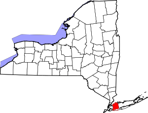
This list is intended to provide a comprehensive list of Registered Historic Places in Nassau County, New York. It includes 146 buildings, structures, sites, objects or districts listed on the U.S. National Register of Historic Places. Four of these are further designated National Historic Landmarks, and one is a National Historic Site operated by the National Park Service.
The locations of all the National Register properties for which the latitude and longitude coordinates are included below, may be seen in a map.[1]
- This National Park Service list is complete through NPS recent listings posted December 16, 2016.[2]
| Albany (Albany) – Allegany – Bronx – Broome – Cattaraugus – Cayuga – Chautauqua – Chemung – Chenango – Clinton – Columbia – Cortland – Delaware – Dutchess (Poughkeepsie, Rhinebeck) – Erie (Buffalo) – Essex – Franklin – Fulton – Genesee – Greene – Hamilton – Herkimer – Jefferson – Kings – Lewis – Livingston – Madison – Monroe (Rochester) – Montgomery – Nassau – New York (Below 14th Street, 14th to 59th Streets, 59th to 110th Streets, Above 110th Street, Islands) – Niagara – Oneida – Onondaga (Syracuse) – Ontario – Orange – Orleans – Oswego – Otsego – Putnam – Queens – Rensselaer – Richmond – Rockland – St. Lawrence – Saratoga – Schenectady – Schoharie – Schuyler – Seneca – Steuben – Suffolk – Sullivan – Tioga – Tompkins – Ulster – Warren – Washington – Wayne – Westchester (Northern, Southern, New Rochelle, Peekskill, Yonkers) – Wyoming – Yates |
NRHP Listings by Town
Hempstead
There are 30 places listed on the NRHP in the town of Hempstead.
North Hempstead
There are 51 places listed in the town of North Hempstead.
Oyster Bay
There are 65 places listed in the town of Oyster Bay.
See also
References
- ↑ The latitude and longitude information provided in this table was derived originally from the National Register Information System, which has been found to be fairly accurate for about 99% of listings. For about 1% of NRIS original coordinates, experience has shown that one or both coordinates are typos or otherwise extremely far off; some corrections may have been made. A more subtle problem causes many locations to be off by up to 150 yards, depending on location in the country: most NRIS coordinates were derived from tracing out latitude and longitudes off of USGS topographical quadrant maps created under the North American Datum of 1927, which differs from the current, highly accurate WGS84 GPS system used by most on-line maps. Chicago is about right, but NRIS longitudes in Washington are higher by about 4.5 seconds, and are lower by about 2.0 seconds in Maine. Latitudes differ by about 1.0 second in Florida. Some locations in this table may have been corrected to current GPS standards.
- ↑ "National Register of Historic Places: Weekly List Actions". National Park Service, United States Department of the Interior. Retrieved on December 16, 2016.
| Topics |   | |
|---|---|---|
| Lists by county |
| |
| Lists by city | ||
| Other lists | ||
| ||