| [2] |
Name on the Register |
Image |
Date listed[3] |
Location |
Neighborhood |
Description |
|---|
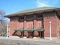
| 1 |
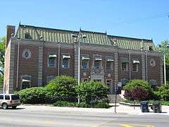
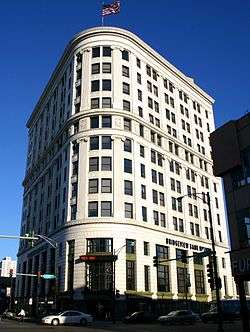
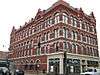
42nd Precinct Police Station |
|
000000002013-01-29-0000January 29, 2013
(#12001236) |
3600 N. Halsted Street
41°56′51″N 87°38′58″W / 41.9474433°N 87.6495186°W / 41.9474433; -87.6495186 (42nd Precinct Police Station) |
Lake View |
Former Chicago Police Station and Lake View Town Hall
|
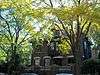
| 2 |
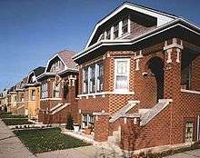
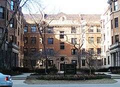
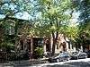
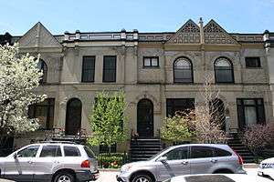
Alta Vista Terrace Historic District |
|
000000001972-03-16-0000March 16, 1972
(#72000448) |
Block bounded by W. Byron Street, W. Grace Street, N. Kenmore Avenue, and N. Seminary Avenue
41°56′59″N 87°39′26″W / 41.949722°N 87.657222°W / 41.949722; -87.657222 (Alta Vista Terrace Historic District) |
Lake View |
1904
|
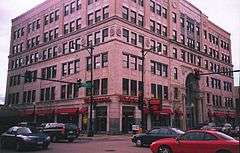
| 3 |
Anderson-Carlson Building |
|
000000002005-11-15-0000November 15, 2005
(#05001259) |
2044-48 W. Farwell Avenue
42°00′31″N 87°40′58″W / 42.008611°N 87.682778°W / 42.008611; -87.682778 (Anderson-Carlson Building) |
West Ridge |
|
| 4 |
Andersonville Commercial Historic District |
|
000000002010-03-09-0000March 9, 2010
(#08000294) |
4900-5800 N. Clark Street
41°59′00″N 87°40′08″W / 41.983333°N 87.668889°W / 41.983333; -87.668889 (Andersonville Commercial Historic District) |
Edgewater |
|
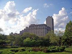
| 5 |
The Aquitania |
|
000000002002-03-01-0000March 1, 2002
(#02000099) |
5000 N. Marine Drive
41°58′25″N 87°39′05″W / 41.973611°N 87.651389°W / 41.973611; -87.651389 (The Aquitania) |
Uptown |
|
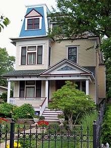
| 6 |
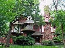
Emil Bach House |
|
000000001979-01-23-0000January 23, 1979
(#79000821) |
7415 N. Sheridan Road
42°00′58″N 87°39′53″W / 42.016111°N 87.664722°W / 42.016111; -87.664722 (Emil Bach House) |
Rogers Park |
House designed by Frank Lloyd Wright
|
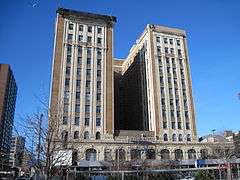
| 7 |
Balaban and Katz Uptown Theatre |
|
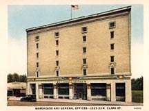
000000001986-11-20-0000November 20, 1986
(#86003181) |
4814-4816 N. Broadway
41°58′11″N 87°39′38″W / 41.969722°N 87.660556°W / 41.969722; -87.660556 (Balaban and Katz Uptown Theatre) |
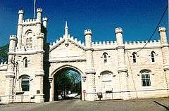
Uptown |
|
| 8 |
Belden Stratford Hotel |
|
000000001992-05-11-0000May 11, 1992
(#92000485) |
2300 N. Lincoln Park West
41°55′26″N 87°38′12″W / 41.923889°N 87.636667°W / 41.923889; -87.636667 (Belden Stratford Hotel) |
Lincoln Park |
|
| 9 |
Belmont-Sheffield Trust and Savings Bank Building |
|
000000001984-03-01-0000March 1, 1984
(#84000931) |
1001 W. Belmont Avenue and 3146 N. Sheffield Avenue
41°56′23″N 87°39′17″W / 41.939722°N 87.654722°W / 41.939722; -87.654722 (Belmont-Sheffield Trust and Savings Bank Building) |
Lake View |
|
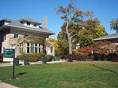
| 10 |
Berger Park |
|
000000002010-01-12-0000January 12, 2010
(#09001225) |
6205-6247 N. Sheridan Road
41°59′41″N 87°39′20″W / 41.994675°N 87.655494°W / 41.994675; -87.655494 (Berger Park) |
Edgewater |
|
| 11 |
Best Brewing Company of Chicago Building |
|
000000001987-07-30-0000July 30, 1987
(#87001263) |
1315-1317 W. Fletcher Street
41°56′19″N 87°39′42″W / 41.938611°N 87.661667°W / 41.938611; -87.661667 (Best Brewing Company of Chicago Building) |
Lake View |
|
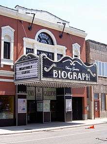
| 12 |
Biograph Theater Building |
|
000000001984-05-17-0000May 17, 1984
(#84000934) |
2433 N. Lincoln Avenue
41°55′35″N 87°38′57″W / 41.926389°N 87.649167°W / 41.926389; -87.649167 (Biograph Theater Building) |
Lincoln Park |
|
| 13 |
Bohemian National Cemetery |
|
000000002006-05-11-0000May 11, 2006
(#06000374) |
5255 N. Pulaski Road
41°58′45″N 87°43′27″W / 41.979167°N 87.724167°W / 41.979167; -87.724167 (Bohemian National Cemetery) |
North Park |
|
| 14 |
Roger Brown Home and Studio |
|
000000002011-02-22-0000February 22, 2011
(#11000029) |
1926 N. Halsted Street
41°55′01″N 87°38′56″W / 41.916944°N 87.648889°W / 41.916944; -87.648889 (Roger Brown Home and Studio) |
Lincoln Park |
|
| 15 |
Bryn Mawr Avenue Historic District |
|
000000001995-04-20-0000April 20, 1995
(#95000482) |
W. Bryn Mawr Avenue from N. Sheridan Road to N. Broadway
41°59′02″N 87°39′22″W / 41.983889°N 87.656111°W / 41.983889; -87.656111 (Bryn Mawr Avenue Historic District) |
Edgewater |
|
| 16 |
Buena Park Historic District |
|
000000001984-07-13-0000July 13, 1984
(#84000937) |
Roughly bounded by Graceland Cemetery, N. Marine Drive, W. Irving Park Road, & W. Montrose Avenue
41°57′29″N 87°39′06″W / 41.958056°N 87.651667°W / 41.958056; -87.651667 (Buena Park Historic District) |
Uptown |
|
| 17 |
Building at 2440 N. Lakeview Avenue |
|
000000002011-11-22-0000November 22, 2011
(#11000847) |
2440 N. Lakeview Avenue[4]
41°55′36″N 87°38′23″W / 41.926706°N 87.639614°W / 41.926706; -87.639614 (Building at 2440 N. Lakeview Avenue) |
Lincoln Park |
|
| 18 |
Building at 320 West Oakdale Avenue |
|
000000002013-04-23-0000April 23, 2013
(#13000184) |
320 W. Oakdale Ave.
41°56′09″N 87°38′17″W / 41.935803°N 87.63802°W / 41.935803; -87.63802 (Building at 320 West Oakdale Avenue) |
Lake View |
|
| 19 |
Building at 399 West Fullerton Parkway |
|
000000002007-05-22-0000May 22, 2007
(#07000456) |
399 W. Fullerton Parkway
41°55′31″N 87°38′21″W / 41.925278°N 87.639167°W / 41.925278; -87.639167 (Building at 399 West Fullerton Parkway) |
Lincoln Park |
|
| 20 |
Building at 5510 North Sheridan |
|
000000002001-08-08-0000August 8, 2001
(#01000870) |
5510 N. Sheridan Road
41°58′57″N 87°39′20″W / 41.9825°N 87.655556°W / 41.9825; -87.655556 (Building at 5510 North Sheridan) |
Edgewater |
|
| 21 |
Castlewood Terrace |
|
000000002009-09-03-0000September 3, 2009
(#09000232) |
819-959 W. Castlewood Terrace
41°58′14″N 87°39′06″W / 41.970556°N 87.651667°W / 41.970556; -87.651667 (Castlewood Terrace) |
Uptown |
|
| 22 |
Chicago and North Western Railroad Depot |
|
000000002001-02-09-0000February 9, 2001
(#01000081) |
6088 N. Northwest Highway
41°59′30″N 87°47′56″W / 41.991667°N 87.798889°W / 41.991667; -87.798889 (Chicago and North Western Railroad Depot) |
Norwood Park |
|
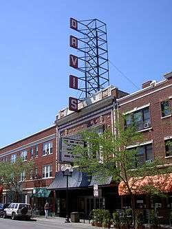
| 23 |
Davis Theater |
|
000000002016-04-26-0000April 26, 2016
(#15000930) |
4616-4630 N. Lincoln Ave.
41°57′56″N 87°41′12″W / 41.965517°N 87.686616°W / 41.965517; -87.686616 (Davis Theater) |
Lincoln Square |
|
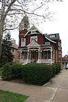
| 24 |
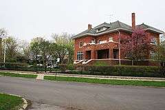
Francis J. Dewes House |
|
000000001973-08-14-0000August 14, 1973
(#73000694) |
503 W. Wrightwood Avenue
41°55′50″N 87°38′31″W / 41.930556°N 87.641944°W / 41.930556; -87.641944 (Francis J. Dewes House) |
Lincoln Park |
|
| 25 |
East Ravenswood Historic District |
|
000000001991-09-03-0000September 3, 1991
(#91001364) |
Roughly bounded by W. Lawrence Avenue, N. Clark Street, W. Irving Park Road and N. Ravenswood Avenue
41°57′37″N 87°40′09″W / 41.960278°N 87.669167°W / 41.960278; -87.669167 (East Ravenswood Historic District) |
Lake View and Uptown |
|
| 26 |
Edgewater Beach Apartments |
|
000000001994-08-16-0000August 16, 1994
(#94000979) |
5555 N. Sheridan Road
41°59′01″N 87°39′17″W / 41.983611°N 87.654722°W / 41.983611; -87.654722 (Edgewater Beach Apartments) |
Edgewater |
|
| 27 |
Edison Park |
|
000000002007-09-21-0000September 21, 2007
(#07000990) |
6755 N. Northwest Highway
42°00′14″N 87°49′03″W / 42.003889°N 87.8175°W / 42.003889; -87.8175 (Edison Park) |
Edison Park |
|
| 28 |
Episcopal Church of the Atonement and Parish House |
|
000000002009-07-30-0000July 30, 2009
(#09000590) |
5751 N. Kenmore Avenue
41°59′12″N 87°39′24″W / 41.986717°N 87.656692°W / 41.986717; -87.656692 (Episcopal Church of the Atonement and Parish House) |
Edgewater |
|
| 29 |
Epworth Methodist Episcopal Church |
|
000000002008-06-10-0000June 10, 2008
(#08000503) |
5253 N. Kenmore Avenue
41°58′39″N 87°39′23″W / 41.977502°N 87.656415°W / 41.977502; -87.656415 (Epworth Methodist Episcopal Church) |
Edgewater |
|
| 30 |
Eugene Field Park |
|
000000002006-08-08-0000August 8, 2006
(#06000677) |
5100 N. Ridgeway Avenue
41°58′36″N 87°43′25″W / 41.976667°N 87.723611°W / 41.976667; -87.723611 (Eugene Field Park) |
Albany Park and North Park |
|
| 31 |
Falconer Bungalow Historic District |
|
000000002007-03-07-0000March 7, 2007
(#07000114) |
Roughly bounded by W. Wellington Avenue, N. Lamon Avenue, N. Laramie Avenue, and the alley north of W. Diversey Avenue
41°56′00″N 87°45′10″W / 41.933439°N 87.752758°W / 41.933439; -87.752758 (Falconer Bungalow Historic District) |
Belmont Cragin |
|
| 32 |
John Gauler Houses |
|
000000001977-06-17-0000June 17, 1977
(#77000475) |
5917-5921 N. Magnolia Avenue
41°59′23″N 87°39′40″W / 41.9896389°N 87.6612222°W / 41.9896389; -87.6612222 (John Gauler Houses) |
Edgewater |
|
| 33 |
Henry Gerber House |
|
000000002015-07-21-0000July 21, 2015
(#15000584) |
1710 North Crilly Court
41°54′47″N 87°38′09″W / 41.91306°N 87.63583°W / 41.91306; -87.63583 (Henry Gerber House) |
Old Town |
1885 Queen Anne house where Henry Gerber founded the short-lived Society for Human Rights in the mid-1920s, the first American LGBT rights organization
|
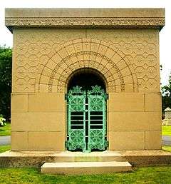
| 34 |
Getty Tomb |
|
000000001974-02-15-0000February 15, 1974
(#74000750) |
Graceland Cemetery, N. Clark Street and W. Irving Park Road
41°57′40″N 87°39′41″W / 41.961111°N 87.661389°W / 41.961111; -87.661389 (Getty Tomb) |
Uptown |
|
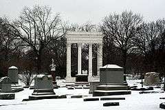
| 35 |
Graceland Cemetery |
|
000000002001-01-18-0000January 18, 2001
(#00001628) |
4001 N. Clark Street
41°57′28″N 87°39′50″W / 41.957778°N 87.663889°W / 41.957778; -87.663889 (Graceland Cemetery) |
Uptown |
|
| 36 |
Ann Halsted House |
|
000000001973-08-17-0000August 17, 1973
(#73000695) |
440 W. Belden Avenue
41°55′26″N 87°38′25″W / 41.923889°N 87.640278°W / 41.923889; -87.640278 (Ann Halsted House) |
Lincoln Park |
|
| 37 |
Hermitage Apartments |
|
000000001985-02-14-0000February 14, 1985
(#85000266) |
4606 N. Hermitage Avenue
41°57′57″N 87°40′22″W / 41.965833°N 87.672778°W / 41.965833; -87.672778 (Hermitage Apartments) |
Uptown |
|
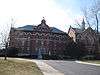
| 38 |
Immaculata High School |
|
000000001977-08-30-0000August 30, 1977
(#77000476) |
600 W. Irving Park Road
41°57′18″N 87°38′45″W / 41.955°N 87.645833°W / 41.955; -87.645833 (Immaculata High School) |
Uptown |
|
| 39 |
Independence Park |
|
000000002009-02-18-0000February 18, 2009
(#09000023) |
3945 N. Springfield Avenue
41°57′09″N 87°43′30″W / 41.952561°N 87.724925°W / 41.952561; -87.724925 (Independence Park) |
Irving Park |
|
| 40 |
Indian Boundary Park |
|
000000001995-04-20-0000April 20, 1995
(#95000485) |
2500 W. Lunt Avenue
42°00′34″N 87°41′36″W / 42.009444°N 87.693333°W / 42.009444; -87.693333 (Indian Boundary Park) |
West Ridge |
|
| 41 |
Jefferson Park |
|
000000002006-08-08-0000August 8, 2006
(#06000679) |
4822 N. Long Avenue
41°58′14″N 87°45′50″W / 41.970556°N 87.763889°W / 41.970556; -87.763889 (Jefferson Park) |
Jefferson Park |
|
| 42 |
Kosciuszko Park Field House |
|
000000002013-10-16-0000October 16, 2013
(#13000830) |
2732 N. Avers Ave
41°55′51″N 87°43′26″W / 41.930914°N 87.723793°W / 41.930914; -87.723793 (Kosciuszko Park Field House) |
Logan Square |
|
| 43 |
Krause Music Store |
|
000000002006-05-31-0000May 31, 2006
(#06000452) |
4611 N. Lincoln Avenue
41°58′02″N 87°41′10″W / 41.967222°N 87.686111°W / 41.967222; -87.686111 (Krause Music Store) |
Lincoln Square |
|
| 44 |
Lakeview Historic District |
|
000000001977-09-15-0000September 15, 1977
(#77000478) |
Roughly bounded by W. Wrightwood Avenue, N. Lakeview Avenue, N. Sheridan Road, W. Belmont Avenue, N. Halsted Street, W. Wellington Avenue, N. Racine Avenue, and W. George Street; also 701, 705, 711, 715-717, 721, 733-735, 737, and 739 W. Belmont Avenue, 3162 and 3164 N. Orchard Street, and 3171 N. Halsted Street
41°56′06″N 87°38′56″W / 41.935°N 87.648889°W / 41.935; -87.648889 (Lakeview Historic District) |
Lake View and Lincoln Park |
Second set of boundaries represents a boundary increase of 000000001986-05-16-0000May 16, 1986
|
| 45 |
Lakewood Balmoral Historic District |
|
000000001999-02-12-0000February 12, 1999
(#99000162) |
Bounded by N. Magnolia Avenue, N. Wayne Avenue, W. Foster Avenue, and W. Bryn Mawr Avenue
41°58′48″N 87°39′45″W / 41.98°N 87.6625°W / 41.98; -87.6625 (Lakewood Balmoral Historic District) |
Edgewater |
|
| 46 |
Julia C. Lathrop Homes |
|
000000002012-02-21-0000February 21, 2012
(#12000025) |
Bounded by N. Clybourn Avenue, N. Damen Avenue, N. Leavitt Street & the North Branch of the Chicago River
41°55′47″N 87°40′27″W / 41.929613°N 87.674296°W / 41.929613; -87.674296 (Julia C. Lathrop Homes) |
Lincoln Park and North Center |
|
| 47 |
Lincoln Park |
|
000000001994-08-26-0000August 26, 1994
(#94001029) |
2045 N. Lincoln Park West
41°55′49″N 87°37′52″W / 41.930278°N 87.631111°W / 41.930278; -87.631111 (Lincoln Park) |
Lincoln Park |
|
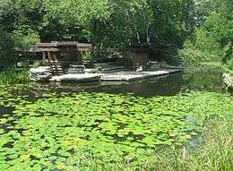
| 48 |
Lincoln Park Lily Pool |
|
000000002006-02-17-0000February 17, 2006
(#06000235) |
W. Fullerton Drive between N. Cannon Drive and N. Stockton Drive in Lincoln Park
41°55′30″N 87°38′02″W / 41.924933°N 87.633975°W / 41.924933; -87.633975 (Lincoln Park Lily Pool) |
Lincoln Park |
|
| 49 |
Lincoln Park, South Pond Refectory |
|
000000001986-11-20-0000November 20, 1986
(#86003154) |
2021 N. Stockton Drive
41°55′09″N 87°38′02″W / 41.919167°N 87.633889°W / 41.919167; -87.633889 (Lincoln Park, South Pond Refectory) |
Lincoln Park |
|
| 50 |
Logan Square Boulevards Historic District |
|
000000001985-11-20-0000November 20, 1985
(#85002901) |
W. Logan Boulevard, Logan Square, N. Kedzie Boulevard, Palmer Square, and N. Humboldt Boulevard
41°55′42″N 87°42′25″W / 41.928432°N 87.707015°W / 41.928432; -87.707015 (Logan Square Boulevards Historic District) |
Logan Square |
Three boulevards connected by two parks, on both the North Side and West Side.
|
| 51 |
Charles N. Loucks House |
|
000000001984-02-09-0000February 9, 1984
(#84001006) |
3926 N. Keeler Avenue
41°57′09″N 87°43′58″W / 41.9525°N 87.732778°W / 41.9525; -87.732778 (Charles N. Loucks House) |
Irving Park |
|
| 52 |
Malden Towers |
|
000000001983-12-08-0000December 8, 1983
(#83003560) |
4521 N. Malden Street
41°57′51″N 87°39′43″W / 41.964167°N 87.661944°W / 41.964167; -87.661944 (Malden Towers) |
Uptown |
|
| 53 |
Mandel Brothers Warehouse Building |
|
000000001993-08-19-0000August 19, 1993
(#93000841) |
3254 N. Halsted Street
41°56′30″N 87°38′58″W / 41.941667°N 87.649444°W / 41.941667; -87.649444 (Mandel Brothers Warehouse Building) |
Lake View |
|
| 54 |
Manor House |
|
000000001987-08-12-0000August 12, 1987
(#87001290) |
1021-1029 W. Bryn Mawr Avenue
41°59′01″N 87°39′22″W / 41.983611°N 87.656111°W / 41.983611; -87.656111 (Manor House) |
Edgewater |
|
| 55 |
Meekerville Historic District |
|
000000002006-05-12-0000May 12, 2006
(#06000383) |
303 W. Barry Avenue, 325,303-341,344 W. Wellington Avenue, 340 W. Oakdale Avenue
41°56′12″N 87°38′18″W / 41.936667°N 87.638333°W / 41.936667; -87.638333 (Meekerville Historic District) |
Lake View |
|
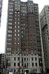
| 56 |
Mundelein College Skyscraper Building |
|
000000001980-05-31-0000May 31, 1980
(#80001348) |
6363 N. Sheridan Road
41°59′54″N 87°39′25″W / 41.998333°N 87.656944°W / 41.998333; -87.656944 (Mundelein College Skyscraper Building) |
Rogers Park |
|
| 57 |
Noble-Seymour-Crippen House |
|
000000002000-08-10-0000August 10, 2000
(#00000950) |
5622-5624 N. Newark Avenue
41°59′02″N 87°47′43″W / 41.983889°N 87.795278°W / 41.983889; -87.795278 (Noble-Seymour-Crippen House) |
Norwood Park |
|
| 58 |
North Mayfair Bungalow Historic District |
|
000000002006-02-01-0000February 1, 2006
(#05001608) |
Roughly bounded by W. Foster Avenue, N. Pulaski Road, N. Kilbourn Avenue, and W. Lawrence Avenue
41°58′19″N 87°44′08″W / 41.971944°N 87.735556°W / 41.971944; -87.735556 (North Mayfair Bungalow Historic District) |
Albany Park |
|
| 59 |
Northwestern Terra Cotta Company Building |
|
000000001989-02-08-0000February 8, 1989
(#88003245) |
1701-1711 W. Terra Cotta Place
41°55′40″N 87°40′17″W / 41.927778°N 87.671389°W / 41.927778; -87.671389 (Northwestern Terra Cotta Company Building) |
Lincoln Park |
|
| 60 |
Norwood Park Historical District |
|
000000002002-11-21-0000November 21, 2002
(#02001350) |
Roughly bounded by N. Harlem Avenue, N. Nagle Avenue, W. Bryn Mawr Avenue, and N. Avondale Avenue
41°59′21″N 87°47′59″W / 41.989167°N 87.799722°W / 41.989167; -87.799722 (Norwood Park Historical District) |
Norwood Park |
|
| 61 |
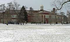
Old Main Building |
|
000000001982-02-11-0000February 11, 1982
(#82002529) |
3235 W. Foster Avenue on North Park College Campus
41°58′30″N 87°42′36″W / 41.975°N 87.71°W / 41.975; -87.71 (Old Main Building) |
North Park |
|
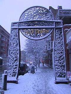
| 62 |
Old Town Triangle Historic District |
|
000000001984-11-08-0000November 8, 1984
(#84000347) |
Roughly bounded by W. Armitage Avenue, W. North Avenue, N. Clark Street, and N. Mohawk Street.
41°54′49″N 87°38′01″W / 41.913611°N 87.633611°W / 41.913611; -87.633611 (Old Town Triangle Historic District) |
Lincoln Park |
|
| 63 |
Passionist Fathers Monastery |
|
000000002013-03-06-0000March 6, 2013
(#13000048) |
5700 N. Harlem Avenue
41°59′07″N 87°48′30″W / 41.985191°N 87.80821°W / 41.985191; -87.80821 (Passionist Fathers Monastery) |
Norwood Park |
|
| 64 |
Pattington Apartments |
|
000000001980-03-08-0000March 8, 1980
(#80001349) |
660-700 W. Irving Park Road
41°57′17″N 87°38′54″W / 41.954722°N 87.648333°W / 41.954722; -87.648333 (Pattington Apartments) |
Uptown |
|
| 65 |
Portage Park |
|
000000001995-04-20-0000April 20, 1995
(#95000484) |
4100 N. Long Avenue
41°57′18″N 87°45′52″W / 41.955°N 87.764444°W / 41.955; -87.764444 (Portage Park) |
Portage Park |
|
| 66 |
Portage Park Bungalow Historic District |
|
000000002014-09-17-0000September 17, 2014
(#14000620) |
Roughly bounded by W. Pensacola, N. Lockwood & N. Central Aves., W. Hutchinson St.
41°57′31″N 87°45′49″W / 41.958692°N 87.76349°W / 41.958692; -87.76349 (Portage Park Bungalow Historic District) |
Portage Park |
|
| 67 |
Ravenswood Manor Historic District |
|
000000002008-09-05-0000September 5, 2008
(#08000836) |
Bounded by N. Sacramento Avenue, North Branch of Chicago River, alleys south of W. Lawrence Avenue and north of W. Montrose Avenue
41°57′55″N 87°42′03″W / 41.965278°N 87.700833°W / 41.965278; -87.700833 (Ravenswood Manor Historic District) |
Albany Park |
|
| 68 |
Reebie Moving and Storage Company |
|
000000001979-03-21-0000March 21, 1979
(#79000828) |
2325-2333 N. Clark Street
41°55′28″N 87°38′23″W / 41.924444°N 87.639722°W / 41.924444; -87.639722 (Reebie Moving and Storage Company) |
Lincoln Park |
|
| 69 |
Jacob A. Riis Park |
|
000000001995-04-20-0000April 20, 1995
(#95000483) |
6100 W. Fullerton Avenue
41°55′33″N 87°46′44″W / 41.925833°N 87.778889°W / 41.925833; -87.778889 (Jacob A. Riis Park) |
Belmont Cragin |
|
| 70 |
Rogers Park Manor Bungalow Historic District |
|
000000002005-11-15-0000November 15, 2005
(#05001258) |
Roughly bounded by W. Lunt Avenue, N. Western Avenue, both sides of W. Farwell Avenue and N. California Avenue
42°00′24″N 87°41′42″W / 42.006667°N 87.695°W / 42.006667; -87.695 (Rogers Park Manor Bungalow Historic District) |
West Ridge |
|
| 71 |
Ropp-Grabill House |
|
000000001985-04-15-0000April 15, 1985
(#85000840) |
4132 N. Keeler Avenue
41°57′24″N 87°43′58″W / 41.956667°N 87.732778°W / 41.956667; -87.732778 (Ropp-Grabill House) |
Irving Park |
|
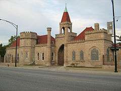
| 72 |
Rosehill Cemetery Administration Building and Entry Gate |
|
000000001975-04-24-0000April 24, 1975
(#75000651) |
5800 N. Ravenswood Avenue
41°59′11″N 87°40′31″W / 41.986389°N 87.675278°W / 41.986389; -87.675278 (Rosehill Cemetery Administration Building and Entry Gate) |
Lincoln Square |
|
| 73 |
Theodore Rozek House |
|
000000002011-11-02-0000November 2, 2011
(#11000779) |
6337 N. Hermitage Avenue
41°59′54″N 87°40′23″W / 41.998333°N 87.673056°W / 41.998333; -87.673056 (Theodore Rozek House) |
Edgewater |
|
| 74 |
Sauganash Historic District |
|
000000002010-06-07-0000June 7, 2010
(#10000310) |
Roughly bounded by N. Lemont Avenue, N. Keating Avenue, the Chicago and Northwestern Railway and the alley to the east of N. Kilbourn Avenue
41°59′24″N 87°44′32″W / 41.990028°N 87.742283°W / 41.990028; -87.742283 (Sauganash Historic District) |
Forest Glen |
|
| 75 |
Schorsch Irving Park Gardens Historic District |
|
000000002004-02-25-0000February 25, 2004
(#04000075) |
Roughly bounded by W. Grace Street, W. Patterson Avenue, N. Austin Avenue, and N. Melvena Avenue
41°57′00″N 87°46′45″W / 41.95°N 87.779167°W / 41.95; -87.779167 (Schorsch Irving Park Gardens Historic District) |
Dunning |
|
| 76 |
Carl Schurz High School |
|
000000002011-02-22-0000February 22, 2011
(#11000031) |
3601 N. Milwaukee Avenue
41°56′47″N 87°44′08″W / 41.946389°N 87.735556°W / 41.946389; -87.735556 (Carl Schurz High School) |
Irving Park |
|
| 77 |
Sheffield Historic District |
|
000000001976-01-11-0000January 11, 1976
(#76000704) |
Bounded roughly by W. Fullerton Avenue, N. Lincoln Avenue, N. Larrabee Street, W. Dickens Avenue, N. Burling Street, W. Wisconsin Street, N. Clybourn Avenue, N. Lakewood Avenue, W. Belden Avenue, and N. Southport Avenue; also W. Montana Street, W. Altgeld Street and Southport Avenue; also roughly bounded by W. Altgeld Street and N. Lakewood Avenue, W. Fullerton Avenue, N. Southport Avenue; also roughly bounded by W. Wisconsin Street, W. Armitage Avenue, N. Howe Street, N. Halsted Street, N. Willow Street, and N. Kenmore Avenue
41°55′15″N 87°39′12″W / 41.920833°N 87.653333°W / 41.920833; -87.653333 (Sheffield Historic District) |
Lincoln Park |
Second, third, and fourth sets of boundaries represent boundary increases of 000000001983-02-17-0000February 17, 1983, 000000001985-06-19-0000June 19, 1985, and 000000001986-08-22-0000August 22, 1986 respectively
|
| 78 |
Sheridan Park Historic District |
|
000000001985-12-27-0000December 27, 1985
(#85003352) |
Roughly bounded by W. Lawrence Avenue, N. Racine Avenue, W. Montrose Avenue, and N. Clark Street
41°57′55″N 87°39′47″W / 41.965278°N 87.663056°W / 41.965278; -87.663056 (Sheridan Park Historic District) |
Uptown |
|
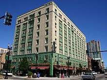
| 79 |
Sheridan Plaza Hotel |
|
000000001980-11-21-0000November 21, 1980
(#80001350) |
4601-4613 N. Sheridan Road
41°57′56″N 87°39′16″W / 41.965556°N 87.654444°W / 41.965556; -87.654444 (Sheridan Plaza Hotel) |
Uptown |
|
| 80 |
Swedish American Telephone Company Building |
|
000000001985-09-13-0000September 13, 1985
(#85002286) |
5235-5257 N. Ravenswood Avenue
41°58′39″N 87°40′27″W / 41.9775°N 87.674167°W / 41.9775; -87.674167 (Swedish American Telephone Company Building) |
Edgewater |
|
| 81 |
Talman West Ridge Bungalow Historic District |
|
000000002008-12-10-0000December 10, 2008
(#08001169) |
Bounded roughly by N. Campbell Avenue, W. Devon Avenue, N. Fairfield Avenue, and W. Pratt Avenue
41°59′52″N 87°41′32″W / 41.9977°N 87.692344°W / 41.9977; -87.692344 (Talman West Ridge Bungalow Historic District) |
West Ridge |
|
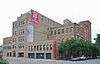
| 82 |
Curt Teich and Company Building |
|
000000001990-03-07-0000March 7, 1990
(#90000340) |
1733-55 W. Irving Park Road
41°57′14″N 87°40′25″W / 41.953889°N 87.673611°W / 41.953889; -87.673611 (Curt Teich and Company Building) |
Lake View |
|
| 83 |
Theurer-Wrigley House |
|
000000001980-07-28-0000July 28, 1980
(#80001352) |
2466 N. Lakeview Avenue
41°55′39″N 87°38′21″W / 41.9275°N 87.639167°W / 41.9275; -87.639167 (Theurer-Wrigley House) |
Lincoln Park |
|
| 84 |
Uptown Broadway Building |
|
000000001986-11-06-0000November 6, 1986
(#86003143) |
4703-4715 N. Broadway
41°58′05″N 87°39′31″W / 41.968056°N 87.658611°W / 41.968056; -87.658611 (Uptown Broadway Building) |
Uptown |
|
| 85 |
Uptown Square Historic District |
|
000000002000-11-08-0000November 8, 2000
(#00001336) |
Roughly along Lawrence Avenue, and Broadway
41°58′05″N 87°39′26″W / 41.968056°N 87.657222°W / 41.968056; -87.657222 (Uptown Square Historic District) |
Uptown |
|
| 86 |
Vassar Swiss Underwear Company Building |
|
000000002008-09-17-0000September 17, 2008
(#07000859) |
2545 W. Diversey Avenue
41°55′56″N 87°41′35″W / 41.9323°N 87.693006°W / 41.9323; -87.693006 (Vassar Swiss Underwear Company Building) |
Logan Square |
|
| 87 |
Villa Historic District |
|
000000001979-09-11-0000September 11, 1979
(#79000830) |
Roughly bounded by N. Avondale Avenue, W. Addison Street, N. Pulaski Road and N. Hamlin Avenue; also 3948-3952 and 3949-3953 W. Waveland Avenue
41°56′52″N 87°43′30″W / 41.947778°N 87.725°W / 41.947778; -87.725 (Villa Historic District) |
Avondale and Irving Park |
Second set of boundaries represents a boundary increase of 000000001983-03-10-0000March 10, 1983
|
| 88 |
West Argyle Street Historic District |
|
000000002010-06-03-0000June 3, 2010
(#10000311) |
Roughly bounded by N. Sheridan Road, W. Ainslie Street, N. Broadway, and W. Winona Street; also N. Broadway & E. block face of N. Sheridan Rd. between W. Argyle St. & W. Winona Ave
41°58′24″N 87°39′28″W / 41.9733°N 87.657789°W / 41.9733; -87.657789 (West Argyle Street Historic District) |
Uptown |
Second set of boundaries represents a boundary increase of 000000002013-07-30-0000July 30, 2013:
|
| 89 |
Wrightwood Bungalow Historic District |
|
000000002004-09-15-0000September 15, 2004
(#04000975) |
4600 and 4700 Blocks of W. Wrightwood Avenue
41°55′49″N 87°44′39″W / 41.930278°N 87.744167°W / 41.930278; -87.744167 (Wrightwood Bungalow Historic District) |
Belmont Cragin |
|
| 90 |
Yondorf Block and Hall |
|
000000001984-11-13-0000November 13, 1984
(#84000297) |
758 W. North Avenue
41°54′40″N 87°38′53″W / 41.911111°N 87.648056°W / 41.911111; -87.648056 (Yondorf Block and Hall) |
Lincoln Park |
|


.jpg)


%2C_640_West_Irving_Park_Road%2C_Chicago_(Cook_County%2C_Illinois).jpg)