| [1] |
Name on the Register |
Image |
Date listed[2] |
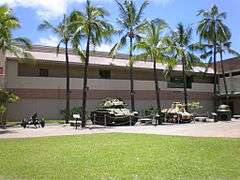
Location |
Community |
Description |
|---|
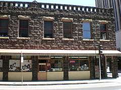
| 1 |
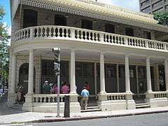
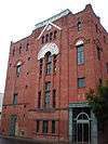
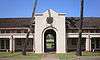
Alexander and Baldwin Building |
|
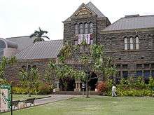
000000001979-09-07-0000September 7, 1979
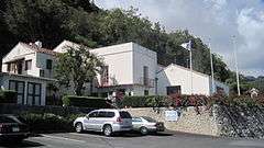
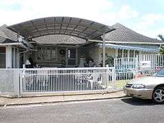
(#79000755) |
822 Bishop St.
21°18′29″N 157°51′45″W / 21.307982°N 157.862635°W / 21.307982; -157.862635 (Alexander and Baldwin Building) |
Honolulu |
|
| 2 |
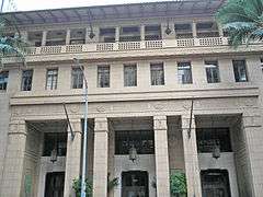
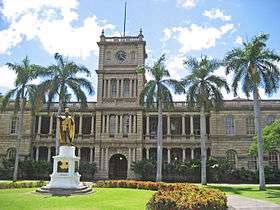
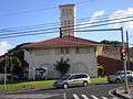
Aliiolani Hale |
|
000000001972-02-02-0000February 2, 1972
(#72000414) |
King St.
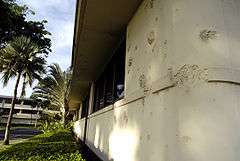
21°18′19″N 157°51′36″W / 21.305413°N 157.860136°W / 21.305413; -157.860136 (Aliiolani Hale) |
Honolulu |
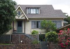
|
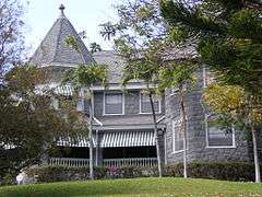
| 3 |
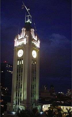
Aloha Tower |
|
000000001976-05-13-0000May 13, 1976
(#76000660) |
Pier 9 in Honolulu Harbor
21°18′25″N 157°51′58″W / 21.307052°N 157.865994°W / 21.307052; -157.865994 (Aloha Tower) |
Honolulu |
|
| 4 |
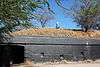
Battery Hasbrouck |
|
000000001984-06-05-0000June 5, 1984
(#84000925) |
Fort Kamehameha
21°19′30″N 157°57′40″W / 21.325°N 157.961111°W / 21.325; -157.961111 (Battery Hasbrouck) |
Honolulu |
Site of coastal artillery in Fort Kamehameha
|
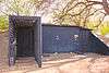
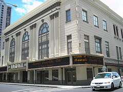
| 5 |
Battery Hawkins |
|
000000001984-06-05-0000June 5, 1984
(#84000928) |
440 Nelson Avenue
21°19′N 157°58′W / 21.32°N 157.96°W / 21.32; -157.96 (Battery Hawkins) |
Honolulu |
Site of coastal artillery in Fort Kamehameha
|
| 6 |
Battery Hawkins Annex |
|
000000001984-06-05-0000June 5, 1984
(#84000948) |
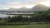
Fort Kamehameha
21°19′N 157°58′W / 21.32°N 157.96°W / 21.32; -157.96 (Battery Hawkins Annex) |
Honolulu |
Site of bunker in Fort Kamehameha
|
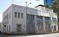
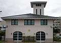
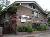
| 7 |
Battery Jackson |
Upload image |
000000001984-06-05-0000June 5, 1984
(#84000954) |
Fort Kamehameha
21°19′06″N 157°57′22″W / 21.318333°N 157.956111°W / 21.318333; -157.956111 (Battery Jackson) |
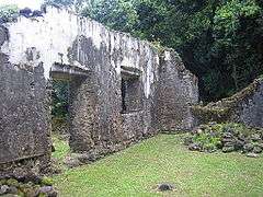
Honolulu |
Site of coastal artillery in Fort Kamehameha
|
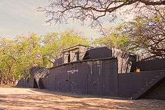
| 8 |
Battery Randolph |
|
000000001984-06-05-0000June 5, 1984
(#84000971) |
32 Kalia Road
21°16′58″N 157°50′11″W / 21.282778°N 157.836389°W / 21.282778; -157.836389 (Battery Randolph) |
Honolulu |
Site of coastal artillery in Fort DeRussy, now a museum
|
| 9 |
Battery Selfridge |
Upload image |
000000001984-06-05-0000June 5, 1984
(#84000975) |
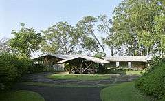
Fort Kamehameha
21°19′05″N 157°57′09″W / 21.318056°N 157.9525°W / 21.318056; -157.9525 (Battery Selfridge) |
Honolulu |
Site of coastal artillery in Fort Kamehameha
|
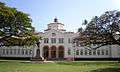
| 10 |
Bellows Field Archeological Area |
Upload image |
000000001973-08-14-0000August 14, 1973
(#73002278) |
Address Restricted
|
Waimanalo |
|
| 11 |
Bernice P. Bishop Museum |
|
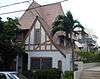
000000001982-07-26-0000July 26, 1982
(#82002500) |
1355 Kalihi St.
21°20′00″N 157°52′16″W / 21.3332°N 157.871079°W / 21.3332; -157.871079 (Bernice P. Bishop Museum) |
Honolulu |
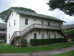
|
| 12 |
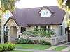
Boettcher Estate |
|
000000002002-04-26-0000April 26, 2002
(#02000388) |
248 North Kalaheo
21°24′16″N 157°44′23″W / 21.404533°N 157.739691°W / 21.404533; -157.739691 (Boettcher Estate) |
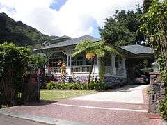
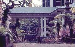
Kailua |
built 1937, architect Vladimir Ossipoff
|
| 13 |
C. Brewer Building |
|
000000001980-04-02-0000April 2, 1980
(#80001272) |
827 Fort St.
21°18′30″N 157°51′47″W / 21.308362°N 157.863134°W / 21.308362; -157.863134 (C. Brewer Building) |
Honolulu |
|
| 14 |
Burial Platform |
Upload image |
000000001973-08-14-0000August 14, 1973
(#73000670) |
Address Restricted
|
Kahuku |
|
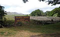
| 15 |
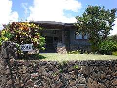
Thomas Alexander Burningham House |
|
000000001993-10-13-0000October 13, 1993
(#93001029) |
2849 Pali Highway
21°20′07″N 157°50′25″W / 21.335229°N 157.84018°W / 21.335229; -157.84018 (Thomas Alexander Burningham House) |
Honolulu |
|
| 16 |
Georges de S. Canavarro House |
|
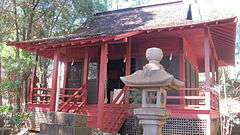
000000001980-05-28-0000May 28, 1980
(#80001274) |
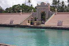
2756 Rooke Ave.
21°20′16″N 157°50′46″W / 21.33785°N 157.845997°W / 21.33785; -157.845997 (Georges de S. Canavarro House) |
Honolulu |
Now a Korean Cultural Center
|
| 17 |
Lloyd Case House |
|
000000001987-06-05-0000June 5, 1987
(#86002829) |
3581 Woodlawn Dr.
21°19′07″N 157°47′52″W / 21.318612°N 157.797807°W / 21.318612; -157.797807 (Lloyd Case House) |
Honolulu |
|
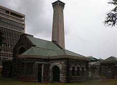
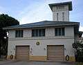
| 18 |
Central Fire Station |
|
000000001980-12-02-0000December 2, 1980
(#80001273) |
104 S. Beretania St.
21°18′40″N 157°51′32″W / 21.311195°N 157.858989°W / 21.311195; -157.858989 (Central Fire Station) |
Honolulu |
renovated 1934, architects Dickey & Young
|
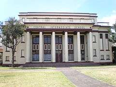
| 19 |
Central Intermediate School |
|
000000002004-02-11-0000February 11, 2004
(#03001049) |
1302 Queen Emma St.
21°18′41″N 157°51′24″W / 21.311389°N 157.856667°W / 21.311389; -157.856667 (Central Intermediate School) |
Honolulu |
|
| 20 |
Jean Charlot House |
|
000000002000-11-30-0000November 30, 2000
(#00001371) |
Address Restricted
|
Honolulu |
|
| 21 |
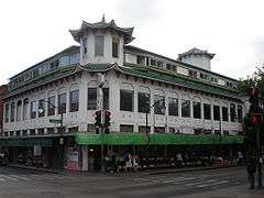
Chinatown Historic District |
|
000000001973-01-17-0000January 17, 1973
(#73000658) |
Bounded roughly by Beretania St. on the northeast, Nuuanu Stream on the north, Nuuanu Ave. on the southeast, and Honolulu Harbor
21°18′43″N 157°51′46″W / 21.311985°N 157.862669°W / 21.311985; -157.862669 (Chinatown Historic District) |
Honolulu |
|
| 22 |
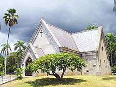
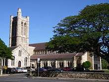
Church of the Crossroads |
|
000000001992-11-20-0000November 20, 1992
(#92001551) |
1212 University Ave.
21°17′39″N 157°49′19″W / 21.294223°N 157.821909°W / 21.294223; -157.821909 (Church of the Crossroads) |
Honolulu |
|
| 23 |
CINCPAC Headquarters |
|
000000001987-05-28-0000May 28, 1987
(#87001295) |
Pearl Harbor Naval Base
21°22′03″N 157°56′18″W / 21.3675°N 157.938333°W / 21.3675; -157.938333 (CINCPAC Headquarters) |
Pearl Harbor |
|
| 24 |
James L. Coke House |
|
000000001986-08-20-0000August 20, 1986
(#86001618) |
3649 Nuuanu Pali Dr.
21°20′37″N 157°49′43″W / 21.343684°N 157.82874°W / 21.343684; -157.82874 (James L. Coke House) |
Honolulu |
Also called Waipuna, built 1934, architects Richard Tongg and C.W. Dickey
|
| 25 |
Grace Cooke House |
|
000000001983-10-24-0000October 24, 1983
(#83003556) |
2365 Oahu Ave.
21°18′21″N 157°49′07″W / 21.305763°N 157.818588°W / 21.305763; -157.818588 (Grace Cooke House) |
Honolulu |
Bungalow style built in 1912
|
| 26 |
Charles Montague Cooke, Jr., House and Kuka'o'o Heiau |
|
000000001985-10-31-0000October 31, 1985
(#85003402) |
2859 Manoa Rd.
21°18′44″N 157°48′52″W / 21.312247°N 157.814562°W / 21.312247; -157.814562 (Charles Montague Cooke, Jr., House and Kuka'o'o Heiau) |
Honolulu |
Grand Tudor Revival residence built in 1912 by architects Emory & Webb
|
| 27 |
Clarence H. Cooke House |
|
000000001986-08-20-0000August 20, 1986
(#86001619) |
3860 Old Pali Rd.
21°20′53″N 157°49′33″W / 21.348173°N 157.825964°W / 21.348173; -157.825964 (Clarence H. Cooke House) |
Honolulu |
|
| 28 |
Bartlett Cooper House |
|
000000001987-06-05-0000June 5, 1987
(#86002833) |
4850 Kahala Ave.
21°16′11″N 157°46′45″W / 21.269655°N 157.779165°W / 21.269655; -157.779165 (Bartlett Cooper House) |
Honolulu |
|
| 29 |
C.W. Dickey House |
|
000000001984-11-01-0000November 1, 1984
(#84000201) |
3030 Kalakaua Ave.
21°15′32″N 157°49′07″W / 21.258951°N 157.818644°W / 21.258951; -157.818644 (C.W. Dickey House) |
Honolulu |
|
| 30 |
Dilks Property |
Upload image |
000000002016-05-17-0000May 17, 2016
(#16000272) |
1302 Mokulua Dr.
21°23′11″N 157°42′42″W / 21.386418°N 157.711796°W / 21.386418; -157.711796 (Dilks Property) |
Kailua |
|
| 31 |
Dillingham Transportation Building |
|
000000001979-09-07-0000September 7, 1979
(#79000756) |
735 Bishop St.
21°18′26″N 157°51′47″W / 21.307222°N 157.863086°W / 21.307222; -157.863086 (Dillingham Transportation Building) |
Honolulu |
|
| 32 |
James D. Dole Homestead |
|
000000001978-06-23-0000June 23, 1978
(#78001024) |
Waipahu Cultural Garden
21°23′07″N 158°00′43″W / 21.385278°N 158.011944°W / 21.385278; -158.011944 (James D. Dole Homestead) |
Waipahu |
1901 house of Pineapple planter
|
| 33 |
Carl H. Duhrsen House |
|
000000001987-06-05-0000June 5, 1987
(#86002834) |
3029 Felix St.
21°17′46″N 157°48′26″W / 21.296109°N 157.807154°W / 21.296109; -157.807154 (Carl H. Duhrsen House) |
Honolulu |
|
| 34 |
Ewa Plain Battlefield |
Upload image |
000000002016-05-23-0000May 23, 2016
(#16000273) |
Roosevelt Avenue, approximately 5.5 miles (8.9 km) southwest of Ford Island
Coordinates missing |
Kapolei vicinity |
|
| 35 |
Jessie Eyman–Wilma Judson House |
|
000000001986-08-20-0000August 20, 1986
(#86001621) |
3114 Paty Dr.
21°18′36″N 157°48′03″W / 21.309939°N 157.800802°W / 21.309939; -157.800802 (Jessie Eyman–Wilma Judson House) |
Honolulu |
built 1926, architect C.W. Dickey
|
| 36 |
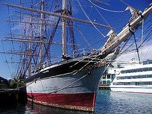
FALLS OF CLYDE |
|
000000001973-07-02-0000July 2, 1973
(#73000659) |
Pier 7 in Honolulu Harbor
21°18′21″N 157°51′54″W / 21.305718°N 157.865029°W / 21.305718; -157.865029 (FALLS OF CLYDE) |
Honolulu |
Only surviving iron-hulled, four-masted full rigged ship, and only surviving sail-driven oil tanker in the world.
|
| 37 |
Dr. Robert Faus House |
|
000000001987-06-05-0000June 5, 1987
(#86002828) |
2311 Ferdinand Ave.
21°18′26″N 157°49′26″W / 21.307242°N 157.823915°W / 21.307242; -157.823915 (Dr. Robert Faus House) |
Honolulu |
|
| 38 |
Fort Ruger Historic District |
|
000000001983-07-14-0000July 14, 1983
(#83000249) |
Diamond Head Rd.
21°16′03″N 157°48′31″W / 21.2675°N 157.808611°W / 21.2675; -157.808611 (Fort Ruger Historic District) |
Honolulu |
|
| 39 |
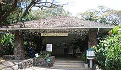
Foster Botanical Garden |
|
000000001993-05-13-0000May 13, 1993
(#93000377) |
50 N. Vineyard Boulevard
21°18′58″N 157°51′28″W / 21.316183°N 157.857781°W / 21.316183; -157.857781 (Foster Botanical Garden) |
Honolulu |
|
| 40 |
Friendship Garden |
Upload image |
000000002016-06-07-0000June 7, 2016
(#15000885) |
45-226 Kokokani Pl.
21°24′17″N 157°46′37″W / 21.404759°N 157.776917°W / 21.404759; -157.776917 (Friendship Garden) |
Kaneohe |
|
| 41 |
J. B. Guard House |
Upload image |
000000002015-11-23-0000November 23, 2015
(#15000847) |
305A Portlock Rd.
21°16′33″N 157°42′31″W / 21.275959°N 157.708680°W / 21.275959; -157.708680 (J. B. Guard House) |
Honolulu |
|
| 42 |
John Guild House |
|
000000001980-08-01-0000August 1, 1980
(#80001275) |
2001 Vancouver Dr.
21°18′03″N 157°49′21″W / 21.30084°N 157.822418°W / 21.30084; -157.822418 (John Guild House) |
Honolulu |
|
| 43 |
Hawaii Capital Historic District |
|
000000001978-12-01-0000December 1, 1978
(#78001020) |
Beretania, Richards, King, Queen, Punchbowl, and Kawaiahao Sts.
21°18′26″N 157°51′29″W / 21.307087°N 157.85798°W / 21.307087; -157.85798 (Hawaii Capital Historic District) |
Honolulu |
|
| 44 |
Hawaii Shingon Mission |
|
000000002002-04-26-0000April 26, 2002
(#02000386) |
915 Sheridan St.
21°17′52″N 157°50′27″W / 21.297817°N 157.840963°W / 21.297817; -157.840963 (Hawaii Shingon Mission) |
Honolulu |
|
| 45 |
Hawaii Theatre |
|
000000001978-11-14-0000November 14, 1978
(#78001021) |
1130 Bethel St.
21°18′40″N 157°51′40″W / 21.311018°N 157.861243°W / 21.311018; -157.861243 (Hawaii Theatre) |
Honolulu |
|
| 46 |
Heeia Fishpond |
|
000000001973-01-17-0000January 17, 1973
(#73000671) |
Address Restricted
|
Kaneohe |
|
| 47 |
Edgar and Lucy Henriques House |
|
000000001984-11-01-0000November 1, 1984
(#84000202) |
20 Old Pali Pl.
21°20′48″N 157°49′36″W / 21.346782°N 157.826648°W / 21.346782; -157.826648 (Edgar and Lucy Henriques House) |
Honolulu |
|
| 48 |
Hickam Field |
|
000000001985-09-16-0000September 16, 1985
(#85002725) |
Southeast of Pearl Harbor Naval Base
21°20′07″N 157°56′54″W / 21.335278°N 157.948333°W / 21.335278; -157.948333 (Hickam Field) |
Honolulu |
|
| 49 |
Alfred Hocking House |
|
000000001984-11-15-0000November 15, 1984
(#84000246) |
1302 Nehoa St.
21°18′32″N 157°50′05″W / 21.308942°N 157.834767°W / 21.308942; -157.834767 (Alfred Hocking House) |
Honolulu |
Built 1903, designed by E.A.P. Newcomb and C.W. Dickey in Queen Anne style architecture
|
| 50 |
Lemon Wond Holt House |
|
000000002006-05-24-0000May 24, 2006
(#06000422) |
3704 Anuhea St.
21°17′11″N 157°47′42″W / 21.286318°N 157.795054°W / 21.286318; -157.795054 (Lemon Wond Holt House) |
Honolulu |
|
| 51 |
Honouliuli Internment Camp |
Upload image |
000000002012-02-21-0000February 21, 2012
(#09000855) |
Address Restricted
|
Waipahu vicinity |
|
| 52 |
Honolulu Museum of Art |
|
000000001972-03-25-0000March 25, 1972
(#72000415) |
900 S. Beretania St.
21°18′15″N 157°50′55″W / 21.304109°N 157.848634°W / 21.304109; -157.848634 (Honolulu Museum of Art) |
Honolulu |
|
| 53 |
House at 3023 Kalakaua Avenue |
|
000000001987-06-05-0000June 5, 1987
(#86002820) |
3023 Kalakaua Ave.
21°15′33″N 157°49′08″W / 21.259108°N 157.819019°W / 21.259108; -157.819019 (House at 3023 Kalakaua Avenue) |
Honolulu |
Built 1932 by Earl Williams
|
| 54 |
House at 3023A Kalakaua Avenue |
|
000000001987-06-05-0000June 5, 1987
(#86002821) |
3023A Kalakaua Ave.
21°15′33″N 157°49′09″W / 21.259063°N 157.819111°W / 21.259063; -157.819111 (House at 3023A Kalakaua Avenue) |
Honolulu |
Built 1932 by Earl Williams
|
| 55 |
House at 3023B Kalakaua Avenue |
|
000000001987-06-05-0000June 5, 1987
(#86002822) |
3023B Kalakaua Ave.
21°15′33″N 157°49′09″W / 21.259028°N 157.819226°W / 21.259028; -157.819226 (House at 3023B Kalakaua Avenue) |
Honolulu |
Built 1932 by Earl Williams
|
| 56 |
House at 3027 Kalakaua Avenue |
|
000000001987-06-05-0000June 5, 1987
(#86002826) |
3027 Kalakaua Ave.
21°15′32″N 157°49′08″W / 21.258991°N 157.818958°W / 21.258991; -157.818958 (House at 3027 Kalakaua Avenue) |
Honolulu |
Built 1932 by Earl Williams
|
| 57 |
House at 3033 Kalakaua Avenue |
|
000000001987-06-05-0000June 5, 1987
(#86002827) |
3033 Kalakaua Ave.
21°15′32″N 157°49′09″W / 21.258956°N 157.819063°W / 21.258956; -157.819063 (House at 3033 Kalakaua Avenue) |
Honolulu |
Built 1932 by Earl Williams
|
| 58 |
House at 3033B Kalakaua Avenue |
|
000000001987-06-05-0000June 5, 1987
(#86002825) |
3033B Kalakaua Ave.
21°15′32″N 157°49′09″W / 21.258919°N 157.819191°W / 21.258919; -157.819191 (House at 3033B Kalakaua Avenue) |
Honolulu |
Built 1932 by Earl Williams
|
| 59 |
House at 4109 Black Point Road |
Upload image |
000000001987-06-05-0000June 5, 1987
(#86002836) |
4109 Black Point Rd.
21°15′28″N 157°47′31″W / 21.257676°N 157.791929°W / 21.257676; -157.791929 (House at 4109 Black Point Road) |
Honolulu |
|
| 60 |
Huilua Fishpond |
|
000000001966-10-15-0000October 15, 1966
(#66000295) |
In Kahana Bay, 13 miles north of Kaneohe on Hawaii Route 83 adjacent to Ahupuaʻa O Kahana State Park
21°33′28″N 157°52′06″W / 21.557659°N 157.868441°W / 21.557659; -157.868441 (Huilua Fishpond) |
Kaneohe |
|
| 61 |
Iolani Palace |
|
000000001966-10-15-0000October 15, 1966
(#66000293) |
364 S. King St.
21°18′24″N 157°51′32″W / 21.306728°N 157.858795°W / 21.306728; -157.858795 (Iolani Palace) |
Honolulu |
|
| 62 |
Kahaluu Fish Pond |
|
000000001973-03-14-0000March 14, 1973
(#73000668) |
Northwest of Laenani St. off Kamehameha Highway
21°27′34″N 157°50′10″W / 21.459339°N 157.836138°W / 21.459339; -157.836138 (Kahaluu Fish Pond) |
Kahaluu |
Private property
|
| 63 |
Kahaluu Taro Lo'i |
|
000000001973-03-14-0000March 14, 1973
(#73000669) |
West of the western end of Hui Kelu St.
21°25′57″N 157°50′36″W / 21.4325°N 157.843333°W / 21.4325; -157.843333 (Kahaluu Taro Lo'i) |
Kahaluu |
Camouflaged trail access beside Ahuimanu Stream between Heno Pl. and Lile Pl. on mountain side of Hui Kelu St.
|
| 64 |
Kahuku Habitation Area |
Upload image |
000000001972-09-11-0000September 11, 1972
(#72000424) |
Address Restricted
|
Kahuku |
|
| 65 |
Kaimuki Fire Station |
|
000000001980-12-02-0000December 2, 1980
(#80001276) |
971 Koko Head Ave.
21°16′42″N 157°47′58″W / 21.278428°N 157.79933°W / 21.278428; -157.79933 (Kaimuki Fire Station) |
Honolulu |
built 1924, architect G. Robert Miller
|
| 66 |
Kakaako Fire Station |
|
000000001980-12-02-0000December 2, 1980
(#80001277) |
620 South St.
21°18′09″N 157°51′34″W / 21.302439°N 157.85931°W / 21.302439; -157.85931 (Kakaako Fire Station) |
Honolulu |
built 1929, architect Solomon F. Kenn
|
| 67 |
Kakaako Pumping Station |
|
000000001978-10-04-0000October 4, 1978
(#78001022) |
653 Ala Moana Boulevard
21°17′54″N 157°51′46″W / 21.298251°N 157.862796°W / 21.298251; -157.862796 (Kakaako Pumping Station) |
Honolulu |
|
| 68 |
Kalihi Fire Station |
|
000000001980-12-02-0000December 2, 1980
(#80001278) |
1742 N. King St.
21°19′53″N 157°52′33″W / 21.331517°N 157.875934°W / 21.331517; -157.875934 (Kalihi Fire Station) |
Honolulu |
built 1924, architect G. Robert Miller
|
| 69 |
Kamehameha V Post Office |
|
000000001972-05-05-0000May 5, 1972
(#72000416) |
Corner of Merchant and Bethel Sts.
21°18′35″N 157°51′47″W / 21.309639°N 157.863113°W / 21.309639; -157.863113 (Kamehameha V Post Office) |
Honolulu |
|
| 70 |
Kaneohe Naval Air Station |
|
000000001987-05-28-0000May 28, 1987
(#87001299) |
Area between 1st St. and Kāne'ohe Bay
21°26′45″N 157°46′11″W / 21.445833°N 157.769722°W / 21.445833; -157.769722 (Kaneohe Naval Air Station) |
Kailua |
|
| 71 |
Kaneohe Ranch Building |
|
000000001987-06-05-0000June 5, 1987
(#87001150) |
Castle junction
21°22′30″N 157°46′49″W / 21.375001°N 157.780378°W / 21.375001; -157.780378 (Kaneohe Ranch Building) |
Kailua |
|
| 72 |
Kaniakapupu |
|
000000001986-10-15-0000October 15, 1986
(#86002805) |
Address Restricted
|
Nuuanu |
Ruins of the summer palace of King Kamehameha III
|
| 73 |
Kapapa Island Complex |
Upload image |
000000001972-08-21-0000August 21, 1972
(#72000430) |
Address Restricted
|
Kapapa Island |
|
| 74 |
Kapuaiwa Building |
|
000000001973-07-02-0000July 2, 1973
(#73000660) |
426 Queen St.
21°18′17″N 157°51′36″W / 21.304723°N 157.859969°W / 21.304723; -157.859969 (Kapuaiwa Building) |
Honolulu |
Built 1884, architect George Lucas
|
| 75 |
Kaumakapili Church |
|
000000002008-05-05-0000May 5, 2008
(#08000372) |
766 N. King St.
21°19′18″N 157°51′59″W / 21.32171°N 157.866516°W / 21.32171; -157.866516 (Kaumakapili Church) |
Honolulu |
|
| 76 |
Kawaʻewaʻe Heiau |
|
000000001972-08-21-0000August 21, 1972
(#72000427) |
On hill above dead end of Lipalu Street[3]
Coordinates missing |
Kaneohe |
|
| 77 |
Kawaiahao Church and Mission Houses |
|
000000001966-10-15-0000October 15, 1966
(#66000294) |
957 Punchbowl St., 553 S. King St.
21°18′16″N 157°51′28″W / 21.304364°N 157.857829°W / 21.304364; -157.857829 (Kawaiahao Church and Mission Houses) |
Honolulu |
|
| 78 |
Kawailoa Ryusenji Temple |
|
000000001978-11-21-0000November 21, 1978
(#78001019) |
North of Haleiwa at 179-A Kawailoa Dr.
21°36′37″N 158°05′02″W / 21.610278°N 158.083889°W / 21.610278; -158.083889 (Kawailoa Ryusenji Temple) |
Haleiwa |
Demolished.[4] Congregation and some religious symbols relocated to Wahiawa Ryūsenji Sōtō Mission.[5]
|
| 79 |
Kea'au Talus Sites Archeological District |
Upload image |
000000001987-05-04-0000May 4, 1987
(#86002808) |
Address Restricted
|
Waianae |
|
| 80 |
Keaiwa Heiau |
|
000000001972-11-09-0000November 9, 1972
(#72000413) |
At top of Aiea Heights Dr.
21°24′01″N 157°54′26″W / 21.400278°N 157.907222°W / 21.400278; -157.907222 (Keaiwa Heiau) |
Aiea |
Temple site with many plants used for healing
|
| 81 |
John and Kate Kelly House |
Upload image |
000000001991-08-27-0000August 27, 1991
(#91001085) |
4117 Blackpoint Rd.
21°15′23″N 157°47′32″W / 21.256294°N 157.792345°W / 21.256294; -157.792345 (John and Kate Kelly House) |
Honolulu |
|
| 82 |
Kualoa Ahupua'a Historical District |
|
000000001974-10-16-0000October 16, 1974
(#74000718) |
Kamehameha Highway
21°31′29″N 157°50′39″W / 21.524722°N 157.844167°W / 21.524722; -157.844167 (Kualoa Ahupua'a Historical District) |
Kaneohe |
|
| 83 |
Kukaniloko Birth Site |
|
000000001973-04-11-0000April 11, 1973
(#73000674) |
At corner of Kamehameha Highway and Whitmore Ave.
21°30′17″N 158°02′10″W / 21.504725°N 158.036218°W / 21.504725; -158.036218 (Kukaniloko Birth Site) |
Wahiawa |
|
| 84 |
Kukuipilau Heiau |
Upload image |
000000001984-11-16-0000November 16, 1984
(#84000254) |
On grounds of Hawaiʻi Youth Correctional Facility off Kalanianaʻole Highway
21°22′36″N 157°44′56″W / 21.3766°N 157.748825°W / 21.3766; -157.748825 (Kukuipilau Heiau) |
Kailua |
In gulch below buildings of Hawaiʻi Youth Correctional Facility[6]
|
| 85 |
Kunia Camp |
Upload image |
000000002014-12-01-0000December 1, 2014
(#14000970) |
Roughly bounded by Kunia & Pu'u Drives
21°27′44″N 158°03′33″W / 21.4623°N 158.0592°W / 21.4623; -158.0592 (Kunia Camp) |
Kunia |
|
| 86 |
Kupopolo Heiau |
Upload image |
000000001973-06-04-0000June 4, 1973
(#73000657) |
Address Restricted
|
Haleiwa |
|
| 87 |
Kyoto Gardens of Honolulu Memorial Park |
|
000000002004-02-11-0000February 11, 2004
(#04000020) |
22 Craigside Place
21°19′21″N 157°50′51″W / 21.322422°N 157.847625°W / 21.322422; -157.847625 (Kyoto Gardens of Honolulu Memorial Park) |
Honolulu |
|
| 88 |
Leleahina Heiau |
Upload image |
000000001973-03-20-0000March 20, 1973
(#73000672) |
South of Haiku Plantation Dr.
21°25′28″N 157°49′37″W / 21.424444°N 157.826944°W / 21.424444; -157.826944 (Leleahina Heiau) |
Kaneohe |
|
| 89 |
Lihiwai |
|
000000001982-07-26-0000July 26, 1982
(#82002501) |
51 Kepola Pl.; also 41C Kepola Pl.
21°20′29″N 157°49′54″W / 21.341345°N 157.831664°W / 21.341345; -157.831664 (Lihiwai) |
Honolulu |
41C Kepola represents a boundary increase of Template:Dst
|
| 90 |
Liljestrand House |
|
000000002008-03-26-0000March 26, 2008
(#08000207) |
3300 Tantalus Dr.
21°19′27″N 157°49′52″W / 21.324284°N 157.83112°W / 21.324284; -157.83112 (Liljestrand House) |
Honolulu |
built 1952, architect Vladimir Ossipoff, featured in House Beautiful magazine as a Pace Setter House in 1958.
|
| 91 |
Linekona School |
|
000000001980-05-28-0000May 28, 1980
(#80001279) |
Victoria and Beretania Sts.
21°18′10″N 157°50′52″W / 21.302748°N 157.847835°W / 21.302748; -157.847835 (Linekona School) |
Honolulu |
|
| 92 |
R.N. Linn House |
|
000000001986-08-20-0000August 20, 1986
(#86001622) |
2013 Kakela Dr.
21°18′13″N 157°49′29″W / 21.303679°N 157.824607°W / 21.303679; -157.824607 (R.N. Linn House) |
Honolulu |
|
| 93 |
Makiki Fire Station |
|
000000001980-12-02-0000December 2, 1980
(#80001280) |
1202 Wilder Ave.
21°18′24″N 157°50′21″W / 21.306642°N 157.839032°W / 21.306642; -157.839032 (Makiki Fire Station) |
Honolulu |
built 1929, architect Solomon F. Kenn
|
| 94 |
MALIA (Hawaiian canoe) |
Upload image |
000000001993-12-17-0000December 17, 1993
(#93001385) |
Southeastern corner of the junction of Kapiolani Boulevard and McCully St.
21°17′18″N 157°49′54″W / 21.288275°N 157.831789°W / 21.288275; -157.831789 (MALIA (Hawaiian canoe)) |
Honolulu |
Wooden dugout-style Hawaiian canoe built in 1933 by James Takeo Yamasaki
|
| 95 |
Marconi Wireless Telegraphy Station |
Upload image |
000000002013-06-04-0000June 4, 2013
(#13000352) |
56-1095 Kamehameha Hwy.
21°42′26″N 157°58′23″W / 21.707222°N 157.973139°W / 21.707222; -157.973139 (Marconi Wireless Telegraphy Station) |
Kahuku |
|
| 96 |
Marigold Building |
|
000000001983-08-18-0000August 18, 1983
(#83000250) |
94-837 Waipahu St.
21°23′07″N 158°00′29″W / 21.385239°N 158.007987°W / 21.385239; -158.007987 (Marigold Building) |
Waipahu |
Original building http://focus.nps.gov/pdfhost/docs/NRHP/Photos/83000250.pdf replaced by Leeward Oahu Pharmacy
|
| 97 |
McKinley High School |
|
000000001980-08-11-0000August 11, 1980
(#80001281) |
1039 S. King St.
21°17′57″N 157°50′54″W / 21.29909°N 157.848221°W / 21.29909; -157.848221 (McKinley High School) |
Honolulu |
Designed by Louis Davis
|
| 98 |
J.P. Mendonca House |
|
000000001986-10-07-0000October 7, 1986
(#86002798) |
1942 Judd Hillside Rd.
21°18′25″N 157°49′33″W / 21.307071°N 157.82578°W / 21.307071; -157.82578 (J.P. Mendonca House) |
Honolulu |
|
| 99 |
Merchant Street Historic District |
|
000000001973-06-19-0000June 19, 1973
(#73000661) |
Along Merchant St. from Nuuanu Ave. through Fort St.
21°18′35″N 157°51′48″W / 21.309671°N 157.86337°W / 21.309671; -157.86337 (Merchant Street Historic District) |
Honolulu |
|
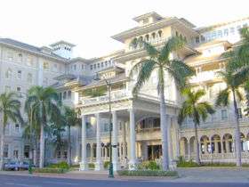
| 100 |
Moana Hotel |
|
000000001972-08-07-0000August 7, 1972
(#72000417) |
2365 Kalakaua Ave.
21°16′36″N 157°49′36″W / 21.276583°N 157.826656°W / 21.276583; -157.826656 (Moana Hotel) |
Honolulu |
|
| 101 |
Moiliʻili Japanese Cemetery |
|
000000002015-04-07-0000April 7, 2015
(#15000128) |
2624 Kapiolani Boulevard
21°17′18″N 157°49′14″W / 21.288466°N 157.820522°W / 21.288466; -157.820522 (Moiliʻili Japanese Cemetery) |
Honolulu |
|
| 102 |
Mokapu Burial Area |
Upload image |
000000001972-11-15-0000November 15, 1972
(#72000428) |
Address Restricted
|
Kaneohe |
|
| 103 |
Molii Fishpond |
|
000000001972-12-05-0000December 5, 1972
(#72000429) |
Southeast of Kamehameha Highway between Kualoa and Johnson Rds.
21°30′35″N 157°50′46″W / 21.509755°N 157.846245°W / 21.509755; -157.846245 (Molii Fishpond) |
Kaneohe |
|
| 104 |
National Memorial Cemetery of the Pacific |
|
000000001976-01-11-0000January 11, 1976
(#76002276) |
2177 Puowaina Dr.
21°18′46″N 157°50′46″W / 21.312725°N 157.846245°W / 21.312725; -157.846245 (National Memorial Cemetery of the Pacific) |
Honolulu |
|
| 105 |
Nuuanu Petroglyph Complex |
Upload image |
000000001973-03-14-0000March 14, 1973
(#73000662) |
Address Restricted
|
Honolulu |
|
| 106 |
Oahu Railway and Land Company Right-of-Way |
|
000000001975-12-01-0000December 1, 1975
(#75000621) |
Barbers Point
21°20′49″N 158°01′38″W / 21.346844°N 158.027176°W / 21.346844; -158.027176 (Oahu Railway and Land Company Right-of-Way) |
Nanakuli |
also see Oahu Railway and Land Company
|
| 107 |
George D. Oakley House |
|
000000001984-11-15-0000November 15, 1984
(#84000249) |
2110 Kakela Pl.
21°18′17″N 157°49′29″W / 21.304604°N 157.824645°W / 21.304604; -157.824645 (George D. Oakley House) |
Honolulu |
Tudor cottage
|
| 108 |
Frederick Ohrt House |
|
000000001987-06-05-0000June 5, 1987
(#86002835) |
2958 Pali Highway
21°20′13″N 157°50′21″W / 21.336871°N 157.839118°W / 21.336871; -157.839118 (Frederick Ohrt House) |
Honolulu |
|
| 109 |
Okiokilepe Pond |
|
000000001973-03-14-0000March 14, 1973
(#73000673) |
0.3 miles northwest of Iroquois Point at the entrance to Pearl Harbor
21°20′21″N 157°58′32″W / 21.339109°N 157.975466°W / 21.339109; -157.975466 (Okiokilepe Pond) |
Pearl Harbor |
|
| 110 |
Opana Radar Site |
Upload image |
000000001991-09-19-0000September 19, 1991
(#91001379) |
Off Kamehameha Highway, south of Kawela Bay
21°41′08″N 158°00′35″W / 21.685485°N 158.009666°W / 21.685485; -158.009666 (Opana Radar Site) |
Kawela Bay |
|
| 111 |
Our Lady of Peace Cathedral |
|
000000001972-08-07-0000August 7, 1972
(#72000418) |
1183 Fort St.
21°18′39″N 157°51′34″W / 21.310745°N 157.859414°W / 21.310745; -157.859414 (Our Lady of Peace Cathedral) |
Honolulu |
|
| 112 |
Pahukini Heiau |
|
000000001972-09-11-0000September 11, 1972
(#72000426) |
Southwest of Kapaa Quarry
21°23′41″N 157°46′11″W / 21.394722°N 157.769722°W / 21.394722; -157.769722 (Pahukini Heiau) |
Kailua |
|
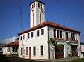
| 113 |
Palama Fire Station |
|
000000001976-04-21-0000April 21, 1976
(#76000661) |
879 N. King St.
21°19′21″N 157°52′04″W / 21.32238°N 157.867775°W / 21.32238; -157.867775 (Palama Fire Station) |
Honolulu |
built 1901, architect Oliver G. Traphagen
|
| 114 |
Palm Circle Historic District |
|
000000001984-10-26-0000October 26, 1984
(#84000104) |
Roughly bounded by Carter Dr., Richardson and Funston Rds., and A and B Sts.
21°20′44″N 157°53′17″W / 21.345545°N 157.887956°W / 21.345545; -157.887956 (Palm Circle Historic District) |
Honolulu |
|
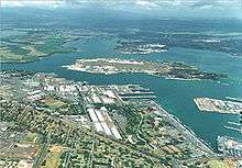
| 115 |
Pearl Harbor, U.S. Naval Base |
|
000000001966-10-15-0000October 15, 1966
(#66000940) |
3 miles south of Pearl City on Hawaii Route 73
21°21′09″N 157°57′20″W / 21.35258°N 157.955614°W / 21.35258; -157.955614 (Pearl Harbor, U.S. Naval Base) |
Pearl City |
|
| 116 |
Joseph W. Podmore Building |
|
000000001983-03-24-0000March 24, 1983
(#83000251) |
202-206 Merchant St.
21°18′27″N 157°51′41″W / 21.307382°N 157.861313°W / 21.307382; -157.861313 (Joseph W. Podmore Building) |
Honolulu |
built 1902, architect Lee Wai
|
| 117 |
Pohaku ka luahine |
Upload image |
000000001973-07-23-0000July 23, 1973
(#73002273) |
Address Restricted
|
Kaneohe |
|
| 118 |
Punahou School Campus |
|
000000001972-08-07-0000August 7, 1972
(#72000419) |
1601 Punahou St.
21°18′14″N 157°49′49″W / 21.303929°N 157.83032°W / 21.303929; -157.83032 (Punahou School Campus) |
Honolulu |
|
| 119 |
Puu o Mahuka Heiau |
|
000000001966-10-15-0000October 15, 1966
(#66000292) |
4 miles northeast of Haleiwa on Hawaii Route 83, overlooking Waimea Bay
21°38′29″N 158°03′33″W / 21.641446°N 158.059037°W / 21.641446; -158.059037 (Puu o Mahuka Heiau) |
Haleiwa |
|
| 120 |
Queen Emma's Summer Home |
|
000000001972-08-07-0000August 7, 1972
(#72000420) |
2913 Pali Highway
21°20′09″N 157°50′21″W / 21.335902°N 157.839119°W / 21.335902; -157.839119 (Queen Emma's Summer Home) |
Honolulu |
|
| 121 |
Royal Brewery |
|
000000001972-11-29-0000November 29, 1972
(#72000421) |
553 S. Queen St.
21°18′11″N 157°51′33″W / 21.303139°N 157.85903°W / 21.303139; -157.85903 (Royal Brewery) |
Honolulu |
|
| 122 |
Royal Mausoleum |
|
000000001972-08-07-0000August 7, 1972
(#72000422) |
2261 Nuuanu Ave.
21°19′30″N 157°50′50″W / 21.325°N 157.847222°W / 21.325; -157.847222 (Royal Mausoleum) |
Honolulu |
burial site of royal family known as Mauna ʻAla bilt in 1863
|
| 123 |
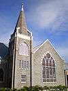
Sacred Heart Church |
|
000000002001-02-06-0000February 6, 2001
(#89001875) |
1701 Wilder Ave.
21°18′06″N 157°49′52″W / 21.301617°N 157.831001°W / 21.301617; -157.831001 (Sacred Heart Church) |
Honolulu |
|
| 124 |
Salvation Army Waioli Tea Room |
|
000000001998-10-30-0000October 30, 1998
(#98001288) |
3016 Oahu Ave.
21°18′58″N 157°48′47″W / 21.316048°N 157.813052°W / 21.316048; -157.813052 (Salvation Army Waioli Tea Room) |
Honolulu |
built 1926, architects Emory & Webb, founded as a girls home and bakery
|
| 125 |
Schofield Barracks Historic District |
Upload image |
000000001998-07-31-0000July 31, 1998
(#98000889) |
Roughly bounded by Foote Ave., Wright Ave., McMahon Rd., and Wright-Smith Rd.
21°29′52″N 158°03′30″W / 21.497778°N 158.058333°W / 21.497778; -158.058333 (Schofield Barracks Historic District) |
Schofield Barracks |
|
| 126 |
Schofield Barracks Stockade |
Upload image |
000000001998-08-24-0000August 24, 1998
(#98000974) |
Lyman Rd.
21°29′12″N 158°03′19″W / 21.486667°N 158.055278°W / 21.486667; -158.055278 (Schofield Barracks Stockade) |
Schofield Barracks |
|
| 127 |
J. Alvin Shadinger House |
|
000000001987-06-05-0000June 5, 1987
(#86002832) |
4584 Kahala Ave.
21°15′50″N 157°47′05″W / 21.263961°N 157.784669°W / 21.263961; -157.784669 (J. Alvin Shadinger House) |
Honolulu |
also known as The Gingerbread House
|
| 128 |
Charles A. Simpson House |
|
000000001987-06-05-0000June 5, 1987
(#86002831) |
4354 Kahala Ave.
21°15′38″N 157°47′31″W / 21.260506°N 157.791819°W / 21.260506; -157.791819 (Charles A. Simpson House) |
Honolulu |
|
| 129 |
Dr. Archibald Neil Sinclair House |
|
000000001983-10-13-0000October 13, 1983
(#83003557) |
2726 Hillside Ave.
21°18′36″N 157°48′58″W / 21.309936°N 157.81604°W / 21.309936; -157.81604 (Dr. Archibald Neil Sinclair House) |
Honolulu |
built 1917, architects Emory & Webb, Colonial Revival style
|
| 130 |
Small Heiau |
Upload image |
000000001973-03-14-0000March 14, 1973
(#73000667) |
1 mile south of Kaaawa off Kaaawa Valley Rd.
21°32′32″N 157°51′21″W / 21.542222°N 157.855833°W / 21.542222; -157.855833 (Small Heiau) |
Kaaawa |
|
| 131 |
Mabel Smyth Memorial Building |
|
000000001994-02-03-0000February 3, 1994
(#93001558) |
510 South Beretania St.
21°18′25″N 157°51′19″W / 21.306883°N 157.855163°W / 21.306883; -157.855163 (Mabel Smyth Memorial Building) |
Honolulu |
built 1941, architect C.W. Dickey, renovated 1999[7]
|
| 132 |
St. Andrew's Cathedral |
|
000000001973-07-02-0000July 2, 1973
(#73000663) |
Beretania St. (Queen Emma Sq.)
21°18′35″N 157°51′26″W / 21.309849°N 157.857193°W / 21.309849; -157.857193 (St. Andrew's Cathedral) |
Honolulu |
|
| 133 |
Tantalus-Round Top Road |
|
000000002009-08-14-0000August 14, 2009
(#08000373) |
Tantalus Dr., Round Top Dr.
21°19′48″N 157°48′51″W / 21.330006°N 157.8143°W / 21.330006; -157.8143 (Tantalus-Round Top Road) |
Honolulu |
|
| 134 |
Frank Tavares House |
|
000000001987-06-05-0000June 5, 1987
(#86002830) |
2826 Coconut Ave.
21°15′31″N 157°49′04″W / 21.258726°N 157.817815°W / 21.258726; -157.817815 (Frank Tavares House) |
Honolulu |
|
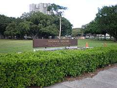
| 135 |
Thomas Square |
|
000000001972-04-25-0000April 25, 1972
(#72000423) |
Bounded by King, S. Beretania, and Victoria Sts. and Ward Ave.
21°18′10″N 157°50′57″W / 21.302749°N 157.849037°W / 21.302749; -157.849037 (Thomas Square) |
Honolulu |
|
| 136 |
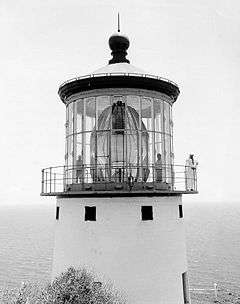
U.S. Coast Guard Diamond Head Lighthouse |
|
000000001980-10-31-0000October 31, 1980
(#80001282) |
3399 Diamond Head Rd.
21°15′20″N 157°48′34″W / 21.25568°N 157.809492°W / 21.25568; -157.809492 (U.S. Coast Guard Diamond Head Lighthouse) |
Honolulu |
|
| 137 |
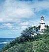
U.S. Coast Guard Makapuu Point Light |
|
000000001977-12-07-0000December 7, 1977
(#77000447) |
Southeast of Waimanalo off the Kalanianaole Highway
21°18′35″N 157°38′59″W / 21.309861°N 157.649743°W / 21.309861; -157.649743 (U.S. Coast Guard Makapuu Point Light) |
Waimanalo |
|
| 138 |
U.S. Immigration Office |
|
000000001973-08-14-0000August 14, 1973
(#73000664) |
595 Ala Moana Boulevard
21°17′59″N 157°51′50″W / 21.299722°N 157.863889°W / 21.299722; -157.863889 (U.S. Immigration Office) |
Honolulu |
|
| 139 |
U.S. Post Office, Customhouse, and Courthouse |
|
000000001975-01-27-0000January 27, 1975
(#75000620) |
335 Merchant St.
21°18′22″N 157°51′38″W / 21.306158°N 157.860635°W / 21.306158; -157.860635 (U.S. Post Office, Customhouse, and Courthouse) |
Honolulu |
|
| 140 |
Ukanipo Heiau |
Upload image |
000000001982-08-13-0000August 13, 1982
(#82002502) |
Address Restricted
|
Makaha |
|
| 141 |
Ulu Po Heiau |
|
000000001972-11-09-0000November 9, 1972
(#72000425) |
Off Route 61 northeast of the Castle Medical Center[8]
21°23′08″N 157°45′10″W / 21.385636°N 157.752876°W / 21.385636; -157.752876 (Ulu Po Heiau) |
Kailua |
|
| 142 |
U.S.S. ARIZONA Memorial |
|
000000001966-10-15-0000October 15, 1966
(#66000944) |
3 miles south of Pearl City on Hawaii Route 73
21°21′53″N 157°57′00″W / 21.36485°N 157.949969°W / 21.36485; -157.949969 (U.S.S. ARIZONA Memorial) |
Pearl City |
|
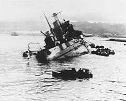
| 143 |
USS ARIZONA Wreck |
|
000000001989-05-05-0000May 5, 1989
(#89001083) |
Off Ford Island in Pearl Harbor
21°21′53″N 157°57′01″W / 21.36475°N 157.950194°W / 21.36475; -157.950194 (USS ARIZONA Wreck) |
Pearl City |
|
| 144 |
USS BOWFIN |
|
000000001982-11-16-0000November 16, 1982
(#82000149) |
11 Arizona Memorial Dr.
21°22′07″N 157°56′22″W / 21.368611°N 157.939444°W / 21.368611; -157.939444 (USS BOWFIN) |
Honolulu |
a submarine
|
| 145 |
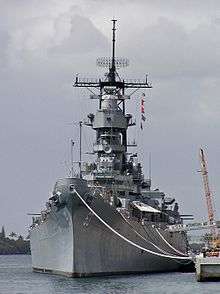
U.S.S. MISSOURI |
|
000000001971-05-14-0000May 14, 1971
(#71000877) |
63 Cowpens St.
21°21′43″N 157°57′13″W / 21.361944°N 157.953611°W / 21.361944; -157.953611 (U.S.S. MISSOURI) |
Honolulu |
Moved from Bremerton, Washington and opened as a museum ship in 1999[9]
|
| 146 |
USS UTAH Wreck |
|
000000001989-05-05-0000May 5, 1989
(#89001084) |
Off Ford Island in Pearl Harbor
21°22′08″N 157°57′45″W / 21.368976°N 157.962494°W / 21.368976; -157.962494 (USS UTAH Wreck) |
Honolulu |
|
| 147 |
Ernest Shelton Van Tassel House |
Upload image |
000000001981-12-16-0000December 16, 1981
(#81000203) |
3280 Round Top Dr.
21°18′54″N 157°49′15″W / 21.315031°N 157.820844°W / 21.315031; -157.820844 (Ernest Shelton Van Tassel House) |
Honolulu |
Former macadamia nut plantation, also called Nutridge, built 1922, architect Hart Wood
|
| 148 |
Waialua Agricultural Company Engine No. 6 |
Upload image |
000000001974-08-19-0000August 19, 1974
(#74000719) |
Off Hawaii Route 78
21°19′56″N 158°02′47″W / 21.33215°N 158.046457°W / 21.33215; -158.046457 (Waialua Agricultural Company Engine No. 6) |
Lualualei |
Now at the Hawaiian Railway Society.[10]
|
| 149 |
Waialua Fire Station |
|
000000001980-12-02-0000December 2, 1980
(#80001270) |
66-420 Haleiwa Rd.
21°35′12″N 158°06′43″W / 21.586561°N 158.111965°W / 21.586561; -158.111965 (Waialua Fire Station) |
Haleiwa |
built 1932, architect A.W. Heen
|
| 150 |
Waialua School |
|
000000001980-08-11-0000August 11, 1980
(#80001271) |
66-505 Haleiwa Rd.
21°35′05″N 158°06′49″W / 21.58484°N 158.113658°W / 21.58484; -158.113658 (Waialua School) |
Haleiwa |
|
| 151 |
Waianae District |
Upload image |
000000001974-01-21-0000January 21, 1974
(#74000720) |
Address Restricted
|
Waianae |
|
| 152 |
Waikane Taro Flats |
Upload image |
000000001973-04-11-0000April 11, 1973
(#73000675) |
1 mile northwest of Waikane in Upper Waikane Valley
21°30′16″N 157°52′39″W / 21.504444°N 157.8775°W / 21.504444; -157.8775 (Waikane Taro Flats) |
North Ko'olaupoko |
|
| 153 |
Wakamiya Inari Shrine |
|
000000001980-01-08-0000January 8, 1980
(#80001285) |
Waipahu Cultural Garden
21°23′29″N 158°00′58″W / 21.391389°N 158.016111°W / 21.391389; -158.016111 (Wakamiya Inari Shrine) |
Waipahu |
|
| 154 |
H. Alexander Walker Residence |
|
000000001973-04-24-0000April 24, 1973
(#73000665) |
2616 Pali Highway
21°19′55″N 157°50′38″W / 21.332007°N 157.843774°W / 21.332007; -157.843774 (H. Alexander Walker Residence) |
Honolulu |
|
| 155 |
War Memorial Natatorium |
|
000000001980-08-11-0000August 11, 1980
(#80001283) |
Kalakaua Ave.
21°15′52″N 157°49′20″W / 21.264491°N 157.822199°W / 21.264491; -157.822199 (War Memorial Natatorium) |
Honolulu |
|
| 156 |
George R. Ward House |
Upload image |
000000002016-02-23-0000February 23, 2016
(#16000029) |
2438 Ferdinand Ave.
21°18′32″N 157°49′21″W / 21.308798°N 157.822368°W / 21.308798; -157.822368 (George R. Ward House) |
Honolulu |
|
| 157 |
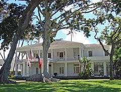
Washington Place |
|
000000001973-06-18-0000June 18, 1973
(#73000666) |
320 Beretania St.
21°18′32″N 157°51′24″W / 21.308773°N 157.85674°W / 21.308773; -157.85674 (Washington Place) |
Honolulu |
|
| 158 |
Wheeler Field |
|
000000001987-05-28-0000May 28, 1987
(#87001297) |
Area around Wright Ave. and the flight line
21°28′53″N 158°02′16″W / 21.481465°N 158.03765°W / 21.481465; -158.03765 (Wheeler Field) |
Schofield Barracks |
|
.jpg)
.JPG)
.jpg)

%2C_Honolulu%2C_Hawaii.JPG)
.jpg)
_burning_after_the_Japanese_attack_on_Pearl_Harbor_-_NARA_195617_-_Edit.jpg)
.jpg)