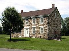
| [3] |
Name on the Register |
Image |
Date listed[4] |
Location |
City or town |
Description |
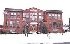
|---|
| 1 |
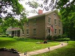
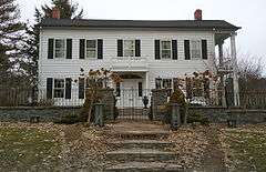
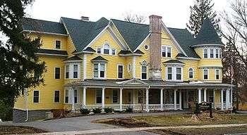
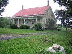
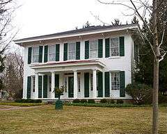
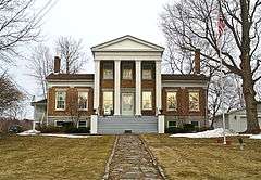
Alvord House |
|
000000001976-08-27-0000August 27, 1976
(#76001257) |
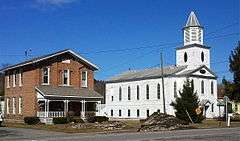
Fred Sehr Park, North of Syracuse on Berwick Road
43°05′19″N 76°08′01″W / 43.088611°N 76.133611°W / 43.088611; -76.133611 (Alvord House) |
Salina |
Stone farmhouse of Alvord family, merchants in the salt manufacturing business of the Salina area in the early 19th century.[5]
|
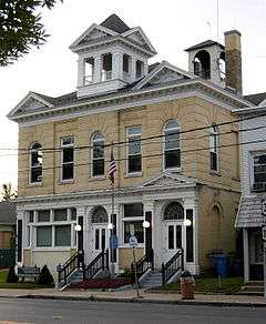
| 2 |
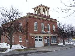
Baldwinsville Village Hall |
|
000000001997-05-09-0000May 9, 1997
(#97000421) |
16 W. Genesee St.
43°09′32″N 76°20′03″W / 43.158889°N 76.334167°W / 43.158889; -76.334167 (Baldwinsville Village Hall) |
Baldwinsville |
|
| 3 |
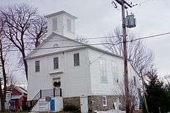
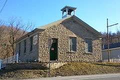
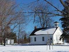
Borodino District School #8 |
|
000000002007-01-04-0000January 4, 2007
(#06001206) |
1845 Rose Hill Rd.
42°51′40″N 76°20′16″W / 42.861111°N 76.337778°W / 42.861111; -76.337778 (Borodino District School #8) |
Borodino |
|
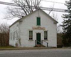
| 4 |
Borodino Hall |
|
000000002006-07-28-0000July 28, 2006
(#06000647) |
1861 E. Lake Rd.
42°51′31″N 76°20′20″W / 42.858611°N 76.338889°W / 42.858611; -76.338889 (Borodino Hall) |
Borodino |
|
| 5 |
Dan Bradley House |
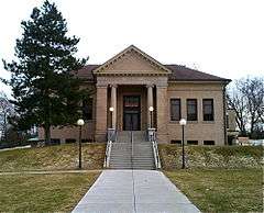
|
000000001978-12-12-0000December 12, 1978
(#78001889) |
59 South St.
42°58′35″N 76°20′24″W / 42.976389°N 76.34°W / 42.976389; -76.34 (Dan Bradley House) |
Marcellus |
|
| 6 |
Brook Farm |
Upload image |
000000002003-12-18-0000December 18, 2003
(#03001304) |
2870 W. Lake Rd.
42°54′58″N 76°25′47″W / 42.916111°N 76.429722°W / 42.916111; -76.429722 (Brook Farm) |
Skaneateles |
|
| 7 |
Camillus Union Free School |
|
000000001991-05-28-0000May 28, 1991
(#91000628) |
Jct. of First and LeRoy Sts.
43°02′26″N 76°18′21″W / 43.040556°N 76.305833°W / 43.040556; -76.305833 (Camillus Union Free School) |
Camillus Village |
|
| 8 |
Carley Onondaga Site |
Upload image |
000000002011-01-10-0000January 10, 2011
(#10001127) |
Address Restricted
|
Pompey |
|
| 9 |
Christ Church and Manlius Village Cemeteries |
|
000000002007-01-25-0000January 25, 2007
(#06001298) |
East Seneca St.
43°00′09″N 75°58′12″W / 43.0025°N 75.97°W / 43.0025; -75.97 (Christ Church and Manlius Village Cemeteries) |
Manlius |
|
| 10 |
Church of the Good Shepherd |
|
000000001997-05-08-0000May 8, 1997
(#97000113) |
NY 11A, south of its junction with Webster Rd., on the Onondaga Reservation
42°56′42″N 76°09′43″W / 42.945°N 76.161944°W / 42.945; -76.161944 (Church of the Good Shepherd) |
Onondaga Indian Reservation |
|
| 11 |
Community Place |
|
000000001979-04-20-0000April 20, 1979
(#79001611) |
S of Skaneateles at 725 Sheldon Rd.
42°58′58″N 76°27′17″W / 42.982778°N 76.454722°W / 42.982778; -76.454722 (Community Place) |
Skaneateles |
|
| 12 |
Mrs. I. L. Crego House |
|
000000002007-06-27-0000June 27, 2007
(#07000631) |
7979 Crego Rd.
43°09′21″N 76°21′13″W / 43.155833°N 76.353611°W / 43.155833; -76.353611 (Mrs. I. L. Crego House) |
Baldwinsville |
|
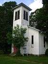
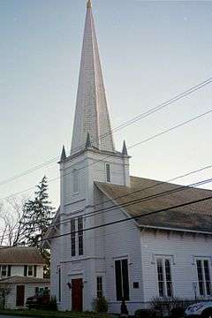
| 13 |
Delphi Baptist Church |
|
000000001979-08-24-0000August 24, 1979
(#79001610) |
Oran-Delphi Rd.
42°52′38″N 75°54′48″W / 42.877222°N 75.913333°W / 42.877222; -75.913333 (Delphi Baptist Church) |
Delphi Falls |
|
| 14 |
Delphi Village School |
|
000000001986-05-22-0000May 22, 1986
(#86001152) |
East Rd.
42°52′31″N 75°54′54″W / 42.875278°N 75.915°W / 42.875278; -75.915 (Delphi Village School) |
Delphi Falls |
|
| 15 |
Drover's Tavern |
|
000000002003-04-18-0000April 18, 2003
(#03000265) |
4065 Pompey Hollow Rd.
42°58′04″N 75°54′57″W / 42.967778°N 75.915833°W / 42.967778; -75.915833 (Drover's Tavern) |
Oran |
|
| 16 |
Elbridge Hydraulic Industry Archeological District |
Upload image |
000000001982-06-15-0000June 15, 1982
(#82003391) |
Address Restricted
|
Elbridge |
|
| 17 |
Elbridge Village Historic District |
|
000000002002-01-24-0000January 24, 2002
(#01001494) |
Roughly along NY 5 bet. Skaneatetes Creek and Carpenter's Brook
43°02′06″N 76°26′49″W / 43.035°N 76.446944°W / 43.035; -76.446944 (Elbridge Village Historic District) |
Elbridge |
|
| 18 |
Charles Estabrook Mansion |
|
000000001996-04-26-0000April 26, 1996
(#96000487) |
7262 E. Genesee St.
43°01′42″N 76°01′16″W / 43.028333°N 76.021111°W / 43.028333; -76.021111 (Charles Estabrook Mansion) |
Fayetteville |
|
| 19 |
Fabius Village Historic District |
|
000000002000-11-22-0000November 22, 2000
(#00001409) |
Roughly bounded by N. West St., Mill St., Keeney St., and Fabius Town Line
42°50′05″N 75°59′12″W / 42.834722°N 75.986667°W / 42.834722; -75.986667 (Fabius Village Historic District) |
Fabius |
|
| 20 |
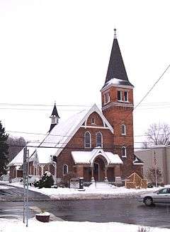
First Baptist Church of Camillus |
|
000000002001-06-08-0000June 8, 2001
(#01000573) |
23 Genesee St.
43°02′19″N 76°18′29″W / 43.038611°N 76.308056°W / 43.038611; -76.308056 (First Baptist Church of Camillus) |
Camillus Village |
|
| 21 |
James and Lydia Canning Fuller House |
|
000000002003-07-03-0000July 3, 2003
(#03000595) |
W. Genesee St.
42°56′41″N 76°26′22″W / 42.944722°N 76.439444°W / 42.944722; -76.439444 (James and Lydia Canning Fuller House) |
Skaneateles |
|
| 22 |
Genesee Street Hill-Limestone Plaza Historic District |
|
000000001982-07-29-0000July 29, 1982
(#82003392) |
Roughly both sides of Genesee St., from Chapel St. to Limestone Plaza
43°01′46″N 76°00′36″W / 43.029444°N 76.01°W / 43.029444; -76.01 (Genesee Street Hill-Limestone Plaza Historic District) |
Fayetteville |
|
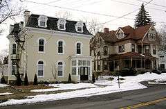
| 23 |
Lucius Gleason House |
|
000000001990-05-10-0000May 10, 1990
(#90000693) |
314 Second St.
43°06′13″N 76°12′37″W / 43.103611°N 76.210278°W / 43.103611; -76.210278 (Lucius Gleason House) |
Liverpool |
|
| 24 |
Hazelhurst |
|
000000002010-05-28-0000May 28, 2010
(#10000302) |
150 E. Genesee St.
42°56′39″N 76°25′08″W / 42.94415°N 76.4189°W / 42.94415; -76.4189 (Hazelhurst) |
Skaneateles |
|
| 25 |
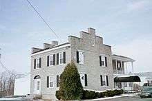
Gen. Orrin Hutchinson House |
|
000000001973-04-13-0000April 13, 1973
(#73001233) |
4311 W. Seneca Tpke.
42°59′41″N 76°12′57″W / 42.994722°N 76.215833°W / 42.994722; -76.215833 (Gen. Orrin Hutchinson House) |
Onondaga |
|
| 26 |
Indian Castle Village Site |
Upload image |
000000002011-01-10-0000January 10, 2011
(#10001126) |
Address Restricted
|
Manlius |
|
| 27 |
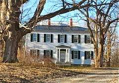
Dr. John Ives House |
|
000000001985-08-29-0000August 29, 1985
(#85001938) |
6575 E. Seneca Turnpike
42°59′27″N 76°04′04″W / 42.990833°N 76.067778°W / 42.990833; -76.067778 (Dr. John Ives House) |
Jamesville |
|
| 28 |
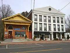
Jordan Village Historic District |
|
000000001983-09-15-0000September 15, 1983
(#83001753) |
Roughly bounded by N. Main, S. Main, Elbridge, Clinton, Hamilton, Lawrence, and Mechanic Sts.
43°03′55″N 76°28′25″W / 43.065278°N 76.473611°W / 43.065278; -76.473611 (Jordan Village Historic District) |
Jordan |
|
| 29 |
Kelsey-Davey Farm |
|
000000001980-04-16-0000April 16, 1980
(#80004277) |
NE of Skaneateles on Old Seneca Tpke.
42°59′01″N 76°23′23″W / 42.983611°N 76.389722°W / 42.983611; -76.389722 (Kelsey-Davey Farm) |
Skaneateles |
|
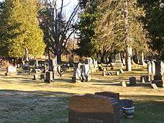
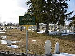
| 30 |
Liverpool Cemetery |
Upload image |
000000002015-05-26-0000May 26, 2015
(#15000267) |
225 6th St.
43°06′34″N 76°12′35″W / 43.109349°N 76.2096297°W / 43.109349; -76.2096297 (Liverpool Cemetery) |
Liverpool |
Mid-19th century cemetery is final resting place of many residents, particularly immigrants
|
| 31 |
Manlius Village Historic District |
|
000000001973-11-06-0000November 6, 1973
(#73001232) |
Pleasant, Franklin, North, Clinton, and E. Seneca Sts.
43°00′11″N 75°58′31″W / 43.003056°N 75.975278°W / 43.003056; -75.975278 (Manlius Village Historic District) |
Manlius |
|
| 32 |
Martisco Station |
|
000000002007-04-05-0000April 5, 2007
(#07000292) |
Martisco Rd., N of Lyons Rd.
43°01′02″N 76°20′09″W / 43.017222°N 76.335833°W / 43.017222; -76.335833 (Martisco Station) |
Martisco |
|
| 33 |
Mycenae Schoolhouse |
|
000000001983-08-11-0000August 11, 1983
(#83001754) |
NY 5
43°02′48″N 75°56′01″W / 43.046667°N 75.933611°W / 43.046667; -75.933611 (Mycenae Schoolhouse) |
Manlius |
|
| 34 |
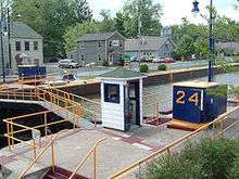
New York State Barge Canal |
|
000000002014-10-15-0000October 15, 2014
(#14000860) |
Linear across county
Coordinates missing |
Baldwinsville, Cicero, Clay, Elbridge, Geddes, Liverpool, Lysander, Salina, Van Buren |
Successor to Erie Canal approved by state voters in early 20th century to compete with railroads.
|
| 35 |
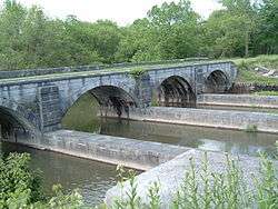
Nine Mile Creek Aqueduct |
|
000000001976-05-17-0000May 17, 1976
(#76001256) |
NE of Camillus on Thompson Rd.
43°03′32″N 76°17′09″W / 43.058889°N 76.285833°W / 43.058889; -76.285833 (Nine Mile Creek Aqueduct) |
Camillus |
|
| 36 |
Oran Community Church |
|
000000002002-01-24-0000January 24, 2002
(#01001503) |
8560 Cazenovia Rd, NY 92
42°58′44″N 75°56′09″W / 42.978889°N 75.935833°W / 42.978889; -75.935833 (Oran Community Church) |
Pompey |
|
| 37 |
Oran District No. 22 Schoolhouse |
|
000000001998-08-06-0000August 6, 1998
(#98001002) |
Jct. of Ny 92 and Delphi Rd.
42°58′43″N 75°56′06″W / 42.978611°N 75.935°W / 42.978611; -75.935 (Oran District No. 22 Schoolhouse) |
Oran, in Pompey |
|
| 38 |
Oswego-Oneida Streets Historic District |
|
000000001982-07-29-0000July 29, 1982
(#82003390) |
Oswego, East and West Sts., and Sunset Terr.
43°09′41″N 76°20′08″W / 43.161389°N 76.335556°W / 43.161389; -76.335556 (Oswego-Oneida Streets Historic District) |
Baldwinsville |
|
| 39 |
Pompey Centre District No. 10 Schoolhouse |
|
000000001998-08-06-0000August 6, 1998
(#98001007) |
8354 US 20
42°55′25″N 75°56′58″W / 42.923611°N 75.949444°W / 42.923611; -75.949444 (Pompey Centre District No. 10 Schoolhouse) |
Pompey Center, in Pompey |
|
| 40 |
Robinson Site (AO67-02-0001) |
Upload image |
000000001985-03-28-0000March 28, 1985
(#85000660) |
Address Restricted
|
Brewerton |
|
| 41 |
Saint Mark's Church |
|
000000001997-03-09-0000March 9, 1997
(#97000114) |
6492 E. Seneca Trnpk.
42°59′28″N 76°04′21″W / 42.991111°N 76.0725°W / 42.991111; -76.0725 (Saint Mark's Church) |
Jamesville |
|
| 42 |
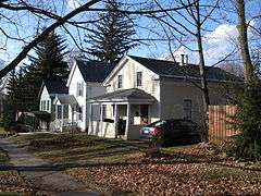
Shepard Family Houses |
Upload image |
000000002015-12-22-0000December 22, 2015
(#15000923) |
28 W. Genesee & 6 Hannum Sts.
Coordinates missing |
Skaneateles |
Houses of prominent local family, built 1848 and 1901 respectively.
|
| 43 |
Shepard Settlement Cemetery |
|
000000002010-11-29-0000November 29, 2010
(#10000938) |
Stump & Foster Rds
42°59′42″N 76°23′40″W / 42.9951°N 76.3945°W / 42.9951; -76.3945 (Shepard Settlement Cemetery) |
Shepard Settlement |
|
| 44 |
Skaneateles Historic District |
|
000000001984-05-10-0000May 10, 1984
(#84002818) |
Jordan, Fennell, E. and W. Genesee Sts.
42°57′14″N 76°25′36″W / 42.953889°N 76.426667°W / 42.953889; -76.426667 (Skaneateles Historic District) |
Skaneateles |
|
| 45 |
Reuel E. Smith House |
|
000000001979-07-27-0000July 27, 1979
(#79001612) |
28 W. Lake St.
42°56′31″N 76°26′05″W / 42.941944°N 76.434722°W / 42.941944; -76.434722 (Reuel E. Smith House) |
Skaneateles |
Designed by Alexander Jackson Davis
|
| 46 |
Levi Snell House |
|
000000001987-08-20-0000August 20, 1987
(#87001365) |
416 Brooklea Dr.
43°02′05″N 76°00′30″W / 43.034722°N 76.008333°W / 43.034722; -76.008333 (Levi Snell House) |
Fayetteville |
|
| 47 |
Solvay Public Library |
|
000000002007-10-31-0000October 31, 2007
(#07001124) |
615 Woods Rd.
43°03′27″N 76°12′26″W / 43.0575°N 76.207222°W / 43.0575; -76.207222 (Solvay Public Library) |
Solvay |
|
| 48 |
Southwood Two-Teacher School |
|
000000002000-04-06-0000April 6, 2000
(#00000349) |
4621 Barker Hill Rd.
42°59′42″N 76°06′34″W / 42.995°N 76.109444°W / 42.995; -76.109444 (Southwood Two-Teacher School) |
Jamesville |
|
| 49 |
Stone Arabia School |
|
000000002007-04-12-0000April 12, 2007
(#07000289) |
6453 NY 31
43°10′39″N 76°04′31″W / 43.1775°N 76.075278°W / 43.1775; -76.075278 (Stone Arabia School) |
Cicero |
|
| 50 |
Tefft-Steadman House |
|
000000002007-10-31-0000October 31, 2007
(#07001125) |
18 North St.
42°59′18″N 76°20′23″W / 42.988333°N 76.339722°W / 42.988333; -76.339722 (Tefft-Steadman House) |
Marcellus |
|
| 51 |
Whig Hill and Dependencies |
|
000000001975-05-12-0000May 12, 1975
(#75001217) |
E. of Plainville at jct. of W. Genesee and Gates Rds.
43°09′33″N 76°26′01″W / 43.159167°N 76.433611°W / 43.159167; -76.433611 (Whig Hill and Dependencies) |
Plainville |
|
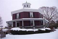
| 52 |
Wilcox Octagon House |
|
000000001983-07-28-0000July 28, 1983
(#83001756) |
5420 W. Genesee St.
43°02′28″N 76°16′42″W / 43.041111°N 76.278333°W / 43.041111; -76.278333 (Wilcox Octagon House) |
Camillus |
|

.jpg)
.jpg)


.jpg)
.jpg)
.jpg)
.jpg)