Nerlandsøya
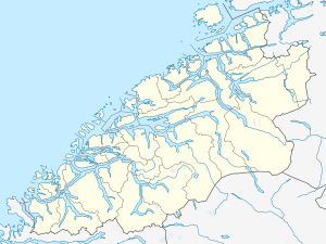
 Nerlandsøya Location in Møre og Romsdal | |
| Geography | |
|---|---|
| Location | Norway |
| Coordinates | 62°19′59″N 05°32′15″E / 62.33306°N 5.53750°ECoordinates: 62°19′59″N 05°32′15″E / 62.33306°N 5.53750°E |
| Area | 14.6 km2 (5.6 sq mi) |
| Highest elevation | 430 m (1,410 ft) |
| Highest point | Storevarden |
| Administration | |
| County | Møre og Romsdal |
| Municipality | Herøy |
Nerlandsøya is an island in the municipality of Herøy in Møre og Romsdal county, Norway. The island is located northwest of the municipal center of Fosnavåg and east of the island of Skorpa. The island is connected to the island Bergsøya (to the southeast) by the Nerlandsøy Bridge. The Flåvær islands lie to the south. The highest point on the island is Storevarden which is 430 metres (1,410 ft) above sea level. The island has an area of 14.6 square kilometres (5.6 sq mi).[1]
References
- ↑ Store norske leksikon. "Nerlandsøya" (in Norwegian). Retrieved 2010-09-19.
This article is issued from Wikipedia - version of the 11/28/2016. The text is available under the Creative Commons Attribution/Share Alike but additional terms may apply for the media files.