New Roads, Louisiana
| New Roads, Louisiana | |
| City | |
| Country | United States |
|---|---|
| State | Louisiana |
| Parish | Pointe Coupee |
| Elevation | 30 ft (9.1 m) |
| Coordinates | 30°41′47″N 91°26′20″W / 30.69639°N 91.43889°WCoordinates: 30°41′47″N 91°26′20″W / 30.69639°N 91.43889°W |
| Area | 4.6 sq mi (11.9 km2) |
| - land | 4.6 sq mi (12 km2) |
| - water | 0.0 sq mi (0 km2), 0% |
| Population | 4,831 (2010) |
| Density | 1,091.8/sq mi (421.5/km2) |
| Mayor | Robert Myer (D) |
| Timezone | CST (UTC-6) |
| - summer (DST) | CDT (UTC-5) |
| ZIP code | 70760 |
| Area code | 225 |
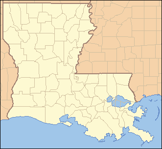 Location of New Roads in Louisiana | |
 Location of Louisiana in the United States | |
| Website: http://www.newroads.net | |
New Roads (historically French: Poste-de-Pointe-Coupée[1]) is a city in and the parish seat of Pointe Coupee Parish, Louisiana, United States.[2] The center of population of Louisiana is located in New Roads . The population was 4,831 at the 2010 census. The city's ZIP code is 70760. It is part of the Baton Rouge Metropolitan Statistical Area.
History
Le Poste de Pointe Coupée (“The Pointe Coupee Post”) is one of the oldest communities in the Mississippi River Valley established by European colonists. The trading post was founded in the 1720s by settlers from France. It was located upstream from the point crossed by explorers, immediately above but not circled by False River. The name referred to the area along the Mississippi River northeast of what is now New Roads.
The post was initially settled by native French, as well as French-speaking Creoles born in the colony. Additional ethnic French settlers migrated down from Fort de Chartres, Illinois. The colonists imported numerous African slaves from the French West Indies (Guadeloupe, Martinique, Saint-Domingue), and many directly from Africa, as workers for the plantations. Historian Gwendolyn Midlo Hall discovered extensive French and Spanish documentation of the early slave trade, which provided more information than is usually available as to the ethnicity and names of individual slaves, all in the court house at New Roads. Using this and other research, she has produced "The Louisiana Slave Database and the Louisiana Free Database: 1719–1820," which is searchable on line.
Commandants of Pointe Coupee (1729–1762)
- 1729: Chevalier Henri du Loubois
- 1731: Jean Baptiste François Tisserand De Moncharvaux
- 1734–38: Claude Joseph de Favrot
- 1738–1742: Jean Louis Richard de la Houssaye
- 1742–1744: Claude Joseph de Favrot
- 1744–1753: Jean Joseph Delfau de Pontalba, a relative by marriage of Micaela Almonester, Baroness de Pontalba, the New Orleans native who in the mid-19th century built the Pontalba Buildings and redesigned Jackson Square.
- 1753: Chevalier Morlière
- 1753–1756: Francois Artaud
- 1756–1759: Pierre Benoist, Sieur Payen de Noyan de Chavoy
- 1759–1762: Jean Louis Richard de la Houssaye
Spanish rule
After Great Britain defeated France in the Seven Years' War (also known as the French and Indian War in North America), France ceded this territory to Spain. About 1776, the Spanish built a Chemin Neuf, French for "New Road," connecting the Mississippi River with False River, a 22-mile (35 km) long oxbow lake and formerly the main channel of the Mississippi.
In 1791, the Mina (an African people) slave uprising, the Mina Conspiracy, started on the estate of Widow Provillar in the New Roads vicinity. Three years later, there was another area slave revolt near Point Coupee community, called the Pointe Coupée Conspiracy.
Louisiana Purchase
In 1803 the United States made the Louisiana Purchase, and the territory became part of the United States. In-migration of American settlers increased, changing Louisiana culture.
In 1822, Catherine Dispau (a free woman of color called "La Fille Gougis") made a four or six block subdivision out of her False River plantation. This was located at the terminus of a "new road" linking False River with the older Mississippi River settlement to the north. This is the area now bounded by West Main, New Roads, West Second and St. Mary Streets. The latter was named for St. Mary's Catholic Church, founded in 1823. The community was referred to variously as the "village of St. Mary" or Chemin Neuf.
The founding of the church helped the community develop. In 1847, New Roads was named as the seat of Pointe Coupée Parish, and a courthouse was built. Between these "strong celestial poles," the Main Street business district developed. After the abandonment of the competing parish port of Waterloo during 1882–84 due to flooding, New Roads became the major commercial port and city of Pointe Coupée Parish. The railroad reached the city in 1898–99, bringing much industrial development.
The official name of the community changed frequently during the years after Louisiana became part of the United States. The first post office was established in 1858 as "False River," but it was discontinued in 1861. When the town was incorporated by the state legislature in 1875, it was named "New Roads." But, in 1878, when the post office reopened, it was named "St. Mary's." In 1879, the city and post office name was changed to New Roads. The old incorporation fell into disuse. The city was reincorporated in 1892, and received its charter two years later. Several names were proposed, among them "St. Mary" and "Rose Lake." But "New Roads" was finally chosen, although it was often misspelled "New Rhodes."
New Roads was spared any major battles during the Civil War. There were periodic raids and the Union Army briefly encamped in the Place de la Croix, the public square in front of St. Mary's. On January 31, 1865, toward the end of the war, five squadrons of Union cavalry marched into New Roads. They found five Confederate officers under the command of Colonel John S. Scott hiding in closets, under houses, and in a hole.[3]
Scott and his guerrilla forces had operated around Morganza, trading for black market supplies from Union forces in control of Baton Rouge. Union officials exchanged food, clothing, and other necessities for cotton smuggled by Scott's men.[3]
Since its founding, New Roads has been the hub of an agricultural community that cultivated commodity crops of sugar cane, cotton, and pecans, among others. Today, the economy is also based on industry, retail stores, restaurants, and lodging enterprises, five banks, and modern health care and nursing facilities.
Notable people
- Lindy Boggs, former U.S. Ambassador to the Vatican and former U.S. Representative from Louisiana's 2nd congressional district
- Hewitt Leonidas Bouanchaud, politician, served as Lieutenant Governor and state House Speaker
- Emmitt Douglas, president of the Louisiana NAACP (1966–1981), lived in New Roads from 1949 until his death in 1981.
- Ernest J. Gaines, African-American fiction writer, writer-in-residence at the University of Louisiana at Lafayette
- Clark Gaudin, member of the Louisiana House of Representatives; 1967–1968; 1972–1996; Baton Rouge attorney, native of New Roads
- J. Thomas Jewell, member of the Louisiana House of Representatives, 1936–1968; House Speaker, 1960–1964; resided in New Roads
- John Archer LeJeune, Lieutenant General of the United States Marines. (Marine Camp LeJeune in North Carolina is named in his honor)
- Catherine D. Kimball, former chief justice of the Louisiana Supreme Court, former New Roads resident, retired in Ventress
- Clyde Kimball, former member of the Louisiana House of Representatives for Pointe Coupee and West Baton Rouge parishes; husband of Catherine Kimball
- DeLesseps Story Morrison, former New Orleans Mayor, was born in New Roads.
- Jacob Haight Morrison, his half-brother, was also born in New Roads.
- Thomas "Tommy" Nelson, former mayor of New Roads
- Julien de Lallande Poydras, a merchant, planter, poet, statesman, banker, and philanthropist, helped to establish the state's first public schools in Pointe Coupee Parish in the early 19th century. He endowed a trust fund to provide impoverished brides with dowries in Pointe Coupee and West Baton Rouge parishes.
- Albin Provosty, district attorney and from 1912 to 1920 a member of the Louisiana State Senate, publisher of The Pointe Coupee Banner
- James Ryder Randall, an English professor who wrote the poem "Maryland, My Maryland" in April 1861, at nearby Poydras College on False River. The poem was later set to music, and was adopted as Maryland's official state song.
Modern attractions
New Roads hosts the oldest Mardi Gras celebration in Louisiana outside of New Orleans each Shrove Tuesday. This parade, started by the Carnival Club, was founded by a French-Spanish Creole named James Mortimer Boudreaux, more commonly known as "Jimmy Boudreaux." He is buried in St. Mary's Catholic Church cemetery. The town's first recorded Mardi Gras ball was staged in 1881, and its first-known parade rolled in 1897. Today, as many as 80,000 people converge on the hospitable Creole town for family-friendly parades. New Roads' parades are civic events, open to public participation. The Community Center Carnival parade, founded in 1922 and the state's oldest outside New Orleans, rolls at 11 a.m. The New Roads Lions Carnival parade, founded in 1941 and which is staged as a charitable fundraiser, rolls at 1:30 p.m.
New Roads' narrow, tree-lined streets include outstanding examples of 19th-century Creole and Victorian architecture, particularly along Main Street, Poydras Street, Pennsylvania Avenue, and North Carolina Avenue. Visitor attractions include Satterfield's Riverwalk and Restaurant, the Pointe Coupee Parish Courthouse and Gen. John Archer LeJeune Monument, St. Mary's Catholic Church and Cemetery, the Julien Poydras Monument and Museum (old Poydras High School), Morrison Parkway located next to False River, and numerous fine dining and shopping opportunities as well as beautiful views and boating on False River.
The city is home to Rosenwald Elementary, Catholic High School of Pointe Coupee, Catholic Elementary of Pointe Coupee, and False River Academy.
The Jumonville-Memorial Technical Institute, located in New Roads, is named for the late State Senator J. E. Jumonville, Sr., of Ventress.
Geography
New Roads is located at 30°41′47″N 91°26′20″W / 30.69639°N 91.43889°W (30.696305, -91.438980)[4] and has an elevation of 30 feet (9.1 m).[5]
According to the United States Census Bureau, the city has a total area of 4.6 square miles (12 km2), all land.
Gradually sloping from a high of 36 feet (11 m) above sea level on Main Street immediately adjacent to False River to a low of 25 feet (7.6 m) along Portage Canal in the north, the city lies on a Mississippi River flood-plain but has never flooded to any great extent since 1912. Levee breaks or "crevasses" on the Mississippi River to the north and east overbanked False River and submerged all of New Roads in 1867, 1882 and 1884. The 1882 flood was the most severe, with four feet of water standing in Main Street during the height of the crisis. During the floods of 1912 and 1927, however, the southern portion of the town, including the main business district, remained dry, as the flood waters to the north and east were held back by the Texas & Pacific Railroad embankment.
Demographics
| Historical population | |||
|---|---|---|---|
| Census | Pop. | %± | |
| 1900 | 770 | — | |
| 1910 | 1,352 | 75.6% | |
| 1920 | 1,294 | −4.3% | |
| 1930 | 1,473 | 13.8% | |
| 1940 | 2,255 | 53.1% | |
| 1950 | 2,818 | 25.0% | |
| 1960 | 3,965 | 40.7% | |
| 1970 | 3,945 | −0.5% | |
| 1980 | 3,924 | −0.5% | |
| 1990 | 5,303 | 35.1% | |
| 2000 | 4,966 | −6.4% | |
| 2010 | 4,831 | −2.7% | |
| Est. 2015 | 4,697 | [6] | −2.8% |
As of the census[8] of 2000, there were 4,966 people, 1,818 households, and 1,243 families residing in the city. The population density was 1,091.8 inhabitants per square mile (421.5/km2). There were 2,044 housing units at an average density of 449.4 per square mile (173.5/km2). The racial makeup of the city was 38.99% White, 59.32% African American, 0.22% Native American, 0.79% Asian, 0.16% from other races, and 0.52% from two or more races. Hispanic or Latino of any race were 0.62% of the population.
There were 1,818 households out of which 33.2% had children under the age of 18 living with them, 40.4% were married couples living together, 23.6% had a female householder with no husband present, and 31.6% were non-families. 28.8% of all households were made up of individuals and 14.7% had someone living alone who was 65 years of age or older. The average household size was 2.61 and the average family size was 3.24.
In the city the population was spread out with 27.4% under the age of 18, 9.0% from 18 to 24, 24.0% from 25 to 44, 21.0% from 45 to 64, and 18.6% who were 65 years of age or older. The median age was 38 years. For every 100 females there were 82.8 males. For every 100 females age 18 and over, there were 75.0 males.
The median income for a household in the city was $24,583, and the median income for a family was $31,250. Males had a median income of $32,679 versus $20,547 for females. The per capita income for the city was $14,840. About 23.6% of families and 30.3% of the population were below the poverty line, including 40.3% of those under age 18 and 22.7% of those age 65 or over.
Government
In 1978, Trina Olinde Scott (1920-2016) became New Roads's first female mayor to succeed her late husband, William Haile "Booty" Scott, Sr., who had been elected mayor in 1960. Mrs. Scott was appointed to complete his term and was thereafter elected to two full terms of her own. A former educator who attended H. Sophie Newcomb Memorial College in New Orleans and Louisiana State University in Baton Rouge, Trina Scott was instrumental in revitalizing Main Street, increasing the size and effectiveness of the police force, and extending the municipal boundaries. Under her administration, New Roads was elevated from town to city status. During William Scott's administration, New Roads joined with the Pointe Coupee Parish Police Jury to acquire property on which to construct needed facilities. Under Mrs. Scott, the city and parish brought forth the Scott Civic Center, False River Regional Airport, playgrounds, and sports parks.[9]
Trina Scott was succeeded as mayor by Sylvester Muckelroy, the first African American in the office. The current mayor, Robert Myer, also an African American, was first elected in 2010. On August 3, 2016, Myer was indicted by a Pointe Coupee Parish grand jury on nine counts of malfeasance in office and abuse of power. From 2011 to 2014, Myer allegedly used a city-issued credit card for personal reasons. He also allegedly permitted the former municipal finance director to use the card in exchange for sexual favors.[10]
References
- ↑ http://www.thecajuns.com/oldnew.htm
- ↑ "Find a County". National Association of Counties. Retrieved 2011-06-07.
- 1 2 John D. Winters, The Civil War in Louisiana, Baton Rouge: Louisiana State University Press, 1963, ISBN 0-8071-0834-0, p. 412
- ↑ "US Gazetteer files: 2010, 2000, and 1990". United States Census Bureau. 2011-02-12. Retrieved 2011-04-23.
- ↑ "US Board on Geographic Names". United States Geological Survey. 2007-10-25. Retrieved 2008-01-31.
- ↑ "Annual Estimates of the Resident Population for Incorporated Places: April 1, 2010 to July 1, 2015". Retrieved July 2, 2016.
- ↑ "Census of Population and Housing". Census.gov. Retrieved June 4, 2015.
- ↑ "American FactFinder". United States Census Bureau. Retrieved 2008-01-31.
- ↑ "The Honorable Trina Olinde "Punkin" Scott". The Baton Rouge Advocate. Retrieved August 3, 2016.
- ↑ Terry L. Jones (August 3, 2016). "New Roads mayor indicted on counts of malfeasance in office". The Baton Rouge Advocate. Retrieved August 4, 2016.
External links
| Wikimedia Commons has media related to New Roads, Louisiana. |
- City of New Roads
- New Roads Interactive Map
- Gwendolyn Midlo Hall, "The Louisiana Slave Database and the Louisiana Free Database: 1719-1820", iBiblio website
- Pointe Coupee Tourism
- Pointe Coupee at the Millennium Documentary Photography Project
- Pointe Coupee Chamber of Commerce
Municipalities and communities of Pointe Coupee Parish, Louisiana, United States | ||
|---|---|---|
| City |  | |
| Towns | ||
| Village | ||
| CDP | ||
| Other unincorporated communities | ||
| Ghost towns | ||