New York State Route 230
| ||||
|---|---|---|---|---|
|
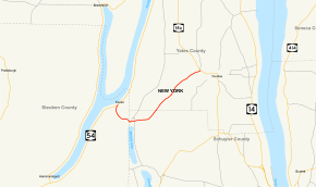
Map of Finger Lakes region in the Southern Tier of New York with NY 230 highlighted in red | ||||
| Route information | ||||
| Maintained by NYSDOT | ||||
| Length: | 8.94 mi[1] (14.39 km) | |||
| Existed: | 1930[2] – present | |||
| Major junctions | ||||
| West end: |
| |||
| East end: |
| |||
| Location | ||||
| Counties: | Steuben, Schuyler, Yates | |||
| Highway system | ||||
| ||||

New York State Route 230 (NY 230) is a state highway in the Finger Lakes District of New York in the United States. NY 230 is an east–west highway between the eastern edge of Steuben County to the interior of adjacent Yates County. The western terminus of NY 230 is the community of Keuka in the town of Wayne on the edge of Keuka Lake at NY 54. The eastern terminus is at its junction with NY 14A in the town of Barrington, west of the village of Dundee.
Route description

NY 230 begins at an intersection with NY 54 in Keuka, a hamlet with the town of Wayne on the eastern shore of Keuka Lake. NY 230 proceeds southbound from NY 54 as a two-lane woods road, bending to the southeast, crossing Keuka Lake Road near the hamlet of Sylvan Beach. The route crosses a creek, and crosses the county line into Schuyler County. In Schuyler County, NY 230 enters the town of Tyrone, passing to the north of Waneta Lake and intersecting with County Route 26 (CR 26; Hammondsport-Wayne Road), which connects NY 230 to the county line (where CR 26 becomes Steuben CR 87). Crossing through the hamlet of Wayne, NY 230 bends northeast, becoming a two-lane rural roadway through Tyrone, crossing the county line once again, now into Yates County. In Yates County, NY 230 enters the town of Barrington.[3]
In Barrington, NY 230 continues northeast, crossing as a two-lane residential street through the hamlet of Crystal Spring. The route returns to its rural background northeast of Crystal Spring, crossing John Green Road and Ray Crosby Road before intersecting with NY 14A in Barrington. NY 230 terminates at this intersection, while NY 14A proceeds eastward towards the village of Dundee.[3]
History
In 1908, the New York State Legislature created Route 13, an unsigned legislative route extending from Bath to Dundee via modern NY 54, County Routes 87 and 88 (CR 87 and CR 88) in Steuben County, and NY 230.[4][5] On March 1, 1921, Route 13 was reassigned elsewhere in the state as part of a partial renumbering of New York's legislative route system.[6] NY 230, meanwhile, was assigned in the 1930 renumbering of state highways in New York to its current alignment from NY 54A (now NY 54) in Wayne to NY 14A near Dundee.[2][7] The route was extended eastward along NY 14A and Dundee–Lakemont Road to NY 14 east of Dundee c. 1932,[8][9] but truncated back to NY 14A west of Dundee in the early 1940s.[10][11] A short spur connecting NY 230 to CR 87 in Tyrone, formerly part of legislative Route 13, is designated as NY 961L, an unsigned reference route.[12]
Major intersections
| County | Location | mi[1] | km | Destinations | Notes |
|---|---|---|---|---|---|
| Steuben | Wayne | 0.00 | 0.00 | ||
| Yates | Barrington | 8.94 | 14.39 | ||
| 1.000 mi = 1.609 km; 1.000 km = 0.621 mi | |||||
See also
.svg.png) New York Roads portal
New York Roads portal
References
- 1 2 "2008 Traffic Volume Report for New York State" (PDF). New York State Department of Transportation. June 16, 2009. p. 192. Retrieved February 1, 2010.
- 1 2 Road Map of New York (Map). Cartography by General Drafting. Standard Oil Company of New York. 1930.
- 1 2 Microsoft; Nokia (April 23, 2012). "overview map of NY 230" (Map). Bing Maps. Microsoft. Retrieved April 23, 2012.
- ↑ State of New York Department of Highways (1909). The Highway Law. Albany, NY: J. B. Lyon Company. p. 59. Retrieved June 5, 2010.
- ↑ New York State Department of Highways (1920). Report of the State Commissioner of Highways. Albany, NY: J. B. Lyon Company. p. 521. Retrieved June 5, 2010.
- ↑ New York State Legislature (1921). "Tables of Laws and Codes Amended or Repealed". Laws of the State of New York passed at the One Hundred and Forty-Fourth Session of the Legislature. Albany, NY: J. B. Lyon Company. pp. 42, 55. Retrieved June 5, 2010.
- ↑ New York in Soconyland (Map). Cartography by General Drafting. Standard Oil Company of New York. 1929.
- ↑ New York (Map). Cartography by H.M. Gousha Company. Kendall Refining Company. 1931.
- ↑ Texaco Road Map – New York (Map). Cartography by Rand McNally and Company. Texas Oil Company. 1932.
- ↑ Map of New York (Map). Cartography by H.M. Gousha Company. Shell Oil Company. 1940.
- ↑ New York with Pictorial Guide (Map). Cartography by General Drafting. Esso. 1942.
- ↑ New York State Department of Transportation (January 2012). Official Description of Highway Touring Routes, Bicycling Touring Routes, Scenic Byways, & Commemorative/Memorial Designations in New York State (PDF). Retrieved February 15, 2012.
External links
| Wikimedia Commons has media related to New York State Route 230. |
- New York State Route 230 at New York Routes • New York State Highway Termini