New York State Route 433
| ||||
|---|---|---|---|---|
| North Greenwich Road | ||||
|
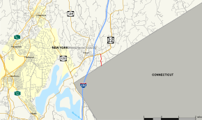
Map of Westchester County in southeastern New York with NY 433 highlighted in red | ||||
| Route information | ||||
| Maintained by NYSDOT | ||||
| Length: | 0.70 mi[1] (1.13 km) | |||
| Existed: | January 1971[2] – present | |||
| Major junctions | ||||
| South end: | Riversville Road in Greenwich, CT | |||
| North end: |
| |||
| Location | ||||
| Counties: | Westchester | |||
| Highway system | ||||
| ||||

New York State Route 433 (NY 433) is a short state highway located entirely in the town of North Castle in Westchester County, New York, in the United States. It runs for 0.70 miles (1.13 km) from the Connecticut state line, where it continues south into Greenwich as a local highway known as Riversville Road, to an intersection with NY 22 near the hamlet of Armonk. NY 433 is one of six New York touring routes less than a mile (1.6 km) in length. The route was originally designated as part of NY 128 in the 1930s. NY 128 was truncated to its junction with NY 22 in Armonk in January 1971 at which time its former routing along North Greenwich Road was redesignated as NY 433.
Route description

NY 433 begins at the Connecticut state line in the town of North Castle. A northern, state-maintained continuation of Greenwich's Riversville Road, NY 433 proceeds north through North Castle as North Greenwich Road. NY 433 winds northward through a residential area of North Castle, passing the wooded Johnson Park on the southbound side of the highway. The route winds northward past several intersections with local streets, soon reaching the junction with NY 22 (Armonk–Bedford Road). This junction marks the northern terminus of NY 433, just 0.7-mile (1.1 km) north of the state line. The right-of-way continues north of NY 22 as Niles Avenue, while just east of this intersection are junctions with NY 128 and I-684 in Armonk.[3]
History
When NY 128 was assigned as part of the 1930 renumbering of state highways in New York, it initially ended at NY 22 in Armonk.[4] It was extended southward to the Connecticut state line in the mid-1930s over NY 22 and North Greenwich Road.[5][6] The extension of NY 128 remained intact until January 1971 when NY 128 was cut back to its original terminus in Armonk. NY 128's former routing along North Greenwich Road was then re-designated as NY 433.[2]
Major intersections
The entire route is in Westchester County.
| Location | mi[1] | km | Destinations | Notes | |
|---|---|---|---|---|---|
| North Castle | 0.00 | 0.00 | Riversville Road North – Greenwich, CT | Continuation into Connecticut | |
| Armonk | 0.70 | 1.13 | |||
| 1.000 mi = 1.609 km; 1.000 km = 0.621 mi | |||||
See also
References
- 1 2 "2008 Traffic Data Report for New York State" (PDF). New York State Department of Transportation. June 16, 2009. p. 314. Retrieved January 10, 2010.
- 1 2 "Route 128 To Become Route 433" (PDF). The Review Press-Reporter. January 21, 1971. Retrieved August 13, 2016.
- ↑ Microsoft; Nokia (April 15, 2013). "overview map of NY 433" (Map). Bing Maps. Microsoft. Retrieved April 15, 2013.
- ↑ Road Map of New York (Map). Cartography by General Drafting. Standard Oil Company of New York. 1930.
- ↑ Road Map of New York (Map). Cartography by Rand McNally and Company. Texas Oil Company. 1934.
- ↑ Happy Motoring in New York (Map). Cartography by General Drafting. Esso. 1936.
External links
| Wikimedia Commons has media related to New York State Route 433. |
- New York State Route 433 at New York Routes • New York State Highway Termini