Newby and Scalby
| Newby and Scalby | |
|---|---|
| Civil parish | |
 | |
| Coordinates: 54°18′N 0°27′W / 54.300°N 0.450°WCoordinates: 54°18′N 0°27′W / 54.300°N 0.450°W | |
| Country | England |
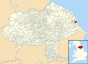
| Primary council | Scarborough |
| County | North Yorkshire |
| Region | Yorkshire and the Humber |
| Status | Parish |
| Government | |
| • Type | Parish Council |
| • UK Parliament | Scarborough and Whitby |
| • EU Parliament | Yorkshire and the Humber |
| Area | |
| • Total | 5.13 sq mi (13.29 km2) |
| Population (2011 census)[1] | |
| • Total | 9,513 |
| • Density | 1,900/sq mi (720/km2) |
| Website | http://www.newbyandscalbypc.org.uk |
Newby and Scalby is a civil parish in the Scarborough district of North Yorkshire, England, formed by the smaller southern area of Newby and the larger, northern, area of Scalby.
Geography
The shape of the parish is a rectangle perpendicular to the coast, omitting the south-east corner which is the sea life centre and park of Scarborough, with a north-west rectangular projection most of which is closer to Burniston than Scalby. The village forms one large cluster in the mid-south of this area traversed by several small roads and passing through is a section of the relatively minor A171. Newby is south of the Scalby Beck (or Sea Cut) and is physically undivided from the rest of Scarborough. The coast here is cliffs topped by the Cleveland Way including Scalby Ness.
Demography
According to the 2011 UK census, Newby and Scalby parish had a population of 9,513. At the time of the last census the rate of home ownership (with or without a loan) was greater than the average in the district and the proportion of social housing was significantly lower in terms of housing stock.[1] The population here had decreased by 2.4% from the 2001 UK census figure of 9,748.[2]
| Output area | Homes owned outright | Owned with a loan | Socially rented | Privately rented | Shared ownership | Other | km² green spaces | km² roads | km² water | km² domestic gardens | km² domestic buildings | km² non-domestic buildings | Usual residents | km² |
|---|---|---|---|---|---|---|---|---|---|---|---|---|---|---|
| Newby and Scalby | 2,182 | 1,277 | 306 | 321 | 45 | 64 | 10.45 | 0.50 | 0.48 | 1.67 | 0.38 | 0.06 | 9,513 | 13.29 |
Amenities
Scalby has the high street of the two settlements, commercial at street-level leading westward and upwards into the North York Moors National Park.
Scarborough Rugby Union Football Club play and train immediately north of the built-up area. A separate ground in Scarborough itself is the ground of Scarborough Pirates ARLFC.
The 13th-century parish church to St Laurence in Scalby was modified to include a tower since 1683 and is a grade II* listed building, the middle category of listing.[4]
Newby and Scalby Primary School is a main amenity named after both villages or suburbs.
References
- 1 2 "Key Figures for 2011 Census: Key Statistics: Area: Newby and Scalby CP (Parish)". Neighbourhood Statistics. Office for National Statistics. Retrieved 9 February 2013.
- ↑ "2001 Census: Key Statistics: Parish Headcounts: Area: Newby and Scalby CP (Parish)". Neighbourhood Statistics. Office for National Statistics. Retrieved 5 July 2008.
- ↑ Key Statistics: Dwellings; Quick Statistics: Population Density; Physical Environment: Land Use Survey 2005
- ↑ Historic England. "Church of St Laurence (1148211)". National Heritage List for England. Retrieved 26 November 2013.
External links
![]() Media related to Newby and Scalby at Wikimedia Commons
Media related to Newby and Scalby at Wikimedia Commons