Nievern
| Nievern | ||
|---|---|---|
| ||
 Nievern | ||
Location of Nievern within Rhein-Lahn-Kreis district 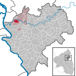 | ||
| Coordinates: 50°20′N 7°41′E / 50.333°N 7.683°ECoordinates: 50°20′N 7°41′E / 50.333°N 7.683°E | ||
| Country | Germany | |
| State | Rhineland-Palatinate | |
| District | Rhein-Lahn-Kreis | |
| Municipal assoc. | Bad Ems | |
| Government | ||
| • Mayor | Franz Lehmler | |
| Area | ||
| • Total | 4.29 km2 (1.66 sq mi) | |
| Population (2015-12-31)[1] | ||
| • Total | 977 | |
| • Density | 230/km2 (590/sq mi) | |
| Time zone | CET/CEST (UTC+1/+2) | |
| Postal codes | 56132 | |
| Dialling codes | 02603 | |
| Vehicle registration | EMS | |
| Website | www.nievern.de | |

Nievern is a municipality in the district of Rhein-Lahn, in Rhineland-Palatinate, in western Germany.
Geography
The municipality is located on the south shore of the river Lahn, at Kilometre 128, rising up to the hills of the Taunus mountains. The residential and commercial district of Maaracker, about 1 km to the east, joins directly with the neighbouring town and district capital of Bad Ems. It is then clockwise surrounded by the neighbouring municipalities of Frücht, Miellen and Fachbach on the opposite shore of the Lahn river.
Traffic and infrastructure
Nievern is connected to the State Road B260 running up the Lahn valley from Lahnstein to Wiesbaden via a bridge crossing the river. Other roads connect to Bad Ems, Frücht and Miellen. The Lahn Valley cycle way runs through Fachbach on the opposite shore of the river. The Lahn Valley Railway passes through the village and operates a stop in the centre of the municipality.
History
The area of the modern municipality was incorporated into the Roman Empire by the first century AD and protected by the fortified frontier of the Limes, which ran across the Westerwald and Taunus mountains and crossed the Lahn river, the boundary between those, just 5 km to the east in the modern town centre of Bad Ems.
Nievern was first mentioned 1275 AD, although settlement has been suggested from around 900. It was owned by the family of the Von der Leyen since 1629 and then by the Duchy of Nassau since 1806.
During the Second World War, the nearby ironwork Nieverner Hütte, located on an island in the river, served as a production facility for munitions. Bombing raids on the factory and the nearby strategically important cities of Koblenz, Lahnstein and Nassau caused minor destruction and casualties due to accidental collateral damages in the village. Shortly before the municipality was liberated by the U.S. Army on 25 March 1945, the Wehrmacht destroyed both the rail bridge connecting the Lahntalbahn to the ironwork and the first road bridge connecting Nievern with Fachbach dating from 1928. The latter was rebuilt shortly after the war.[2]
Sons and Daughters of the Town
- Marcellus de Niveriis, O.F.M. ( died either 1460 or 1462 ), a Franciscan monk and priest, became a swindler and adventurer and then managed to become the 26th Bishop of Skálholt in Iceland. He never went to Iceland. He stayed in Denmark and became the Chancellor as well as the Royal Councilor under King Christian I of Denmark and Norway. He tried to get himself promoted to the Archbishop of Nidaros in Norway but lost to Heinrich Kalteisen, O.P., a Dominican who happened to be from nearby Koblenz.
References
- ↑ "Gemeinden in Deutschland mit Bevölkerung am 31. Dezember 2015" (PDF). Statistisches Bundesamt (in German). 2016.
- ↑ van Ackern, G. et al. (1997): Nievern. The inhabitants and their history