Nkanu East
| Nkanu East | |
|---|---|
| LGA | |
 Nkanu East Location in Nigeria | |
| Coordinates: 6°20′N 7°39′E / 6.333°N 7.650°ECoordinates: 6°20′N 7°39′E / 6.333°N 7.650°E | |
| Country |
|
| State | Enugu State |
| Area | |
| • Total | 795 km2 (307 sq mi) |
| Population (2006 census) | |
| • Total | 148,774 |
| Time zone | WAT (UTC+1) |
| 3-digit postal code prefix | 402 |
| ISO 3166 code | NG.EN.NE |
Nkanu East is a Local Government Area of Enugu State, Nigeria, bordering Ebonyi State to the east. Its headquarters are in the town of Amagunze.
Villages in Nkanu East include Ugbakwa, Nkerefi, Nume, Nara unateze, Owoh, Ubahu, Amaechi idodo, Ama nkanu, Oruku, Amagunze.
Owoh village is famous for its Traditional Masquerade (Omaba)
The local Council, that was formed around 1983 has not advanced the area very much in terms of basic amenities like electricity, hospitals, modern housing and schools. Nkanu East Cut off From Modernity. Hopefully this will improve over time.
It has an area of 795 km² and a population of 148,774 at the 2006 census.
The postal code of the area is 402.[1]
References
- ↑ "Post Offices- with map of LGA". NIPOST. Archived from the original on October 7, 2009. Retrieved 2009-10-20.
}
State capital: Enugu | ||
| LGAs | 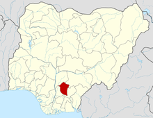 | |
This article is issued from Wikipedia - version of the 9/12/2016. The text is available under the Creative Commons Attribution/Share Alike but additional terms may apply for the media files.