Norcan Lake
| Norcan Lake | |
|---|---|
 | |
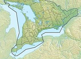 Norcan Lake Location in Southern Ontario | |
| Location | North Frontenac, Ontario |
| Coordinates | 45°09′41″N 76°52′00″W / 45.16139°N 76.86667°WCoordinates: 45°09′41″N 76°52′00″W / 45.16139°N 76.86667°W |
| Type | Reservoir |
| Primary inflows | Madawaska River |
| Primary outflows | Madawaska River |
| Basin countries | Canada |
| Max. length | 8 km (5.0 mi) |
| Max. width | 1 km (0.62 mi) |
| Surface elevation | 194 m (636 ft) |
Norcan Lake is a reservoir lake in the municipality of North Frontenac, Frontenac County in Eastern Ontario, Canada.[1][2] It is on the Madawaska River system, is part of the Saint Lawrence River drainage basin, and is located in geographic townships of North Canonto Township and South Canonto Township.[3]
The lake was formed when land flooded upon the completion of the Barrett Chute dam and generating station in 1943.
Tributaries
Clockwise from the mouth
- Reddys Creek
- Norcan Creek
- Juniper Creek
- Madawaska River
References
- ↑ "Norcan Lake". Geographical Names Data Base. Natural Resources Canada. Retrieved 2012-10-12.
- ↑ "Norcan Lake". Atlas of Canada. Natural Resources Canada. 2010-02-04. Retrieved 2012-10-12. Shows the area of the lake highlighted on a map.
- ↑ "North & South Canonto" (PDF). Geology Ontario - Historic Claim Maps. Ontario Ministry of Northern Development, Mines and Forestry. Retrieved 2012-10-12.
Other map sources:
- Map 10 (PDF) (Map). 1 : 700,000. Official road map of Ontario. Ministry of Transportation of Ontario. 2012-01-01. Retrieved 2012-10-12.
- Restructured municipalities - Ontario map #5 (Map). Restructuring Maps of Ontario. Ontario Ministry of Municipal Affairs and Housing. 2006. Retrieved 2012-10-12.
This article is issued from Wikipedia - version of the 8/31/2016. The text is available under the Creative Commons Attribution/Share Alike but additional terms may apply for the media files.