North Fork Breitenbush River
| North Fork Breitenbush River | |
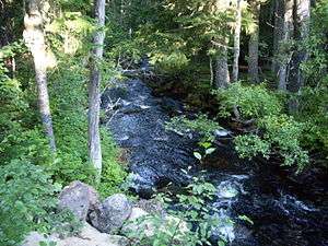 Near the headwaters | |
| Country | United States |
|---|---|
| State | Oregon |
| County | Marion |
| Source | Papoose Lakes |
| - location | Mount Hood National Forest, Cascade Range |
| - elevation | 5,731 ft (1,747 m) [1] |
| - coordinates | 44°45′17″N 121°46′38″W / 44.75472°N 121.77722°W [2] |
| Mouth | Breitenbush River |
| - location | near Breitenbush Hot Springs |
| - elevation | 2,277 ft (694 m) [2] |
| - coordinates | 44°46′47″N 121°57′53″W / 44.77972°N 121.96472°WCoordinates: 44°46′47″N 121°57′53″W / 44.77972°N 121.96472°W [2] |
 Location of the mouth of the North Fork Breitenbush River in Oregon | |
The North Fork Breitenbush River is a tributary of the Breitenbush River in the U.S. state of Oregon.[2] It begins at Papoose Lakes near Breitenbush Lake in the Cascade Range north of Mount Jefferson and flows generally northwest and west through the Mount Hood National Forest, Olallie Scenic Area, Mount Jefferson Wilderness, and Willamette National Forest.[3] It merges with the South Fork Breitenbush River to form the Breitenbush River main stem slightly upstream of Breitenbush Hot Springs.[3]
The three named tributaries of the North Fork Breitenbush River from source to mouth are the South Fork North Fork Breitenbush River, Mink Creek, and Rapidan Creek.[3]
See also
References
- ↑ Source elevation derived from Google Earth search using GNIS source coordinates.
- 1 2 3 4 "North Fork Breitenbush River". Geographic Names Information System. United States Geological Survey. November 28, 1980. Retrieved December 16, 2012.
- 1 2 3 "United States Topographic Map". United States Geological Survey. Retrieved February 5, 2016 – via Acme Mapper.
This article is issued from Wikipedia - version of the 9/11/2016. The text is available under the Creative Commons Attribution/Share Alike but additional terms may apply for the media files.