Ogbia
| Ogbia | |
|---|---|
| LGA and town | |
 Ogbia Location in Nigeria | |
| Coordinates: 4°47′N 6°20′E / 4.783°N 6.333°ECoordinates: 4°47′N 6°20′E / 4.783°N 6.333°E | |
| Country |
|
| State | Bayelsa State |
| Area | |
| • Total | 1,698 km2 (656 sq mi) |
| Population (2006 census) | |
| • Total | 266,008 |
| Time zone | WAT (UTC+1) |
| 3-digit postal code prefix | 560 |
| ISO 3166 code | NG.BY.OG |
Ogbia is a Local Government Area of Bayelsa State in the Niger Delta region of Nigeria. Its headquarters is in the town of Ogbia in the south of the area at4°39′00″N 6°16′00″E / 4.65000°N 6.26667°E.
It has an area of 695 km² and a population of 179,926.It is well known for its Historic value to the today Nigerian state economy mainsay i.e. its oil industry, being the local government area encompassing Oloibiri the first place oil was discovered on Sunday 15 January 1956.
The postal code of the area is 562.[1]
The inhabitants of Ogbia land are mainly fishermen and farmers. Former Nigerian president Goodluck Ebele Jonathan was born in Otueke, Ogbia.
Ogbia Communities/Town
- Ogbia
- Imiringi
- Elebele
- Kolo 1
- Kolo 2
- Emeyal 1
- Emeyal 2
- Otuosega
- Oruema
- Emakalakala
- Akipelai
and more...
References
- ↑ "Post Offices- with map of LGA". NIPOST. Archived from the original on 2012-11-26. Retrieved 2009-10-20.
State capital: Yenagoa | ||
| LGAs | 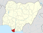 | |
This article is issued from Wikipedia - version of the 11/11/2016. The text is available under the Creative Commons Attribution/Share Alike but additional terms may apply for the media files.