Oltedal
| Oltedal | |
|---|---|
| Village | |
|
View of the village area | |
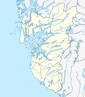 Oltedal  Oltedal Location in Rogaland county | |
| Coordinates: 58°49′42″N 06°02′12″E / 58.82833°N 6.03667°ECoordinates: 58°49′42″N 06°02′12″E / 58.82833°N 6.03667°E | |
| Country | Norway |
| Region | Western Norway |
| County | Rogaland |
| District | Jæren |
| Municipality | Gjesdal |
| Area[1] | |
| • Total | 0.55 km2 (0.21 sq mi) |
| Elevation[2] | 84 m (276 ft) |
| Population (2015)[1] | |
| • Total | 961 |
| • Density | 1,747/km2 (4,520/sq mi) |
| Time zone | CET (UTC+01:00) |
| • Summer (DST) | CEST (UTC+02:00) |
| Post Code | 4333 Oltedal |
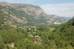
Oltedal is a village in Gjesdal municipality in Rogaland county, Norway. The village is located in a narrow river valley about 11 kilometres (6.8 mi) northeast of the municipal centre of Ålgård and about 9 kilometres (5.6 mi) west of the village of Dirdal, just west of the Høgsfjorden. The lake Oltedalsvatnet lies on the southwestern edge of the village. Oltedal Church is located in the village. The village has some small industries such as yarn making, chemicals, and sand/gravel pits.[3]
The 0.55-square-kilometre (140-acre) village has a population (2015) of 961, giving the village a population density of 1,747 inhabitants per square kilometre (4,520/sq mi).[1]
References
- 1 2 3 Statistisk sentralbyrå (1 January 2015). "Urban settlements. Population and area, by municipality.".
- ↑ "Oltedal, Gjesdal (Rogaland)" (in Norwegian). yr.no. Retrieved 2016-03-01.
- ↑ Store norske leksikon. "Oltedal" (in Norwegian). Retrieved 2016-03-01.
This article is issued from Wikipedia - version of the 8/4/2016. The text is available under the Creative Commons Attribution/Share Alike but additional terms may apply for the media files.