Oud-Beijerland
| Oud-Beijerland | |||
|---|---|---|---|
| Municipality | |||
|
Old city hall | |||
| |||
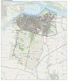
.svg.png) Location in South Holland | |||
| Coordinates: 51°49′N 4°24′E / 51.817°N 4.400°ECoordinates: 51°49′N 4°24′E / 51.817°N 4.400°E | |||
| Country | Netherlands | ||
| Province | South Holland | ||
| Government[1] | |||
| • Body | Municipal council | ||
| • Mayor | Klaas Tigelaar (ChristenUnie) | ||
| Area[2] | |||
| • Total | 19.61 km2 (7.57 sq mi) | ||
| • Land | 18.75 km2 (7.24 sq mi) | ||
| • Water | 0.86 km2 (0.33 sq mi) | ||
| Elevation[3] | 0 m (0 ft) | ||
| Population (May 2014)[4] | |||
| • Total | 23,683 | ||
| • Density | 1,263/km2 (3,270/sq mi) | ||
| Demonym(s) | Oud-Beijerlander | ||
| Time zone | CET (UTC+1) | ||
| • Summer (DST) | CEST (UTC+2) | ||
| Postcode | 3260–3263 | ||
| Area code | 0186 | ||
| Website |
www | ||


Oud-Beijerland (![]() pronunciation ) is a town and municipality in the western Netherlands, in the province of South Holland. With a population of 23,683 in 2014, it is the most populous municipality on the Hoeksche Waard island. The town is located adjacent to the confluence of the Oude Maas and Spui River.
pronunciation ) is a town and municipality in the western Netherlands, in the province of South Holland. With a population of 23,683 in 2014, it is the most populous municipality on the Hoeksche Waard island. The town is located adjacent to the confluence of the Oude Maas and Spui River.

The municipality of Oud-Beijerland also includes the communities Vuurbaken and Zinkweg.
History

After the St. Elizabeth's flood (1421), large parts of the islands Putten and Grote Waard were lost and became clay banks and salt marshes which would be inundated at high tide and be unsuitable for habitation. In subsequent centuries, portions of land would be reclaimed.
Oud-Beijerland was formed in 1559 as "Beijerland" by Lamoral, Count of Egmont. He was granted the rights to this area in 1557 and had the land reclaimed. This new polder was named Beijerland, Moerkerken, Cromstrijen en de Greup. Circa 1624 the smaller polders Bosschenpolder and Nieuwlandpolder were added to it. Beijerland was named after Sabina of Bavaria (Dutch: Beijeren), wife of the Count of Egmont.
In 1582 the name was changed to Oud-Beijerland, in order to distinguish it from Nieuw-Beijerland which was formed several kilometers to the west.
In 1604 the village got its churchtower from Sabina van Beijeren, and in 1622 the town hall was built. Oud-Beijerland then became one of the most important market places of the Hoeksche Waard. Its economy was dependent on trade, industry, agriculture and fishing. This brought prosperity which is still reflected in the elegant mansions along the Vliet.
From the end of the 19th century until ca. 1955, a tram connected Oud-Beijerland with Rotterdam. The tram was nicknamed "Het Moordenaartje" (The Little Murderer) because of the high rate of casualties involved with its operation.[5][6]
References
- ↑ "College van B & W" [Board of mayor and aldermen] (in Dutch). Gemeente Oud-Beijerland. Retrieved 17 August 2013.
- ↑ "Kerncijfers wijken en buurten" [Key figures for neighbourhoods]. CBS Statline (in Dutch). CBS. 2 July 2013. Retrieved 12 March 2014.
- ↑ "Postcodetool for 3262GM". Actueel Hoogtebestand Nederland (in Dutch). Het Waterschapshuis. Retrieved 17 August 2013.
- ↑ "Bevolkingsontwikkeling; regio per maand" [Population growth; regions per month]. CBS Statline (in Dutch). CBS. 26 June 2014. Retrieved 24 July 2014.
- ↑ "De tramwegen en stoombootveren van de RTM rondom Rotterdam". Engelfriet.net. Retrieved 2014-05-14.
- ↑ "Rotterdam toen en nu". Rotterdam010.nl. Retrieved 2014-05-14.
External links
 Media related to Oud-Beijerland at Wikimedia Commons
- Official website
 |
Albrandswaard Oude Maas |
| ||
| Spijkenisse / Spui | |
Binnenmaas | ||
| ||||
| | ||||
| Korendijk | Cromstrijen |
