Oursbelille
| Oursbelille | ||
|---|---|---|
|
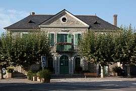
The town hall | ||
| ||
 Oursbelille | ||
|
Location within Occitanie region  Oursbelille | ||
| Coordinates: 43°17′16″N 0°02′18″E / 43.2878°N 0.0383°ECoordinates: 43°17′16″N 0°02′18″E / 43.2878°N 0.0383°E | ||
| Country | France | |
| Region | Occitanie | |
| Department | Hautes-Pyrénées | |
| Arrondissement | Arrondissement of Tarbes | |
| Canton | Canton of Bordères-sur-l'Échez | |
| Government | ||
| • Mayor (2008–2014) | Henri Fatta | |
| Area1 | 11.33 km2 (4.37 sq mi) | |
| Population (1999)2 | 1,198 | |
| • Density | 110/km2 (270/sq mi) | |
| Time zone | CET (UTC+1) | |
| • Summer (DST) | CEST (UTC+2) | |
| INSEE/Postal code | 65350 / 65490 | |
| Elevation |
259–376 m (850–1,234 ft) (avg. 270 m or 890 ft) | |
|
1 French Land Register data, which excludes lakes, ponds, glaciers > 1 km² (0.386 sq mi or 247 acres) and river estuaries. 2 Population without double counting: residents of multiple communes (e.g., students and military personnel) only counted once. | ||
.svg.png)
Oursbelille is a commune in the Hautes-Pyrénées department in south-western France.
See also
References
| Wikimedia Commons has media related to Oursbelille. |
This article is issued from Wikipedia - version of the 2/11/2016. The text is available under the Creative Commons Attribution/Share Alike but additional terms may apply for the media files.