Ovča
| Ovča Овча | |
|---|---|
| Town | |
|
A street in Ovča | |
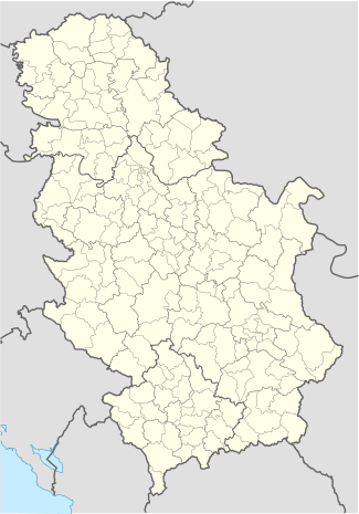 Ovča | |
| Coordinates: 44°53′N 20°32′E / 44.883°N 20.533°ECoordinates: 44°53′N 20°32′E / 44.883°N 20.533°E | |
| Country | Serbia |
| District | Belgrade |
| Municipality | Palilula |
| Population (2011)[1] | |
| • Total | 2,742 |
| Time zone | CET (UTC+1) |
| • Summer (DST) | CEST (UTC+2) |
| Postal code | 11212 |
| Area code(s) | 011 |
| Vehicle registration | BG |

Ovča (Serbian Cyrillic: Овча, pronounced [ôːʋt͡ʃa]) is a suburban settlement of Belgrade, the capital of Serbia. It is located to the northeast of the city, in the municipality of Palilula.
Name
In Serbian the settlement is known as Ovča (Овча), in Romanian as Ofcea, in Hungarian as Ovcsa or Bárányos, and in German as Gisellenhain.
Location
Ovča is located in the northern, Banat section of the Palilula municipality (Pančevački Rit), 13 kilometers north of downtown Belgrade. The settlement is located 6 kilometers to the east of the settlement of Padinska Skela and the Zrenjaninski put road connects Belgrade with the city of Zrenjanin, in Vojvodina.
History
First recorded mention of the village of Ovči is from 1456, as part of the Syrmia county of the Kingdom of Hungary. The name have a Slavic origin. As some of the first settlers were Vlach (Romanian) shepherds, it is believed that this gave name to the settlement (Serbian word ovčar means "shepherd" in English). The village was captured by the Ottoman Empire in 1537, and was included into the Sanjak of Smederevo. It was granted a waqf status by the sanjak-bey Mehmet-pasha, for the mosque and imaret (public kitchen) of Belgrade's Dorćol district.
In the mid-18th century the village was evacuated because of the plague outbreak and Ovča sentry outpost was built instead. Turned into a wasteland, the village was repopulated in 1813.
Ovča was part of the municipality of Borča until May 30, 1952 when it got its own municipality. However, in 1955 all the municipalities of the Pančevački Rit were merged into one, municipality of Krnjača, which in turn became part of the municipality of Palilula in 1965. A movement for restoring former municipality of Krnjača (under the name of Dunavski Venac) is gaining momentum since the early 2000s.
Population
Population is generally stagnating. The apparent decline of population by almost one quarter in the 1970s is a result of change of the administrative borders of the settlements, as many outer farms and smaller sub-settlements were regrouped into adjacent Padinska Skela, which in turn grew by these measures by over 400%.

Population of Ovča:[1]
- 1921: 1,469
- 1932: 1.452 (1,400 Romanians, 23 Serbs, 20 Germans, 7 Slovaks and 2 Hungarians)
- 1971: 3,383
- 1981: 2,530
- 1991: 2,306
- 2002: 2,567
- 2011: 2,742
Ethnic structure (Census 2002): Serbs (63.96% or 1,642), Romanians (27.46%), Romani (1.36%), Yugoslavs (0.85%), Macedonians (0.62%), etc.
Economy

Despite being classified as an urban settlement, the majority of economic activity in Ovča is still agricultural. Prominent features are the large bowl natural gas tanks which dominate the flat landscape and hydrothermal spring of Ovčanska banja (Ovča spa). The spa is not arranged for public usage but is very popular among the local population. A pond with an area of 150 square meters and one meter deep has been filled by the natural salt water since the mid-1980s. Ovča is also accessible by train as it lies on the Belgrade–Pančevo railroad.
A new stretch of highway between the Zrenjanin road and Ovča was built and opened on October 2015, as a part of the northern Belgrade bypass connecting Pančevo with the new Mihajlo Pupin Bridge over the Danube.[2] The last section of the bypass, from Ovča to Pančevo road was opened in December 2015. The new road significantly improved transport connections to rather remote Ovča, and is expected to contribute to its development.[3]
References
- 1 2 "2011 Census of Population, Households and Dwellings in the Republic of Serbia: Comparative Overview of the Number of Population in 1948, 1953, 1961, 1971, 1981, 1991, 2002 and 2011, Data by settlements" (PDF). Statistical Office of Republic Of Serbia, Belgrade. 2014. p. 31. ISBN 978-86-6161-109-4. Retrieved 2014-06-27.
- ↑ "Od Pupinovog mosta sada lakše do Ovče" (in Serbian). Mondo.rs. 3 October 2015.
- ↑ "Meštane Ovče preporodio Pupinov most: Više nismo slepo crevo!" (in Serbian). Blic. 23 October 2015.
External links
-
 Media related to Ovča at Wikimedia Commons