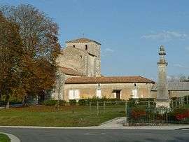
Péreuil
| Péreuil | |
|---|---|
 | |
 Péreuil | |
|
Location within Nouvelle-Aquitaine region  Péreuil | |
| Coordinates: 45°28′56″N 0°01′17″W / 45.4822°N 0.0214°WCoordinates: 45°28′56″N 0°01′17″W / 45.4822°N 0.0214°W | |
| Country | France |
| Region | Nouvelle-Aquitaine |
| Department | Charente |
| Arrondissement | Angoulême |
| Canton | Blanzac-Porcheresse |
| Intercommunality | Blanzacais |
| Government | |
| • Mayor (2008–2014) | Jean-Claude Ardouin |
| Area1 | 17.18 km2 (6.63 sq mi) |
| Population (2008)2 | 408 |
| • Density | 24/km2 (62/sq mi) |
| Time zone | CET (UTC+1) |
| • Summer (DST) | CEST (UTC+2) |
| INSEE/Postal code | 16257 / 16250 |
| Elevation |
47–153 m (154–502 ft) (avg. 89 m or 292 ft) |
|
1 French Land Register data, which excludes lakes, ponds, glaciers > 1 km² (0.386 sq mi or 247 acres) and river estuaries. 2 Population without double counting: residents of multiple communes (e.g., students and military personnel) only counted once. | |
Péreuil is a former commune in the Charente department in southwestern France. On 1 January 2016, it was merged into the new commune Val-des-Vignes.[1]
Population
| Historical population | ||
|---|---|---|
| Year | Pop. | ±% |
| 1793 | 794 | — |
| 1800 | 900 | +13.4% |
| 1806 | 748 | −16.9% |
| 1821 | 1,090 | +45.7% |
| 1831 | 890 | −18.3% |
| 1841 | 841 | −5.5% |
| 1846 | 832 | −1.1% |
| 1851 | 752 | −9.6% |
| 1856 | 762 | +1.3% |
| 1861 | 754 | −1.0% |
| 1866 | 721 | −4.4% |
| 1872 | 722 | +0.1% |
| 1876 | 661 | −8.4% |
| 1881 | 682 | +3.2% |
| 1886 | 647 | −5.1% |
| 1891 | 558 | −13.8% |
| 1896 | 576 | +3.2% |
| 1901 | 589 | +2.3% |
| 1906 | 592 | +0.5% |
| 1911 | 587 | −0.8% |
| 1921 | 528 | −10.1% |
| 1926 | 529 | +0.2% |
| 1931 | 552 | +4.3% |
| 1936 | 482 | −12.7% |
| 1946 | 479 | −0.6% |
| 1954 | 508 | +6.1% |
| 1962 | 487 | −4.1% |
| 1968 | 446 | −8.4% |
| 1975 | 418 | −6.3% |
| 1982 | 385 | −7.9% |
| 1990 | 410 | +6.5% |
| 1999 | 393 | −4.1% |
| 2008 | 408 | +3.8% |
See also
References
- ↑ Arrêté préfectoral 5 October 2015 (French)
| Wikimedia Commons has media related to Péreuil. |
This article is issued from Wikipedia - version of the 2/2/2016. The text is available under the Creative Commons Attribution/Share Alike but additional terms may apply for the media files.