Pallipattu
| Pallipattu பள்ளிப்பட்டு ఫలిపత్తు | |
|---|---|
| town | |
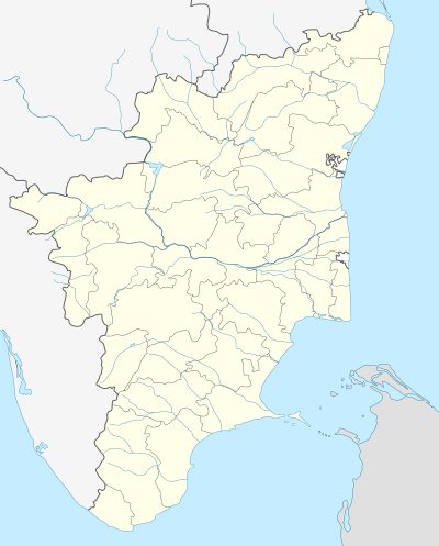 Pallipattu Location in Tamil Nadu, India | |
| Coordinates: 13°20′N 79°27′E / 13.33°N 79.45°ECoordinates: 13°20′N 79°27′E / 13.33°N 79.45°E | |
| Country |
|
| State | Tamil Nadu |
| District | Tiruvallur |
| Government | |
| • Type | Municipal corporation |
| • Body | Nagar Palika |
| Elevation | 154 m (505 ft) |
| Population (2014) | |
| • Total | 8,650 |
| Languages | |
| • Official | Tamil |
| Time zone | IST (UTC+5:30) |
| PIN | 631207 |
| Telephone code | (91)44 - 2784 |
| Vehicle registration | TN-20 |
Pallipattu (Tamil:பள்ளிபட்டு) is a town in Tiruvallur district in the state of Tamil Nadu, India.
Geography
Pallipat is located at 13°20′N 79°27′E / 13.33°N 79.45°E.[1] It has an average elevation of 154 metres (505 feet).
Demographics
As of 2001 India census,[2] Pallipattu had a population of 8,650. Males constitute 50% of the population and females 50%. Pallipattu has an average literacy rate of 71%, higher than the national average of 59.5%: male literacy is 79%, and female literacy is 63%. Pallipattu is blessed with the flowing of river, from west to east, named 'Kusasthalai' also called as 'Kotralai' which is the main source of water for Poondi Reservoir. The north side is covered by a Lake. If you have to travel by bus from Chennai(Koyambedu)it takes 4 hours journey, 97 and 97N are the bus routes provided by the Tamil Nadu bus Corporation Ltd. The interesting fact is that we can reach the place in four different routes(three from Tamil Nadu and one from Andhra pradesh), the roads which leads to Pallipattu from Tamil Nadu cross Andhra state. pallipattu is nice place to see .from pallipattu you can go from Chennai,Tirupati,chittoor . with in 3 to 4 hours you can reach the Chennai city . nearby pallipattu there are some company like sugar factory,juice factory,cultivation is the major source for villages around pallipat.
Taluk Name : Pallipattu taluk
District : Thiruvallur
State : Tamil Nadu
Language : Tamil and Telugu
Time zone: IST (UTC+5:30)
Elevation / Altitude: 103 meters. Above Seal level
Telephone Code / Std Code: 044
By Train
There is no railway station near to Pallipattu in less than 10 km. However Tirupati Rail Way Station is major railway station 36 KM near to Pallipattu Pincodes near 631207 ( Pallipat ) , Nearby Railway Stations
Vepagunta- 15 KM Ekambarakuppan- 16 KM Nagari- 17 KM Puttur- 18 KM
Places to Visit
Thiruthani- 29 KM
Tirupati- 36 KM
Chittoor- 43 KM
Srikalahasti- 59 KM
vellore- 64 KM
Kanipakam-54Km
Sanakuppam - 6 Km
VELIAGARAM-5 KM(Famous for Shri Somanadha Eshwarar temple-Hill Temple)
Few nearby places of pallipattu are listed below for your reference:
Cities
Podaturpet- 10 KM
Nagari- 17 KM
Puttur- 19 KM
Sholingur- 27 KM
Tiruttani- 28 KM
Taluks
Karvetinagar- 10 KM
Srirangarajapuram- 10 KM
Palasamudram- 13 KM
Airports
Tirupati Airport- 38 KM
Chennai Airport- 98 KM
Bengaluru International Airport- 210 KM
Salem Airport- 261 KM
District Head Quarters
Chittoor- 45 KM
Thiruvallur- 61 KM
Vellore- 65 KM
Kanchipuram- 69 KM
Schools
There are many schools in the town to provide education to people of Pallipat and surrounding villages. The medium of instruction in these schools are in Tamil, Telugu and English. The schools are :
- Saai Sri Matriculation School
- P.U.Elementary School (Main)
- P.U. Ele. School, Dalavaipattadai
- P.U. Ele. School, Anjaneya Nagar
- Government High School For Boys
- Government High School For Girls
- Government Higher Sec. School
- St. Mary's Matriculation School
Developments
There are many development projects coming up in this area like Government Arts college and Railway Station that connects chennai to Chittor.
Politics
Pallipattu is pat of Tiruttani (State Assembly Constituency) and Arakkonam (Lok Sabha constituency).
The Major Towns in this Conctituensy Includes
1.Podatturpet
2.R.K.Pet
3.Athimanjeripet.[3]
References
- ↑ Falling Rain Genomics, Inc - Pallipattu
- ↑ "Census of India 2001: Data from the 2001 Census, including cities, villages and towns (Provisional)". Census Commission of India. Archived from the original on 2004-06-16. Retrieved 2008-11-01.
- ↑ "List of Parliamentary and Assembly Constituencies" (PDF). Tamil Nadu. Election Commission of India. Retrieved 2008-10-08.