Paranda Tahsil
| Paranda Tahsil परंडा तहसील | |
|---|---|
| tehsil | |
 Paranda Tahsil Location in Maharashtra, India | |
| Coordinates: 18°18′N 075°29′E / 18.300°N 75.483°ECoordinates: 18°18′N 075°29′E / 18.300°N 75.483°E | |
| Country |
|
| State | Maharashtra |
| District | Osmanabad |
| Population (2011) | |
| • Total | 140,436 |
| Language | |
| • Official | Marathi |
| Time zone | IST (UTC+5:30) |
| PIN | 413502 |
| Lok Sabha constituency | Osmanabad |
| Vidhan Sabha constituency | Paranda[1] |
Paranda Tahsil is a tahsil (subdistrict) in Osmanabad district, Marathwada region in Maharashtra on Deccan Plateau of India. The town of Paranda is the administrative headquarters of the tahsil. There are seventy-two panchayat villages in Paranda Tahsil.[2]
Demographics
In the 2001 Indian census, Paranda Tahsil had a population of 125,136, with 64,707 (51.7%) males and 60,429 (48.3%) females, for a gender ratio of 934 females per thousand males.[3]
In the 2011 census, Paranda Tahsil had 140,436 inhabitants[4] and a gender ratio of 898 females per thousand males.[5] The tahsil was 86.6% rural.[4] The literacy rate in 2011 was 72.25% overall in Paranda Tahsil, with a rate of 81.32% for males and 62.29% for females.[6] In 2011 in Paranda Tahsil, 11.8% of the population was 0 to 6 years of age.[4]
Monuments and attractions in the tahsil
- Sina Kolegaon (Kalyan Sagar) Dam is located near the village of Domgaom on the Sina River (Seena River). The reservoir is a place of scenic beauty where migratory birds can also be found. The nearby temple of Kalyan Swami, one of the beloved followers of Ramdas Swami, is now surrounded by water on three sides. The backwater of the dam extends to the village of Sonari, a popular family weekend resort.
References
- ↑ "Assembly Constituencies-Post delimitation: Maharashtra: Osmanabad District" (PDF). National Informatics Centre, Government of India.
- ↑ "Reports of National Panchayat Directory: Village Panchayat Names of Paranda, Osmanabad, Maharashtra". Ministry of Panchayati Raj, Government of India.
- ↑ "Census 2001 Population Finder: Maharashtra: Osmanabad: Paranda". Office of The Registrar General & Census Commissioner, Ministry of Home Affairs, Government of India.
- 1 2 3 "Population, Child Population in the age-group 0-6 and Literates by residence and sex, State, Districts, Tahsils 2011: Maharashtra" (PDF). Press Information Bureau, Mumbai. p. 40.
- ↑ "Sex ratio of Population and Child Population in the age-group 0-6, State, Districts, Tahsils 2011: Maharashtra" (PDF). Press Information Bureau, Mumbai. p. 8.
- ↑ "Literacy rates by residence and sex, State, Districts, Tahsils 2011: Maharashtra" (PDF). Press Information Bureau, Mumbai. p. 17.
Osmanabad district topics | ||
|---|---|---|
| History | 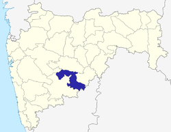 | |
| Cities and towns | ||
| Monuments | ||
| Lok Sabha constituencies | ||
| Vidhan Sabha constituencies | ||