Parengarenga Harbour
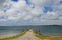
Parengarenga Harbour is a natural harbour close to the northernmost point on the North Island of New Zealand. Located at the northern end of the Aupouri Peninsula,[1] it extends inland for over 10 kilometres, almost severing the northern tip of the island from the rest of the peninsula. Bay mouth is facing with Great Exhibition Bay. The island's northernmost point, at the Surville Cliffs is only about 10 kilometres north of the harbour. Te Hapua is a settlement at the western side of the harbour.[2]
The brilliantly white sand of Kokota Sandspit, at the southern head of Parengarenga Harbour, has provided a source of high purity silica sand for glassmaking.[3] Dredging continued here until 1997. While smaller or lower purity deposits are found elsewhere in Northland, the Parengarenga area holds the region's largest silica sand resource by far.[4]
The water is a habitat for Green sea turtles, and dolphins, Killer whales, and Pilot whales visit the adjacent areas.
References
- ↑ "Aupōuri Peninsula". Te Ara Encyclopedia of New Zealand.
- ↑ Peter Dowling (editor) (2004). Reed New Zealand Atlas. Reed Books. map 2. ISBN 0-7900-0952-8.
- ↑ "Rock, limestone and clay - sources and uses". Te Ara Encyclopedia of New Zealand.
- ↑ Christie, A. B.; Barker, R. G. (May 2007). Mineral resource assessment of the Northland Region, New Zealand (PDF). GNS Science Report. 2007/06, 179. Lower Hutt: GNS Science. pp. 123–126. ISBN 0-478-09969-X. Retrieved 25 April 2009.
Coordinates: 34°31′S 172°57′E / 34.517°S 172.950°E