Ma'ale Hever
| Ma'ale Hever מַעֲלֵה חֶבֶר | |
|---|---|
 Ma'ale Hever | |
| Coordinates: 31°29′10″N 35°9′58″E / 31.48611°N 35.16611°ECoordinates: 31°29′10″N 35°9′58″E / 31.48611°N 35.16611°E | |
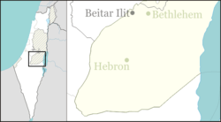
| District | Judea and Samaria Area |
| Council | Har Hebron |
| Region | West Bank |
| Affiliation | Amana |
| Founded | 1982 |
| Population (2015)[1] | 432 |
Ma'ale Hever (Hebrew: מַעֲלֵה חֶבֶר) or Pnei Hever (Hebrew: פְּנֵי חֶבֶר), at an elevation of 810 metres, is a communal Israeli settlement in the West Bank. Located in the eastern Hebron hills to the east of Hebron, it falls under the jurisdiction of Har Hebron Regional Council. In 2015 it had a population of 432.
The international community considers Israeli settlements in the West Bank illegal under international law, but the Israeli government disputes this.[2]
History
The settlement was established as Nahal Yakin on 31 January 1982 as a pioneer Nahal military outpost and demilitarized when turned over to eleven families on 24 August 1983, after which it was renamed after the nearby Hever Stream. In its early years, the only route leading to the village passed through the Palestinian town of Bani Na'im.
In 2009, Assaf Ramon, son of Israeli Astronaut Ilan Ramon who was aboard the fatal mission Columbia when the space shuttle exploded, was killed when the F-16 he was flying crashed in the vicinity of Ma'ale Hever.[3]
References
- ↑ "List of localities, in Alphabetical order" (PDF). Israel Central Bureau of Statistics. Retrieved 16 October 2016.
- ↑ "The Geneva Convention". BBC News. 10 December 2009. Retrieved 27 November 2010.
- ↑ Late astronaut's pilot son killed in crash Ynetnews, 13 September 2009