Pennsylvania Route 170
| ||||
|---|---|---|---|---|
 | ||||
| Route information | ||||
| Maintained by PennDOT | ||||
| Length: | 11.629 mi[1] (18.715 km) | |||
| Existed: | 1928 – present | |||
| Major junctions | ||||
| South end: |
| |||
| North end: |
| |||
| Location | ||||
| Counties: | Wayne | |||
| Highway system | ||||
| ||||

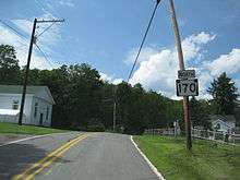
Pennsylvania Route 170 (designated by the Pennsylvania Department of Transportation as SR 170) is an 11.65-mile-long (18.75 km) state highway located in Wayne County in Pennsylvania. The southern terminus is at U.S. Route 6 in Prompton. The northern terminus is at Route 670 near Mount Pleasant Township. The route was designated in 1928 by the Pennsylvania Department of Highways as a spur of Route 70, although did not intersect with Route 70. Route 70 was renumbered in 1961 to Route 171. It is currently one of three remaining spurs of Route 70, including Route 370 and Route 670.
Route description
Route 170 begins at the intersection with U.S. Route 6 (Roosevelt Highway / Grand Army of the Republic Highway) in the borough of Prompton. Route 170 heads northward as Creek Drive, heading uphill through forests before a clearing near Prompton Lake. Once the highway approaches the lake, it turns to the northwest to parallel the lake and the border into Prompton State Park. The surroundings remain wooded for a distance, paralleling the lake and some nearby homes. At the intersection with Lakeview Road, Route 170 turns from the northwest to the north as Prompton Lake dissipates into a creek. Near the intersection with Beech Grove Road, the highway turns to the northwest again and crosses over the new creek. After winding through forests, the highway returns to civilization entering the hamlet of Aldenville. Route 170 passes through downtown before turning northward back into the rural surroundings. The surroundings remain the same for several miles until the highway enters the hamlet of Creamton. In Creamton, Route 170, where it intersects with Route 247 (Creamton Drive).[2]

Continuing north from Creamton, the route turns to the northwest again, remaining rural for several miles. The route bends to the north, then northwest again. At a nearby home, Route 170 intersects with Sherwood Drive and McAvoy Road, where the highway and Creek Drive moniker turn to the northeast. After the intersection with Memorial Links Road, Route 170 leaves the forests for fields and intersects at a T with Route 670 (Bethany Turnpike) in now Mount Pleasant Township. At this intersection, the Route 170 designation terminates.[2]
History
The alignment that was designated Route 170 in 1928, as one of six spurs designated off of Route 70. At that time, only the portion from U.S. Route 6 in Prompton to the hamlet of Aldenville was a paved highway.[3] The stretch from Aldenville to the intersection with McAvoy Road was paved in 1939.[4] Eight years later, Route 170 was paved from the intersection with McAvoy Road north to the terminus at Route 670.[5] In 1961, Route 70 was re-designated as Route 171, which orphaned the x70 series highways.[6]
Major intersections
The entire route is in Wayne County.
| Location | mi[1] | km | Destinations | Notes | |
|---|---|---|---|---|---|
| Prompton | 0.000 | 0.000 | Southern terminus of Route 170. | ||
| Clinton Township | 6.877 | 11.067 | |||
| Mount Pleasant Township | 11.629 | 18.715 | Northern terminus of Route 170. | ||
| 1.000 mi = 1.609 km; 1.000 km = 0.621 mi | |||||
See also
 U.S. Roads portal
 Pennsylvania portal
- Pennsylvania Route 171 - The parent highway formerly designated Route 70.
- Pennsylvania Route 370 - The other remaining spur of Route 70.
References
- 1 2 Bureau of Maintenance and Operations (January 2015). Roadway Management System Straight Line Diagrams (Report) (2015 ed.). Pennsylvania Department of Transportation. Retrieved June 30, 2015.
- Wayne County (PDF)
- 1 2 Microsoft; Nokia (July 13, 2011). "Overview map of Pennsylvania Route 170" (Map). Bing Maps. Microsoft. Retrieved July 13, 2011.
- ↑ Map Showing Pennsylvania State Highways (Map). Pennsylvania Department of Highways. 1928.
- ↑ Pennsylvania Official Road Map (Map). Pennsylvania Department of Highways. 1939.
- ↑ Pennsylvania Official Road Map (Map). Pennsylvania Department of Highways. 1947.
- ↑ Pennsylvania (Map). Pennsylvania Department of Highways. 1961.
External links
- Kitsko, Jeffrey J. (2011). "PA 170". Pennsylvania Highways. Retrieved July 13, 2011.
- Prince, Adam J. (2002). "PA 170". State-Ends.com. Retrieved July 13, 2011.