Perry County Airport (Tennessee)
| Perry County Airport | |||||||||||
|---|---|---|---|---|---|---|---|---|---|---|---|
 | |||||||||||
|
IATA: none – ICAO: none – FAA LID: M15 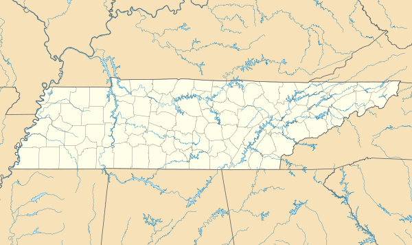 M15 | |||||||||||
| Summary | |||||||||||
| Airport type | Public | ||||||||||
| Operator | Perry County | ||||||||||
| Serves | Linden, Lobelville | ||||||||||
| Location | Linden, Tennessee | ||||||||||
| Elevation AMSL | 740 ft / 226 m | ||||||||||
| Coordinates | 35°35′45″N 087°52′36″W / 35.59583°N 87.87667°W | ||||||||||
| Runways | |||||||||||
| |||||||||||
| Statistics (2008) | |||||||||||
| |||||||||||
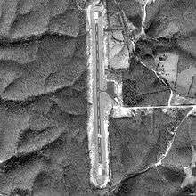
Perry County Airport (FAA LID: M15) is a county-owned, public-use airport located three nautical miles (6 km) southwest of the central business district of Linden, a town in Perry County, Tennessee, United States. M15 is located on the Atlanta and Memphis sectional charts.[1]
Facilities and aircraft
Perry County Airport covers an area of 65 acres (26 ha) at an elevation of 740 feet (226 m) above mean sea level. It has one runway designated 18/36 with a 3,600 by 75 ft (1,097 x 23 m) asphalt surface. For the 12-month period ending June 6, 2008, the airport had 2,195 aircraft operations, an average of 183 per month: 78% general aviation and 22% military.[1]
The airport is unattended and does not have fuel services. It is included under the Jackson FSS. Although it has pilot controlled runway lighting and PAPI on both runways, it is open during daylight hours only. NOTAMs are filed with McKellar-Sipes Regional Airport.[2][3]
See also
References
- 1 2 3 FAA Airport Master Record for M15 (Form 5010 PDF), effective 2008-04-10
- ↑ PERRY CO. (M15) at FAA Airport/Facility Directory, effective 2008-04-10
- ↑ PERRY COUNTY - M15 at Tennessee DOT Airport Directory
External links
- Resources for this airport:
- FAA airport information for M15
- AirNav airport information for M15
- FlightAware airport information and live flight tracker
- SkyVector aeronautical chart for M15