Pethmakhama, Budgam
| Pethmakhama | |
|---|---|
| Village | |
|
Aastan i Aaliyah Shahi Hamdan Pethamkhama | |
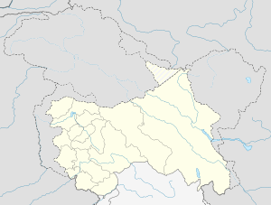 Pethmakhama  Pethmakhama Location in Budgam, Jammu and Kashmir | |
| Coordinates: 34°04′12″N 74°35′41″E / 34.07°N 74.5947°ECoordinates: 34°04′12″N 74°35′41″E / 34.07°N 74.5947°E[1] | |
| Country | India |
| State | Jammu and Kashmir |
| District | Budgam |
| Elevation | 1,740 m (5,710 ft) |
| Population (2011)[2] | |
| • Total | 4,646 |
| Languages | |
| • Spoken | Kashmiri |
| • Official | English and Urdu |
| Time zone | IST (UTC+5:30) |
| PIN | 193401[3] |

Pethmakhama is a village in Budgam district, in the Indian administrative state of Jammu and Kashmir. It falls under the administrative division of Tehsil Magam.
Demographics
According to the 2011 Census of India, 621 families reside in Pethmakhama, comprising a total population of 4,646; 21.42% of the population (995 people) are children aged 0–6. The average sex ratio is 959, higher than Jammu and Kashmir State's average of 889. There are 910 women for every 1000 men.[2] In 2011, the village literacy rate was 57.66%, compared to the 67.16% overall for Jammu and Kashmir. Male literacy stood at 65.64% while female literacy was 49.44%. According to the constitution of India and the Panchyati Raj Act., Pethmakhama village is administrated by Sarpanch (Head of Village), an elected representative of the village.[4]
Location
Pethmakhama is situated on the bank of the river Sukhnag,[5] about 23 km to the north of the district headquarters, Budgam.[6] The adjacent villages of Pethmakhama are Badran, Magam, Aripanthan, Rathson, Bonmakhama, and Kanihama.
Schools
- Government High School for Boys, Pethmakhama
- Government Middle School for Girls, Pethmakhama[7]
- Sukhnag Educational Institute, Pethmakhama[8]
- Ps Dangerpora Pethmakhama Upgr School, Pethmakhama[9]
Transport
Roads
Pethmakhama is connected to Srinagar via Magam and Budgam district headquarters, via Beerwah, 10 km away. It is also connected to Tehsil Khag via Aripanthan, 16 km away.[8] The road connecting Pethmakhama with Magam was paved but remains deserted.[10]
Rails
The nearest railway stations are Mazhom and Budgam.[8]
References
- ↑ "Maps, Weather, and Airports for Makahom, India". fallingrain.com. Retrieved 2015-10-16.
- 1 2 "Peth Mekehama Village Population – Beerwah – Badgam, Jammu and Kashmir". census2011.co.in. Retrieved 2015-10-16.
- ↑ PostCodesDB. "193401 Peth Makhama India डाक कोड". postalcodesdb.com. Retrieved 2015-10-16.
- ↑ "Census of India 2011 : Jammu & Kashmir" (PDF). Censusindia.gov.in. Retrieved 2015-10-16.
- ↑ "Geography of Jammu and Kashmir State". koausa.org. Retrieved 2015-10-16.
- ↑ "Pethmakhama- Narbal". soki.in. Retrieved 2015-10-16.
- ↑ "List of govt Schools in peth makhama badgam jammu & kashmir – Edukistan". edukistan.com. Retrieved 2015-10-16.
- 1 2 3 "Pethmakhama Village". onefivenine.com. Retrieved 2015-10-16.
- ↑ Link text, additional text.
- ↑ "Report on Delayed Muster Roll for Financial Year: 2014–2015" (PDF). 164.100.72.25. Retrieved 2015-10-16.