Petropavl
| Petropavl Петропавл Петропавловск | ||
|---|---|---|
 | ||
| ||
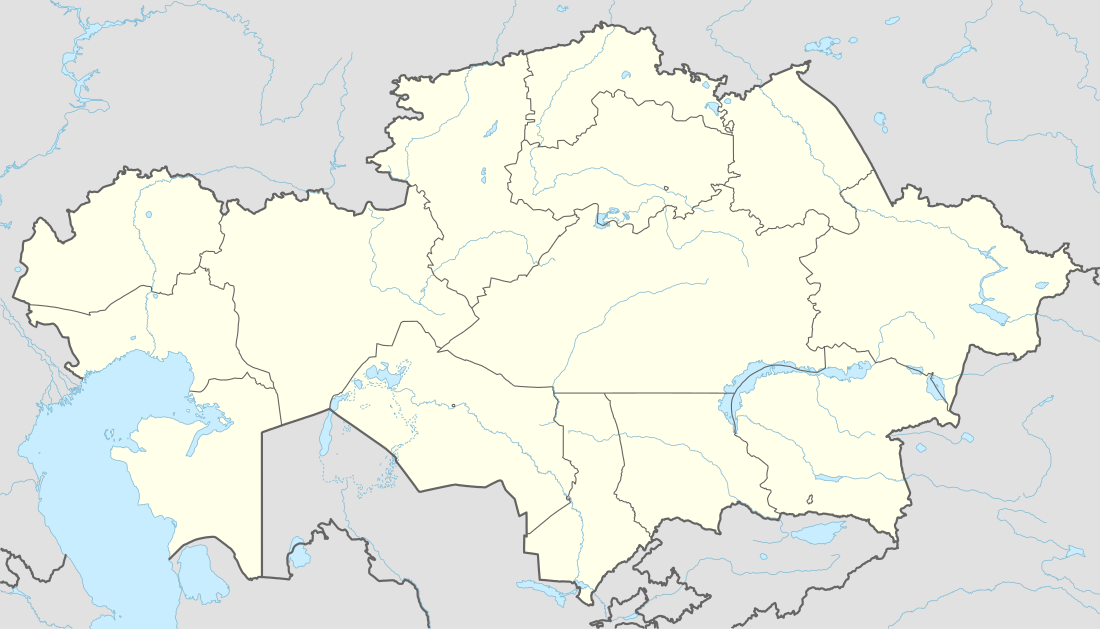 Petropavl Location in Kazakhstan | ||
| Coordinates: 54°53′0″N 69°10′0″E / 54.88333°N 69.16667°E | ||
| Country | Kazakhstan | |
| Region | North Kazakhstan Region | |
| Founded | 1752 | |
| City Status | 1807 | |
| Government | ||
| • Akim (mayor) | Nurzhan Ashimbetov | |
| Area | ||
| • Total | 221.6 km2 (85.6 sq mi) | |
| Elevation | 140 m (460 ft) | |
| Population (2009) | ||
| • Total | 201,446 | |
| • Density | 910/km2 (2,400/sq mi) | |
| Time zone | ALMT (UTC+6) | |
| Postal code | 150001 - 150013 | |
| Area code(s) | +7 7152 | |
| Vehicle registration | T | |
| Website |
www | |
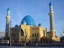
Petropavl (Kazakh: Петропавл/Petropavl), also known as Petropavlovsk (Russian: Петропавловск, Petropavlovsk, not to be confused with Petropavlovsk-Kamchatsky), is a city on the Ishim River in northern Kazakhstan close to the border with Russia, about 261 km west of Omsk along the Trans-Siberian Railway. It is the capital of the North Kazakhstan Region.[1] Population: 201,446 (2009 Census results);[2] 203,523 (1999 Census results).[2]
History
Petropavl was founded in 1752 as a Russian fort extending Russian settlement and influence into the nomadic Kazakh territories to the south. The fort got its name after two Christian saints, apostles Peter and Paul. It was granted the status of city in 1807. Petropavl was an important trading center for silk and carpets until the Russian Revolution of 1917.
Transport
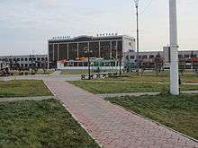
Petropavl has a railway station with connections to the Russian capital Moscow and Kazakhstan's capital Astana.
Petropavl Airport is located 11 km (7 mi) south of the city.
Climate
Petropavl has a humid continental climate (Köppen climate classification Dfb) with cold, dry winters and warm, wetter summers.
| Climate data for Petropavl (1981–2010) | |||||||||||||
|---|---|---|---|---|---|---|---|---|---|---|---|---|---|
| Month | Jan | Feb | Mar | Apr | May | Jun | Jul | Aug | Sep | Oct | Nov | Dec | Year |
| Record high °C (°F) | 4.5 (40.1) |
6.7 (44.1) |
14.5 (58.1) |
31.0 (87.8) |
37.2 (99) |
40.3 (104.5) |
40.5 (104.9) |
38.6 (101.5) |
33.6 (92.5) |
26.2 (79.2) |
15.6 (60.1) |
3.7 (38.7) |
40.5 (104.9) |
| Average high °C (°F) | −11.8 (10.8) |
−10.4 (13.3) |
−2.8 (27) |
9.1 (48.4) |
19.3 (66.7) |
24.6 (76.3) |
25.5 (77.9) |
23.0 (73.4) |
16.4 (61.5) |
8.4 (47.1) |
−3.6 (25.5) |
−9.7 (14.5) |
7.3 (45.1) |
| Daily mean °C (°F) | −15.8 (3.6) |
−15.0 (5) |
−7.8 (18) |
3.7 (38.7) |
12.6 (54.7) |
18.3 (64.9) |
19.7 (67.5) |
17.0 (62.6) |
10.7 (51.3) |
3.7 (38.7) |
−7.3 (18.9) |
−13.6 (7.5) |
2.2 (36) |
| Average low °C (°F) | −20.0 (−4) |
−19.4 (−2.9) |
−12.5 (9.5) |
−1.2 (29.8) |
6.2 (43.2) |
12.0 (53.6) |
14.0 (57.2) |
11.6 (52.9) |
5.7 (42.3) |
−0.3 (31.5) |
−10.9 (12.4) |
−17.6 (0.3) |
−2.7 (27.1) |
| Record low °C (°F) | −48.0 (−54.4) |
−42.5 (−44.5) |
−36.8 (−34.2) |
−26.4 (−15.5) |
−17.6 (0.3) |
−2.6 (27.3) |
1.3 (34.3) |
−4.0 (24.8) |
−9.4 (15.1) |
−25.6 (−14.1) |
−37.5 (−35.5) |
−45.0 (−49) |
−48.0 (−54.4) |
| Average precipitation mm (inches) | 22 (0.87) |
17 (0.67) |
16 (0.63) |
22 (0.87) |
31 (1.22) |
37 (1.46) |
66 (2.6) |
47 (1.85) |
33 (1.3) |
30 (1.18) |
30 (1.18) |
27 (1.06) |
378 (14.88) |
| Average rainy days | 1 | 1 | 4 | 8 | 14 | 14 | 13 | 14 | 15 | 12 | 5 | 2 | 103 |
| Average snowy days | 20 | 17 | 14 | 6 | 2 | 0.1 | 0 | 0 | 0 | 8 | 17 | 20 | 104 |
| Average relative humidity (%) | 82 | 80 | 80 | 69 | 58 | 62 | 69 | 71 | 71 | 77 | 84 | 82 | 74 |
| Mean monthly sunshine hours | 77 | 130 | 188 | 235 | 287 | 308 | 307 | 245 | 184 | 107 | 74 | 62 | 2,204 |
| Source #1: Pogoda.ru.net[3] | |||||||||||||
| Source #2: NOAA (sun, 1961–1990)[4] | |||||||||||||
Education
Petropavl is the location of North Kazakhstan State University, named for M. Kozybaev, established in 1937 as Petropavlovsk Teachers Training Institute.[5]
Sports
The city's bandy team in the Spartakiade 2009 on home ice was victorious.[6] In 2013 it was hosted in Petropavl again, this time the team from Khromtau won. Cyclist Alexander Vinokourov is a native of the city.
International relations
Twin towns — Sister cities
Petropavl is twinned with:
Footnotes
- ↑ Город Петропавловск
- 1 2 "Население Республики Казахстан" (in Russian). Департамент социальной и демографической статистики. Retrieved 8 December 2013.
- ↑ "Weather and Climate - The Climate of Petropavlovsk (Petropavl)" (in Russian). Weather and Climate (Погода и климат). Archived from the original on 25 November 2016. Retrieved 25 November 2016.
- ↑ "Petropavlovsk Climate Normals 1961–1990". National Oceanic and Atmospheric Administration. Retrieved 25 November 2016.
- ↑ "The History of NKSU," North Kazakhstan State University, www.nkzu.kz/ —In English.
- ↑ http://akghaik.ucoz.ru/photo/9-3-0-0-2
External links
Capital: Petropavl | ||
| Districts | 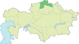 | |
| Major cities | ||
| Capital |  | |
|---|---|---|
| Other cities | ||
Coordinates: 54°53′N 69°10′E / 54.883°N 69.167°E