Pfaffendorf Bridge

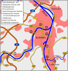
The Pfaffendorf Bridge (German: Pfaffendorfer Brücke) is the oldest bridge over the Rhine at Koblenz in the German state of Rhineland-Palatinate. It carries federal highway B 49 over the Rhine and connects central Koblenz with the suburbs of Pfaffendorf and Ehrenbreitstein. The first bridge was completed in 1864. The current bridge was built in 1953 after this bridge was destroyed in the Second World War.
First bridge across the Rhine


A column on the Rhine shores (opposite the Weindorf Koblenz restaurant) commemorates the original construction of the Pfaffendorf Bridge between 1862 and 1864. According to the inscription on the front of the column, the foundation stone was laid in the reign of King William I on 11 November 1862 and inaugurated on 9 May 1864.
It was initially just a railway bridge over which the trains of the Rhenish Railway Company ran to Oberlahnstein, connecting the left and right bank lines. It had three spans constructed of wrought iron, each 97 m long, across the Rhine. The height of the arch was 3.14 m. It had two 10 metre-high towers at each end of the bridge, which had iron bars that could be used to seal off the bridge in the event of war. In addition, the right bank was protected by the Horchheim Gate Fortress (Horchheimer Torbefestigung) built between 1864 and 1867.
The bridge was built as the result of negotiations between Prussia and the Duchy of Nassau. Prussia wanted a line from the existing left bank line to connect with the eastern hinterland of the Rhine that would not be quickly interrupted by enemy advances in case of a war with France. Nassau, however, advocated a line along the right bank of the Rhine. On the other hand, Nassau was looking for an opportunity to link the left bank line to its own rail network. Under the agreement signed in 1857, Nassau granted a concession for the building of the Lahn Valley Railway via the Prussian cities of Gießen and Wetzlar through Nassau territory to Koblenz, on one hand, and the construction of the Pfaffendorf Bridge on the other hand.
Originally the Pfaffendorf bridge could not be used for road or pedestrian traffic, but as early as 1865, the southern side could be used for general traffic at times when no trains were running. With the construction of the Horchheim Railway Bridge in 1879, the south side of the bridge became permanently available for road traffic.
In 1899, the Coblenzer Straßenbahn-Gesellschaft (Koblenz Tramway Company) was permitted to build a tram line over the bridge in order to expand its network on the eastern bank. The last trains crossed the Pfaffendorf Bridge the beginning of the First World War in August 1914.
Conversion to a road bridge
In 1932, the City of Koblenz owned the Pfaffendorf Bridge and decided to reconstruct it and, in fact, almost totally rebuilt it. With four lanes and two pedestrian walkways, it had a total width of 16 m. The bridge towers were demolished by the council and it received a new connection to the east bank across the railway line to the Ehrenbreitstein–Lahnstein bypass (now federal highway B 42).
War damage and reconstruction

Like all bridges in Koblenz, the Pfaffendorf Bridge was dynamited on 7 March 1945 by German troops. Early in 1946 construction of a temporary bridge began. The approval was given in 1950 for the rebuilding of a new fixed bridge over the Rhine and a steel girder bridge was chosen. The construction of the Pfaffendorf Bridge would allow the pontoon bridge to be removed. The new bridge had a four-lane roadway, adjacent 1.60 m wide bike paths on both sides and 2.60 m wide footpaths. On 18 July 1953, the bridge was opened to traffic. The temporary bridge was removed.
A new grade-separated connection from the Pfaffendorf Bridge to the B 42 was opened on 27 June 2003, after 12 years of construction, as the 294 metre long Glockenberg Tunnel.
References
- "Download of the Central and State Library of Berlin". Atlas zur Zeitschrift für Bauwesen (in German). Berlin. XIV: 47ff. 1864. Retrieved 27 April 2011.
External links
- "Die Pfaffendorfer Brücke" (in German). brueckenweb.de. Retrieved 27 April 2011.
- Pfaffendorf Bridge at Structurae. Retrieved on 27 April 2011.
| Wikimedia Commons has media related to Pfaffendorf Bridge . |
Coordinates: 50°21′11″N 7°36′17″E / 50.35306°N 7.60472°E