Pic de Soularac
| Pic de Soularac | |
|---|---|
.jpg) | |
| Highest point | |
| Elevation | 2,368 m (7,769 ft) |
| Coordinates | 42°49′04″N 1°46′54″E / 42.81778°N 1.78167°ECoordinates: 42°49′04″N 1°46′54″E / 42.81778°N 1.78167°E [1] |
| Geography | |
 Pic de Soularac | |
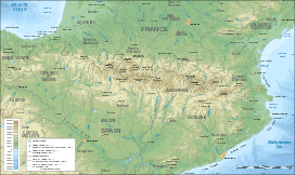
| Parent range | Pyrenees |
The Soularac is a summit in the French Pyrenees, culminating at a height of 2,368 m (7,769 ft) in the Tabe Massif.
References
This article is issued from Wikipedia - version of the 7/16/2015. The text is available under the Creative Commons Attribution/Share Alike but additional terms may apply for the media files.