Pic de l'Estany Fondo
| Pic de l'Estany Fondo | |
|---|---|
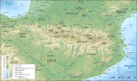 Pic de l'Estany Fondo Location in the Pyrenees | |
| Highest point | |
| Elevation | 2,813 m (9,229 ft) |
| Coordinates | 42°39′12.44″N 1°23′40.19″E / 42.6534556°N 1.3944972°ECoordinates: 42°39′12.44″N 1°23′40.19″E / 42.6534556°N 1.3944972°E |
| Geography | |
| Location | Pallars Sobirà, Catalonia |
| Parent range | Pyrenees |
| Climbing | |
| First ascent | Unknown |
| Easiest route | From Alins |
Pic de l'Estany Fondo is a mountain of Catalonia, Spain. Located in the Pyrenees, it has an elevation of 2,813 metres (9,229 ft) above sea level.[1]
See also
References
- ↑ "Mapa Topogràfic de Catalunya". Institut Cartogràfic de Catalunya. Retrieved May 22, 2010..
This article is issued from Wikipedia - version of the 12/6/2015. The text is available under the Creative Commons Attribution/Share Alike but additional terms may apply for the media files.