Pico del Caballo
| Pico del Caballo | |
|---|---|
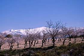 View of the Pico del Caballo behind almond trees | |
| Highest point | |
| Elevation | 3,051 m (10,010 ft) |
| Coordinates | 37°00′39″N 03°26′25″W / 37.01083°N 3.44028°WCoordinates: 37°00′39″N 03°26′25″W / 37.01083°N 3.44028°W |
| Geography | |
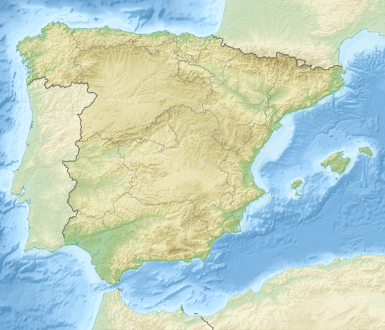 Pico del Caballo Spain | |
| Location | Sierra Nevada, Andalusia |
| Parent range | Cordillera Penibética |
| Geology | |
| Mountain type | Mica-Schist[1] |
| Climbing | |
| First ascent | Unknown |
| Easiest route | From Nigüelas or Lanjarón |
Pico del Caballo, Cerro del Caballo or simply Caballo ("horse") is 3,011 m high mountain in the Sierra Nevada, Spain. It is the westernmost three thousander of the range.
Climbing
Caballo mountain can be accessed from the towns of Lanjaron, Durcal and also from the Sierra Nevada Ski Resort. The Ski Resort is located at Pradollano, also the north west flank of the Veleta mountain. There is a hut at the east side of the mountain at 2800 m altitude. The hut covers eight people and can be used all year around. It belongs into category of bivouac, which means it is built to give protection only. Huts like Poqueira hut are guarded and usually provide meals and heating. Other hut which can be used is the Elorrieta hut on the top of the Tajos de la Virgen mountain. Nearest water taking place is the river Rio Lanjaron at the south side of the mountain. There is also tiny rivers on the west side of the mountain at 2500 m altitude. These seasonal rivers can be difficult to find sometimes. During the winter months Sierra Nevada mountains have Alpine conditions, even there is not much glacier to be met anymore. Ice axe and crampons are essential.
Around the mountain
Caballo mountain offers great views on the neighbouring mountains like : Veleta, Mulhacén and Alcazaba (Sierra Nevada). The ridge starting from Caballo continues several km almost at the same altitude turning at the Tajos de la Virgen mountain, 3237 m. The ridge has become very popular during the recent years, as it provides an easy walk and scramble during summer months. From Tajos de la Virgen the ridge turns towards south west ending at the south side of the Caballo mountain and making a big Y letter. The highest peak on the southern ridge is Tajo de los Machos, 3088m. At the middle of the two ridges starts the river Rio Lanjaron, 400 m lower. Rio Lanjaron flows several km down towards the town of Lanjaron. There is also a few lakes in this wide mountain valley.
References
- ↑ Delgado Calvo-Flores: Geología, Geomorfología y Suelos, en Parque Nacional de Sierra Nevada, Canseco Edt., Talavera de la Reina 2001. ISBN 84-932095-1-1