Pigeon Island (Saint Lucia)
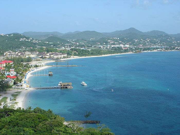
Pigeon Island is a 44-acre (180,000 m2) islet located in Gros Islet in the northern region of Saint Lucia. Once isolated from the country in the Caribbean Sea, the island was artificially joined to the western coast of mainland in 1972 by a man-made causeway built from dirt excavated to form the Rodney Bay Marina. Composed of two peaks the island is a historic site with numerous forts such as an 18th-century British fort and Fort Rodney both used by the British to spy on French Ships from neighbouring Martinique. In 1979 it was named a national park and again in 1992 it became a national landmark under the control of the Saint Lucia National Trust. Today, Pigeon Island is the home and major venue of the Saint Lucia Jazz Festival.
History
The Arawak people, the original inhabitants of Pigeon island, were driven out by the Caribs around 1000 A.D. The Caribs lived in caves along the shore of the island, and hunted for fish, shellfish, small animals and birds. They also foraged for plant food. In the 16th century, a French pirate, François le Clerc, used Pigeon Island as his base. He forged an agreement with the Caribs, so that they would not attack his ship.
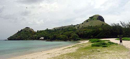
In 1778, Admiral George Rodney took over Pigeon island, expelled the natives, and built a fort on the smaller of the two peaks. This fort is known as Fort Rodney. To establish clear viewpoints, Rodney ordered all trees on Pigeon Island to be cut down. From the higher peak, Signal Hill, Rodney was able to observe the French naval base on Martinique.
Over the next several years, the British built several other structures on Pigeon Island, including two barracks, a mess hall, and a lime kiln.
In 1782, Admiral Rodney sailed from Pigeon Island to confront the French fleet, which he defeated in the Battle of Saints.
See also
Saint Lucia Saint Lucia Jazz Festival Rodney Bay Gros-Islet
References
-
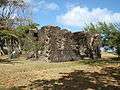
Officer's Kitchen
-
.jpg)
Fort Rodney
Coordinates: 14°05′N 60°58′W / 14.083°N 60.967°W