Piraera
| Piraera | |
|---|---|
| Municipality | |
|
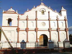
Panoramic View of Piraera town | |
 Piraera Location in Honduras | |
| Coordinates: 14°04′N 88°28′W / 14.067°N 88.467°W | |
| Country | Honduras |
| Department | Lempira |
| Area | |
| • Total | 179 km2 (69 sq mi) |
| Population (2015) | |
| • Total | 14,124 |
| • Density | 79/km2 (200/sq mi) |

Piraera is one of the municipalities of Lempira department in Honduras. It is located on one of the branches of "Congolón" mountain, it is 105 km away from the city of Gracias.
History
Its first inhabitants came from San Antonio, Santa Lucia and Magdalena in Intibuca department. In the population record of 1702 there were some people booked. In the census of 1791, it is a town part of "Curato" de Cerquin and in 1889 it was a municipality of Candelaria. It is supposed that Lempira, the national hero, received the power from "Etempic" chief when the Spanish arrived, lived in this municipality.
Geography
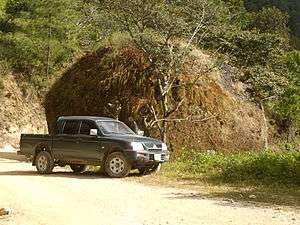
Since it is located on the mountains, the main forests are Pines and Oaks. Its elevation above sea level is the proper one for coffee plantations. Its mountains and hills are very high and steep. It has several water spring running down the steep hills. One curiosity is a huge rock monolith on the way to the departmental capital, which proves the volcanic origins of the rocks in this municupality and the rest of the department.
Boundaries
Its boundaries are:
- North : Gualcince and Erandique municipalities.
- South : Intibuca department and El Salvador.
- East : San Francisco municipality and Intibuca department.
- West : Candelaria and Virginia municipalities.
- Surface Extents: 179 km²
Resources
The coffee is the main product up there in Piraera, followed by cattle, milk derivates, corn, beans and commerce. The trees are plenty and give an income. It also has several water springs, for people and cattle and for the crops. As the rest of the department it has electricity, internet access in the Mayor's and with mobile communication services. A few people sell fuels in their houses.
Population
The cross.breed of Spanish and Indians is the majority, but the traits of Indians are more common to see.
- Population:The population in 2001 was 11,420, and according to estimates by the INE Honduras, 14,124 is expected for 2015.
- Villages: 10
- Settlements: 105
Tourism
The traveler must go through Santa Cruz, San Andrés and Gualcince municipalities. The deviation to Piraera is 85 km from Gracias, to the left, or at any time the locals can help to find the correct way. This dirt road is repaired constantly along the year. The visitor must be careful during the rainy season due to landslides along the way. It has little to offer to visitors, it has the typical colonial distribution. Perhaps the most interesting activity is to hike some hills, which have amazing views of the volcanos of El Salvador, Intibuca department etc. Also there is an exotic waterfall on the way, good for cooling off after the long trip.
- Local Holidays: "Santiago' day, on July 25th; "Sagrado Corazon" and "San Jose" day both on October 19.
External links
| Wikimedia Commons has media related to Piraera. |
Coordinates: 14°04′N 88°28′W / 14.067°N 88.467°W
Capital: Gracias | ||
| Municipalities | 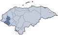 | |