Pizzo Arera
| Pizzo Arera | |
|---|---|
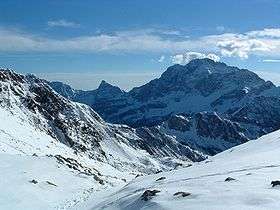 Pizzo Arera as seen from Passo di Mezzeno | |
| Highest point | |
| Elevation | 2,512 m (8,241 ft) |
| Prominence | 691 m (2,267 ft) [1] |
| Coordinates | 45°56′09″N 9°48′54″E / 45.935700°N 9.814947°ECoordinates: 45°56′09″N 9°48′54″E / 45.935700°N 9.814947°E |
| Geography | |
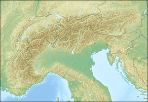 Pizzo Arera Bergamo, Italy | |
| Parent range | Bergamasque Prealps |
Pizzo Arera is a mountain of the Bergamasque Prealps of northern Italy. Its peak is 2,512 metres (8,241 ft) above sea level, and it is part of the ridge that divides Val Seriana from Val Brembana. The town of Roncobello is nearby. Fossils can be found on some ridges.
It is the largest in a group of four mountains that surround Zambla Alta. The residents of the area around the mountain are often bilingual, speaking Italian and Bergamasco.
References
- ↑ "Pizzo Arera - peakbagger". peakbagger.com. Retrieved 13 March 2015.
This article is issued from Wikipedia - version of the 12/4/2015. The text is available under the Creative Commons Attribution/Share Alike but additional terms may apply for the media files.