Plaquemines Parish, Louisiana
| Plaquemines Parish, Louisiana | |
|---|---|
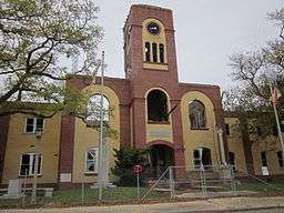 Plaquemines Parish Courthouse | |
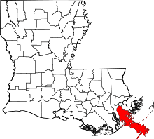 Location in the U.S. state of Louisiana | |
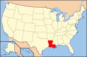 Louisiana's location in the U.S. | |
| Founded | 1807 |
| Named for | Louisiana French word for persimmons |
| Seat | Pointe à la Hache |
| Largest community | Belle Chasse |
| Area | |
| • Total | 2,567 sq mi (6,648 km2) |
| • Land | 780 sq mi (2,020 km2) |
| • Water | 1,787 sq mi (4,628 km2), 70% |
| Population (est.) | |
| • (2015) | 23,495 |
| • Density | 30/sq mi (12/km²) |
| Congressional district | 1st |
| Time zone | Central: UTC-6/-5 |
| Website |
www |
Plaquemines Parish (/ˈplækᵻmɪnz/; Louisiana French: Paroisse des Plaquemines) is a parish located in the U.S. state of Louisiana. As of the 2010 census the population is 23,042.[1] The parish seat is Pointe à la Hache.[2] The parish was formed in 1807.[3]
Plaquemines Parish is part of the New Orleans–Metairie, LA Metropolitan Statistical Area. It was severely damaged in the aftermath of Hurricane Katrina in 2005, and in hurricane events in 2011.
History
The name "Plaquemines," in French Creole, was derived from the Atakapa word, piakimin, meaning the local fruit persimmon. The French used it to name a military post they built on the banks of the Mississippi River, as the site was surrounded by numerous persimmon trees. Eventually the name was applied to the entire parish and to a nearby bayou.
The oldest European settlement in the parish was La Balize, where the French built and inhabited a crude fort by 1699 near the mouth of the Mississippi River. The name in French meant "seamark", a tall structure of wood built as a guide for ships. By 1721 the French built one 62 feet (19 m) high.[4] A surviving map from about 1720 shows the island and fort, and the mouth of the river.[5]
As traffic and trade on the river increased, so did the importance of river pilots who were knowledgeable about the complicated, ever-changing currents and sandbars in the river. They lived at La Balize with their families. The village was destroyed and rebuilt numerous times, but it was abandoned for good after being destroyed by a September 1860 hurricane. The pilots moved upriver and built the settlement they named Pilottown, which reached its peak of population in the 19th century.[6] The river pilots' expertise continues to be critical, but now they generally live with their families in more populated areas. They stay at Pilottown temporarily for work.
An important historical site is Fort Jackson, built in 1822 as recommended by General Andrew Jackson, hero of the Battle of New Orleans in the War of 1812. In 1861, Fort Jackson served as an important Confederate defense for the city of New Orleans during the Civil War because it was at the mouth of the Mississippi River. The US Army used it as a training base during World War I, 1917-1918.
Plaquemines is one of only two parishes that have kept their same boundaries from the beginning of Louisiana's parishes in 1807 to today, the other being St. Bernard Parish.
20th century to present
Because Plaquemines Parish encompasses the last 70 miles (110 km) of the Mississippi River before it reaches the Gulf of Mexico, it is the site of several oil refineries, which rely on the shipping lanes for moving their product. The Mississippi River Delta of Plaquemines is also a base for assistance to offshore oil rigs. Plaquemines Parish was the first place in the United States where shippers used a container for cargo in foreign trade. The area is also known for having the most southern point in Louisiana, at just under 29 degrees north. To be further south in the United States, a person would have to be in Texas, Florida, or Hawaii.
The August 1901 Hurricane caused damage, including 4 feet of water in Buras.[7]
The Great Hurricane of 1915 devastated much of the Parish, with multiple levee breaches on both sides of the Mississippi, a 12-foot storm surge, and hundreds of deaths. Homelessness was widespread, and many people were reduced to starvation until charitable aid arrived.[8] The old Parish Courthouse in Pointe à la Hache was among the many buildings destroyed in the storm, but a new one was completed within the year.
In the early 1900s, Plaquemines was an exporter of citrus. Farmers used the railroads and the Mississippi to ship the large annual harvest to markets. Commercial fisheries, especially for oysters, have been important in the parish economy.
From 1924 to 1969, Plaquemines and St. Bernard parishes were effectively the domain of the political boss Leander Perez, who established a virtual dictatorship in the area.[9] He was notorious for fixing elections and enforcing strict racial segregation. Upon his death, his sons Leander Perez Jr. and Chalin Perez were elected as the dominant political figures of the parish as district attorney and parish president, respectively. Interpersonal feuding weakened the family's hold on power. After another decade, by 1980 political opponents had begun to win local elections.[9]
During the Great Mississippi Flood of 1927, city and state leaders used dynamite to breach a levee at Caernarvon, thirteen miles (19 km) below Canal Street, in order to save the city of New Orleans from flooding. This action resulted in the flooding of much of the less-populated St. Bernard and Plaquemines parishes, causing widespread destruction to agriculture and housing.
The Civil Rights struggle for African-Americans to become registered voters in Plaquemines Parish begin in October 1946, under the guidance of Dr. Rev. Percy Murphy Griffin. With the Aid of Attorneys Earl Amedee and Louis Berry from New Orleans, Griffin and twenty-six African-Americans from Plaquemines Parish organized The Plaquemines Parish Civil and Political Organization, Inc. to fight the racial barriers of Leander Perez. In the summer of 1953, from July through August, Plaquemines Parish was the site of a voter registration drive for African Americans organized by the Plaquemines Parish Civil and Political Organization, under the leadership of Dr. Rev. Percy Murphy Griffin. The organization filed class-action suits against Leander Perez and in 1953, several African-Americans became registered voters in Plaquemines Parish. In 1966 the organization led the fight to integrate the public schools in Plaquemines Parish. The movement also worked to get Seymourville and another small community included within the parish boundaries; the city was trying to exclude these majority-black communities to prevent black votes from being counted. Not all the work was done that summer; in October a black man was the first to register to vote in West Feliciana.[10] The Civil Rights Act of 1964 ended legal segregation, and the Voting Rights Act of 1965 authorized federal oversight and enforcement of voter registration and elections in jurisdictions with historic under-representation of elements of the population. After 1965, African Americans in Louisiana were able to participate again in the political system and exercise their constitutional rights.
In 1965 Hurricane Betsy damaged the area, flooding many buildings, including the Parish Courthouse, and causing nine deaths. Leander Perez sealed off the Parish from the outside world, while trying to control the distribution of state assistance.[11]
Historic sites
The parish includes three United States National Historic Landmarks:
The parish has five other sites listed on the National Register of Historic Places, including Woodland Plantation, which has been depicted on the label of Southern Comfort liqueur since the 1930s. Woodland Plantation is an antebellum mansion located in West Pointe à la Hache, on the west bank of the Mississippi River. It is now operated as a bed and breakfast.
Hurricane Katrina
Hurricane Katrina struck Louisiana on August 29, 2005, resulting in one of the worst disasters in United States history; it severely damaged all of southeast Louisiana. Martial law was not declared in Plaquemines, contrary to many media reports, as no such term exists in Louisiana state law.[12] No place escaped without some damage, while most of Plaquemines, Orleans, and neighboring St. Bernard parishes were severely affected. The towns of Pointe à la Hache, Port Sulphur, Buras, Triumph, Empire, Boothville, Phoenix, and Venice suffered catastrophic damage.
Amid heavy rains accompanied by hurricane-force winds in excess of 120 mph (190 km/h) at initial landfall (with a Category 5 storm surge), the levees failed and broke. The storm surge which flowed in was more than 20 feet (6.1 m) high. Although a majority of the populace had complied with mandatory state evacuation orders, some did not, possibly because they were not able to. At least three residents died.
Geography
According to the U.S. Census Bureau, the parish has a total area of 2,567 square miles (6,650 km2), of which 780 square miles (2,000 km2) is land and 1,787 square miles (4,630 km2) (70%) is water.[13] It is the largest parish by total area in Louisiana. Plaquemines Parish is bordered to the south and southeast by the Gulf of Mexico.
Major highways
Adjacent parishes and features
- Orleans Parish (north)
- St. Bernard Parish (northeast)
- Jefferson Parish (west)
National protected areas
Demographics
| Historical population | |||
|---|---|---|---|
| Census | Pop. | %± | |
| 1820 | 2,354 | — | |
| 1830 | 4,489 | 90.7% | |
| 1840 | 5,060 | 12.7% | |
| 1850 | 7,390 | 46.0% | |
| 1860 | 8,494 | 14.9% | |
| 1870 | 10,552 | 24.2% | |
| 1880 | 11,575 | 9.7% | |
| 1890 | 12,541 | 8.3% | |
| 1900 | 13,039 | 4.0% | |
| 1910 | 12,524 | −3.9% | |
| 1920 | 10,194 | −18.6% | |
| 1930 | 9,608 | −5.7% | |
| 1940 | 12,318 | 28.2% | |
| 1950 | 14,239 | 15.6% | |
| 1960 | 22,545 | 58.3% | |
| 1970 | 25,225 | 11.9% | |
| 1980 | 26,049 | 3.3% | |
| 1990 | 25,575 | −1.8% | |
| 2000 | 26,757 | 4.6% | |
| 2010 | 23,042 | −13.9% | |
| Est. 2015 | 23,495 | [14] | 2.0% |
| U.S. Decennial Census[15] 1790-1960[16] 1900-1990[17] 1990-2000[18] 2010-2013[1] | |||
As of the census[19] of 2000, there were 26,757 people, 9,021 households, and 7,000 families residing in the parish. The population density was 32 people per square mile (12/km²). There were 10,481 housing units at an average density of 12 per square mile (5/km²). The racial makeup of the parish was 69.77% White, 23.39% Black or African American, 2.07% Native American, 2.62% Asian, 0.01% Pacific Islander, 0.73% from other races, and 1.42% from two or more races. 1.62% of the population were Hispanic or Latino of any race. 2.22% reported speaking French or Creole French at home.
There were 9,021 households out of which 39.50% had children under the age of 18 living with them, 57.50% were married couples living together, 14.60% had a female householder with no husband present, and 22.40% were non-families. 18.60% of all households were made up of individuals and 7.10% had someone living alone who was 65 years of age or older. The average household size was 2.89 and the average family size was 3.30.
In the parish the population was spread out with 29.20% under the age of 18, 9.20% from 18 to 24, 30.50% from 25 to 44, 21.40% from 45 to 64, and 9.80% who were 65 years of age or older. The median age was 34 years. For every 100 females there were 99.40 males. For every 100 females age 18 and over, there were 97.30 males.
The median income for a household in the parish was $38,173, and the median income for a family was $42,610. Males had a median income of $37,245 versus $21,691 for females. The per capita income for the parish was $15,937. About 15.40% of families and 18.00% of the population were below the poverty line, including 20.70% of those under age 18 and 18.40% of those age 65 or over.
Economy
Plaquemines has a significant seafood industry. The parish exports millions of pounds of shrimp, crab, oysters, and fish annually. Plaquemines also has a vibrant citrus industry. The seafood and citrus industries have suffered somewhat in the wake of Hurricane Katrina in August 2005. About half the shrimping and shellfish fleet were lost. In January 2007, thousands of citrus trees went unpicked.
As of 2012, Plaquemines parish is the largest crude-oil producing parish in Louisiana. It produced over 14 million barrels in 2012.[20]
Plaquemines Port is one of the largest ports in the United States, handling mostly domestic traffic. The Plaquemines Port, Harbor & Terminal District is coextensive with the parish. It was created in 1954 by the legislature of Louisiana as a state agency. It is governed by a committee of the Plaquemines Parish Council, acting as the Port Board.[21]
Alternative energy
Oil and gas continue to play a dominant role in the Plaquemines economy; however, there is a growing policy and resource trend in favor of renewable resources. The Parish government is working with public and private partners to invest in renewable energy, including hydrokinetic energy and wind energy. Plaquemines has a huge potential for hydrokinetic energy sites along deep bends in the Mississippi River. The flow of the river is 470,000 cubic feet per second at the Head of Passes during normal river stages and 1,250,000 during peak times.[22] Tidal turbines would be placed in deep bends of the river below seagoing and barge traffic. The turbines would also be located below the usual migrating routes of fish. Four companies intending to install turbines are in the regulatory and permitting stages.[23]
The potential installation of wind turbines at the mouth of the Mississippi River is also being considered.[24] The capacity of a wind source to produce energy is generally measured by Wind Power Density. Wind Power Densities are divided into seven Wind Power Classes. According to the American Wind Energy Association, Plaquemines has winds in specified areas that fall into a Wind Power Class of seven, which makes the Parish a particularly attractive location for wind turbine investment. Wind turbines would likely be placed at the mouth of the Mississippi, where winds are the strongest. Wind Energy Systems Technology has proposed to build a 12.5 MV wind farm in Barataria Bay off the coast of Plaquemines Parish. The energy would be sent to Myrtle Gove through an underground cable. The wind farm would be supplemented with natural gas turbines when wind speeds are either not sufficient enough or too robust to supply power. A similar proposal is being considered for the southern portion of the Parish.
Education
Plaquemines Parish School Board operates the public schools of the parish.
Communities
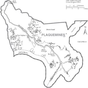
There are no incorporated areas within Plaquemines Parish. Communities not listed below include Dalcour, Myrtle Grove, Nairn, Naomi, Orchid, and Scarsdale.
Census-designated places
- Belle Chasse
- Boothville
- Buras
- Empire
- Pointe à la Hache (parish seat)
- Port Sulphur
- Triumph
- Venice
Unincorporated communities
Outdated designations
Ghost towns
Notable residents
- Dan Alexander
- Milburn E. Calhoun
- Lynn Dean
- Percy M. Griffin, civil rights leader
- Billy Nungesser (b. 1959)
- William "Billy" Nungesser (d. 2006)
- Leander Perez
- Ernest Wooton
See also
- Barataria Bay
- Louisiana Highway 23, on the west bank
- Louisiana Highway 39, on the east bank
- National Register of Historic Places listings in Plaquemines Parish, Louisiana
References
- 1 2 "State & County QuickFacts". United States Census Bureau. Retrieved August 18, 2013.
- ↑ "Find a County". National Association of Counties. Retrieved 2011-06-07.
- ↑ "Plaquemines Parish". Center for Cultural and Eco-Tourism. Retrieved September 6, 2014.
- ↑ David Roth, "Louisiana Hurricane History: 18th Century (1722-1800)", Tropical Weather - National Weather Service - Lake Charles, LA; 24 Jun 2003, accessed 7 May 2008
- ↑ "Carte du Fleuve Saint Louis ou Mississippy dix lieues au dessous de la Novelle Orleans jusqu'a son Embouchoure", Louisiana State Museum Map Database, originally accessed 6 May 2008, only catalog entry available online 4 April 2016
- ↑ David Roth, "Louisiana Hurricane History: Late 19th Century (1851-1900)", Tropical Weather - National Weather Service - Lake Charles, LA; Jun 2003, accessed 6 May 2008
- ↑ "Louisiana Hurricanes", The Cajuns
- ↑ "Hurricane of 1915: Plaquemines Parish History"
- 1 2 Glen Jeansonne, Leander Perez: Boss of the Delta,
- ↑ Louisiana Diary, 16 March 1964, Written, directed and narrated by Richard O. Moore, aired on PBS
- ↑ Glen Jeansonne, Leander Perez: Boss of the Delta, p. 354
- ↑
- ↑ "2010 Census Gazetteer Files". United States Census Bureau. August 22, 2012. Retrieved August 20, 2014.
- ↑ "County Totals Dataset: Population, Population Change and Estimated Components of Population Change: April 1, 2010 to July 1, 2015". Retrieved July 2, 2016.
- ↑ "U.S. Decennial Census". United States Census Bureau. Retrieved August 20, 2014.
- ↑ "Historical Census Browser". University of Virginia Library. Retrieved August 20, 2014.
- ↑ "Population of Counties by Decennial Census: 1900 to 1990". United States Census Bureau. Retrieved August 20, 2014.
- ↑ "Census 2000 PHC-T-4. Ranking Tables for Counties: 1990 and 2000" (PDF). United States Census Bureau. Retrieved August 20, 2014.
- ↑ "American FactFinder". United States Census Bureau. Retrieved 2008-01-31.
- ↑
- ↑ "History", Plaquemines Port Harbor & Terminal District website
- ↑ , Louisiana Coast
- ↑
- ↑ "Economic Development Assessment"
External links
| Wikimedia Commons has media related to Plaquemines Parish, Louisiana. |
- Official website
- Images of destruction caused by Hurricane Katrina in the parish (Photos taken August 31, 2005)
- Water Resources of Plaquemines Parish, Louisiana United States Geological Survey
- Plaquemines Parish Sheriff's Office
 |
Orleans Parish | St. Bernard Parish | | |
| Jefferson Parish | |
|||
| ||||
| | ||||
| Gulf of Mexico | Gulf of Mexico |
Municipalities and communities of Plaquemines Parish, Louisiana, United States | ||
|---|---|---|
| CDPs | | |
| Unincorporated communities |
| |
| Ghost towns | ||
Coordinates: 29°23′N 89°29′W / 29.39°N 89.48°W