Pleumeur-Bodou
| Pleumeur-Bodou Pleuveur-Bodoù | ||
|---|---|---|
|
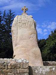
Saint Uzec menhir | ||
| ||
 Pleumeur-Bodou | ||
|
Location within Brittany region  Pleumeur-Bodou | ||
| Coordinates: 48°46′36″N 3°30′59″W / 48.7767°N 3.5164°WCoordinates: 48°46′36″N 3°30′59″W / 48.7767°N 3.5164°W | ||
| Country | France | |
| Region | Brittany | |
| Department | Côtes-d'Armor | |
| Arrondissement | Lannion | |
| Canton | Perros-Guirec | |
| Intercommunality | Lannion Trégor | |
| Government | ||
| • Mayor (2014–2020) | Pierre Terrien | |
| Area1 | 26.71 km2 (10.31 sq mi) | |
| Population (2008)2 | 4,017 | |
| • Density | 150/km2 (390/sq mi) | |
| Time zone | CET (UTC+1) | |
| • Summer (DST) | CEST (UTC+2) | |
| INSEE/Postal code | 22198 / 22560 | |
| Elevation | 0–106 m (0–348 ft) | |
|
1 French Land Register data, which excludes lakes, ponds, glaciers > 1 km² (0.386 sq mi or 247 acres) and river estuaries. 2 Population without double counting: residents of multiple communes (e.g., students and military personnel) only counted once. | ||

Pleumeur-Bodou (Breton: Pleuveur-Bodoù) is a commune in the Côtes-d'Armor department of Brittany in northwestern France.
Population
| Historical population | ||
|---|---|---|
| Year | Pop. | ±% |
| 1793 | 2,151 | — |
| 1800 | 1,745 | −18.9% |
| 1806 | 1,907 | +9.3% |
| 1821 | 2,199 | +15.3% |
| 1831 | 2,360 | +7.3% |
| 1836 | 2,472 | +4.7% |
| 1841 | 2,465 | −0.3% |
| 1846 | 2,525 | +2.4% |
| 1851 | 2,650 | +5.0% |
| 1856 | 2,737 | +3.3% |
| 1861 | 2,864 | +4.6% |
| 1866 | 3,030 | +5.8% |
| 1872 | 3,034 | +0.1% |
| 1876 | 2,970 | −2.1% |
| 1881 | 2,778 | −6.5% |
| 1886 | 3,011 | +8.4% |
| 1891 | 2,955 | −1.9% |
| 1896 | 3,175 | +7.4% |
| 1901 | 3,019 | −4.9% |
| 1906 | 3,257 | +7.9% |
| 1911 | 3,099 | −4.9% |
| 1921 | 2,949 | −4.8% |
| 1926 | 3,037 | +3.0% |
| 1931 | 2,752 | −9.4% |
| 1936 | 2,766 | +0.5% |
| 1946 | 2,920 | +5.6% |
| 1954 | 2,544 | −12.9% |
| 1962 | 2,545 | +0.0% |
| 1968 | 2,542 | −0.1% |
| 1975 | 2,941 | +15.7% |
| 1982 | 3,453 | +17.4% |
| 1990 | 3,677 | +6.5% |
| 1999 | 3,825 | +4.0% |
| 2008 | 4,017 | +5.0% |
Inhabitants of Pleumeur-Bodou are called pleumeurois in French.
See also
References
External links
| Wikimedia Commons has media related to Pleumeur-Bodou. |
This article is issued from Wikipedia - version of the 6/20/2015. The text is available under the Creative Commons Attribution/Share Alike but additional terms may apply for the media files.