Plimptonville (MBTA station)
PLIMPTONVILLE | |||||||||||
|---|---|---|---|---|---|---|---|---|---|---|---|
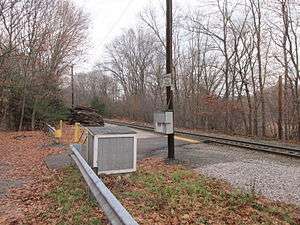 Bare platform at Plimptonville station | |||||||||||
| Location |
185 Plimpton Street Walpole, MA 02081-3712 | ||||||||||
| Coordinates | 42°09′32″N 71°14′10″W / 42.159°N 71.236°WCoordinates: 42°09′32″N 71°14′10″W / 42.159°N 71.236°W | ||||||||||
| Line(s) | |||||||||||
| Platforms | 1 small side platform | ||||||||||
| Tracks | 1 | ||||||||||
| Construction | |||||||||||
| Parking | Several spaces (free) | ||||||||||
| Other information | |||||||||||
| Fare zone | 4 | ||||||||||
| History | |||||||||||
| Opened | ca. 1849 | ||||||||||
| Previous names | Tilton(s), Plymptons | ||||||||||
| Traffic | |||||||||||
| Passengers (2013) | 13 (daily inbound average)[1] | ||||||||||
| Services | |||||||||||
| |||||||||||
Plimptonville is a flag stop station along the MBTA Commuter Rail's Franklin Line located in Walpole, Massachusetts near the Neponset River. It is positioned next to a small dirt parking lot between Plimpton Street and the Franklin Line itself. East of the station, Plimpton Street crosses under the tracks beneath a 12-foot bridge before crossing over the Neponset River on Plimpton Pond.
Plimptonville has one of the smallest station facilities on the MBTA Commuter Rail system: a 10-foot-wide low-level asphalt platform next to the single track, with a metal sign reading "Plimptonville Train Station". It receives the least service of any MBTA station, with just one round trip per day, consisting of an inbound morning train and an outbound evening train at the height of rush hour. Ridership on that round trip averaged just 13 passengers daily by a 2013 count.[1]
History

The Norfolk County Railroad was built through East Walpole beginning in 1846; it opened in 1849.[2] A station was eventually opened between East Walpole and Walpole proper. Originally known as Tiltons (or Tilton[3]) station, it was later called Plymptons.[2] By the early 20th century, the name had settled on Plimptonville, by which it is known today.[4] The station's most famous user was Joseph N. Welch, who lived in Walpole while working at a Boston law firm.
Under MBTA operations, the station has become less important due to its lack of parking and proximity to the well-used Walpole station. Additionally, the station is in the middle of a single-track section of the line, severely limiting the number of trains that can stop. Today, the single round-trip serves a small but dedicated contingent of riders. Ridership counts reached as low as three passengers per day in 2005, with a significant yearly variation.[1]
An unrelated station, also named Plympton, was located on the Old Colony Railroad's main line at Lake Street in Plympton, Massachusetts.[5]
References
- 1 2 3 "Ridership and Service Statistics" (PDF) (14 ed.). Massachusetts Bay Transportation Authority. 2014. Retrieved 4 July 2014.
- 1 2 Karr, Ronald Dale (1995). The Rail Lines of Southern New England. Branch Line Press. pp. 291–293. ISBN 0942147022.
- ↑ Walker Lithograph & Publishing Co. (1891). "Foxborough & Franklin & Holliston & Milford & Norfolk & Sharon & Walpole 1891 Plate 15". Topographical Atlas of Massachusetts, 1891. WardMaps LLC. Retrieved 25 September 2012.
- ↑ United States Geological Survey (1941). "Canton & Dedham & Norwood & Stoughton & Walpole 1941". USGS 7.5 Minute Sheets and Quadrangles, Massachusetts. WardMaps LLC. Retrieved 25 September 2012.
- ↑ Geo. H. Walker & Co. (1901). "Map of Brockton & Plymouth Street Railway". WardMaps LLC. Retrieved 8 December 2012.