Portbail
| Portbail | |
|---|---|
|
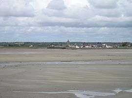
View of Portbail | |
 Portbail | |
|
Location within Normandy region  Portbail | |
| Coordinates: 49°20′10″N 1°41′41″W / 49.3361°N 1.6947°WCoordinates: 49°20′10″N 1°41′41″W / 49.3361°N 1.6947°W | |
| Country | France |
| Region | Normandy |
| Department | Manche |
| Arrondissement | Cherbourg-Octeville |
| Canton | Barneville-Carteret |
| Intercommunality | Communauté de communes de la Côte des Isles |
| Government | |
| • Mayor (2008–2014) | Guy Cholot |
| Area1 | 19.56 km2 (7.55 sq mi) |
| Population (2006)2 | 1,641 |
| • Density | 84/km2 (220/sq mi) |
| Time zone | CET (UTC+1) |
| • Summer (DST) | CEST (UTC+2) |
| INSEE/Postal code | 50412 / 50580 |
| Elevation |
2–90 m (6.6–295.3 ft) (avg. 10 m or 33 ft) |
| Website | www.portbail.fr |
|
1 French Land Register data, which excludes lakes, ponds, glaciers > 1 km² (0.386 sq mi or 247 acres) and river estuaries. 2 Population without double counting: residents of multiple communes (e.g., students and military personnel) only counted once. | |
Portbail (sometimes spelled Port-Bail) is a commune in the Manche department in north-western France.
Heraldry
The arms of Portbail are blazoned :
Azure, a chevron abased, between in fess 3 mullets Or and a lancehead argent.
Demography
| Year | 1962 | 1968 | 1975 | 1982 | 1990 | 1999 |
|---|---|---|---|---|---|---|
| Population | 1431 | 1499 | 1591 | 1707 | 1654 | 1675 |
| From the year 1962 on: No double counting—residents of multiple communes (e.g. students and military personnel) are counted only once. | ||||||
See also
.JPG)
« Thirteen arches bridge»
References
| Wikimedia Commons has media related to Portbail. |
This article is issued from Wikipedia - version of the 1/18/2016. The text is available under the Creative Commons Attribution/Share Alike but additional terms may apply for the media files.