Puerto Barrios
| Puerto Barrios | |||
|---|---|---|---|
| Municipality of Guatemala | |||
|
Amatique Bay | |||
| |||
 Puerto Barrios | |||
| Coordinates: 15°43′N 88°35′W / 15.717°N 88.583°WCoordinates: 15°43′N 88°35′W / 15.717°N 88.583°W | |||
| Country |
| ||
| Department |
| ||
| Government | |||
| • Mayor | Hugo Sarceño[1] | ||
| Population (2003) | |||
| • Total | 40,900 | ||
| Climate | Af | ||
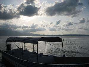


Puerto Barrios (Spanish pronunciation: [ˈpweɾ.to ˈβa.rjos]) is a city in Guatemala, located within the Gulf of Honduras at 15°43′N 88°35′W / 15.717°N 88.583°W. The bay in which the harbour is located is called Bahia de Amatique. Puerto Barrios is the departmental seat of Izabal department and the administrative seat of Puerto Barrios municipality.
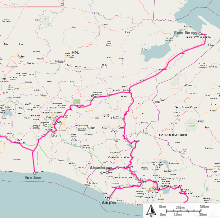
It is Guatemala's main Caribbean Sea port, together with its more modern twin port town just to the southwest, Santo Tomás de Castilla. In 2003 the estimated population of Puerto Barrios was 40,900 people. Puerto Barrios is located 297 kilometers (185 mi) northeast of Guatemala City. It is the terminus of Highway CA9 which begins at the Pacific port city of Puerto San José and traverses the country through Guatemala City.
Puerto Barrios is a mix of mostly Afro-Guatemalans, Maya, Afro-Caribbean (such as Afro-Jamaicans), and other West Indian groups. It's heyday was in the latter 19th and early 20th centuries, following the construction of a railroad connecting large banana and coffee plantations with the shipping docks, all controlled by the International Railways of Central America and the The Great White Fleet, both owned by the United Fruit Company.
Puerto Barrios is divided by many neighborhoods or Barrios such as El rastro, las champas, los tanques, la veinte, la veintedos, la catorce, la trece, el estrecho, etc. Although the town is small, due to its harbor nature, many of its visitors are ship workers who frequent the night entertainment centers throughout the town.
Puerto Barrios is starting to get more visitors in the new century as the nearby town of Santo Tomás de Castilla has started receiving cruise ships. Puerto Barrios Airport is currently being refurbished in order to receive scheduled flights in the near future.
Among the many nearby tourist attractions are: The Mayan ruins of Quirigua. The Castillo de San Felipe de Lara, an old Spanish fort in Río Dulce, guards the entrance to Lake Izabal. Another popular attraction is the lively town of Livingston where Garifuna culture can be experienced first hand with its Punta and Yankunu dances.
History
In 1883, then president general Justo Rufino Barrios had the plan to connect Guatemala City to a port in the Atlanic shore thru a railroad in order to be able to move the coffee produced by his own haciendas and those of his liberal partners; therefore, on 4 August 1883, he issued a decree in which a person with a salary of more than 4 pesos a month could pay 4 pesos a year over a 10-year span to finance the railroad. However, after the untimely death of Barrios in the Battle of Chalchuapa in 1885, this plan was forgotten by his successor, general Manuel Lisandro Barillas.
It was not until in 1892, when José María Reyna Barrios assumed power, that the railroad project was started once again. On 19 July 1895, Reina Barrios issued the executive action #513, which established that, between the Escondido and Estrecho rivers, a city was to be founded, and that it was going to be called Puerto Barrios. The ceremonial act of foundation took place on 5 December 1892. Furthermore, a part of the Northern Railroad project, the executive action #524 declared Puerto Barrios as "Major port of the Republic" and ordered to be transferred over there the customs that used to be in Livingston.[2]
Given that in those days most visitors arriving from Europe and North America arrived at the port on the Caribbean Sea shore, Reina Barrios pushed for the Northern Railroad to be finished on time. Not only was the railroad vital for the Expo success, it was key to transport merchandise and passengers between the Caribbean Sea and the new Port of Iztapa on the Pacific shore of the country. Reina Barrios had high hopes on the railroad to improve the progress and development of the country given that the United States and Spain were still at war over Cuba, and it was evident that a dependable interoceanic communication line was crucial for the North American country.[3] Completing a transoceanic railway was a main objective of Reina Barrios government, with a goal to attract international investors at a time when the Panama Canal was not built yet. However, a sharp decline in the price of coffee and silver, along with the high technical difficulties of the railroad construction close to Guatemala City −mainly due to the steep cliffs and mountain sides around the city− resulted in the collapse of Guatemala's economy, a failure of the Exposición Centroamericana and the eventual murder of president Reina Barrios, on 8 February 1898.
After Reina Barrios's death, civilian lawyer Manuel Estrada Cabrera was designated as president and inherited an enourmes −for the times− external debt with British banks, which forced him to search for an ally in the United States. In 1900, Estrada Cabrera authorized his Secretary of Economy, Rafael Spínola, to set up a contract with an American company, the Central American Improvement Co. Inc., to finish the Northern Railroad and fix those stretches and were in disrepair on the rest of the line.[4] To cover for the expenses, the Guatemalan government gave a concession to the American company to use the railroad along with all of its facilities without any cost; this included the port and dock in Puerto Barrios, for which the Guatemalan people and government had to pay fees if they wanted to use them.[4]
Finally, in 1904, knowing the pro-American attitude of Estrada Cabrera, Minor Keith partners,[lower-alpha 1] began to get concession on railroads of both Guatemala and El Salvador, and in that year, International Railways of Central American (IRCA) was incorporated in Nueva Jersey.;[5] the harbor was then partly built by Theodore Roosevelt's Corps of Engineers in 1906–1908. Eventually, United Fruit Company, owner of IRCA, controlled Puerto Barrios completely, as it owner the docks, the railrods, the banana production from Izabal and, even, the merchanct fleet that transported the cargo and passengers out of the por: the Great White Fleet.
This situation remained as such until the government of Colonel Jacobo Árbenz Guzmán (1951–1954), who decided to build a highway and another port – Santo Tomas de Castilla – to compete with the American fruit company. He also issued an Agrarian Reform that impacted UFCO land. Eventually, Árbenz was accused of Communism and was ousted in 1954, but the highway was almost completed and was completed by his successor, colonel Carlos Castillo Armas. Just as Arbenz had hoped, IRCA last profit was reported in 1957.[5]
The earthquake on February 4, 1976, one of the worst in the history of the country, destroyed most of the port facilities of Puerto Barrios, and most modern cargo traffic moved to its twin port in Santo Tomás de Castilla. In the 21st century, Puerto Barrios remains an important hub for Dole and Fresh Del Monte Produce industries, which are what remains from United Fruit Company.
Transport
Construction of Atlantic Highway and Santo Tomas de Castilla Harbor
In order to establish the necessary physical infrastructure to make possible the "independent" and national capitalist development that could reduce the extreme dependence on the United States and break the American monopolies operating in the country, president Jacobo Árbenz and his government began the planning and construction of the Atlantic Highway, which was intended to compete with the monopoly on land transport exerted by the United Fruit Company, through one of its subsidiaries: the International Railways of Central America (IRCA), which had the concession since 1904, when it was granted by then president Manuel Estrada Cabrera. Construction of the highway began by the Roads Department of the Ministry of Communications, with the help of the military engineering battalion. It was planned to be built parallel along the railway line, as much as possible. The construction of the new port was also aimed to break another UFCO monopoly, since Puerto Barrios was owned and operated solely by The Great White Fleet, another UFCO's subsidiary.[6]
In films
The New Adventures of Tarzan' (1935)

In 1935, the film The New Adventures of Tarzan, was filmed on location in Guatemala, taking advantage of the help from the United Fruit Company and president Jorge Ubico. The places where the filming was made were:
- Chichicastenango: scenes of a native town where the explorers first met.[7]
- Antigua Guatemala: The Green Goddess temple
- Río Dulce
- Puerto Barrios: arrival and departure of the boats carrying the explorers
- Tikal: jungle scenes
- Quiriguá: Mayan city where they get lectured on the maya civilization
- Guatemala City: then luxurious Palace Hotel was used to shoot the scenes of the hotel in the imaginary town of At Mantique[7]
Climate
Puerto Barrios has a tropical rainforest climate (Köppen: Af).
| Climate data for Puerto Barrios | |||||||||||||
|---|---|---|---|---|---|---|---|---|---|---|---|---|---|
| Month | Jan | Feb | Mar | Apr | May | Jun | Jul | Aug | Sep | Oct | Nov | Dec | Year |
| Daily mean °C (°F) | 24.7 (76.5) |
25.1 (77.2) |
27.1 (80.8) |
28.5 (83.3) |
29.0 (84.2) |
29.1 (84.4) |
28.6 (83.5) |
28.7 (83.7) |
28.5 (83.3) |
27.5 (81.5) |
25.8 (78.4) |
24.9 (76.8) |
27.3 (81.1) |
| Average precipitation mm (inches) | 197 (7.76) |
114 (4.49) |
95 (3.74) |
118 (4.65) |
144 (5.67) |
264 (10.39) |
400 (15.75) |
326 (12.83) |
288 (11.34) |
293 (11.54) |
282 (11.1) |
227 (8.94) |
2,748 (108.2) |
| Source: Climate-Data.org [8] Instituto Nacional de Sismología, Vulcanología, Meteorología e Hidrología de Guatemala[9] | |||||||||||||
Geographic location
The municipality has 0 m above sea level at Punta de Manabique and 1276 m above sea level at Cerro San Gil. The municipal capital is located on the shore of Santo Tomás internal bay, which is part of Amatique Bay. There is a small peninsula called Punta de Manabique which separates the small bay from the Gulf of Honduras, and shelters it from storms and hurricanes.
 |
Caribbean Sea, Atlantic Ocean | | ||
| Livingston, Izabal Department municipality | |
Honduras[10] | ||
| ||||
| | ||||
| Morales, Izabal Department municipality Honduras[10] |
Government and infrastructure
There is a prison in the city with an official capacity of 175 prisoners. As of 2016, it has over 900 prisoners, making it over capacity.[11]
Famous People From Puerto Barrios
- David Campos, elected to the San Francisco Board of Supervisors in November 2008
- Freddy Thompson, Soccer Player
- David M Stokes, Soccer Player, 1968 Olympics
See also
-
 Guatemala portal
 -
 Geography portal
 - Mundo Maya International Airport
- United Fruit Company
Notes and references
- ↑ Keith owned United Fruit Company and had already built several railroads in Central America,
References
- ↑ Canal Antigua (2015). "TSE presenta resultados oficiales de alcaldes en Izabal". Canal Antigua (in Spanish). Guatemala. Archived from the original on September 14, 2015. Retrieved 13 September 2015.
- ↑ Secretaría de Relaciones Exteriores (1884). Memoria de la Secretaría de Relaciones Exteriores (in Spanish). Guatemala. pp. 68–69.
- ↑ Buchenau 1996.
- 1 2 Estrada Paniagua 1908, pp. 145–155
- 1 2 West, John (2009) [1993]. "Life wasted chasing trains: Brief story of IRCA". Archived from the original on 19 August 2014. Retrieved 3 September 2014.
- ↑ Velásquez, Eduardo Antonio (2014). "Jacobo Arbenz Guzmán, el hombre desnudo". Nodal (in Spanish). Archived from the original on 26 August 2014. Retrieved 14 August 2014.
- 1 2 Barillas, Edgar (2013). "50 películas filmadas en Guatemala y una que no (1935-1996). Apuntes para una cartografía de los lugares filmados en Guatemala". Revista Historia de la Universidad de San Carlos de Guatemala (in Spanish). Guatemala. Archived from the original on October 22, 2015. Retrieved 22 October 2015.
- ↑ "Climate:Puerto Barrios". Climate-Data.org. Retrieved 21 March 2015.
- ↑ Departamento de Investigación y servicios meteorológicos. "Isotermas de temperatura mínima absoluta anual" (in Spanish). Archived from the original on May 17, 2012.; "Isotermas de temperatura máxima absoluta anual". Archived from the original on May 24, 2012.; "Isotermas de temperatura máxima promedio anual". Archived from the original on May 15, 2012.; "Isotermas de temperature mínima promedio annual". Archived from the original on May 29, 2012.; "Sumatoria de días con lluvia promedio anual". Instituto Nacional de Sismología, Vulcanología, Metereología e Hidrología (in Spanish). Guatemala. Archived from the original on May 15, 2012. Retrieved 23 October 2015.
- 1 2 SEGEPLAN. "Municipios de Izabal, Guatemala". Secretaría General de Planificación. Archived from the original on 5 July 2015. Retrieved 5 July 2015.
- ↑ "Guatemala prison riot leaves eight inmates dead." BBC. January 1, 2016. Retrieved on January 3, 2016.
Bibliography
- Buchenau, J. (1996). In the Shadow of the Giant, the Making of Mexico's Central America Policy (1876–1930) (Vintage ed.). Univ of Alabama Pr. ISBN 0-8173-0829-6.
- Estrada Paniagua, Felipe (1908). Recopilación de las leyes de la República de Guatemala (15 de marzo de 1900 a 15 de marzo de 1901) (in Spanish). XIX. Guatemala: Arturo Síguere y Cía.
External links
| Wikivoyage has a travel guide for Puerto Barrios. |
Capital: Puerto Barrios | ||
| Municipalities |  | |